Home » Accessibility » Recent Articles:

Metro Makes Long-Needed Changes at 18th & Clark, Still Violates ADA

In a couple of weeks Metro’s new North County Transit Center will open, so many MetroBus routes will see major changes:

Metro’s quarterly service change on March 14 will impact the operations of 48 MetroBus routes in the St. Louis metropolitan region, including the introduction of nine new MetroBus routes and discontinuation of service on eight routes. This service change will also introduce a new and completely redesigned MetroBus service plan for North St. Louis County, made possible with the opening of the new North County Transit Center in Ferguson, Missouri on March 14. (Metro)

On that same day, changes will take place in downtown (technically Downtown West):

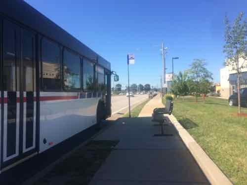
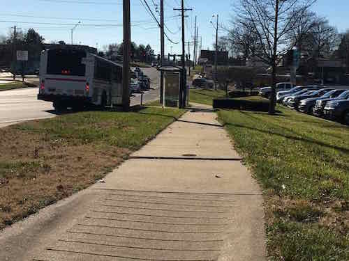
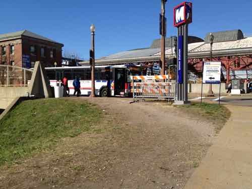
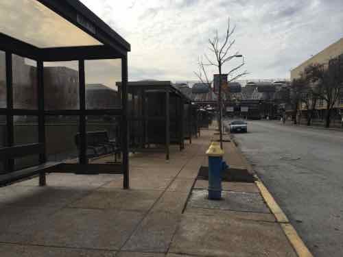
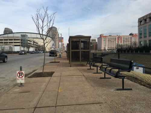
The Civic Center Transit Center is scheduled to be closed down for construction activity shortly, at a date to be decided. In advance of the closure, Metro has prepared bus stops at 18th Street & Clark Street, adjacent to the Union Station MetroLink, to provide the same system connectivity. 

The routing and schedules of the routes serving the Civic Center Transit Center have been modified to serve 18th Street & Clark Street to ensure the same connections with the other MetroBus routes and MetroLink at Union Station instead.

Please note that till the closure of the Civic Center Transit Center, these routes will continue to serve the Civic Center Transit Center. Public Announcement of the closure of the Civic Center Transit Center will be made in advance of the event. (Metro)

The following MetroBus routes will change to include 18th & Clark.

  • 10 Chippewa
  • 32 ML King-Chouteau
  • 41 Lee
  • 73 Carondelet
  • 80 Park-Shaw
  • 94 Page
  • 97 Delmar
  • 99 Downtown Trolley
  • 40X I-55 Express
  • 58X Twin Oaks Express
  • 410X Eureka Express

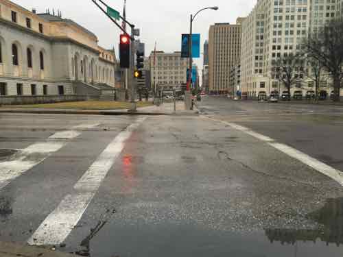
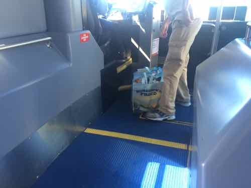
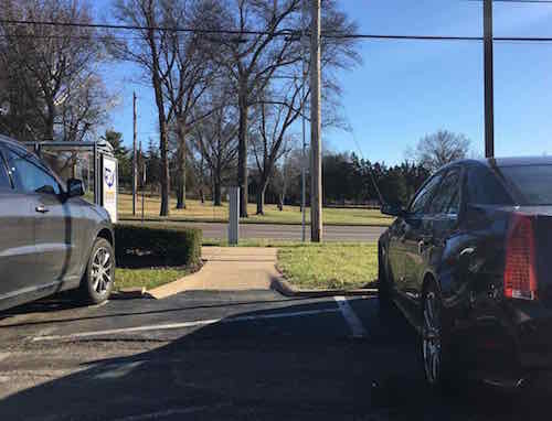
When I need to catch the #10 Westbound I do so at 16th & Olive, but starting March 14th it’ll use 18th rather than 14th Street. Same goes for the #97  — I usually catch it at 16th & Washington but it’ll turn on 18th.  Those who ride the #94 & #97 to Washington & 14th, then catch the #99 Downtown Trolley to take them the rest of the way into the Central Business District (CBD), will need to figure out an alternates. Perhaps catching the Trolley bus at Civic Center/18th & Clark? That’ll require more time though — years ago more bus routes entered the CBD.

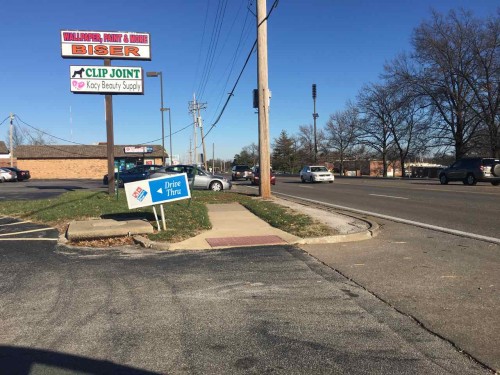
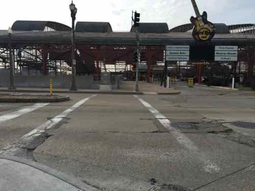
For a few months now I’ve been watching the changes at 18th & Clark. I posted about the upcoming Civic Center changes in 2014, see Civic Center Transit Center Sans Trees, Awaiting Redo.

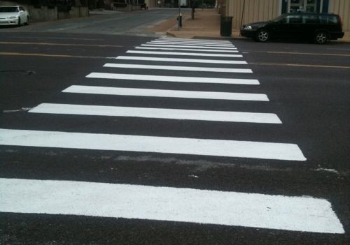
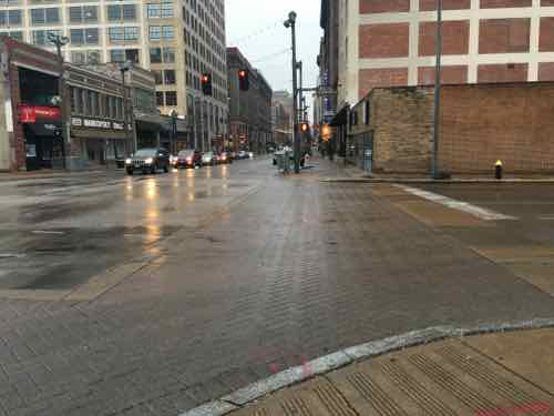
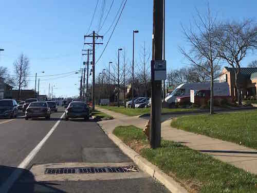
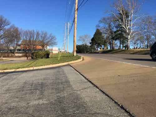
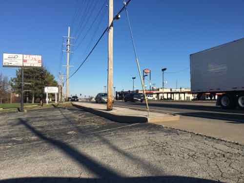
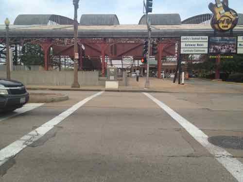
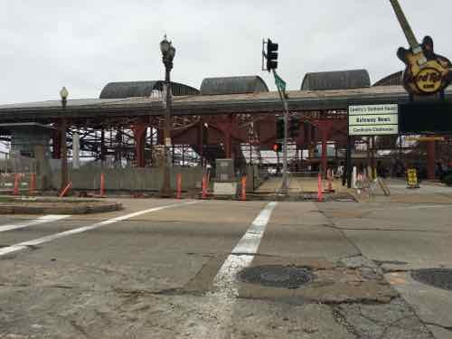
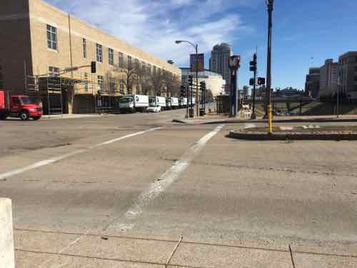
Before I get into the recent changes along Clark I want to show you the before conditions, in October 2011 & August 2012.

Looking west toward the Union Station MetroLink Station from 16th & Clark, October 2011.
At 18th pedestrians had worn a more direct path since MetroLink opened in 1993, October 2011
The crosswalk to Union Station led directly to a curb, those of us in wheelchairs had to go outside the crosswalk and use the auto exit, at right -- a clear ADA violation for years, August 2012
The crosswalk to Union Station led directly to a curb, those of us in wheelchairs had to go outside the crosswalk and use the auto exit, at right — a clear ADA violation for years, August 2012

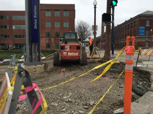
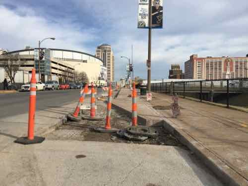
Ok, so now you’ve seen the before. In December last year I began seeing work going on so I braved the cold one day to get some pics:

The asphalt in the parking lane was removed, sidewalk & curb ramp at 16th also removed, December 2015
The old bricks were visible, street trees gone, December 2015
The corner was completely opened up, forms were placed for new concrete, December 2015
Looking West across 18th you can see the curb & sidewalk have been removed, December 2015
From the West side of 18th looking back, December 2015

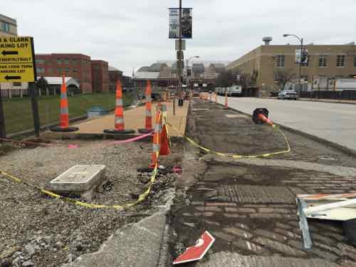
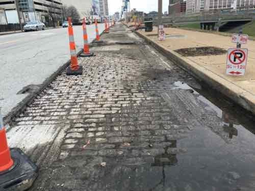
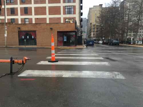
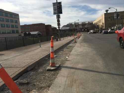
I was encouraged seeing the West end of the crosswalk completely removed — a fresh start so it’ll be done correctly! I returned a month later, in late January:

Now we can see the sidewalk has been widened, replacing half the parking lane, January 2016
About halfway between 16th -18th the extra sidewalk narrows to the original width, January 2016
Looking across 18th we see at the end of the crosswalk --- A NEW CURB! WTF!?!
Looking across 18th we see at the end of the crosswalk — A NEW CURB! WTF!?! January 2016
Pedestrians taking the direct route from MetroLkink East across 18th, with the ramp on the left, January 2016

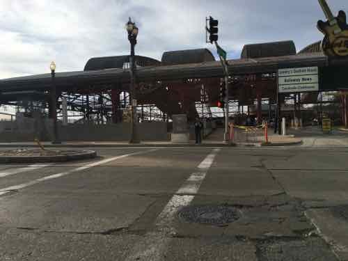
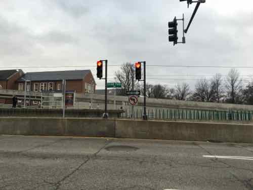
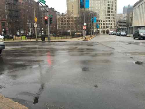
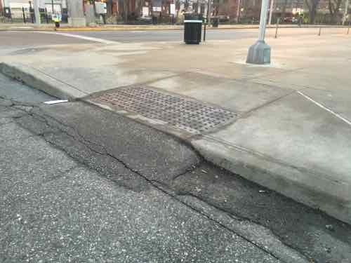
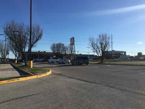
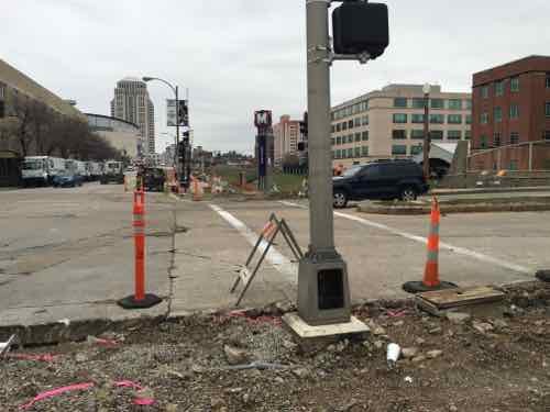
I returned again, a month later, on February 26th:

The widest park, near 16th
The widest park, near 16th, February 2016
Temporary bus shelters added in the narrow section makes it tight, February 2016
There are new benches in places , February 2016
Crosswalk not yet changed to include the new curb ramp, February 2016

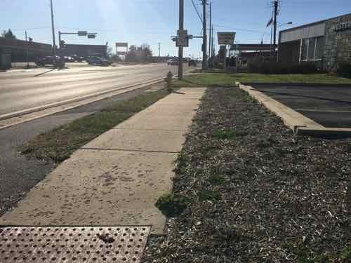
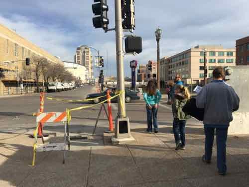
The ramp location behind the crosswalk is a head scratcher, for sure. I resisted the urge to post it to social media — opting to wait until the project is closer to completion.  I even went back yesterday to see if the crosswalk had been changed. It hasn’t. I also discovered another problem: pedestrian signal location.

I arrived on the West side just as people pushing a stroller used the ramp to cross 18th
That's when I noticed the pedestrian signs, far right, wasn't visible. The ramps also aren't aligned, but we already knew they wouldn't.
That’s when I noticed the pedestrian signs, far right, wasn’t visible. The ramps also aren’t aligned, but we already knew they wouldn’t.
The pedestrian signal is visible only when way South pf the ramp & crosswalk
From the same spot you can see the ramp. My chair is very fast so I was able to wait for the walk signal then move to the ramp & cross -- but not everyone can move so quickly
From the same spot you can see the ramp. My chair is very fast so I was able to wait for the walk signal then move to the ramp & cross — but not everyone can move so quickly
From the East side you can see the back of the pedestrian signal and how it doesn't relate to the other side
From the East side you can see the back of the pedestrian signal and how it doesn’t relate to the other side

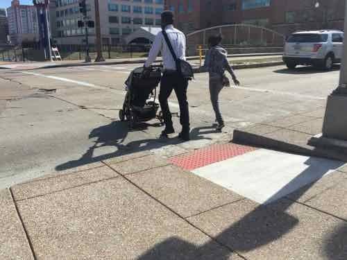
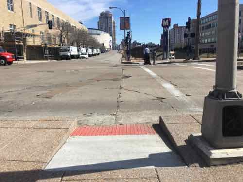
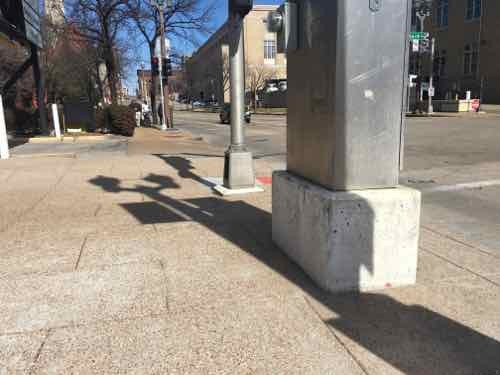
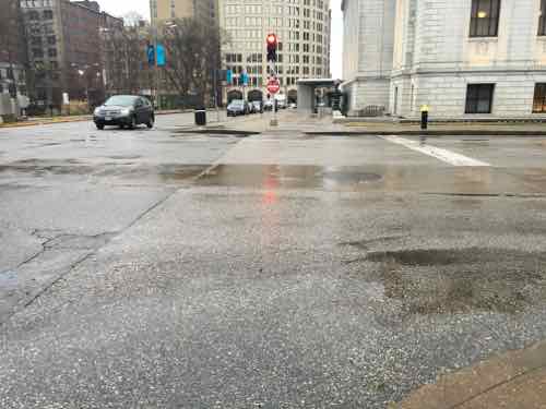
The best words that come to mind are gross incompetence. Both sides were completely opened up — all new concrete. That was the time to move pedestrian signals so they align with the crosswalk, to build the new ramps so they also align. I’m not sure if St. Louis’ new bike-pedestrian coordinator reviewed this, but other civil engineers did see it on paper. This is yet another thing making me realize I need to live in another city.

— Steve Patterson


Local Example of Light Rail in Center of Street

For a while now I’ve been trying to convey how disastrous light rail in the center of Natural Bridge & Jefferson would be. I kept trying to think of a local example, but then the 2006 light rail extension in the center of Forest Park Parkway in Clayton came to mind.

Southbound traffic on S. Meramec in Clayton see a wall and right turn only signs at Forest Park Parkway
Southbound traffic on S. Meramec in Clayton see a wall and right turn only signs at Forest Park Parkway. Click to view in Google Street View
To achieve higher speeds,places to cross would be reduced through the use of concrete walls.

Such walls preventing pedestrians, bicyclists, and motorists and crossing the street except at a few points would be horrible for the surrounding neighborhoods. Do as I did — go to the interception of Meramec & Forest Park Parkway and see if you think that would be good for Natural Bridge or Jefferson.

— Steve Patterson


St. Louis Fails At Crosswalks, Part 2

Monday, in Part 1, I explained why St. Louis officials shouldn’t be shocked their colorful art crosswalks don’t meet federal guidelines. They’re less visible than the classic bright white “continental” crosswalk.

Decorative crosswalk crossing Manchester at Sarah was installed in 2015
From 2011: A freshly painted "continental" crosswalk at 17th & Olive
From 2011: A freshly painted “continental” crosswalk at 17th & Olive

From the Federal Highway Administration (FHA):

8.5 Crosswalks
Crosswalks are a critical part of the pedestrian network. A crosswalk is defined as “the portion of a roadway designated for pedestrians to use in crossing the street” (Institute of Transportation Engineers, 1998). Crosswalks are implied at all intersections whether or not they are marked. Midblock crossings include all marked crosswalks that do not occur at intersections. Midblock crossings are only created if a marked crosswalk is provided. The agency responsible for the roadway must ensure that all marked and unmarked crosswalks and midblock crossings are optimized for the safety and accessibility of all pedestrians.

8.5.1 Crosswalk markings
Crosswalk markings, if provided, are used to define the pedestrian path of travel across the roadway and alert drivers to the crosswalk location. Marked crosswalks should be designed in accordance with the Manual of Uniform Traffic Control Devices (MUTCD). Although the MUTCD provides options for crosswalk markings, the continental design is recommended because research indicates that it is the most visible to drivers (Knoblauch et al., 1988). The ladder design is created with white longitudinal lines at a 90 degree angle to the line of the crosswalk. The lines should be approximately 305 mm to 610 mm (12 in to 24 in) wide and spaced 305 mm to 610 mm (12 in to 24 in) apart (USDOT, 1988). The continental design can also be installed so that the primary paths for vehicular tires are between the crosswalk markings, which helps to reduce wear and maintenance. Use of the continental design for crosswalk markings also improves crosswalk detection for people with low vision and cognitive impairments. It is recommended that the continental design be used consistently to mark all crosswalks; otherwise the impact of less visible markings may be weakened by comparison.

They make it very clear that “continental” crosswalk markings are preferred. The design is such that, if properly done, allows vehicle tires to roll over the non-painted areas — thus reducing wear on the paint.  The last sentence above is worth repeating:

“It is recommended that the continental design be used consistently to mark all crosswalks;
otherwise the impact of less visible markings may be weakened by comparison.”

Crosswalk markings downtown are anything but consistent, the continental marking is rare.

From the National Association of City Transportation Officials:

While pedestrians generally have the right to cross at any intersection regardless of crosswalks, designers should be sensitive to the misperception that a crosswalk is the only legal place to cross the street. Use crosswalks as both a guide for pedestrians and a way to communicate crossings to motorists.

The practice of discouraging pedestrian crossings by leaving uncontrolled crossings unmarked is not a valid safety measure. Instead, it encourages unsafe, risk-taking behavior and discourages walking citywide. Efforts should be made to enhance or highlight desired crossings wherever practicable. Hybrid beacons, rapid flash beacons, raised crossings, medians, and other safety counter-measures may be suitable and less expensive than full signalization. These should all be considered before leaving an uncontrolled crossing unmarked.

But we can’t afford to mark every possible crossing point — how do we determine when to mark and when to leave unmarked?

All legs of signalized intersections must have marked crosswalks unless pedestrians are prohibited from the roadway or section thereof, or if there is physically no pedestrian access on either corner and no likelihood that access can be provided. Pedestrians are unlikely to comply with a 3-stage crossing and may place themselves in a dangerous situation as a result.

Let’s look at 14th Street from Washington Ave to Olive Street to see how inconsistent St. Louis is with crosswalks:

Crossing 14th at Washington Ave the decorative brick crosswalk isn't as visible as the bright white continental design
Crossing 14th at Washington Ave the decorative brick crosswalk isn’t as visible as the bright white continental design
At St. Charles Street (glorified alley) there's no signal, no stop sign. There are two continental crosswalks
At St. Charles Street (glorified alley) there’s no signal, no stop sign. There are two continental crosswalks
The North side of Locust at 14th, a signalized intersection, has no crosswalk marking
The South side of Locust at 14th is the same -- n o crosswalk marking. Behind ,me is a school, the main library across 14th.
The South side of Locust at 14th is the same — n o crosswalk marking. Behind ,me is a school, the main library across 14th.
An aside -- the unmarked crosswalk leads to a non-compliant curb ramp that I pointed out prior to completion of the library.
An aside — the unmarked crosswalk leads to a non-compliant curb ramp that I pointed out prior to completion of the library.
Olive at 14th is the basic parallel white lines. Still more visible than the expensive decorative brick crosswalk at Washington Ave

I’d like to think St. Louis’ new bike/ped coordinator will be able to make a difference — but for so long pedestrians got half-ass infrastructure. Not sure one bureaucrat can change the culture.

— Steve Pattersin


St. Louis Doesn’t Care About Pedestrians, Recycling Bins Still Blocking Sidewalk

Over two years ago I posted about recycling dumpsters blocking a public sidewalk on the West side of Target, At the time Clifton Ave was being resurfaced so I wasn’t sure if they were on the sidewalk temporarily.

The six recycling bins, oriented to the street, viewed from across Clifton Ave
September 2013: The six recycling bins, oriented to the street, viewed from across Clifton Ave

In the time since I’ve noticed them still on the sidewalk, but I was passing by on Chippewa and couldn’t get a picture. Yesterday, Target had the Chippewa entrance to the lower level parking closed, so we turned onto Clifton Ave. — so I stopped the car to get a pic.

December 27, 2015. Click image to view in Google's Street View
December 27, 2015. Click image to view in Google’s Street View

Recycling is important, but so are pedestrians!  All pedestrians should be able to go from Chippewa to Bancroft — that’s why the sidewalk exists.

Here’s what needs to happen:

  1. Move the bins into the street, OR
  2. Add more sidewalk behind the bins, OR.
  3. Relocate the bins elsewhere

I’d love to know who made the decision to block the public sidewalk.

— Steve Patterson


Lemay Ferry (MO-267) Is A Pedestrian Nightmare

Yesterday I posted about the horrible pedestrian environment along the #12 MetroBus route in St. Clair County. I took that bus on Wednesday the 16th. That night, Fox2 ran a related story (Disabled man hit 3 times on Lemay Ferry, due to lack of sidewalks):

Tony Berding says he’s been hit 3 times by vehicles on Lemay Ferry.  Berding is disabled, and lives in a senior apartment complex in the 3600 block Lemay Ferry Road in South St. Louis County.  He uses a motorized wheelchair to travel to a nearby Quick Trip and Kmart.

Berding was struck last Thursday while traveling on a narrow shoulder along northbound Lemay Ferry.

That evening a reader messaged me about the story, but I didn’t have time to watch. The next morning I got a message from Berding’s sister, so I watched — horrified watching her brother use the narrow shoulder to get to the store. We messaged via Facebook, then text, and finally on the phone. This is about real people at risk because of how we have chosen to build our physical environment.

Lemay Ferry in South St. Louis County is far more urban than the area I traveled through in St. Clair County, I’ve taken the #73 MetroBus numerous times, most recently the morning of August 25, 2015:

A passenger got on at the SB stop across from Dierbergs
I took a pic of a vintage convertible in front of the QT mentioned in the Fox2 story
I got off past Lindbergh, I met my husband for lunch at IHOP

What I hadn’t done is roll along the part of Lemay Ferry mention in the Fox2 story. After looking at it on Google Street View I saw just how physically impossible the West side of Lemay Ferry was, the East side isn’t great — but it’s passable. I decided I’d have to drive to photograph. Before doing so I did some research.

Fox2 said St. Louis County indicated they couldn’t afford to buy land for the right-of-way to build a sidewalk on the East side. Two problems here: Lemay Ferry is also known as MO-267 — it’s maintained by MoDOT, not the county.  Secondly, the right-of-way is 80 feet wide — more than enough width for four travel lanes, a center turn lane, and sidewalks on each side! More on this later, let’s take a look at the problem.

Not far into the County there are good sidewalks, but no pads for accessing the bus or routes to buildings set back behind parking.
There are spots on both sides where there is no pretense of a sidewalk, such as this cemetery stop
Even spots where sidewalks exist they don't always connect to buds stops/ The curb here makes this inaccessible.
Even spots where sidewalks exist they don’t always connect to buds stops/ The curb here makes this inaccessible.
Here's a spot where a wheelchair user has no choice but to use the shoulder. What about an able-bodied parent walking with a small child or pushing a stroller?
Here’s a spot where a wheelchair user has no choice but to use the shoulder. What about an able-bodied parent walking with a small child or pushing a stroller?
Just before Reevis Barracks the sidewalk & bus stop are excellent
I was delighted to see a good connection to the adjacent bank!
But pulling back out to Lemay Ferry I noticed the curb to the North
Many spots where you see a sidewalk on the West side they're located on private property, don't connect to adjacent property -- the drive where the car is exiting has a curb.
Many spots where you see a sidewalk on the West side they’re located on private property, don’t connect to adjacent property — the drive where the car is exiting has a curb.
Looking South we have the same situation. A private sidewalk not usable by those who need it. Decoration adding to water runoff issues.
We stopped to fill up the tank at the QT mentioned in the Fox2 story. For many convenience stores are their primary grocery store.
Looking back North you can see what appears to be a sidewalk -- but it isn't accessible. It is, however, located in the PROW.
Looking back North you can see what appears to be a sidewalk — but it isn’t accessible. It is, however, located in the PROW.
How does a pedestrian get to the QT from the sidewalk? Up these steps from the side street!
From the next property to the South we see how the shoulder is the only option for anyone in a wheelchair.
A little further South we see a bus stop sign on a curbed island -- located in the PROW.
A little further South we see a bus stop sign on a curbed island — located in the PROW.
Looking South toward the apartments where Tony Berding has lived since 2001
From the entrance drive looking back North. The QT is less than a 10th of a mile. Click image for map
The Kmart is to the South
Pretty much the same thing heading South to Kmart. Curb after curb...
Pretty much the same thing heading South to Kmart. Curb after curb…
At the Kmart parking lot you see the only way in is the auto driveway

So why not just move? When you’re disabled and low-income housing options are very limited.  It has been 25 years since the Americans with Disabilities Act became law — St. Louis County & the Missouri Dept of Transportation need to prioritize this.

Below are two examples of dividing the existing 80′ right-of-way so still have four drives lanes & a center turn lane.

Two scenarios for the 80' right-of-way. The top version has the overly wide lanes currently in use and the lower has better 10' wide lanes. The ROW is wide enough! Click image to view larger version.
Two scenarios for the 80′ right-of-way. The top version has the overly wide lanes currently in use and the lower has better 10′ wide lanes. The ROW is wide enough! Click image to view larger version.

My guess is decades ago Lemay Ferry was a 2-lane road that got widened after people & businesses began moving to south county from south city. It went from a rural 2-lane to a 4-lane with center turn without any consideration for pedestrians. The 80′ right-of-way might have been in anticipation on more lanes of traffic — the land was subdivided before I-55 was even a dream.But MO-267, aka Lemay Ferry, is used by pedestrians. People use transit. Not all residents own cars.

It hasn’t kept up, but it needs to change.    Before someone gets killed!

— Steve Patterson


Advertisement


[custom-facebook-feed]

Archives

Categories

Advertisement


Subscribe