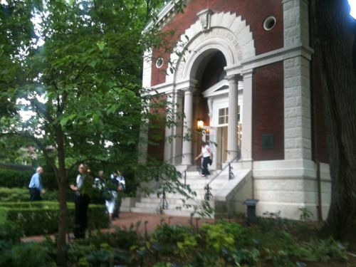
The library building at the Missouri Botanical Gardens is one of the original structures from when Henry Shaw opened his private gardens to the public in 1859 — 160 years ago. It’s a small structure, as the gardens expanded it simply outgrew it. It was rarely opened after being closed.
Since Shaw’s death in 1889, the building has served many functions—from research lab to offices to restaurant. Since its closing in 1982, it’s only open on special occasions, such as Shaw’s birthday celebration each July 24. (Missouri Botanical Garden)
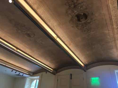
I was fortunate enough to get to see the interior on a rare opening on July 10, 2011. This meant leaving my wheelchair as the bottom of the steps and using the handrails to walk up the steps. It was worth the effort.
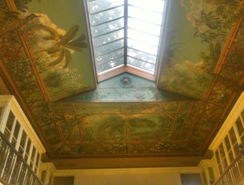
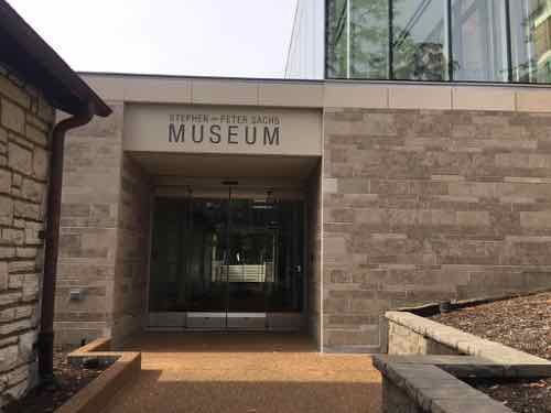
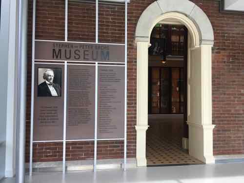
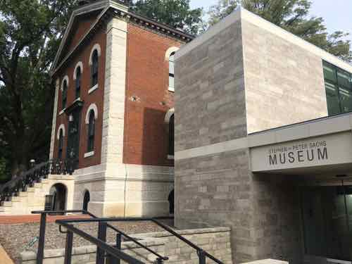
The Museum Building: Commissioned by Henry Shaw in 1858, this neoclassical building was designed by George I. Barnett and modeled after a building at the Royal Botanic Gardens at Kew, England. Originally, this building served as a small natural history museum, and housed the library.Interior in June 2011
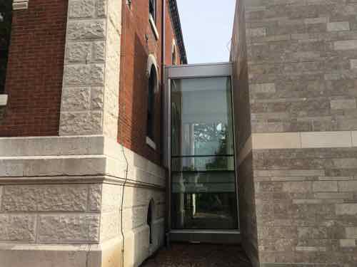
They planned a restoration project and addition to make the building accessible. Adding onto a significant historic building, especially one designed by a noted architect, is very tricky. Most people, I think, probably assume it’s best to use the same materials & style — to try to blend in. That’s the opposite of what is recommended!
Instead you want to use modern materials from current times. It’s best to not do irreversible damage where adding on.
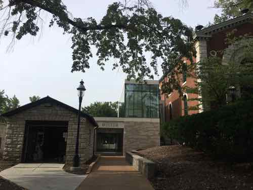
This view shows the original on the left with the 2018 addition on the right. A glass connector attaches addition to the historic. South facade.
I’ll let the architects behind the project explain the addition:
The 2,150 square foot addition is designed with a contemporary use of stone, distinguishing it from the existing building and reflecting current building technologies and materiality. A glass volume creates a formal entry on the north façade while the south façade is comprised of a modern limestone finish. The limestone masses define transparent entries both on the north and south facades. As a whole, the addition is simple, yet unique; providing much-needed access and facilities in a building that subtly complements the original historic structure. (Christner)
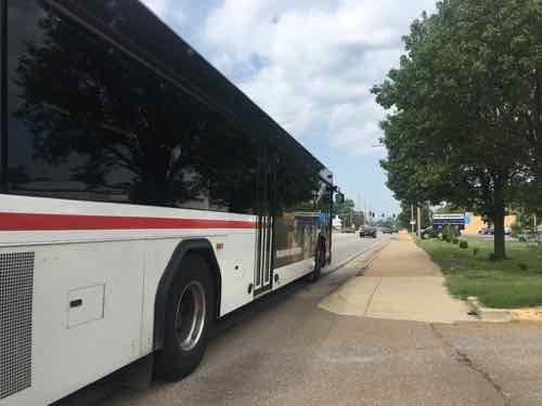
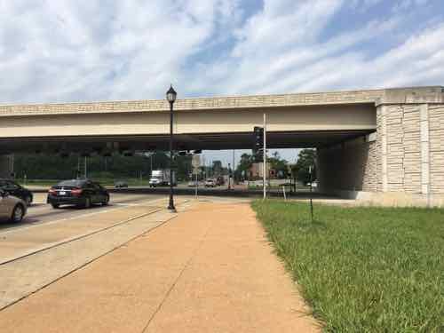
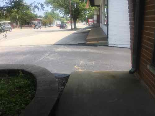
As you approach the historic main entrance from the North you’re directed toward the left.
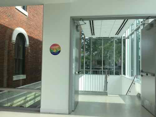
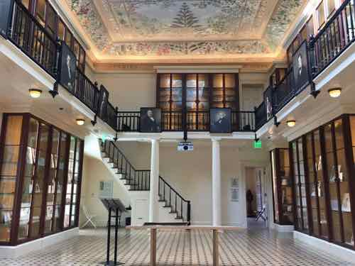
You see this sign first.You turn and see the addition, the garage on the left is old — but not historic.Approaching the entrance you can see through to the South entrance. This view shows an upper floor of glass walls.Looking back North from inside the upper level — the glass box is where the stairs come up. The elevator is behind me.No matter how you get up one level, this is what you see. A little bit of the outside wall is now inside. A former window becomes the opening into the main historic space.This is looking North, toward the original main entrance doors.This is the view looking South. The new addition is accessed at the back left, just past the bookcase. The upper level mezzanine is not open to the public.In the back (south) room a vaulted ceiling had been hidden for decades by a dropped plaster celling.Built-in shutters on the sides of the windows in the back space.Back at the South side you can see how stone on the addition conceals the elevator.
The addition not only provides access to the historic spaces, it also provides much-needed restrooms & drinking fountains on the East side of the garden. It opened last year, but it was only recently I got to see & experience it.
I’m so glad so many parents use baby strollers in public, it’s an added incentive to makes spaces accessible to everyone. Kudos to everyone involved with this project.
University City Missouri is a first-tier suburb of St. Louis. Many towns in the region are older, starting as rural villages. More than a quarter century after the municipal boundaries of the City of St. Louis were set in stone way out in the rural countryside, U City began at those limits:
University City was founded by publisher Edward Gardner Lewis, who began developing the location in 1903 around his publishing complex for Woman’s Magazine and Woman’s Farm Journal. Historic buildings associated with municipal operations, including today’s City Hall, were built by Lewis as facilities for his magazine enterprise. In 1906, the city incorporated and Lewis served as its first mayor. (Wikipedia)
The streetcar from the city was extended West into the new suburb, turning around there. The urban business district is now knows as the Delmar Loop because of the streetcar loop to reverse direction.
University City has a second East-West business district: Olive Boulevard. Where the Delmar Loop was established first, in the streetcar era, Olive developed later. Initially buildings were similar to those on Delmar: 2-story with residential over a business on the ground floor. As development marched Westward the automobile became more important and residential units above retail was no longer a thing — it was all about separation of uses. Business zoning meant businesses only, residential meant single-family detached homes, with a few zones for multi-family. Mixing these was considered a formula for creating blight.
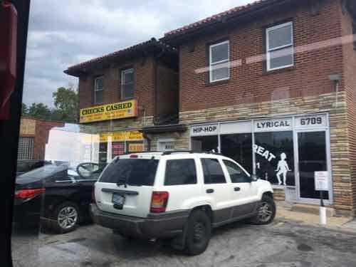
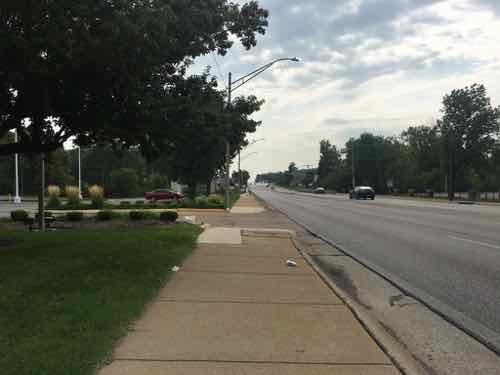
As a result, the 3.6+ miles of Olive Blvd has always been very different than the short half mile of the Delmar Loop business district located within University City’s limits. On Saturday August 25 2018 I decided to explore a portion of Olive Blvd targeted for redevelopment. Today’s post isn’t about proposed development and all the pros & cons associated with it. No, today is about documenting what exists now. My round trip took more than four hours, including stopping for lunch to eat and recharge my wheelchair. In that time I took 181 photos.
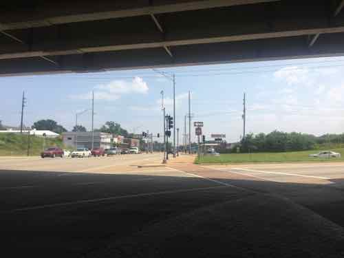
It was quite hot on that Saturday, but I feel it’s important to personally experience an area before writing about it. I’m not going to share all my images, just enough to give you a sense of the area. The #91 MetroBus starts at the Delmar Station (I arrived on the #97 MetroBus, not via MetroLink). Anyway, the #91 heads North on Skinker before turning left to head Westbound on Olive Blvd. — the start of the U City limits.
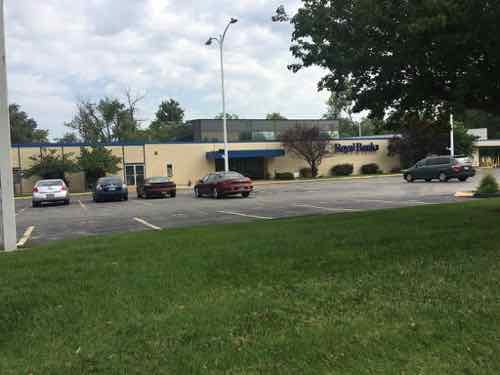
Having lived in St. Louis for over 28 years I’d driven this part of Olive many times, but this was my first time seeing it from the bus window. My interest on Saturday, however, was the far end of Olive. I got off the bus in front of Royal Banks (map). Before I get into my photos illustrating Olive Blvd I should give you some additional background. Neither University City or St. Louis County is responsible for maintenance of the road, sidewalks, signals, etc. The State of Missouri has that responsibility because Olive Blvd is also known as state Route 340.
Route 340 is a highway in the St. Louis metropolitan area. Its western terminus is Route 100 (Manchester Road) in Ellisville, and its eastern terminus is at an intersection with Ferguson Avenue and Olive Boulevard in University City. The stretch of Route 340 between Manchester Road and the Interstate 64 / U.S. 40 / U.S. 61 interchange is known locally as Clarkson Road. The remainder of Route 340 between this intersection and its eastern terminus is variously known as Olive Boulevard (which does not connect with Olive Street in the city of St. Louis. Route 340 ends at Ferguson Avenue in University City, but Olive Boulevard continues to Skinker Boulevard on St. Louis city line. (Wikipedia)
Not a divided limited-access interstate, but an urban corridor that is supposed to move more cars than other corridors — like Delmar Blvd. The headline gives away the theme — it was a nightmare. This comes from auto-centric development in the absence of a mandate for accommodating pedestrians.
OK, let the visual tour begin.
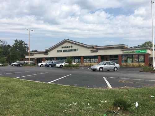
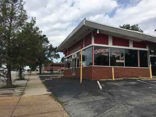
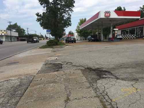
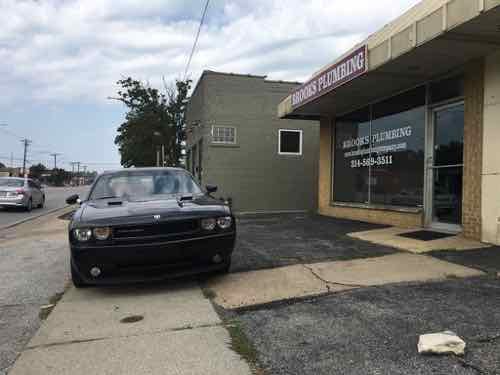
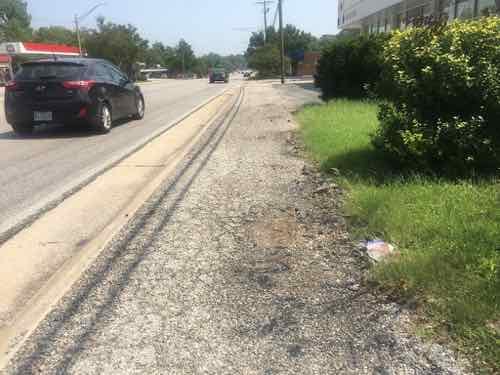
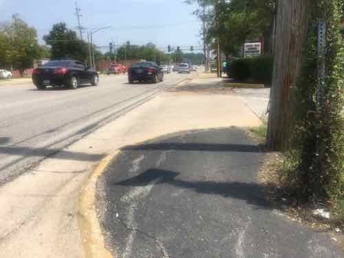
Taken on the bus, this 1915 building has residential above commercial. This is shortly before Olive Blvd becomes Missouri Route 340. Due to parking, clear pedestrian access is limited.Looking West as the bus continues heading on Olive Blvd to Chesterfield Mall.Looking East from the same spot. Olive Blvd is 4 travel lanes, plus a center turn lane. Sidewalks at this point are “attached”, no tree lawn separating roadway from sidewalk.The Royal Banks building, 8021 Olive Blvd, was built in 1971. In 1958 the land was vacant.Next door, to the West, is a store specializing in Asian/International groceries. It was built in 1960 — has been updated many times since. Both are set way back from Olive to provide more room for parking.
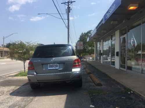
Despite the presence of a bus stop, neither provide an accessible route to their accessible building entrance. This is the case for nearly every property I encountered the next few hours.
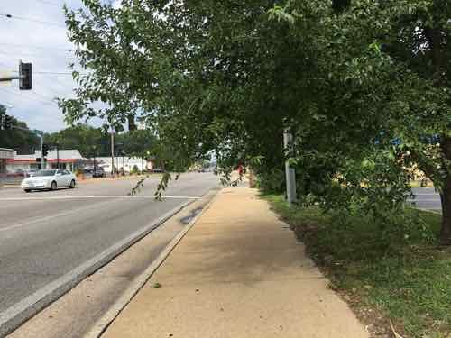
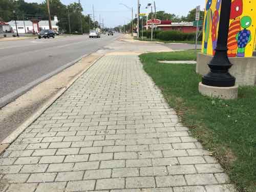
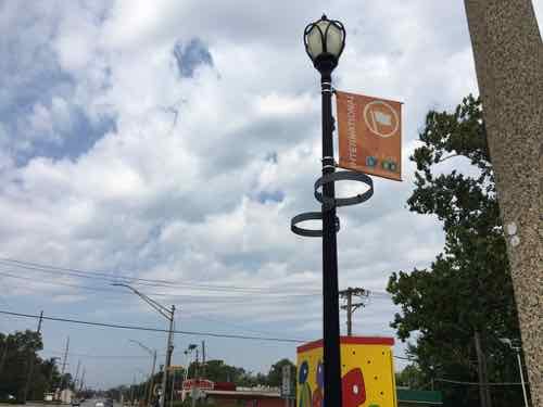
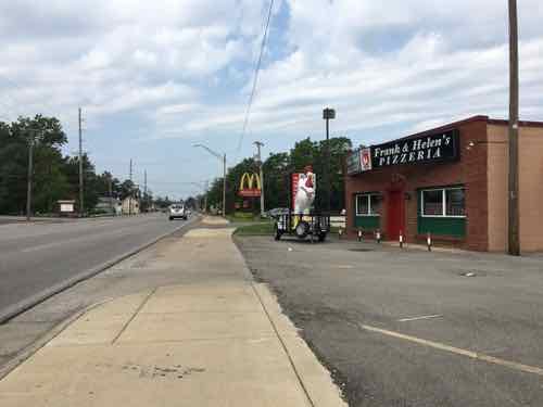
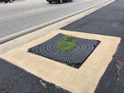
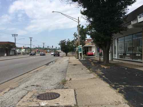
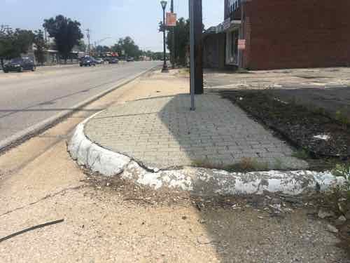
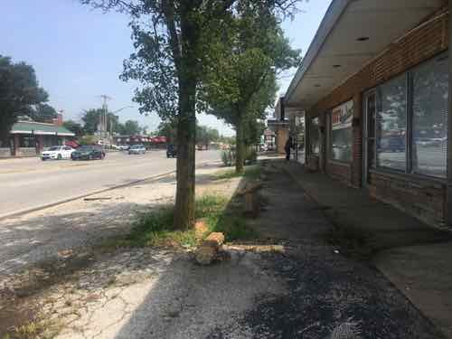
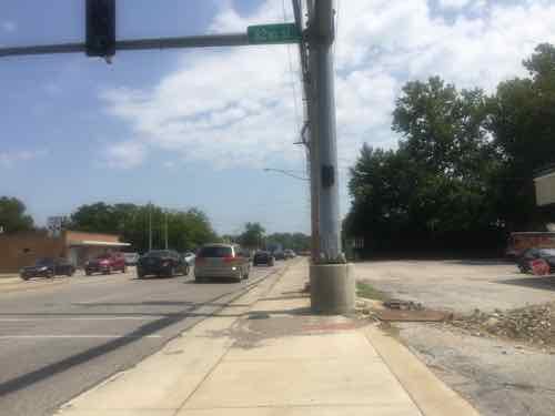
I quickly encounter a point where foliage is hanging over the sidewalk. I’m sitting in my wheelchair and still hit it when ducking.In places the paving changes to a paver brick intended to spruce up the pedestrian experience. As expected, they were uneven.The streetlight is also intended to help the image of Olive. The banner is for the Olive Link International district, next to rings meant to hold planters.This shows a 1962 pizza place is relatively close to Olive.Broken grate around a former street tree.
The above was written back in August, shortly after taking the trip on Olive. Rather than continue procrastinating, I’m going to post more pics with limited commentary to be able to finish this post.
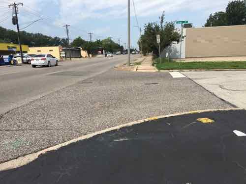
One of many places where no curb cut exists, there’s a good ramp across the street but not this side
Yesterday as I was finishing up this post I reviewed all nearly 200 photos I took that hot August day. After wishing it wasn’t so cold now, I recall all the obstacles I encountered in my wheelchair. I also thought about how horrid the environment is for anyone to experience as a pedestrian.
Now that I’ve finally gotten this post completed, I can post about plans to redevelop the Western end of Olive Blvd in University City.
September 10, 2018Accessibility, Featured, Planning & DesignComments Off on Accessibility Details: Soap Dispensers & Trash Receptacles in Public Restrooms
Section 504 of the 1973 Rehabilitation Act was the first disability civil rights law to be enacted in the United States. It prohibits discrimination against people with disabilities in programs that receive federal financial assistance, and set the stage for enactment of the Americans with Disabilities Act. Section 504 works together with the ADA and IDEA to protect children and adults with disabilities from exclusion, and unequal treatment in schools, jobs and the community. (Disability Rights Education & Defense Fund)
Section 504 was added to the Rehabilitation Act of 1973 four years later, in 1977. It has been over four decades since we first began to construct buildings accessible to the disabled, and more than three decades prior to my becoming disabled due to a stroke in February 2008. Though significantly better than they were decades ago, things still aren’t quite right.
Today a few of minor examples: public restroom soap dispensers & trash receptacles.
After using a public restroom the ability of me to use soap to wash my hand depends on access to the soap dispenser. At the Culinaria grocery store downtown the two soap dispensers are wall-mounted very high in corners. When I’m in my wheelchair it takes a lot of stretching to reach the one on the right. Not everyone who uses a wheelchair can stretch that far.
DuPont, formerly Solae
At Solae (now DuPont) at CORTEX, the soap dispenser is on the side of the sink — much easier to reach — but I still can’t get any soap from it.
This dispenser is very long, it’a designed for use with two hands — one to press down so soap comes out on the other.
I have two hands, but use of my left remains very limited. Shorter dispensers of this type I can use one-handed, pressing down at the back while getting soap on part. Long dispensers like the one at Solae/DuPont is completely useless to me.
Soap dispensers are, generally speaking, specified when buildings are designed/constructed. My other issue is with trash receptacles, this is either because a good location wasn’t part of the original design or the occupants moved them to be in the way.
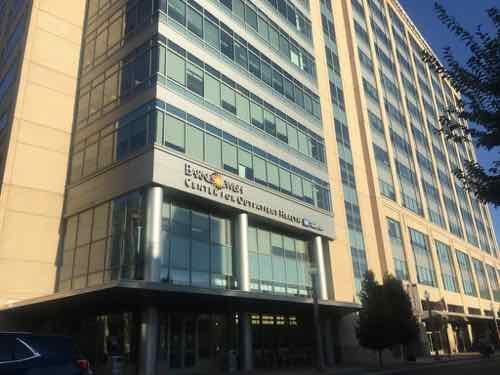
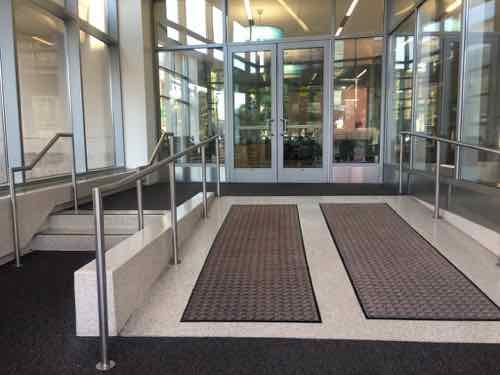
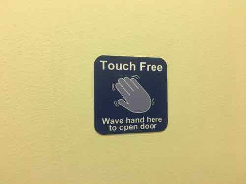
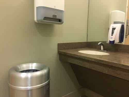
BJC’s recently completed Center for Outpatient Health on the NW corner of Forest Park & EuclidI love how the main entrance off Euclid is a very wide ramp, with steps off to the side — the opposite of so many older buildings with wide steps and a narrow ramp on the side.I also love how inside they have touch-free “buttons” to open bathroom doors.Thankfully the first floor bathroom has two sinks & paper towel dispensers, because the trash receptacle prevents me from reaching the left side. These soap dispensers are mounted low enough to be usable.
In the restroom above there really is no other spot where a trash can could be located. This might have been a good candidate for one under the vanity with the hole in the center, or a wall-mounted paper towel/trash unit.
To make matters worse, what doesn’t work for me may work great for another disabled person. And vice versa.
The take away from this post is details matter. Architects, designers, facilities managers, occupants, and owners of public buildings need to think about the little things. Hiring a disability expert to review projects during design can reduce user issues.
Still, I’m grateful for the ADA, building codes, etc. that have made public restrooms significantly better than they were decades ago.
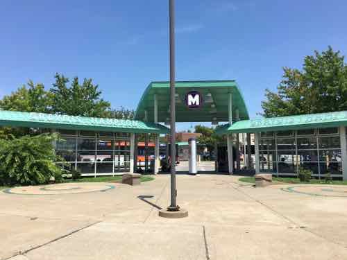
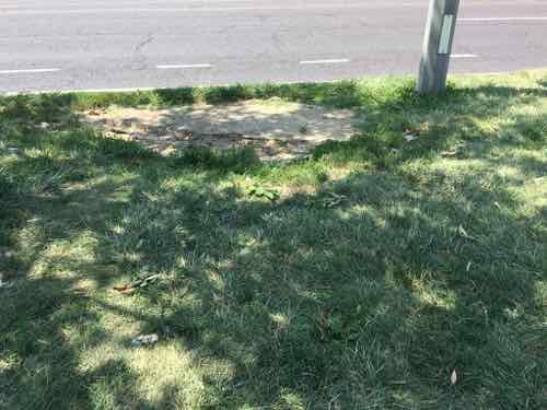
Usually when I go to my regular doctor I take either the #97 (Delmar) MetroBus or MetroLink to connect with the southbound #90 MetroBus at Goodfellow or Forest Park station, respectively. However, depending on the bus schedule and my appointment time I’ll take the #10 MetroBus from Olive @ 16th to the Gravois-Hampton MetroBus Transit Center, and then catch the #90 MetroBus heading northbound. The alternative takes about 15 minutes longer, but often will get me to my destination closer to my appointment time.
The #10 (Lindell-Gravois) MetroBus ends at the transfer center on the NE corner of Hampton & Gravois
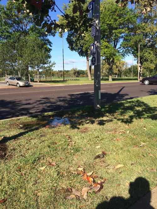
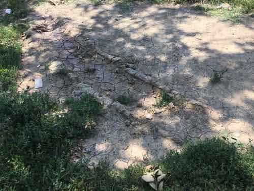
But I only take the Gravois-Hampton alternate if it hasn’t rained recently. You see, the bus stop I use to catch the Northbound #90 is a muddy hole if it has rained recently.
The bus stop is where thw standing water is on this October 2014 photo.
‘The Northbound #90 bus stays on Hampton rather than pulling into the transit center. Riders getting off/on must use the grassy tree lawn.
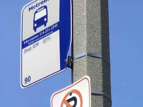
At the bus stop looking South toward the MetroBus transit centerLooking North, note the bus stop sign is mounted very high on the poll — and facing the street. I couldn’t read the stop ID from my wheelchair.Cropping later I could see it’s stop #3275The tree lawn is quite wide here, you can see how the grass is well-worn.Up close I could see a tire track likely made when it was muddy
Even dry this stop is a problem when boarding. When the bus driver puts out the ramp/lift it leaves a huge gap my chair must get up — this is because all the use has worn this spot down so it’s lower than the curb and surrounding grass. Recently I was waiting in the grass just before the stop to avoid this problem. It’s adenegrated experience for everyone dry or wet, impossible for us wheelchair users when wet.
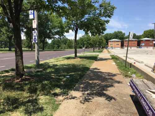
Metro occasionally gets grants to improve accessibility of MetroBus stops — #3275 needs to be toward the top of the list for improvement.
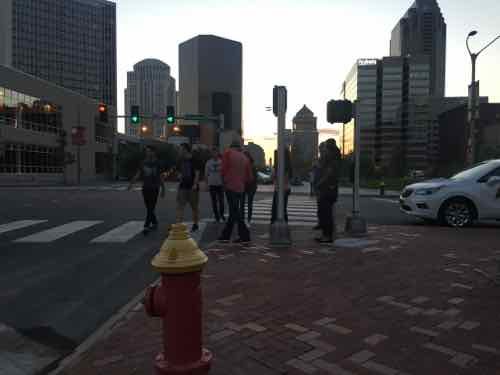
Recent work downtown has been mostly good for pedestrians, but Saturday night my husband and I found an awful corner: the NE corner of Market & Broadway. This is the SW corner of the Old Courthouse. I;m not sure who gets the blame, the possible culprits are city streets dept, city board of public service (BPS), MoDOT, National Park Service, or Gateway Arch Park Foundation.
Most new work has gotten away from placing one curb ramp at the apex at the corner, instead doing a ramp/crosswalk to cross each street. This improves ADA-compliance and reduces inconveniences for all pedestrians.
We had to cross the ramp on the NE corner of Market & Broadway as we crossed Broadway. Both times the ramp was full of pedestrians waiting to cross Market. Both times I had to ask others to move.
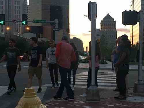
Heading back to Kiener Plaza I snapped this photo of the crowd at the corner, two guys on the left are avoiding the crowd at the corner by walking in the street — not an option for those of us who use mobility devices.In this crowed view you can see hoe the one crosswalk is angled to meet the sole curb ramp.
The idea is to get Arch visitors to start in Kiener Plaza, so this corner should see many pedestrians. It amazes me each crosswalk doesn’t lead to its own curb ramp.
No, I’m not amazed. I’ve experienced first hand how even brand new work ism’t designed by people who think like pedestrians.
AARP Livibility Index
The Livability Index scores neighborhoods and communities across the U.S. for the services and amenities that impact your life the most
Built St. Louis
historic architecture of St. Louis, Missouri – mourning the losses, celebrating the survivors.
Geo St. Louis
a guide to geospatial data about the City of St. Louis