Home » Accessibility » Recent Articles:

St. Louis’ Riverfront Reopening Next Week

We’re all invited to a riverfront picnic next week, Thursday June 2nd.  No blanket needed — a 2,016 foot-long table will be set up, chairs provided.

From the official press release:

Great Rivers Greenway, the City of St. Louis, CityArchRiver Foundation and other partners invite residents from across the region to join them in celebrating the transformation of the St. Louis riverfront on Thursday, June 2. The organizations will be hosting a “Picnic on the Riverfront” event from 5:00 to 8:45 p.m., which will feature St. Louis’ largest-ever community picnic – complete with a 2,016-foot-long table with chairs – to commemorate the opening of the new riverfront beneath the Gateway Arch.

The official ribbon cutting on June 2 will begin at 5 p.m. on the overlook stage along Leonor K. Sullivan Boulevard, with remarks from dignitaries and partners. Afterward, attendees can explore the nearby Mississippi Greenway, enjoy local music and educational activities for kids and purchase dinner from food trucks and other vendors. People are also welcome to bring their own picnic meal. An interfaith blessing will kick off dinner at 6:15 p.m., followed by an aerial photo of all the picnickers. The event will end with a brief fireworks display at 8:30 p.m.

“This new front door for our region celebrates the energy, adventure and awe of the mighty Mississippi and our iconic Gateway Arch,” said Susan Trautman, Executive Director of Great Rivers Greenway, the regional parks and trails district and lead agency on the project. “We invite people to bring their friends, family and neighbors from all parts of the region to celebrate.”

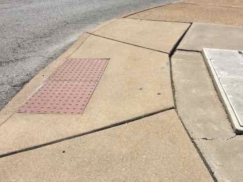
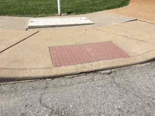
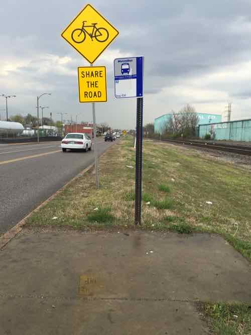
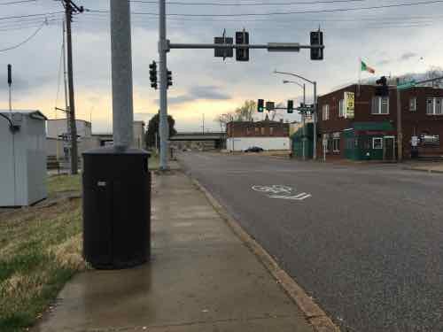
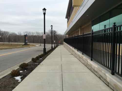
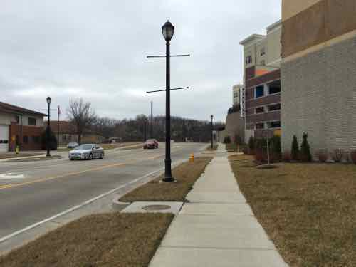
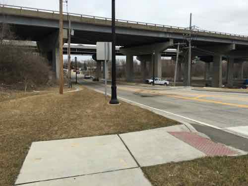
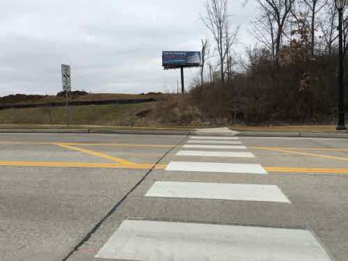
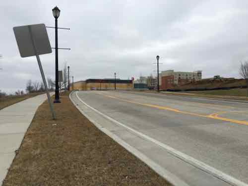
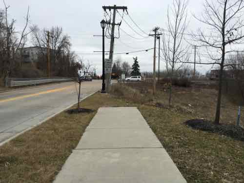
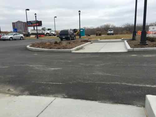
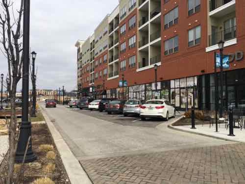
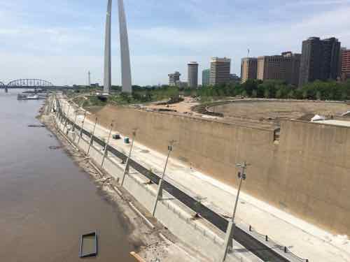
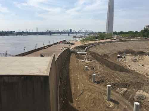
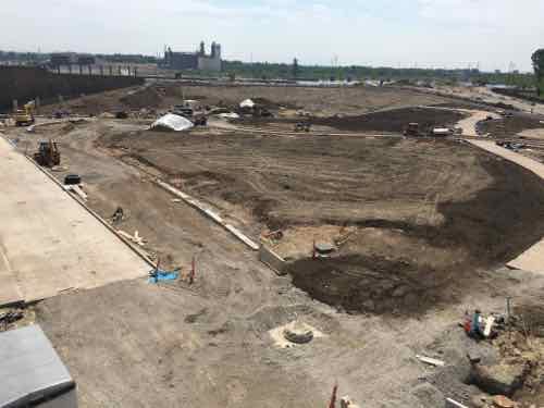
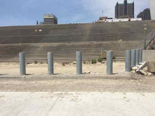
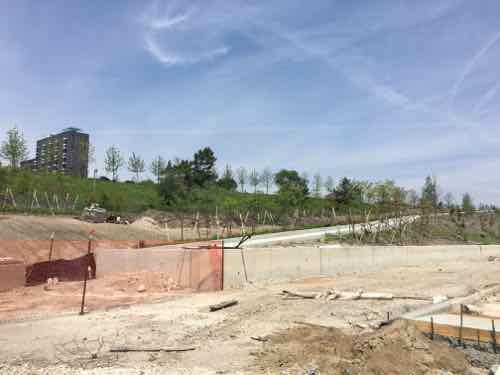
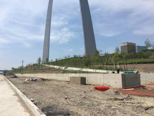
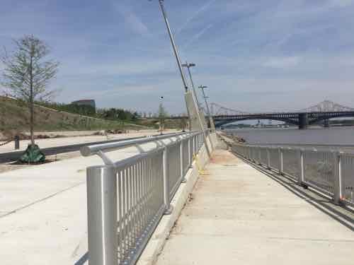
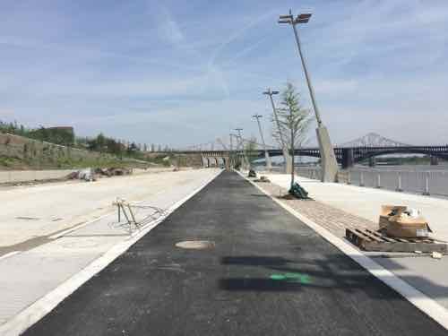
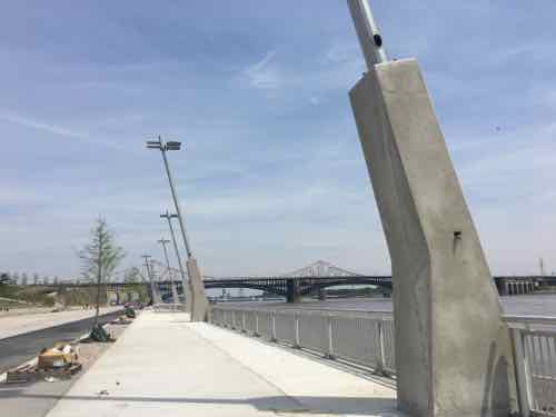
The renovation of the 1.5-mile stretch of riverfront includes the recently rebuilt Leonor K. Sullivan Boulevard and extension of the Mississippi Greenway from the Biddle Street Trailhead south to Chouteau Avenue, with protected walking and biking paths. The entire riverfront was elevated an average of almost two feet to limit flooding, returning more days of the year back to the community for walking, riding bikes, sightseeing and special events. While the historic elements were preserved, such as the cobblestones lining the levee; new amenities such as benches, bike racks, lights, power outlets and a street-level stage will make the space more inviting for events and programs. The lineup for this summer and fall includes bike rides, walk/run events, the St. Louis Brewers Guild Heritage Festival, a free concert series with The Sheldon, swap meets and more.

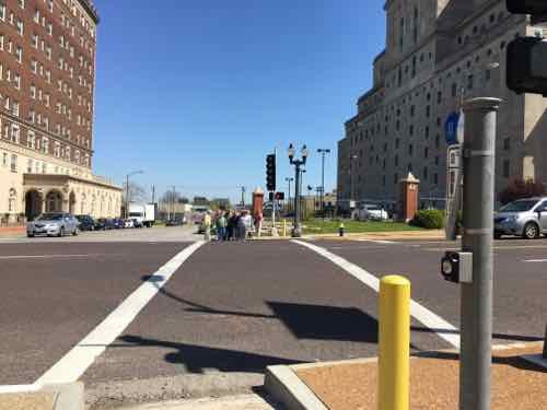
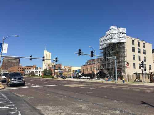
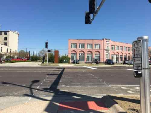
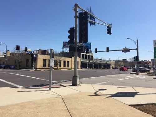
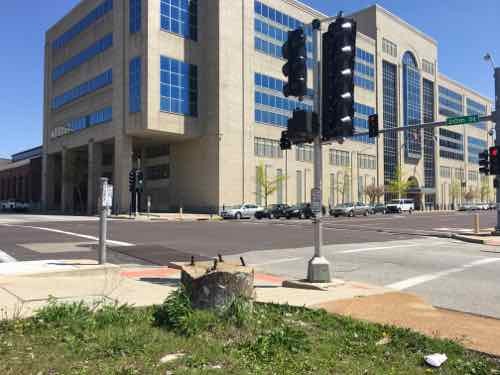
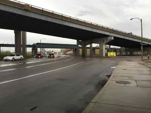
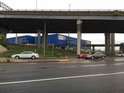
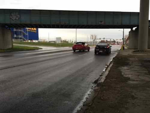
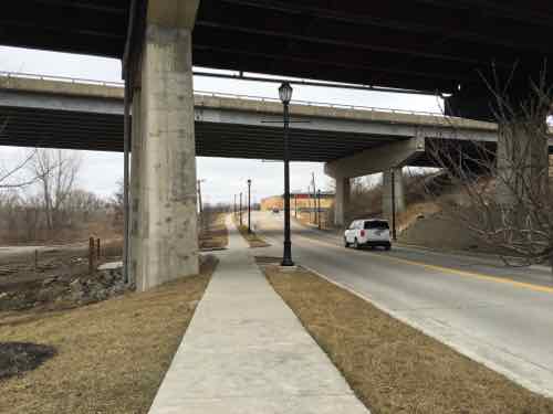
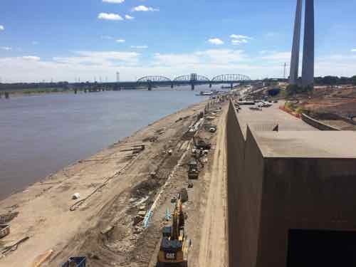
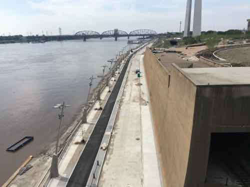
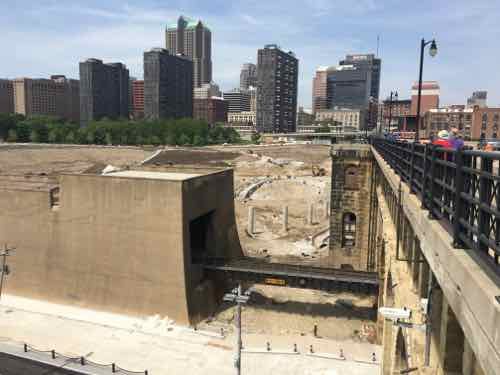
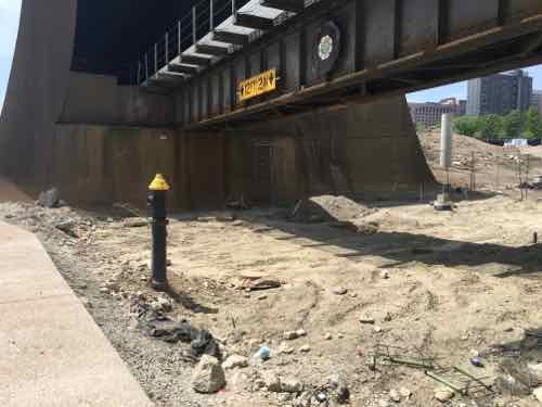
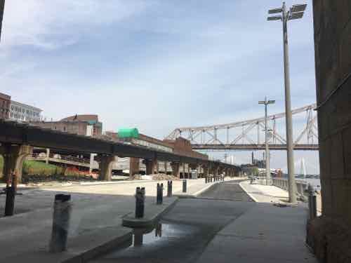
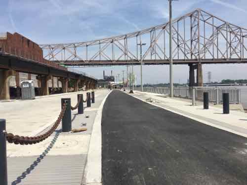
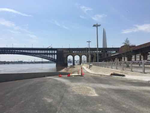
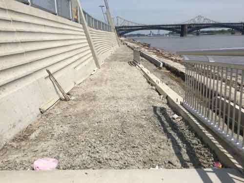
Earlier this month, on May 8th, my husband and I decided to check on the progress from the Eads Bridge. First though, a photo from September 2015:

Work continues on the North end of Lenore K. Sullivan -- raising it was delayed by flooding. Click image to see September 2015 post with more images
Work continues on the North end of Lenore K. Sullivan — raising it was delayed by flooding. Click image to see September 2015 post with more images
Looking more complete on May 8, 2016
Looking West from further out
Looking down river
Looking down river
Moving closer to downtown
Further West
Further West
Down on Lenore K Sullivan looking where Washington Ave used to be
Lenore K Sullivan Blvd is now higher
Looking North from Eads Bridge, Laclede's Landing area on the left beyond the elevated tracks
Looking North from Eads Bridge, Laclede’s Landing area on the left beyond the elevated tracks
Further North, ML King Bridge in background
Looking back south toward the Eads Bridge
Now at the center, some steps will be hidden by the new elevation of Lenore K Sullivan Blvd
Still under constructions are four ramps from the top down to bottom
These ramp will be great for those of us in wheelchairs, pushing strollers, etc
These ramps will be great for those of us in wheelchairs, pushing strollers, etc
There will also be ramps down to the cobblestones
It appears a smooth concrete sidewalk will run along the base pf the wall next to the rough cobblestones
Looking South from the bike/job path
One of the smartest ideas is concrete bases for light fixtures, these can go under flood waters without messing up wiring

So bring food, buy from food trucks, or just show up on June 2nd. I’m looking forward to exploring from end to end. Access is best from Chouteau or Laclede’s Landing Blvd (under the King Bridge).

For more event information see:

I’ll do a complete review after completion.

— Steve Patterson


Downtown>Hampton>IKEA>Downtown Part 2

Yesterday, in Part 1, I talked about the two different transit I’d taken (MetroLink, #90 & #32 MetroBus) and issues faced as a pedestrian trying to navigate in between.  I’d made it to IKEA for shopping, followed by lunch.

I'm obsessed with food so naturally I took a pic of my plate: Veggies balls with vegetarian black bean sauce,, steamed veggies, Swedish apple cake, and tap water.
I’m obsessed with food so naturally I took a pic of my plate: Veggies balls with vegetarian black bean sauce,, steamed veggies, Swedish apple cake, and tap water.
When I was done with lunch the rain had resumed.

I checked the transit options, it would be a while before a MetroBus stopped out front. Plus, that would only get me to Lindell where I’d have to wait in the rain for the #10. The Grand MetroLink is closer than the CWE MetroLink, but Forest Park is the most direct route and I recall some access issues the last time. Plus, my transfer from earlier was now long expired.

No matter what I’d be in the rain, so I decided to just roll home — 2.9 miles. I’ve done it a few times before, though not in the rain. I’m still wearing a poncho to keep me and the controller on my chair dry. My shoes, however, get soaked.  North on Vandeventer to Lindell. I stayed on the West side of Vandeventer because I’m bot sure if the city ever got around to the huge gaps in front of the curb ramps on the NE corner of Vandeventer & Forest Park. At Lindell, I checked the schedule again — I can get home before the next bus would arrive.

Because of the rain I only took a few pictures. The following week I took the bus to Lindell & Spring to backtrack and take pictures of things I saw in the rain.

Lindell & Spring, the crowd passed the walk button. Not sure if required.
New traffic signals being installed at the Lindell/Olive intersection. April 6th
This signal is long overdue! In the background the Hotel Ignacio is getting its EFIS facade repaired
How many years ago did I post about the need for painted crosswalk lines here? August 2011 -- click image for post.
How many years ago did I post about the need for painted crosswalk lines here? August 2011 — click image for post.
Olive & Compton, no need to push the button tho cross Compton. If you want to cross Olive you must press the button.
At Ewing is a ramp my powerful chair cannot get up -- the vertical height is too much. April 6th
At Ewing is a ramp my powerful chair cannot get up — the vertical height is too much. April 6th
The same ramp again. Like hundreds/thousands of curb ramps it was built too high relative to the paving. Plus, like so many, the paving right in from is partially missing. I have to role in Ewing a little bit to get to a driveway.
The same ramp again. Like hundreds/thousands of curb ramps it was built too high relative to the paving. Plus, like so many, the paving right in from is partially missing. I have to role in Ewing a little bit to get to a driveway to get onto the sidewalk.
The West side at Ewing & Olive is another issue. The concrete at the top has caved in. .
The West side at Ewing & Olive is another issue. The concrete at the top has caved in between the top of the ramp and the access panel.
I've not tried to go up this ramp. it might also be impossible
I’ve not tried to go up this ramp. it might also be impossible
At Leffingwell you must press the button to get a walk signal to cross Olive -- even when traffic has a green light
At Leffingwell you must press the button to get a walk signal to cross Olive — even when traffic has a green light
At Olive & 20th I saw the buttons in the rain, they were far away. To cross 20th you needed to be over by Olive and vice versa.
When I went back I confirmed no button is needed to cross 20th but you do need to press a button top cross Olive. The signs are wrong, the button next to each crosswalk is what is wired.

Used to be — but no curb ramp is missing for the nearly 3 mile trip. If I tried to use Locust there are many missing curb ramps.

I still fail to understand why all the cost of the buttons when they don’t need to be pushed in the East-West direction. And why have to press a button to get a walk signal when vehicles from side streets get a green light?  This is how we’ve spent money — building infrastructure that frustrates this pedestrian!

— Steve Patterson


Downtown>Hampton>IKEA>Downtown Part 1

The morning of April 6th I had a 9am appointment on Hampton Ave, between Columbia & Elizabeth. It was raining off and on that day. Today’s post is about the journey there & back.

I had originally planned to take MetroBus there, but I didn’t have any two-hour passes so I’d get a transfer for the 2nd bus. So I went to the Union Station MetroLink station, purchased a few passes, validated one, boarded a Westbound train to the Forest Park MetroLink station. Just before a Southbound #90 (Hampton) MetroBus arrived it began to sprinkle. I left home in a poncho to keep  and my wheelchair’s controller dry.

View out a Southbound #90 MetroBus on Hampton about to cross over I-64. Traffic was backed up on the highway and WB on ramp

After taking care of business at two places on Hampton, I wanted to visit IKEA to shop and have lunch. The most direct route was a short ride on a Northbound #90 (Hampton) MetroBus, then take a #32 (Chouteau-Manchester) MetroBus to Vandeventer. But when I was ready to leave it was going to be a while before the next #90 arrived, I might as well just roll it.

I’ve gone up to Clayton Ave before, so I knew  I could manage — it was about 3/4 of a mile from my starting point to Lloyd Ave. where I’d go right to make my way down to Manchester (map).   As I turned off Hampton onto Lloyd I was pleasantly surprised a sidewalk existed — I wasn’t sure that would be the case. However, a the bottom of the hill there was no sidewalk along Sulphur. Well, there is along the East side, but because of curbs, I couldn’t get to it.

At this point I had two options:

  1. Roll on the Sulphur Ave roadway, or
  2. Go back up to Hampton, cross, reach Manchester on the other side.

Looking at the time I thought I’d miss the next #32 if I went with the safer #2 option. So, when there was no traffic I quickly rolled South to Manchester. Whew…

The ADA ramp to cross Manchester is covered in a fine gravel. I can power over it but others would have difficulty.
Looking back where I'd been
Looking back where I’d been
The EB MetroBus stop. I wish it had a curb at the far right edge to prevent backing up too far and rolling down the hill.
Looking West to see the #32 coming. In September I posted about the danger of reaching one bus stop to the West -- clock image to view that post
Looking West to see the #32 coming. In September I posted about the danger of reaching one bus stop to the West — clock image to view that post

So the #32 MetroBus came right on time, my transfer was still valid, and it had stopped raining. I’d get off at Vandeventer Ave and roll North to IKEA — about a half a mile. So I got off at the last MetroBus stop before Vandeventer Ave., just had to cross one side street first.

Hemp Ave is between the bus stop and Vandeventer, but no curb ramp is visible. But be just out of view
Nope, just 100 feet from a bus stop there's no curb cut! I found a driveway I was barely able to use to get onto the sidewalk
Nope, just 100 feet from a bus stop there’s no curb cut! I found a driveway I was barely able to use to get onto the sidewalk
Looking North I'd hoped to cross here to stay on the West side of Vandeventer -- but pedestrians aren't allowed ri cross at this point
Looking North I’d hoped to cross here to stay on the West side of Vandeventer — but pedestrians aren’t allowed ri cross at this point
So I crossed Vandeventer, them crossed Manchester. The sidewalk design makes it clear to not go East on Chouteau.
QuikTrip thinks this is a compliant pedestrian route. It's not.
QuikTrip thinks this is a compliant pedestrian route. It’s not.
Heading North, but I see a problem ahead. Initially I thought no sidewalk existed after the building on the right
But the tiny sidewalk has been blocked by Laclede Cab. Looking at city records, the public right-of-way is as wide as it is ned to the building -- the sidewalk should be wider!
But the tiny sidewalk has been blocked by Laclede Cab. Looking at city records, the public right-of-way is as wide as it is ned to the building — the sidewalk should be wider!
Continuing, I'm almost to Market St. JJs Clubhouse, a gay bar, is to the right
Continuing, I’m almost to Market St. JJs Clubhouse, a gay bar, is to the right
Turning left, I can see my destination--almost there!
Turning left, I can see my destination–almost there!
Rough surface that would be a challenge for many
When the side on the right is soon developed, this sidewalk will be redone. Still, this was great compared to what I had just experienced
But when IKEA was built one time section was left as gravel and my chair couldn't get up over the vertical edge -- not with me in it. Unlike many, I'm fortunate enough to be able to stand on level ground. So I got up and the chair could then get up to the sidewalk.
But when IKEA was built one time section was left as gravel and my chair couldn’t get up over the vertical edge — not with me in it. Unlike many, I’m fortunate enough to be able to stand on level ground. So I got up and the chair could then get up to the new sidewalk.
Looking back we can see the tiny section left unfinished and inaccessible for more than half a year .
Finally, I can now cross to IKEA.

Combined with public transit, I can cover miles as a pedestrian in my wheelchair — though our public rights-of-way are far from ideal. Looking at Google Maps it suggests using Sarah to reach IKEA instead of Vandeventer — no matter where you start from: Commerce, QuikTrip, Laclede Cab, even JJs Clubhouse! Yes, if you’re at Vandeventer & Market where you can see IKEA it suggests you cross Vandeventer and go West on Clayton Road to Sarah.

This isn’t a lack of money issue — it’s a lack of concern issue. Money is spent building infrastructure that doesn’t work for actual users. This mentality needs to change!

Tomorrow’s post will be about my trip back downtown from IKEA.

— Steve Patterson


An Open Letter To St. Louis’ Bicycle/Pedestrian Coordinator, Jamie Wilson

Jamie,

This open letter is in response to your February email reply regarding my posts St. Louis Fails At Crosswalks, Part 1 and Part 2. You wrote:

Thanks for your input on the crosswalks. I’m working on improving our pedestrian facilities and we will get better. Please feel free to send me other locations you’ve noticed besides those mentioned. I’d also value any pics you may have from other cities in your travels that have different approaches.

Since you asked, I put together information on problems I’ve seen here in St. Louis, along with solutions I’ve seen in other cities. I’m making this open to increase public awareness and discussion. It does cause me concern that a “traffic engineer” is in charge of pedestrian & bike issues — it is traffic engineering that has made it such a liability to be a pedestrian or cyclist in this city & region. This is reflected in pedestrian deaths.

That said, I do know engineers can do good work — when they think like pedestrians instead of drivers! The Portland Pedestrian Design Guide, dated June 1998, is a great place for you to start your re-education. Yes, a document nearly two decades old shows how far behind St. Louis is when it comes to addressing the needs pedestrians.

Here’s my initial list — in no particular order:

  1. Do not require pedestrians to press a button to get a WALK signal — except in very limited circumstances.
  2. Make sure every leg of a signalized intersection includes a pedestrian signal — with countdown timer.
  3. Allow pedestrians to cross at each leg of an intersection.
  4. Give pedestrians a head start with a WALK signal a few seconds before the traffic light turns green.
  5. Give pedestrians the walk before left-turning traffic, trailing left instead of leading left.
  6. Time pedestrian signals consistently. Some say DON’T WALK while traffic still has 30-60 of a green light remaining.
  7. Make sure sidewalks are level, not cracked. Sufficiently wide through path so pedestrians can meet/pass — not single file.
  8. Ramps perpendicular to curb, not on the apex of the corner.
  9. Use street trees and/or parked cars to separate pedestrians from vehicles
  10. Mid-Block crossings should be marked in the middle — a center sign and/or overhead light/sign

I don’t have photos to illustrate all ten items, but here are some:

A crosswalk & pedestrian signal in Cincinnati OH
The sign above the pedestrian signal lets pedestrians know this signal requires activation
They al;so mark the buttons too let pedestrians know they need to activate the walk signal.

In their downtown the bulk of the crossings were automatic, no activation required. This is how it should be in places with higher pedestrian traffic. There were a couple of places where they need a button but that was only to activate audio signals for those visually-impaored — a sign was there to let the rest of us know it was an audio signal — we didn’t need to press it to get a WALK signal.

Cincinnati

As Oklahoma City rebuilds downtown the new crosswalks are very wide, curb ramps can accommodate many users. July 2012

Contrast this with the narrow crosswalks and curb ramp in/around Ballpark Village — which are undersized for game-day pedestrian volume. As I find more examples in my photo library I’ll do a new post(s). In the meantime, I’d like us to take a walk.Ideally, we’d arrange for a power wheelchair for you to use so we can cover more territory.

Additional reading:

And please take 20 minutes to watch Dan Burden:

— Steve Patterson


A Detailed Look at the Streets of St. Charles

Last month I posted about the Streets of St. Charles after driving through it, see Indulge In Urban Living’ At Streets of St. Charles. In that post I wrote:

To most residents of St. Charles County this is more urbanity than they ever thought they’d see on their side of the Missouri River.

A decade or more ago this site would’ve been developed as a big box with an even bigger parking lot. Smaller buildings would’ve dotted the perimeter. Visitors would’ve been expected to arrive via car and to drive to reach other buildings on the site.  From my brief observations, it appears the planners have made sure pedestrians can reach every building via a sidewalk.

While I’m not going to give up my downtown loft to live here, it’s an improvement over old-school development patterns.

I didn’t feel I could be too harsh based on just driving through. So, later in February, I returned in my power wheelchair so I could spend more time there —  to see how well it works…or doesn’t. Within the project boundaries it works fairly well, they’ve made a much better effort than most developments to make sure each business is accessible as a pedestrian. Attempting to reach adjacent & nearby developments proved difficult, though the blame for that isn’t necessarily the fault of this developer.

To reach the Streets of St. Charles I took the St. Charles Area Transit's I-70 bus from the North Hanley station in St. Louis County, click image to see post in new tab/window
To reach the Streets of St. Charles I took the St. Charles Area Transit’s I-70 bus from the North Hanley station in St. Louis County, click image to see post in new tab/window

I arrived at just before 10am — in need of a bathroom. I knew the adjacent Quik Trip would be a good choice.  Just how to get to it.

I know the QT is on the other side of this, office building -- the first built on the site
I know the QT is on the other side of this, office building — the first built on the site
Staying on the sidewalk near the office building i end high up, overlooking the QT
Continuing I'm down lower, but no access route from here
Continuing I’m down lower, but no access route from here
Back on the West side, on the lower sidewalk heading right toward the QT
Even though planned and built simultaneously, nobody thought to connect them! Pavers were added to keep people out of the planter -- but that doesn't work for me.
Even though planned and built simultaneously, nobody thought to connect them! Pavers were added to keep people out of the planter — but that doesn’t work for me.
So I turn West, towered 5th St, to see if I can find a way into the QT
Looking back
Looking back
Crossing the drive heading South
Crossing the drive, heading South
The sidewalk on the QT side of the drive looks like it wants to go into the development -- but no.
The sidewalk on the QT side of the drive looks like it wants to go into the development — but no.
On the South (far) side of the QT now
Found it!
Found it!
From the back side of the QT, looking North toward the office building -- no pedestrian connection
From the back side of the QT, looking North toward the office building — no pedestrian connection
From the front side of the QT, looking North toward the office building -- no pedestrian connection
From the front side of the QT, looking North toward the office building — no pedestrian connection
Back out along 5th St I see signs for the charming historic district ahead -- too early for lunch. Oh never mind, the sidewalk doesn't continue past this driveway
Back out along 5th St I see signs for the charming historic district ahead — too early for lunch. Oh never mind, the sidewalk doesn’t continue past this driveway
I'm back along the North St that connects 5th to Main, this woman parked in the parking lot, right, then walked through the planter to reach the crosswalk. Nobody seemed to plan a way for motorists to walk from their cars to the buildings!
I’m back along the North St that connects 5th to Main, this woman parked in the parking lot, right, then walked through the planter to reach the crosswalk. Nobody seemed to plan a way for motorists to walk from their cars to the buildings!
I headed toward Main St, the East edge of the development, The sidewalk here seemed narrow.
The parking garage entrance
The pedestrian entry to the garage, the movie theater on the left
I went up to the top level of the garage. Here we see the back of the residential building -- which hides the garage from view
I went up to the top level of the garage. Here we see the back of the residential building — which hides the garage from view
Looking North from the top level of the parking garage we see site prep underway for the Drury Hotel to be built soon, I-70 beyond. My lunch destination is just out of view to the left.
Back on the sidewalk, heading East toward Main St
Looking South along Main St
But I want to see if I can get to the historic Main Street from here, since I couldn't via 5th St
But I want to see if I can get to the historic Main Street from here, since I couldn’t via 5th St
Heading North, about to go under I-70. The Ameristar Casino complex can be seen in the upper right
I must cross over to the East side of Main St to continue heading North
Good crosswalk, though pedestrian refuge in the middle would've been comforting
Good crosswalk, though pedestrian refuge in the middle would’ve been comforting
Looking back
Looking back
After going under I-70 the sidewalk suddenly ends -- just shy of the casino & hotel entrance drive and the South end of the historic district. So I turn around and head back.
After going under I-70 the sidewalk suddenly ends — just shy of the casino & hotel entrance drive and the South end of the historic district. So I turn around and head back.
As you can see I was close. The distance between this new development and the casino is only a half mile.
I stayed on the East side of Main St, the AMC theater is on the left, the new hotel will be on the right
The pedestrian crossing sign had been run over
It still wasn't 11am so I stopped and had a hot chocolate at Picasso's, ground floor of the residential building
It still wasn’t 11am so I stopped and had a hot chocolate at Picasso’s, ground floor of the residential building
I leaned public restrooms are in the adjacent hallway connecting the parking garage to the street
There are several of these places to cross the center of the street or sit on a bench --- not ADA-compliant,
There are several of these places to cross the center of the street or sit on a bench — not ADA-compliant,
Heading North for lunch, the hotel will be built to the right
Looking West at restaurants under construction. In the foreground is another non-ADA crossing
My destination is Pieology Pizza
I can cross here, a raised crosswalk
Construction workers to the West managed to put cones in the pedestrian path. I was able to move the first and go around the others
This is what most developments miss -- being able to access every building on the site. A Noodles & Co will open in the space next door
This is what most developments miss — being able to access every building on the site. A Noodles & Co will open in the space next door
Accessible crossing toward the future hotel
Pieology Pizzeria is one of several quick pizza chains where each is made right in front of you
My pizza & salad
My pizza & salad
After lunch I noticed the center median has a path, but it isn't really accessible because vertical heights are too tall
After lunch I noticed the center median has a path, but it isn’t really accessible because vertical heights are too tall
In the end, the feeling of urbanism is very limited to this block.

The internal site issues are pretty easy to correct, including a direct connection toward QT. Other problems, beyond the site, are more complex. St. Charles City, St. Charles County, MoDOT, etc all need to play a role in better connecting this site to its surroundings.

— Steve Patterson


Advertisement


[custom-facebook-feed]

Archives

Categories

Advertisement


Subscribe