Home » History/Preservation » Recent Articles:

Arcade-Wright Converted To Affordable & Market-Rate Apartments

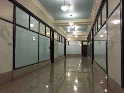
I’ve toured the Arcade-Wright building three times. The first was pre-renovation and pre-stroke — more than a decade ago. We walked through the building and up the stairs to the roof — I foolishly wore my cowboy boots that day. The building smelled of pigeon crap. My last two tours, December 10, 2015 and January 2, 2016 were of the newly renovated building. It was added to the National Register of Historic Places in March 2003

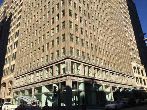
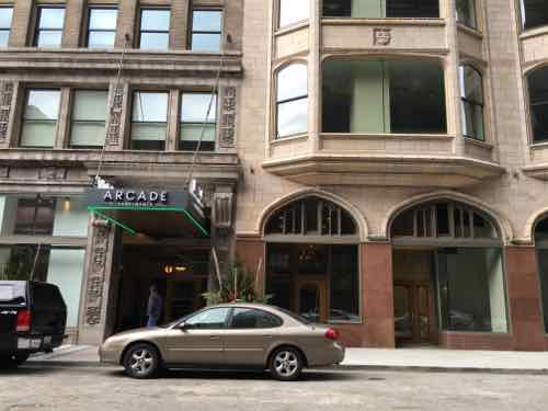
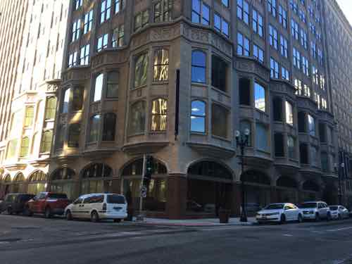
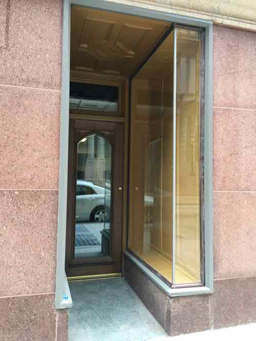
Before I show you the completed project, let’s review some history. First, the Arcade-Wright is two buildings. The Wright, on the corner of 8th & Pine, was built first — in 1906. More than a decade later the owners of the Wright bought most of the rest of the block and razed the existing brick structures. In 1919 construction began on the Arcade, wrapping around two sides of the Wright and connecting the two.

 The Wright is the bottom right corner of the block in 1909, I added the red dashed lime added to illustrate the area to the right is what became the Arcade. The beige sections are fireproof/resistant construction pink is brick, yellow wood frame. Blue indicates stone.
The Wright is the bottom right corner of the block in 1909, I added the red dashed lime added to illustrate the area to the right is what became the Arcade. The beige sections are fireproof/resistant construction pink is brick, yellow wood frame. Blue indicates stone. Click image to view larger version.

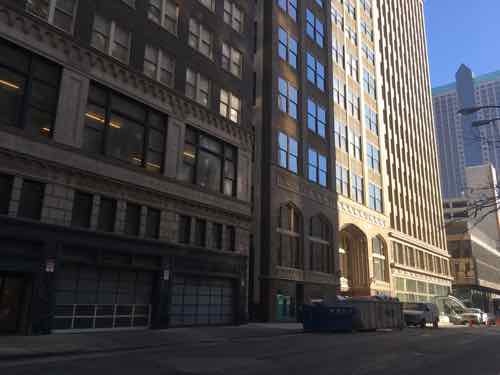
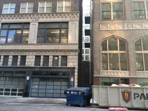
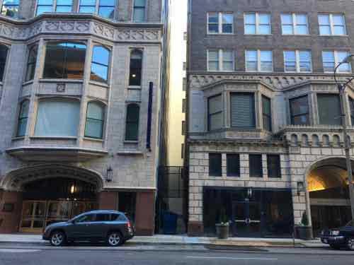
Numerous brick buildings, mostly 3 floors high, were razed to build the Arcade next to the Wright. A similar thing happened in the mid-1920s with the rest of the block — see Paul Brown Building history here. Above you can see a little distance between the buildings, not attached like so many were. This gap remained as the block was rebuilt.

From 9th & Pine we see, L-R, the Paul Brown, Arcade, Wright
From 9th & Pine we see, L-R, the Paul Brown, Arcade, Wright. Click image to view block in Google Maps.
The gap between the Paul Brown & Arcade. Both share the same garage entry on the left. More on this later.
Still on the Pine side (South) we see the Arcade (left) and Wright (right)
The 1906 Wright dominates the corner pf 8th & Pine. A coffee shop will be in the corner of the ground floor. The Arcade addition can be seen on the left & right. The cover over the stairs to the North end of the WB MetroLink light rail tunnel can be see.
The 8th Street transition from Wright (left) to Arcade (right). The 8th St entrance is for the Arcade Apartments.Click image to view website.
At 8th & Olive the big bays of the Arcade dominate. Webster University will have a public museum in the ground floor on this corner.
On the Olive St side we can once again see the gap between the Arcade (left) and Paul Brown (right)
Just to the right of the Olive St entry into the Arcade is a tiny little storefront with a small window display. Not sure how Webster University will use this.
The 2-level retail arcade is completely restored, will be used by Webster University. These types of market arcades pre-dated the indoor mall by decades.
A former 8th St storefront space is now the most attractive residential mailroom downtown -- accessed via the resident lobby, not exterior.
A former 8th St storefront space is now the most attractive residential mailroom downtown — accessed via the resident lobby, not exterior.
In places, original glass elevator doors were retained on upper floors. However, these are now fixed in place.
The first few upper floors were originally used for retail, with offices on the upper floors. Original hallways were retained, behind the glass is a false wall and an apartment.
The apartments with bay windows on 2 & 3 are market rate units.

Before we go up to the roof I want to talk about the basement parking garage. When Pyramid planned to build condos they were going to build larger units — the smallest condos would’ve been about the size of the largest apartments. The resort is more people, more total units. The condo plan had enough parking so each unit got one parking spot with purchase — typical for condos. However, with many more apartments, and Webster University using some of the parking, there isn’t enough for each unit.

The garage is typical except that it includes a car wash area.

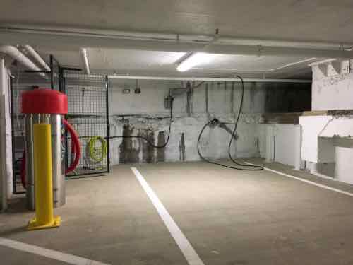
The most expensive market rate apartments include one garage space in the rent. For everyone else, market & affordable, the cost for a parking space is an additional $125/mo — first come. As I posted about in July 2014, they secured an agreement with the Treasurer’s Office for additional parking in the garage in the block to the East — at $75/mo.  Thankfully, this parking is “unbundled” — meaning a person can rent a unit without parking. Or a couple might decide to have only one car. The 8th & Pine MetroLink station is right outside and Enterprise CarShare has six cars downtown.

Remember how I said the Paul Brown and Arcade share a street entrance for parking — when Pyramid owned the Paul Brown it created an easement to allow the Arcade to connect in the basement. This was because the Arcade had no logical place to access the basement from any of the three streets it faces.

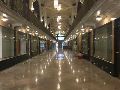
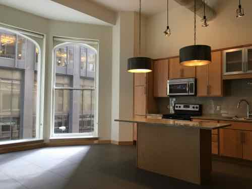
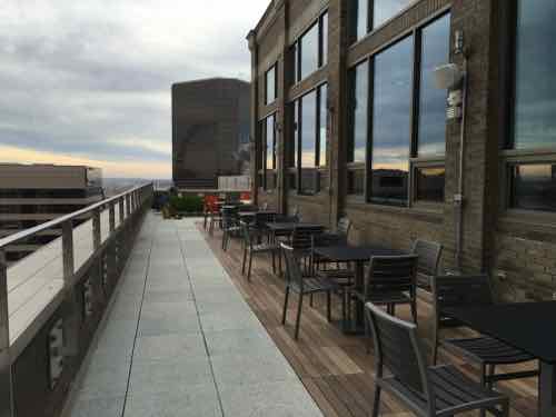
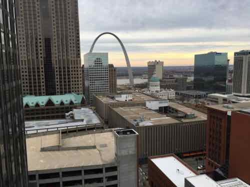
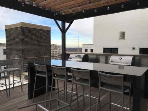
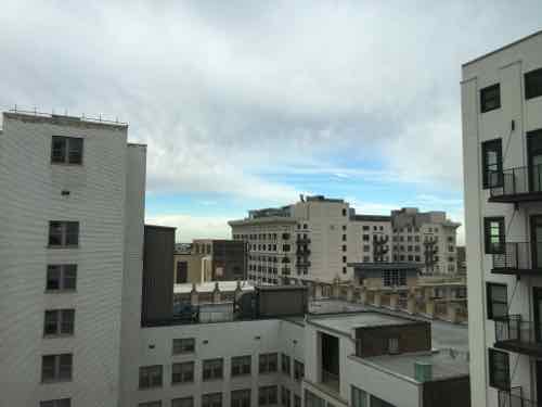
When many buildings downtown were made into loft condos is was common for the top floor and roof to be occupied by large, expensive units.  With apartments the roof here becomes a great place for all residents — those in a small affordable unit and those in a bay window market rate unit.

The top floor & roof are all wheelchair accessible. Thus us the East side which has a great view of downtown and...
The top floor & roof are all wheelchair accessible. Thus us the East side which has a great view of downtown and…
 the Arch and rooftops.
the Arch and rooftops.
On there West side is a grilling area
Looking Northwest from the grilling area you can see the back of the Paul Brown, the bank of the Syndicate, and the edge of the Arcade.
Inside the top floor is common party space, originally this held mechanical equipment
Inside the top floor is common party space, originally this floor held mechanical equipment
There developer even included a commercial kitchen to help with catered events.

Big kudos to everyone involved in this project!

— Steve Patterson


Sunday Poll: The Six Plaza Square Buildings Were Restored To Their Original Colors, Which Are Your Two Favorite Colors?

January 10, 2016 Downtown, Featured, History/Preservation, Sunday Poll Comments Off on Sunday Poll: The Six Plaza Square Buildings Were Restored To Their Original Colors, Which Are Your Two Favorite Colors?
Please vote below
Please vote below

One of the earliest urban renewal projects in St. Louis was Plaza Square — six high rise apartment buildings. Four city blocks were razed — except two churches — to make room for the six buildings. Site selection was made in 1950, but the project wasn’t completed until 1962.

Over the years the ownership on the group has changed numerous times. One was converted to condo ownership a decade ago, the other five are now owned by 2-3 entities. All six have been, or are in process of, renovated. The group are listed as a district on the National Register of Historic Places.  All six now sport their original color schemes, from the National Register listing:

Originally, each building’s enameled panels were painted a different solid color on the east and west elevations, with the panels on the north and south elevations painted white. Specifications and early color photographs are at odds, and conclusive assignments of original colors for three of the buildings have yet to be made. However, evidence shows that Building 20 has orange paint underneath the current coat, Building 30 has green and Building 60 was originally the same blue that it is today. The distinct colors differentiated the individual buildings from each other; this effect was an important balance to the uniform appearances of the buildings. (Section 7 page 6)

I was thinking the owners were too cheap to paint the North & South ends — but that’s how they were originally built!

Today’s poll is one I’ve wanted to do for a long time, I just had to wait  until all six got repainted.

The six colors are presented in random order — please vote for TWO.  This poll will close at 8pm.

— Steve Patterson


Proposed Alterations To Soldiers’ Memorial Should Take These Issues Into Consideration

Soon the Missouri History Museum is expected to show final designs for two blocks of the Gateway Mall bounded by 14th, Pine, 13th, and Market — Soldiers’ Memorial & Court 0f Honor. A big unknown is Chestnut Street which runs one-way Eastbound between the two blocks.

The Gateway Mall Master Plan calls the area around Soldiers' Memorial the "Civic Room"
The Gateway Mall Master Plan calls the area around Soldiers’ Memorial the “Civic Room”
St. Louis' Court of Honor, June 2010
St. Louis’ Court of Honor, June 2010
Soldiers' Memorial, 2011
Soldiers’ Memorial, 2011

Since the Slay administration chose to abandon the Gateway Mall Advisory Board, I don’t know what to expect in the way of review for compliance with the master plan, public input, stakeholder input, etc.

Here are my primary areas of concern:

  • Festivals
  • Street grid, traffic flow
  • Linear hallway along Gateway Mall

Let’s examine each:

FESTIVALS

This might be moot, since the Slay administration ran off great events like the Taste of St. Louis in favor a concert series that never happened:

After a year without major summer festivals in downtown St. Louis, the city may have finally had enough. On Black Friday the mayor’s office announced that it had ended its agreement with Los Angeles-based International Creative Management (ICM) to produce a promised but never held “Summer Rocks” series on the Gateway Mall.

That controversial deal, spearheaded in part by developer Steve Stogel (president of Clayton-based DFC Group) and approved by the city via Festival Reservation Bill 328, blocked out a downtown area from Union Station to City Hall from May to September 2015, and would have continued to do so for another nine years (and possibly more). The non-compete clause had already forced out local festivals like Taste of St. Louis, Ribfest and Bluesweek. (RFT)

The Gateway Mall Master Plan calls for this area to be the city’s main space for festivals. It calls the blocks including, and around, Soldiers’ Memorial the Civic Room:

The Civic Room will create a large uni?ed space well-suited for civic events, markets, festivals and concerts. In order to achieve this, it is anticipated that Chestnut Street would be closed incrementally over time, beginning with temporary closures for festivals, and ultimately consideredfor permanent or seasonal closure, though still allowing emergency and service vehicle access.Chestnut Street should still be hard surfaced with a paving different than surrounding areas, to accommodate tents and other services necessaryfor festivals. Locations for performance stages and cultural or art annexes should be provided to further de?ne the civic character of the space and create attractions to activate the Mall.

Before Citygarden was built a few blocks to the East, that area was used for large events as well — the Taste of St. Louis started where Citygarden is now. With this new agreement, the Missouri Historical Society (MHS) will have discretion for the use of the middle of the Civic Room festival area:

Although MHS will not host concerts or festivals that do not meet with the mission of Soldiers Memorial, it is willing to collaborate with festivals held in its neighboring parks for something that is mission driven. For example, MHS might have a wreath laying ceremony during Pride on the Soldiers Memorial grounds for LGBTQ members of the military. (FAQ)

Personally, I’d like to see large festivals held elsewhere, perhaps in & around the new Kiener Plaza?  Kiener is closing next month for a 12-14 month makeover, the median will be removed from Market Street.

STREET GRID, TRAFFIC FLOW

I never liked the master plan’s suggestion to eventually close Chestnut St. When you close one block of a street that kills activity on the rest of the open blocks before & after the closure. I’d like to see Chestnut & Pine return to two-way traffic West of Tucker. Then they’d feel like neighborhood streets again rather than very long highway on/off ramps.

Missouri History Museum drawing from Fall 2015 shows what appears to be a single lane. Final design may be different.

The problem with this draft is it doesn’t show the surrounding context. What about the blocks to the East West, & North?  What is the whole concept for all of these blocks? It doesn’t need to be built by the history museum but all needs to be part of the design process — so it’ll all work eventually. Looks like they’re designing this in isolation — an island. Chestnut is two lanes with diagonal parking to the East & West — lanes, crosswalks, curb ramps need to align. Without showing surrounding existing conditions it is hard to determine if these have been considered. Most likely they haven’t.

The new parking-protected bike lane on Chestnut is an issue, but it should’ve been on Olive. That would’ve required building accessible bus stops in the parking lane — Chestnut was picked for the bike lane because it was easier than Olive.

HALLWAY

One of the best parts of the Gateway Mall Master Plan is the hallway concept — a wide tree-lined sidewalk along the North side of Market St.

The Gateway Mall master plan calls for this "hallway" to run from Broadway to 20th
The Gateway Mall master plan calls for this “hallway” to run from Broadway to 20th

Their preliminary design doesn’t show the hallway. So far we only have the two blocks along Citygarden.

— Steve Patterson


Sunday Poll: Support or oppose MSD plan to raze vacant buildings to reduce water runoff?

Please vote below
Please vote below

In the news recently:

The Metropolitan St. Louis Sewer District wants to spend $13.5 million of its own money to tear down vacant properties. Grassy lots would let stormwater slowly percolate into the ground instead of rushing into the combined sewer system that serves much of St. Louis.

While it could take several years to spend down the money, even the longest spending scenario would amount to a near doubling of St. Louis’ demolition budget. And areas where MSD sees the most benefit in terms of runoff and watersheds also are the areas – primarily in north St. Louis – where the city’s vacant properties are concentrated. (Post-Dispatch)

So I want to know if this is something you support or oppose?

This unscientific poll will remain open until 8pm.

— Steve Patterson


Sunday Poll: Support or Oppose the Closure of Chestnut St in front of Soldiers Memorial?

Please vote below
Please vote below

Earlier this year approval was given for the Missouri History Museum to take over the city-owned Soldiers Memorial Museum, the agreement was finalized last month. A preliminary sketch showed Chestnut St closed to vehicles, allowing the WWI Memorial building to connect with the WWI/Korean War/Vietnam War memorial to the South. Final designs will be presented early next year.

It is unclear if the street is closed to vehicles, if the city’s only parking-protected bike bike lane would be interrupted.  Which brings us to today’s poll:

The poll will be open until 8pm.

— Steve Patterson


Advertisement


[custom-facebook-feed]

Archives

Categories

Advertisement


Subscribe