Home » History/Preservation » Recent Articles:

New Saint Louis University Hospital An Opportunity To Build A Great Urban Mixed-Use Campus

On Tuesday SSM Health took over Saint Louis University Hospital from Saint Louis University, at the same time announcing plans to construct a new facility:

SSM Health plans to invest $500 million to build a new St. Louis University hospital and ambulatory care center. 

The new facilities, which will be situated in the immediate vicinity of the current 365-bed hospital near the midtown campus of St. Louis University, will be completed within five years, SSM officials said. (Post-Dispatch)

Uncertainty of the existing Desloge Tower left many wondering if it might be razed.

Desloge Tower in 2011

First, some background:

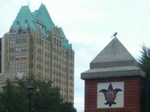
Going back in the history books, Firmin Desloge Hospital was officially dedicated on November 3, 1933, rising 250 feet and topped by a French Gothic roof of copper-covered lead. Over the next several weeks, it began admitting its first patients. It was unique for its time, offering patients private or semi-private rooms instead of the open ward model common in most hospitals. Desloge Tower served as the main hospital building of the Saint Louis University Medical Center until 1959 when Firmin Desloge Hospital, the Bordley Memorial Pavilion and the David P. Wohl Sr. Memorial Institute were collectively renamed Saint Louis University Hospital.

Desloge Tower is also home to the chapel of Christ the Crucified King, commonly known as Desloge Chapel, which was designed by Gothic revivalist architect, Ralph Adams Cram, who was a prolific and influential American architect of collegiate and ecclesiastical buildings. The chapel was designed to echo the contours of the St. Chapelle in Paris, which was Louis IX’s palace chapel, and in 1983, Desloge Chapel was declared a landmark by the Missouri Historical Society.

Desloge Tower continues to serve SLU Hospital with physician offices, gastroenterology, interventional radiology and the cardiac catheterization lab.

Its image is a well-recognized part of the St. Louis skyline, and is often the symbol of the hospital itself. (SLU Hospital)

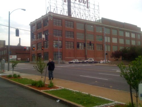
With a fresh start nearby, it does mean the future is uncertain. The future of the old Pevely Dairy just to the North is more certain — it’ll likely be gone.

The former Pevely Dairy at Grand & Chouteau, 2011

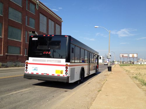
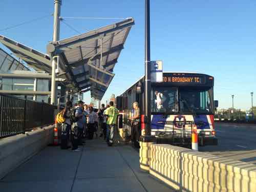
I’m fine with the Pevely coming down — as long as the new facilities are very urban in form. This is on the route of the busiest MetroBus route in the region — the #70 (Grand), and the #32 (ML King-Chouteau) runs in Chouteau. Just to the North is the Grand MetroLink (light rail) station.

Westbound #32 MetroBus on Chouteau just barely west of Grand. The Pevely bldg is to the left. 2012
#70 MetroBus riders at the Grand MetroLink station, August 2012. Dislodge Tower can be seen in the distance

What many in St. Louis, especially at City Hall, fail to realize is facilities can be friendly to motorists and pedestrians — these are not mutually-exclusive. The street grid need-not be decimated to create a campus.

Looking east along Erie St at Fairbanks, Chicago IL

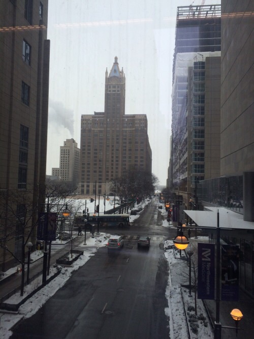
When we visit Chicago next month, our 4th time in 2015, we’ll be staying in a friend’s condo located within the Northwestern Medicine/Northwestern Memorial Hospital campus. The sidewalks are packed with people visiting street-level restaurants. The internal walkway system and lots of parking garages hasn’t made the sidewalks a ghost town.

SSM Health is going to build a new complex. Now’s the opportunity to look at how medical campuses in other cities can be vibrant active places that are also convenient to those using cars. Dislodge Tower could become a mixed-use building with retail, restaurants, offices, and residential.

— Steve Patterson


Long Vacant St. Louis Union Station Reopened 30 Years Ago

Tomorrow marks 30 years since Union station reopened as a “festival marketplace.”

A festival marketplace is a realization by James W. Rouse and the Rouse Company in the United States of an idea conceived by Benjamin C. Thompson of Benjamin Thompson and Associates for European style markets taking hold in the United States in an effort to revitalize downtown areas in major US cities in the late 20th century. Festival marketplaces were a leading downtown revitalization strategy in American cities during the 1970s and 1980s. The guiding principles are a mix of local tenants instead of chain stores, design of shop stalls and common areas to energize the space, and uncomplicated architectural ornament in order to highlight the goods. (Wikipedia)

This occurred just as I was starting my freshman year of college — studying architecture. The reimagining of Union Station, and other historic buildings, was influential during my college years. Just 5 years before reopening, Union Station looked so bad its Grand Hall was used as the location of a big fight scene in Escape From New York!

As noted yesterday, I moved to St. Louis just 5 years after Union Station reopened. At that time the retail portion of Union Station was still doing well. It’s impossible to say how well it would’ve done if it hadn’t received competition from downtown’s St. Louis Centre mall and the Westroads Shopping Center not been rebuilt into the Saint Louis Galleria. Lacking big anchors the retail probably would’ve declined regardless of competition.

When it reopened in 1985 the midway contained glass retail booths. These have been removed, the midway is now event space. October 2011 photo

Some history:

On September 1, 1894 St. Louis Union Station opened as the largest, most beautiful terminal in the United States. This enormous project was built at the cost of $6.5 million. The gem of this new Station was the Grand Hall with its gold leaf, Romanesque arches, 65-foot barrel vaulted ceiling and stained glass windows. The most magnificent of these stained glass windows is the “Allegorical Window” which is majestically framed by the famous “Whispering Arch.”

Just beyond the Head house was the Midway, which was the midway point where friends bid farewell or welcomed home visitors from across the nation and around the world. In its heyday in the mid 1940’s, the Midway was the spot where over 100,000 passengers a day traversed on their way to or from a train. The platform area was covered by an enormous single-span train shed designed by George H. Pegram. This was not only one of the largest train sheds ever built, but it also covered the greatest number of tracks. After World War II, the general public began choosing other forms of transportation. In 1976, this magnificent station was designated a National Historic Landmark. Finally, on October 31, 1978, the last train pulled out of St. Louis Union Station. (Union Station)

What this doesn’t say is the newly formed Amtrak (1971) ceased using the head house a few years before the last train left in 1978. Many wished train service was still at Union Station, but the back in train shed just doesn’t work well for low volume train stations.

The Grand Hall in Union Station. Photo by William Zbaren from the book American City: St. Louis Architecture
The Grand Hall in Union Station. Photo by William Zbaren from the book American City: St. Louis Architecture — used with permission

Yes, the very same space where the Escape From New York fight scene was filmed. I’m very glad outside developers & bankers saw what locals couldn’t.

— Steve Patterson


A Century Since the River Des Peres Flood of 1915

August 20, 2015 Environment, Featured, History/Preservation, Planning & Design, South City, St. Louis County Comments Off on A Century Since the River Des Peres Flood of 1915

One hundred years ago today St. Louis experienced deadly flooding. The problem wasn’t the Mississippi, it was the River Des Peres!

On the afternoon of Aug. 19, 1915, remnants of a hurricane reached St. Louis from Texas. Heavy and steady rainfall fell through the next day, dumping a total of 7.4 inches across the area. (6.85 inches on Aug. 20 remains the one-day record in St. Louis.)

The River Des Peres rushed from its banks, swamping long stretches of Delmar and Lindell boulevards, Manchester Avenue and other streets. People were stranded on the Wabash Railroad platform at Delmar (now a Metrolink station) by a seven-foot-deep current 200 yards wide. Firefighters reached them with ladders and used boats to rescue residents of Maple and Hodiamont avenues. (St. Louis Post-Dispatch — includes vintage photos)

In August 1915, St. Louis was flooded. All roads leading to the suburbs were cut off, and in Maplewood, the waters reached the second floor of some homes. The water was a mile-wide in Forest Park. Three bridges in the park were washed away, the Zoo’s Bird Cage and Bear Pits were flooded. The platforms at the old Delmar Station were destroyed. Passengers at the Wabash Station were surrounded by seven feet of water and had to be rescued by firefighters. Other people were trapped in their homes, and some even drowned. By the time the disaster was over, 11 people had died and more than 1,000 homes were lost.

The cause of the disaster was not the Mississippi River but the smaller River Des Peres, which ran along the City’s western edge.

River Des Peres, or “River of the Fathers,” was named after two Jesuit priests who founded a mission on its banks around 1700. Problems associated with flood and sewage control became obvious as St. Louis grew. In 1887, city officials planned to drain River Des Peres and Mill Creek. This plan was not completed, though, and River Des Peres had become an open sewer by the early 1900s.
Parts of the river were covered or diverted in preparation for the World’s Fair in 1904, and monitoring of flooding conditions began in 1905. However, no steps had been taken by 1915 that could have prevented the devastating flood that same year. (St. Louis Public Library)

Perhaps the first sewage the River des Peres received was from St. Louis’ Central West End chamberpots. In response to the volume of waste, the city wrote an ordinance in 1887 “to prevent discharge of sewerage or offensive matter of any kind into the River des Peres.” If the city had funded the ordinance, then a separate sewer system would have been built and the River des Peres’ history might have taken a different course. Instead, the government of St. Louis began a trend that has plagued the river for more than a century: St. Louis would support ideas to protect the River des Peres as a sewer more than as a river.

As St. Louis grew westward, so did the expanses of pavement. With less open ground to soak up the rains, the River swelled with runoff. The River des Peres flooded in 1897, 1905, 1912, and 1913. The flood of 1915 killed 11 people and forced 1025 families from their homes. Flooding – not sewage – prompted St. Louisans to action. Mayor Henry W. Kiel called for a hydrologic study, which was completed by W.W. Horner and presented to the St. Louis Board of Public Service in 1916. St. Louis voters chose to implement Horner’s recommendations, which cost $11 million.

The project was called the River des Peres Sewerage and Drainage Works, and it took nine years to complete (from 1924 to 1933). Workers re-graded and paved the River’s banks and straightened its bends. Elsewhere the River was directed below ground to join with the sewer. The engineering innovations brought national recognition for Horner (who was also the project engineer). Scientific American and Engineering News-Record featured the marvelous new River des Peres. In 1988, the American Society of Civil Engineers recognized the project as a National Historic Civil Engineering Landmark. (River Des Peres Watershed Coalition)

The bond issue vote was in 1923 — 7 years after the plan was presented.

River Des Peres at S. Broadway, March 2012
River Des Peres, looking East from Hampton, July 2015
River Des Peres; looking North from Gravois. Tuesday August 18, 2015

Problem solved? Wrong.

Explore any city enough, and at some point you’re likely to walk on water, so to speak. San Francisco is full of ghost rivers. So are Washington, D.C. and Los Angeles. In the urban core of Baltimore, up to 98 percent of streams are underground. 

Early city planners may have hoped for healthier cities when they covered up these streams, but it turns out they created new problems. Paving over and piping waterways often worsens flooding. And as new research by scientists at the Environmental Protection Agency indicates, buried streams can also exacerbate pollution. 

In a paper published in PLOS ONE, lead authors and EPA research scientists Jake Beaulieu and Heather Golden found that nitrates—nutrients that can become pollutants—travel on average 18 times further in buried urban streams than they do in open streams, before they are taken out of the water column. (City Lab)

From February 2014:

Starting in a few days, MSD will begin construction of a 3,028 foot-long tunnel under the River Des Peres, just south of Carondelet.

The tunnel will hold a pressurized pipe that will carry sewage to the Lemay Wastewater Treatment Plant.

MSD spokesperson Lance LeComb said the new pipe will increase the plant’s capacity to take in sewage, and also serve as a back-up in case the existing “force main” ? which dates back to the 1960s ? has a problem.

The project is the first of about a dozen tunnels, totaling nearly 33 miles in length, that the MSD will be digging under St. Louis in the next couple decades. Most of the tunnels will hold a mix of stormwater and sewage. “The longest one will be nine miles long, running underneath the River Des Peres, almost 200 feet below ground,” LeComb said. “And 30 feet in diameter.” (St, Louis Public Radio)

Hopefully this will keep our sewage out of the waterways and not create more problems! The River Des Peres starts in St. Louis County, flash flooding remains an issue.

— Steve Patterson


Hidden Jewels of North St. Louis: Capturing the Beauty Beyond the Delmar Divide

July 10, 2015 Books, Featured, History/Preservation, North City Comments Off on Hidden Jewels of North St. Louis: Capturing the Beauty Beyond the Delmar Divide

My friend, filmmaker Phillip Johnson, has begun an interesting new project:

Hidden Jewels of North St. Louis is a photo book/video project telling the story of North St. Louis through the lens of homeowners living north of the “Delmar Divide” it is also a book that explores the reasons behind the Delmar Divide and projects a vision of a new North Side.

Here’s the video to kickoff the fundraising effort:

To contribute to this project go to gofundme.com/HiddenJewelsofSTL

— Steve Patterson


Sunday Poll: What Should St. Louis Do About The Confederate Memorial & Street In Forest Park?

Please vote in the poll, located in the right sidebar

Since nine people were shot & killed at a historically black church in Charleston S.C., the confederate flag has thankfully become politically toxic:

In South Carolina, the governor called for the Confederate flag to stop flying over the capitol. The governors of Virginia and North Carolina quickly declared that they would remove the flag from state license plates. Meanwhile, several of the country’s top retailers — from Walmart to eBay and Amazon — announced in quick succession that they would stop selling Confederate flag merchandise.

Not for the first time this year, the concerns of political leaders and business elites converged on a single issue — and swiftly forced dramatic change. (CNN: Why business fought the Confederate flag)

The confederate battle flag should’ve been banished decades ago, but what about other confederate symbols & memorials? Namely the confederate memorial in Forest Park…located on Confederate Drive:

Historians say don’t let the old artillery mislead you. Forest Park was never a civil war battle field. The only reason there a confederate statue here is because it is where the donor wanted it built back in 1914. But now, some want it gone.

For 100 years the statue has stood just east of the Missouri History museum and some would say on the southern side of the state’s Civil War history – a monument to Confederate “soldiers and sailors” built fifty years after the war. (KSDK: Confederate memorial debate in Forest Park)

Today’s poll question asks: “What should St. Louis do about the confederate memorial & street name in Forest Park?”

The poll, open until 8pm tonight, is at the top of the right sidebar. Mobile users will need to switch to the desktop view to vote.

— Steve Patterson


Advertisement


[custom-facebook-feed]

Archives

Categories

Advertisement


Subscribe