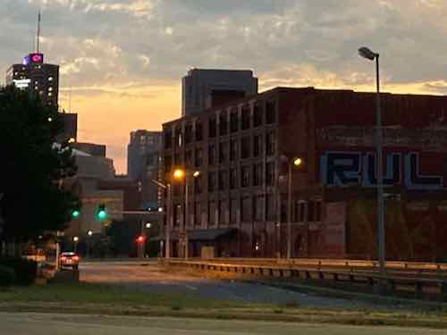
When cold water flats and tenements were cleared just north of downtown for St. Louis’ first high-rise public housing project, Cochran Gardens, several blocks of 8th Street were erased from the grid. Six decades later 8th Street was rebuilt* when the mixed-income Cambridge Heights apartments & townhouses replaced Cochran Gardens’ towers.
* 110 feet of 8th Street wasn’t replaced!
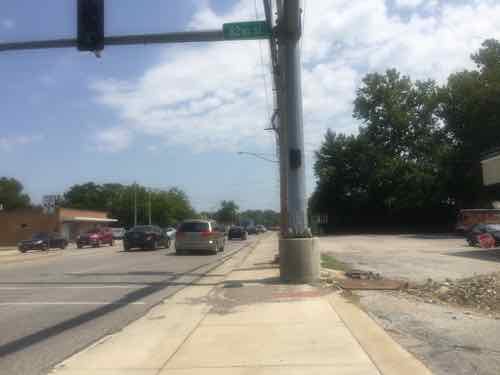
This short missing piece is a connectivity problem for those of us who live here. Later, when Cass Ave over I-44 (aka I-70) was raised as part of the Stan Musial Veterans Memorial Bridge project 7th Street got disconnected from Cass Ave. So now neither 7th or 8th connect to Cass. Getting to/from the bus at Cass Ave & Broadway is likely the primary reason for needing access here, it would also be nice when we go to Shady Jack’s or walk/roll up Broadway.
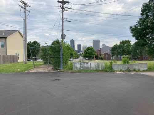
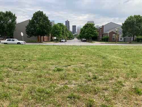
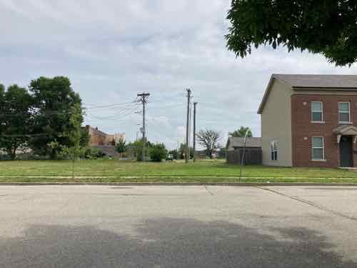
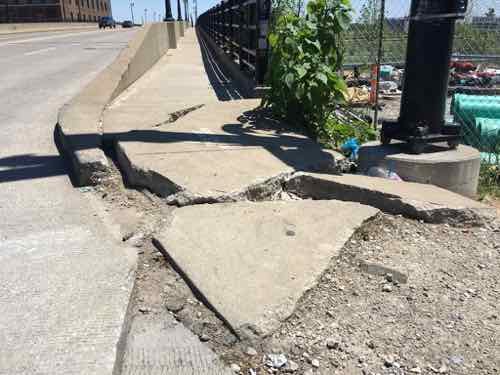
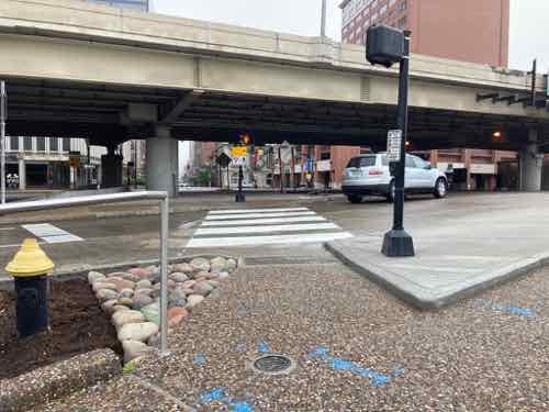
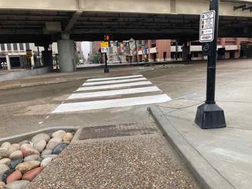
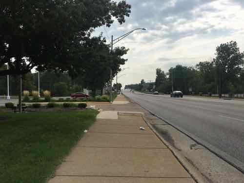
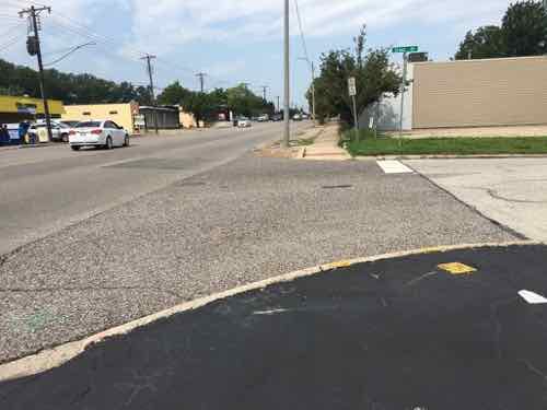
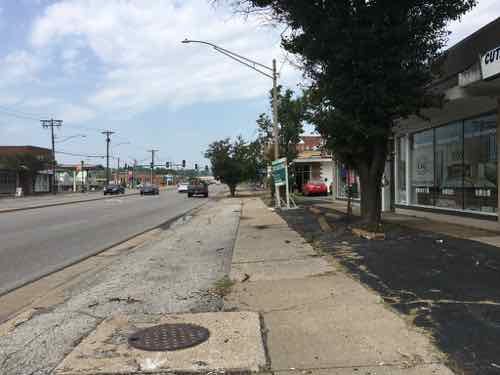
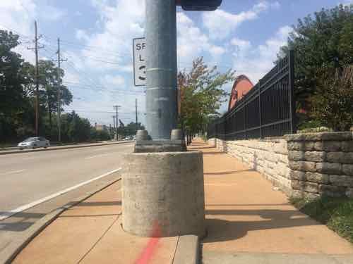
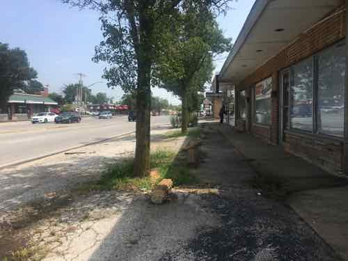
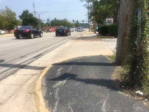
A little bit of the original 8th Street exists south of Cass Ave, but it quickly ends at an alley. Jersey barriers exist to keep drivers from going straight ahead.From the broken sidewalk on the east side of 8th you can see a clear route to 8th Street 100 feet further south. The west side of 8th, unfortunately, has no sidewalk.In the field you can see beyond Dickson Street to 8th StreetAt the public sidewalk you can look south along 8th Street to downtown. 8th Street is the center of Cambridge Heights.
Motorists use the alley south of Cass to get to/from Cass Ave, but pedestrians often walk though vacant land where 110 feet of 8th street should be. As you’ll see, putting in street, curbs, drainage, etc would be challenging & costly — all that’s needed is a 110 foot long sidewalk and a couple of curb ramps.
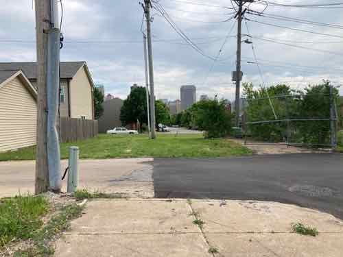
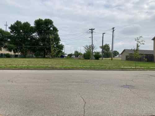
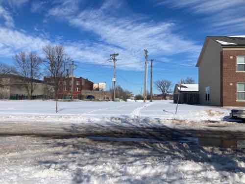
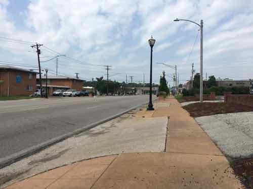
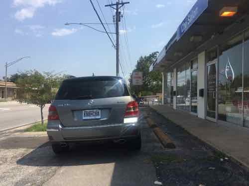
Looking toward Cass Ave from the SW corner of 8th & Dickson streets.Looking toward Cass Ave from the SW corner of 8th & Dickson streets.The same view after a recent snowfall. Two desire lines where people walked are clear. A community center is visible on the left, but no good way to get there directly.
This is needed because going between the neighborhood and Cass Ave is challenging as a pedestrian. I’ve thought so for the 3+ years I’ve lived here. I’ve also seen a woman at least 15 years my senior (so 70+) walking though the grass with a cane. The trail through the snow earlier this year was also a clue.
You might be thinking this land is vacant do it can be developed for more housing. Let’s take a look at the property lines.
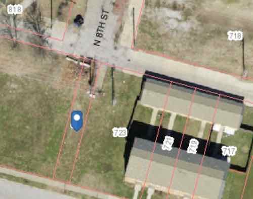
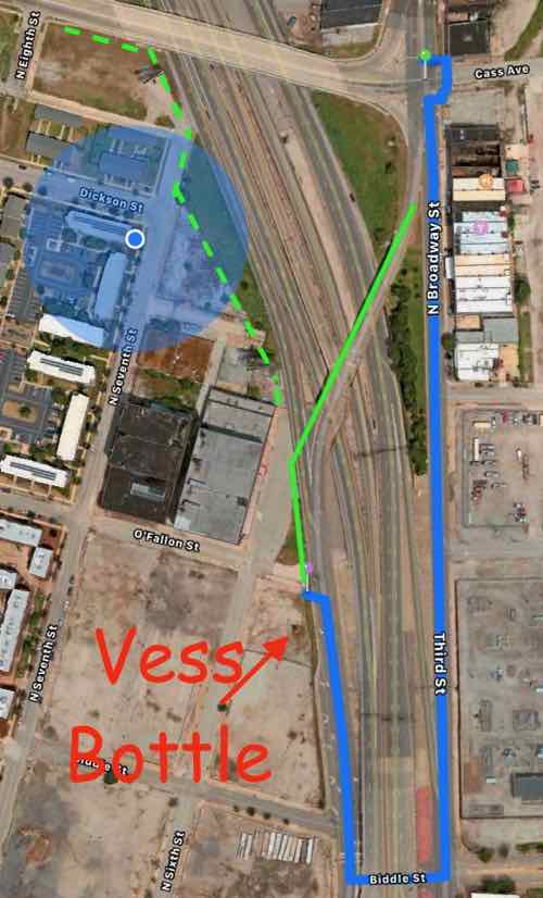
The blue dot marks a 15 foot wide parcel owned by the St. Louis Housing Authority (725 Dickson Street). They also own the land from here to 9th Street. 723 Dickson Street is 64.26 feet wide, includes the 22 foot wide end of 3 townhouses.
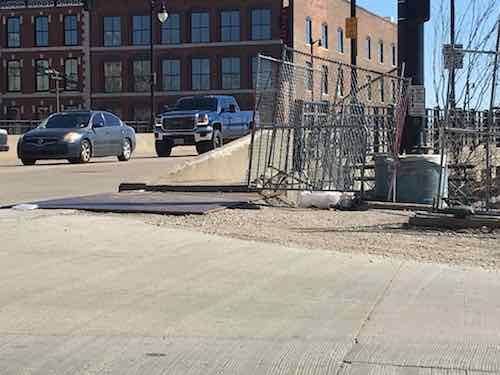
My assumption is the 15 foot wide parcel known as 725 Dickson (map) is there to prevent anyone building over utilities, like sewer, under the old 8th Street. The end row house has a lot of extra land beyond their fence. Basically there’s more than enough width to create a generous pedestrian path. There are some obstacles near the alley.
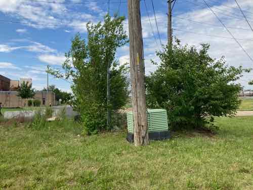
From the alley you can see a little bit of concrete and some useless chain link. And an electric utility pole.From the lot you can see the pole and an electrical box (transformer?). There are also wires to help keep the pole upright on the private land side.
There’s room to fit a 5′ wide walkway at the alley to then toward 8th & Dickson streets, we just need to figure out property lines, utilities, easements, etc. City mowers have a hard time during the summer keeping the back area cut — a private home owner would get a violation letter from the city for such conditions. The elevation is slightly higher at the alley than south at Dickson Street.
The need exists, much of the land is owned by the housing authority. Cost wouldn’t be that substantial. I’d love to see fruit trees planed on both sides of a walkway so the public can access free fruit.
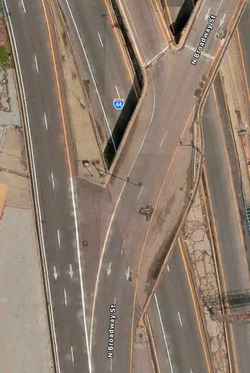
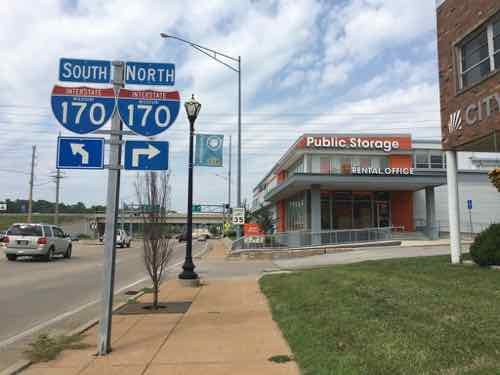
Urban highways & interstates allow drivers to get from point A to point B quicker than had they taken surface streets, but they’re also a major divider between the existing neighborhoods they cut through. In the late 1950s the downtown’s 3rd Street Parkway was being extended north, eventually connecting with the new Mark Twain Expressway (aka I-70/I-44) in July 1961.
I live on the west side of the highway, but I can stand in my kitchen and see Broadway & Cass, on the east side of the highway. I know first hand how the highway divides the historic north riverfront from my neighborhood, Columbus Square.
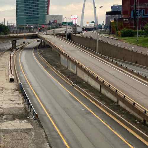
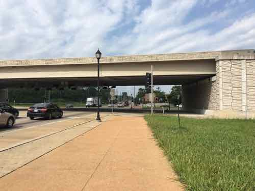
Looking south from the Cass Ave bridge over I-44, June 2020. The lane center is a southbound express lane, to the right is the express lane exit ramp to southbound Broadway.
Ideally we’d remove urban interstates and weave our neighborhoods back together, but that’s never going to happen. What should happen is when we rebuild crumbling infrastructure we add connections civil engineers in the 1950s never considered at the time the highways were planned.
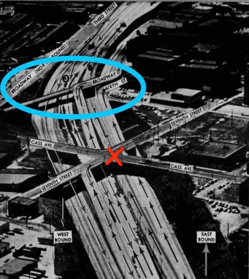
The same view Monday with southbound Broadway bridge and the exit ramp gone.The blue oval is the southbound Broadway bridge, the red X is where Csss & 7th were connected until construction began for the Stan Musial Veterans Memorial Bridge. Post-Dispatch July 9, 1961, p161.
The distance from Broadway & Cass to Broadway & O’Fallon is only 2/10 of a mile, but the distance required for the last 60 years has been double that — 4/10 of a mile.
The Missouri Department of Transportation supports pedestrian facilities:
MoDOT works with planning partners to create transportation facilities that work for all users because we value bicycle and pedestrian travel. Accommodating for bicyclists or pedestrians may be as simple as providing a well-designed road that all road users share or as complex as a separate-grade structure, such as a bridge. Developing appropriate facility design for nonmotorists depends on a variety of geometric and operational factors that are inter-related, such as available right-of-way, projected traffic counts and adjacent roadway design speeds.
We strive to integrate nonmotorized travel into the existing system to provide connections where none exist to promote efficiency and to focus on a primary concern—the safety of those who depend on walking or bicycling to reach their destinations. (MoDOT)
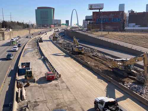
Unfortunately MoDOT failed to accommodate the needs of cyclists and pedestrians in the replacement. This is a huge mistake — it’ll be another 60+ years before we get another chance to reconnect these areas.
View from Broadway near Cass looking SW toward Broadway @ O’Fallon (just beyond building), June 2021The buildings on the right are part of a National Register Historic District.
You might be thinking it would be too difficult to include a pedestrian sidewalk. The old bridge, removed over the weekend, couldn’t have easily been retrofitted. But when building the new bridge entirely from the ground up it is actually pretty easy.
Here’s the overview:
The blue circle is my location. The blue line represents the route required to walk from Broadway @ Cass to Broadway @ O’Fallon — twice as far as the direct route shown in solid green. The dashed green line is how to connect Cass to 7th & 6th streets. Apple Maps
Now let’s take a look at the old bridge and highway exit ramps.
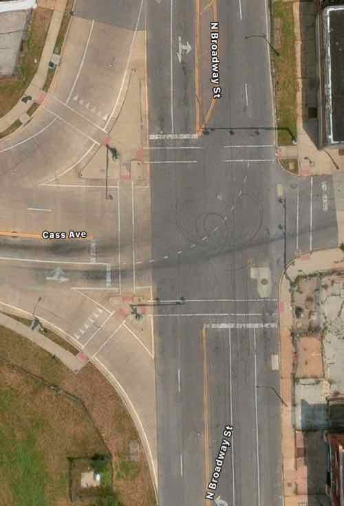
Broadway is only one lane per direction north of Cass, but it widens to 2 right turn lanes onto westbound Cass and 2 southbound lane to continue across the highway. One lane expands to four! Apple MapsSo 2 lanes of Broadway continued over the highway. The express lane exit is one lane but the Broadway exit is 2 lanes. Four lanes continue toward Cole before getting reduced to 2 further south.
The solution is the one southbound lane of Broadway splits into 3 before Cass — one left, one right, one straight ahead. This means the same width bridge can also accommodate bikes & pedestrians. The traffic exiting the southbound express lane and the highway have plenty of length for drivers to decelerate. Rumble strips (or similar) can be used to communicate to the driver to slow down as they approach Broadway. The 2 highway exit lanes can narrow to one before Broadway. Not sure if signals are necessary or just a flashing red light and notices to yield to pedestrians.
I would like to see Broadway south of Cole to return to two-way traffic in the future, so I’d like the new bridge to accommodate 2-way traffic and pedestrians on one side.
Again, I’m trying to connect two areas that have been separated for over 60 years. Both have enormous potential for redevelopment — new construction & adaptive reuse to the south and mostly captive reuse to the north. I’d love to see football fans have pre-game drinks at Shady Jack’s Saloon and then walk down to the Dome to see the St. Louis Battlehawks when the XFL returns under new ownership.
I’ve working on my bucket list in the last two years living with stage IV kidney cancer. Right after Memorial Day I was able to visit Milwaukee, my very first time in Wisconsin. I’m also working on items closer to home that I can safely do during a pandemic. To help me I pulled the 2013 book 100 Things To Do In Saint Louis Before You Die off my bookshelf. One of several books written or co-authored by my longtime friend Amanda Doyle.
Well, I don’t see myself being able to physically sled down Art Hill, or use a paddle boat in Forest Park. Hmm, visit Cahokia Mounds? I’ve always wanted to see it, it’s likely the only additional World Heritage site I’ll be able to visit — I’ve been to Independence Hall & many Frank Lloyd Wright buildings, including Fallingwater.
Embarrassingly in my 31+ years living in St. Louis I must admit I’ve never once visited Cahokia Mounds, a World Heritage site only a 15-minute drive into Illinois from St. Louis. Like so many places I thought I could go & things I could do in the future, until I became disabled a month before my 41st birthday. I had lived here less than 18 years before I had a massive stroke, meaning I couldn’t walk around the large Cahokia Mounds site. My power wheelchair allows me to “walk” around places like the Missouri Botanical Gardens.
In case you’re unfamiliar with Cahokia Mounds:
The remains of the most sophisticated prehistoric native civilization north of Mexico are preserved at Cahokia Mounds State Historic Site. Within the 2,200-acre tract, located a few miles west of Collinsville, Illinois, lie the archaeological remnants of the central section of the ancient settlement that is today known as Cahokia. (Cahokia Mounds Museum Society)
The fastest way there is for me and my husband to just drive there. But, I couldn’t see much because I can’t walk far. I also have a manual wheelchair we can put in the trunk, but he’d have to push me or I use my right foot and right hand to propel myself. One of us would get worn out.
I’ve traveled to five different states using transit and my power wheelchair so I should be able to go less than 10 miles. So I looked. Yes, I can roll 8/10 of a mile to the Convention Center MetroLink light rail station, take the train east to the Emerson Park station, and then catch the #18 Madison County bus northbound to Fairmont Ave at Collinsville Rd. Then it’s just a mile west along Collinsville Rd to the entrance to Cahokia Mounds State Historic Site (map).
A mile isn’t an issue at all, a week ago I rolled almost 5 miles home from Siteman Cancer Center. Yes, returning home on MetroLink would’ve been considerably faster but I got to see a lot of stuff along my route. I’m on disability so I’m usually not in a hurry. So what’s the problem?
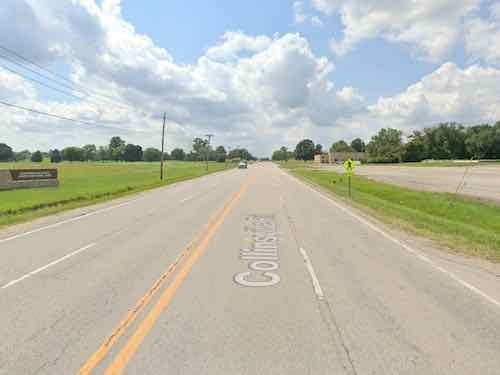
The problem is Collinsville Road is a high-speed (45mph) 4-lane roadway with zero pedestrian infrastructure. None. No pedestrian signals or crosswalks at the signalized intersection near the bus stop. A few businesses near the intersection have a public sidewalk but they’re not connected to each other. Most of the mile distance is just a very tiny shoulder and a ditch. If I were somehow to make it I’d need to cross Collinsville Rd. Opposite the entrance to Cahokia Mounds is a pedestrian sign, but trying to cross 4 lanes of high-speed traffic is a death wish.
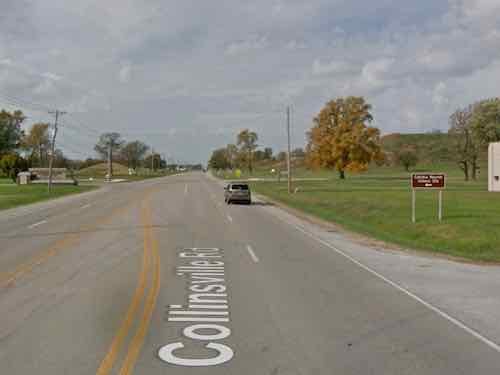
Approaching Cahokia Mounds from the east you see it on the left. On the right is a pedestrian crossing ahead sign, next to the ditch.Further up as you get close to the entrance the road splits so there’s a center turn lane. On the right is a Cahokia Mounds sign pointing drivers left. The driveway to the right has a culvert under it so any water in the ditch can continue to flow.
My thoughts turned to contacting someone to bug them about this. But who? Most of the north side of Collinsville Rd is in Namioki Township, Madison County. Part of the south side of Collinsville Rd & Cahokia Mounds are in Collinsville, St. Clair County. Yes, most of Collinsville is in Madison County, but this part is in St. Clair County. And finally the the intersection of Collinsville Rd & Fairmont Ave/Black Lane is State Park Place, an unincorporated community in both Madison & St Clair Counties. Maddening fragmentation!
I suppose an able-bodied person could navigate this last mile, but I doubt anyone would. Back at State Park Place there’s business on both sides of Collinsville Rd, including a Mexican restaurant on each side. I read somewhere a while ago that one is among the best Mexican restaurants in the Metro East.
My first task will be to contact Cahokia Mounds to see if they have any power wheelchairs/scooters for rent, their website doesn’t mention accessibility at all. I’ll also contact the Highway Dept at each county, though it might take state and/or federal funds to get anything built. I just want to get things…rolling.
The renovation of the Arch grounds a few years back greatly improved accessibility for the public. Going from the top of the steps down to the riverfront used to be a major challenge if you were pushing a stroller, or using a wheelchair. New ramps now make it very easy.
But the project accidentally cut off access to the pedestrian walkway on the Eads Bridge, as early as May 2015. This month it was finally rectified, though the solution created another problem.
Looking west heading into St. Louis from the Eads Bridge. May 13, 2020
Let’s do a quick recap of the problem caused when a contractor busted through into the light rail tunnel below.
The earliest I can find the issue on Google Street View is from May 2015, how much earlier it began is uncertain.
May 7, 2017 is my oldest photo of the problem. This is when I began conversations with various officials about being able to access the pedestrian walkway in my wheelchair.By March 16, 2019 the broken concrete had been removed but the height from steel plate to bridge sidewalk was too much for 99.9% of wheelchairs.
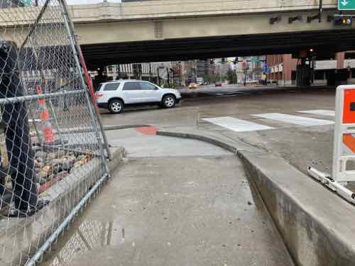
A week ago a friend sent a pic to me showing work happening. Yay, finally! Yesterday I went by to see the result, approaching from the North.
Approaching from Laclede’s Landing. I’m happy to see a smooth transition to the bridge, but the width of the crosswalk markings have no relationship to the width of the ramps on either end.
I’m happy to report the accessibility is better than it ever was. The slopes, cross-slopes, ramps, etc. are all improved. I was very relived to be able to access the bridge. I then went to head West toward downtown.
Approaching the corner from the Arch grounds. At left is the point to cross the street to head into downtown proper.Here’s a more direct view. Like before, the crosswalk is much wider than the ramp, but that’s not the main problem.The stupid “beg button” for a walk signal is set back too far from the curb — only by leaning and stretching could I reach it.
Walkable areas shouldn’t have buttons to get a walk signal — they should always come up in the cycle. But if you’re going to make us press these damn buttons at least place them where they can be reached! I can see bottlenecks here post-covid with lots of tourists coming and going.
University City Missouri is a first-tier suburb of St. Louis. Many towns in the region are older, starting as rural villages. More than a quarter century after the municipal boundaries of the City of St. Louis were set in stone way out in the rural countryside, U City began at those limits:
University City was founded by publisher Edward Gardner Lewis, who began developing the location in 1903 around his publishing complex for Woman’s Magazine and Woman’s Farm Journal. Historic buildings associated with municipal operations, including today’s City Hall, were built by Lewis as facilities for his magazine enterprise. In 1906, the city incorporated and Lewis served as its first mayor. (Wikipedia)
The streetcar from the city was extended West into the new suburb, turning around there. The urban business district is now knows as the Delmar Loop because of the streetcar loop to reverse direction.
University City has a second East-West business district: Olive Boulevard. Where the Delmar Loop was established first, in the streetcar era, Olive developed later. Initially buildings were similar to those on Delmar: 2-story with residential over a business on the ground floor. As development marched Westward the automobile became more important and residential units above retail was no longer a thing — it was all about separation of uses. Business zoning meant businesses only, residential meant single-family detached homes, with a few zones for multi-family. Mixing these was considered a formula for creating blight.
As a result, the 3.6+ miles of Olive Blvd has always been very different than the short half mile of the Delmar Loop business district located within University City’s limits. On Saturday August 25 2018 I decided to explore a portion of Olive Blvd targeted for redevelopment. Today’s post isn’t about proposed development and all the pros & cons associated with it. No, today is about documenting what exists now. My round trip took more than four hours, including stopping for lunch to eat and recharge my wheelchair. In that time I took 181 photos.
It was quite hot on that Saturday, but I feel it’s important to personally experience an area before writing about it. I’m not going to share all my images, just enough to give you a sense of the area. The #91 MetroBus starts at the Delmar Station (I arrived on the #97 MetroBus, not via MetroLink). Anyway, the #91 heads North on Skinker before turning left to head Westbound on Olive Blvd. — the start of the U City limits.
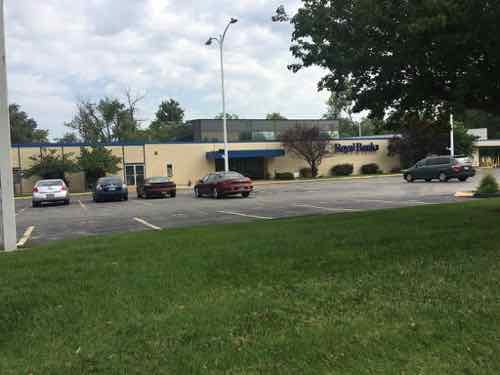
Having lived in St. Louis for over 28 years I’d driven this part of Olive many times, but this was my first time seeing it from the bus window. My interest on Saturday, however, was the far end of Olive. I got off the bus in front of Royal Banks (map). Before I get into my photos illustrating Olive Blvd I should give you some additional background. Neither University City or St. Louis County is responsible for maintenance of the road, sidewalks, signals, etc. The State of Missouri has that responsibility because Olive Blvd is also known as state Route 340.
Route 340 is a highway in the St. Louis metropolitan area. Its western terminus is Route 100 (Manchester Road) in Ellisville, and its eastern terminus is at an intersection with Ferguson Avenue and Olive Boulevard in University City. The stretch of Route 340 between Manchester Road and the Interstate 64 / U.S. 40 / U.S. 61 interchange is known locally as Clarkson Road. The remainder of Route 340 between this intersection and its eastern terminus is variously known as Olive Boulevard (which does not connect with Olive Street in the city of St. Louis. Route 340 ends at Ferguson Avenue in University City, but Olive Boulevard continues to Skinker Boulevard on St. Louis city line. (Wikipedia)
Not a divided limited-access interstate, but an urban corridor that is supposed to move more cars than other corridors — like Delmar Blvd. The headline gives away the theme — it was a nightmare. This comes from auto-centric development in the absence of a mandate for accommodating pedestrians.
OK, let the visual tour begin.
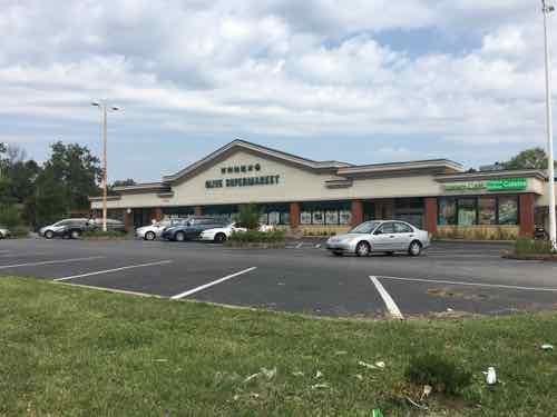
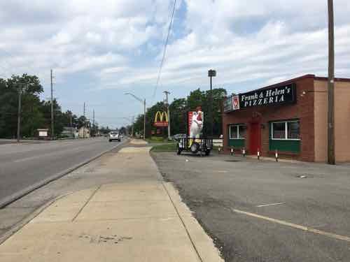
Taken on the bus, this 1915 building has residential above commercial. This is shortly before Olive Blvd becomes Missouri Route 340. Due to parking, clear pedestrian access is limited.Looking West as the bus continues heading on Olive Blvd to Chesterfield Mall.Looking East from the same spot. Olive Blvd is 4 travel lanes, plus a center turn lane. Sidewalks at this point are “attached”, no tree lawn separating roadway from sidewalk.The Royal Banks building, 8021 Olive Blvd, was built in 1971. In 1958 the land was vacant.Next door, to the West, is a store specializing in Asian/International groceries. It was built in 1960 — has been updated many times since. Both are set way back from Olive to provide more room for parking.
Despite the presence of a bus stop, neither provide an accessible route to their accessible building entrance. This is the case for nearly every property I encountered the next few hours.
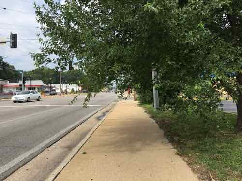
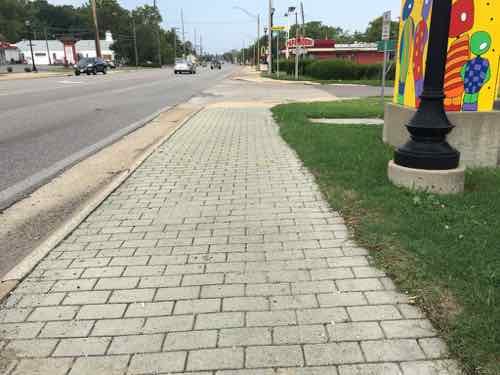
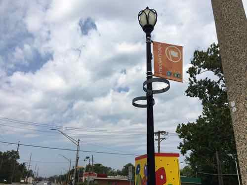
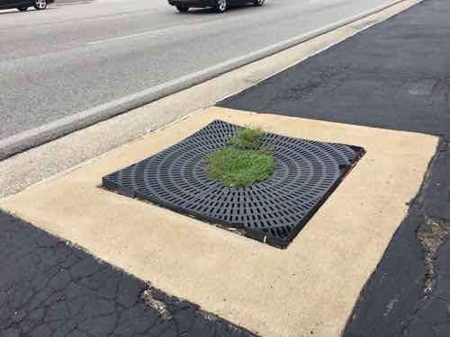
I quickly encounter a point where foliage is hanging over the sidewalk. I’m sitting in my wheelchair and still hit it when ducking.In places the paving changes to a paver brick intended to spruce up the pedestrian experience. As expected, they were uneven.The streetlight is also intended to help the image of Olive. The banner is for the Olive Link International district, next to rings meant to hold planters.This shows a 1962 pizza place is relatively close to Olive.Broken grate around a former street tree.
The above was written back in August, shortly after taking the trip on Olive. Rather than continue procrastinating, I’m going to post more pics with limited commentary to be able to finish this post.
One of many places where no curb cut exists, there’s a good ramp across the street but not this side
Yesterday as I was finishing up this post I reviewed all nearly 200 photos I took that hot August day. After wishing it wasn’t so cold now, I recall all the obstacles I encountered in my wheelchair. I also thought about how horrid the environment is for anyone to experience as a pedestrian.
Now that I’ve finally gotten this post completed, I can post about plans to redevelop the Western end of Olive Blvd in University City.
AARP Livibility Index
The Livability Index scores neighborhoods and communities across the U.S. for the services and amenities that impact your life the most
Built St. Louis
historic architecture of St. Louis, Missouri – mourning the losses, celebrating the survivors.
Geo St. Louis
a guide to geospatial data about the City of St. Louis