November 26, 2018Featured, Planning & Design, Public TransitComments Off on Possible Development at Forest Park-DeBaliviere MetroLink Station Will Include Lots of Parking
After 25 years the Forest Park-DeBaliviere MetroLink (light rail) station may finally be getting new higher-density development. From last week:
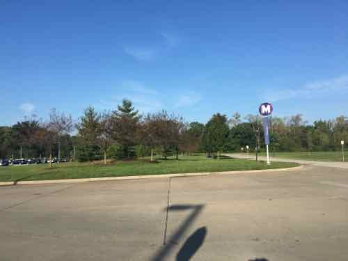
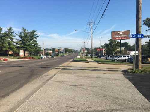
An Indianapolis developer plans to transform the block around the Forest Park-DeBaliviere MetroLink station with a $70 million development adding 265 apartments and 34,000 square feet of retail.
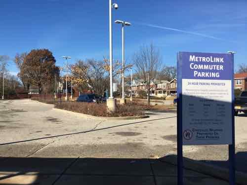
The Bi-State Development Board of Commissioners on Friday voted to proceed with the project. The Bi-State-owned parking lot at the northwest corner of Forest Park Parkway and DeBaliviere Avenue along with the drop-off lot on the east side of DeBaliviere Avenue are targeted for new apartment and retail buildings. The privately owned strip mall to the north of the Bi-State parking lot is also part of the project, slated for a four-story, 106-apartment building with 16,000 square feet of ground-floor retail. The Bi-State parking lot will be turned into a six-story building with 108 apartments and almost 13,000 square feet of ground-floor retail. Metro’s drop-off lot across the street would become a five-story, 51-apartment building with 5,000 square feet of street-level retail. Plans also call for public art and streetscape improvements. (Post-Dispatch)
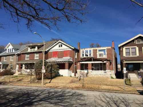
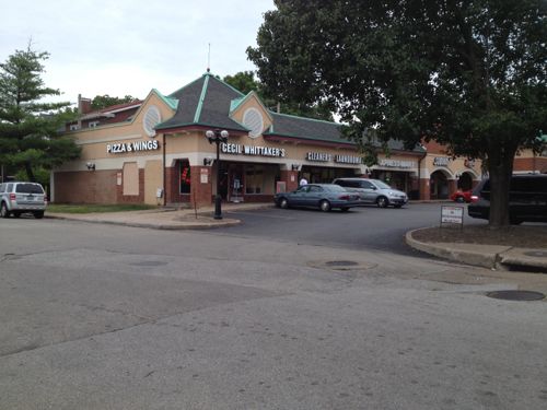
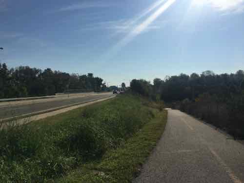
Over the last quarter century other developers have also talked about developing around the station. Maybe it’ll finally happen. Over the last few years we have seen high-end high-density housing filling in gaps along Pershing Ave, to the East of DeBaliviere. Yet, five houses West on De Giverville, facing the parking lot to be developed. are two houses in poor condition.
The house missing the roof is 5727 De Giverville.
Across from a light rail transit station for 25 years. Part of the problem with this area is a lack of retail/services — namely a grocery store:
5727 De Giverville Avenue has a Walk Score of 64 out of 100. This location is Somewhat Walkable so some errands can be accomplished on foot.
5727 De Giverville Avenue is a three minute walk from the MLB MetroLink Blue Line and the MLR MetroLink Red Line at the FOREST PARK METROLINK STATION stop. (WalkScore)
Hopefully the new development will substantially increase the WalkScore for this area. Certainly couldn’t lower it!
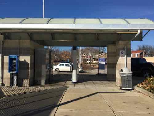
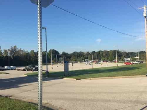
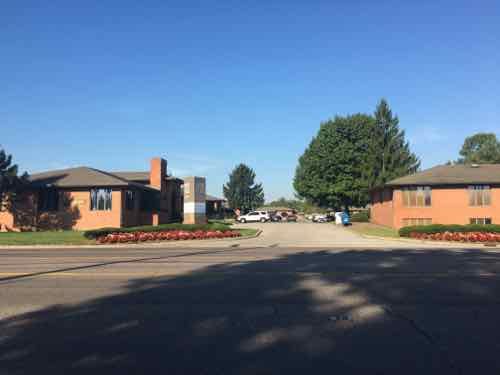
Metro’s free park & ride lot was redone in 2006 when the Blue line was added. This structure is also from 2006. The houses on De Giverville can be seen in the background.Full on weekdays, the free parking at the station is usually empty on the weekendsThe old kiss & ride space on the East side of DeBaliviere will also be developed.
I’ve previously posted about how awful the strip retail building at DeGiverville & DeBaliviere is — especially need to a light rail station.
Low-density suburban style strip center isn’t an asset for the area, tenants include Metro’s Transit Access Center where Call-A-Ride operations are and where disabled riders. like myself, go to get a reduced=fare card. Very low volume.
Can’t wait to see that building demolished!
Hopefully a developer will snap up the former Talayna’s on the NE corner of DeBaliviere & Pershing.
While I’m happy a new developer is interested in this area, I’m not thrilled Metro will still have 100 parking spaces (per Wikipedia). This just increases the cost of housing & commercial rents in the new development — meaning those of us on the low end of the income scale who use transit won’t be able to afford to live here.
Back in September 2016, on the 20th, I received a press release from our transit agency Metro — aka Bi-State Development:
SWANSEA, IL, SEPT. 20, 2016… Southwestern Illinois Development Authority (SWIDA), in partnership with Bywater Development Group and Bi-State Development (BSD), is pleased to announce a new, $10.5 million development that will bring senior apartment living adjacent to the Swansea MetroLink Station in Swansea, Ill. The transit-oriented development (TOD) project, which will be developed by SWIDA and Bywater, was approved by the Illinois Housing Development Authority (IHDA) in Chicago on September 16.
This new development, called Metro Landing of Swansea, will feature a handsome three-story building with 62 affordable one- and two-bedroom apartments for older adults seeking an independent lifestyle. Located adjacent to the Swansea MetroLink Station, residents will have car-free transportation options via MetroLink and MetroBus to conveniently access restaurants, retail, entertainment venues, recreational locations, employment centers, and medical facilities around the bi-state region. The Swansea Station is located on the Metro East Park and Recreation District BikeLink trail system, so seniors will be able to utilize the trail for exercise and recreation.
This development would not have occurred without the collaboration of a number of groups including IHDA, the St. Clair County Transit District and the Village of Swansea. The Village has been a vital asset in the predevelopment planning process. “It is truly an example of how public and private partnerships can lead to an important community investment,” James Nations, SWIDA’s Chairman said. “This is an excellent opportunity for SWIDA and Bywater Development Group to contribute to active senior housing as this segment of the population continues to grow.” The SWIDA Board of Directors is seeking other markets in the region in need of comparable developments.
Mike Lundy, Executive Director of SWIDA said, “It has been great working with Bi-State Development. We are very pleased with the new senior housing development and worked extremely hard to move this development forward.”
“This new development to be positioned next to the Swansea MetroLink Station reflects other successful transit-oriented projects in our area, and is a testament to the positive benefits the Metro transit system brings to the region,” said John Nations, President and CEO of Bi- State Development (BSD). BSD operates the metro public transportation system for the St. Louis region.
“Metro Landing of Swansea is reflective of a very strong and effective public/private partnership and stands to serve as a model for transit oriented senior housing. It will create both a positive impact on the community and an ideal living environment for its residents. Our organization is highly honored to be a part of this collective effort,” said Aaron Burnett, President of Bywater Development Group.
Metro Landing of Swansea is scheduled for construction commencement in the summer of 2017 with full completion by late summer of 2018.
About SWIDA
The Southwestern Illinois Development Authority is a special-purpose, municipal corporation and local governmental unit whose purpose is to promote and enhance economic development within the counties of Bond, Clinton, Madison and St. Clair Ill. To learn more, visit www.swida.org.
About Bi-State Development
Bi-State Development (BSD) operates the St. Louis Regional Freightway, the region’s freight district, and the Bi-State Development Research Institute. BSD is the operator of the Metro public transportation system for the St. Louis region, which includes the 87 vehicle, 46-mile MetroLink light rail system; 391 MetroBus vehicle fleet that serves 77 MetroBus routes; and Metro Call-A-Ride, a paratransit fleet of 120 vans. BSD owns and operates St. Louis Downtown Airport and the Gateway Arch Riverboats, as well as operates the Gateway Arch Revenue Collections Center and Gateway Arch trams.
Within 90 minutes of receiving the press release I emailed Mike Lundy of SWIDA and Aaron Burnett of Bywater Development volunteering to help with accessibility, pedestrian issues, etc. I wanted to make sure they avoided common problems I’ve found throughout the region.Unfortunately, I’ve yet to hear back from either.
The stories online that day from the Post-Dispatch & other media outlets was a rephrasing of the press release along with the image provided. Rather than do the same as others, I visited the Swansea MetroLink station and surrounding area a few days later — on the morning of September 23rd. I was in the area nearly 2 hours — taking 158 photos in that time.
Go back up and read the press release again, you’ll see buzz words/phrases like ‘car-free’, ‘transit-oriented senior housing’, and ‘ideal living environment.’ Yeah…not so much.
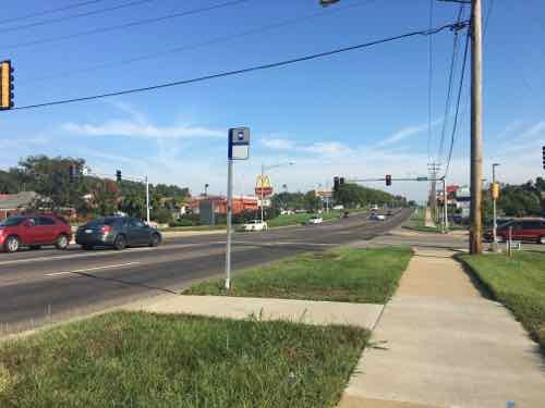
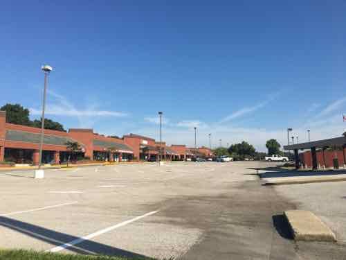
The main thing these independent seniors will be buying is groceries. The nearest grocery store is al Aldi about a half a mile walk to the South, a Schnucks just over a half mile to the North. Before we go to the grocery stores let’s take a look at the station.
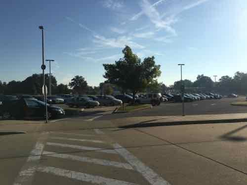
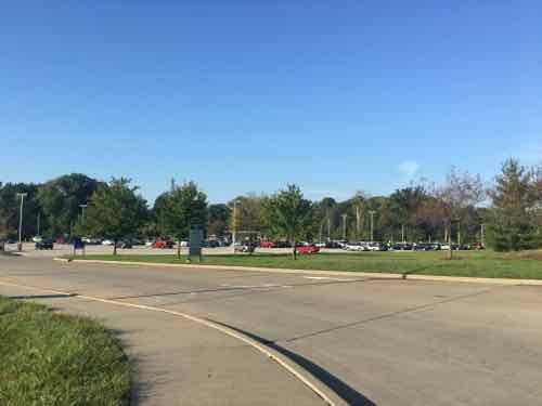
From the station looking out we see a drive for buses, a drive for cars, and surface parking for cars.Out looking back we see the main parking lot — another is to the left out of frame. Most likely the new building will be built on the grassy area to the right.A more direct look at the likely spot where the building whirl be built. Other than the parking lots, this is the largest land owned by Metro at this station.Further away firom the station we see the secondary parking lot on the left
Let’s go to the Aldi first since it is slightly closer and we’re almost out to the main road, IL-159/N. Illinois St.
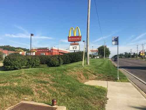
Looking back from near the main road.Looking South at IL-159, but no sidewalk on this side. Metro also owns owns this land and building, so perhaps they plan to build senior housing here?I went back to the station and used the circuitous trail to head South. The trail goes under Belt (left), a spur comes up (right)Heading toward the side of the AldiGetting closerAt this point you’re dumped into the parking lot where you risk getting hit by cars. The store entry is to the left out of the frame.
Let’s return to the station entrance and go North to try to access the Schnucks. Though the Schnucks is also on the West side of IL-159, there’s no sidewalk so we must cross to the West to head North.
Not exactly friendlyLooking back West we see an office park that includes medical offices — not reachable as a pedestrian thoughCatching a bus at the station would save some distance, the Schnucks is behind the Mcdonald’sOn the NW corner of 159 & Fullerton Rd we see the bus stop needed if we wanted to catch the bus back to the station. There’s no sidewalk here, how do we reach the store?The North side of Fullerton Rd has a sidewalk, but theres no connection to the Schnucks or other businesses.
Seniors living here might not be able to carry a bag or two of groceries, so an inexpensive folding shopping cart is a good option. But traversing parking lots are dangerous and trying to get the cart up & over many curbs is a challenge at any age/ability. My experience confirms the WalkScore of 33 out of 100 for the MetroLink light rail station — car dependent.
Metro and its partners want everyone to believe seniors will be able to live here car-free. I realize pedestrian-friendly development doesn’t happen around transit immediacy — it takes time. This station has only been open since…May 5th…2001 — over 15 years!
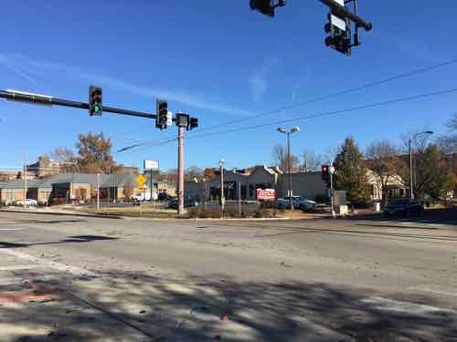
In 2006/07 I attended many public meetings on a proposed Northside-Southside light rail line, it was finalized in 2008. In writing about these plans in the last year, people have asked if I’d seen the new study that was done, it’s not the same as it was in 2008. The study they’re referring to, Transit Oriented Development Study for the PROPOSED NORTHSIDE-SOUTHSIDE ALIGNMENT, isn’t anything new on the actual transportation side. It was completed in July 2013. At first, it wasn’t online. I pushed to get it online…downloading it on April 18 2014.
Today’s post is about this study — dispelling myths about what it is — and isn’t. My criticism of running high-speed light rail down streets like Natural Bridge & Cherokee is the street grid will be severed to achieve desired speeds. I’m an advocate of rail transit, and the preferred route. If it were up to me, I’d build it immediately — as modern streetcar/tram instead of light rail. This greatly simplifies construction by eliminating the need to reduce conflicts with a train speeding down the center of the street.
STUDY OBJECTIVE: To assist the City of St. Louis, its neighborhoods, and developers with preparing for and taking advantage of transit investment along the proposed Northside-Southside Alignment.
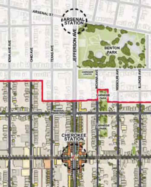
As the study title & objective indicate — it is about development related to proposed stations. The study is a detailed look at two stations on the proposed alignment: Kingshighway & Cherokee.
This study builds upon the goals set forth in previous plans, while giving a strong framework for decision-making regarding Transit Oriented Development, which ,as defined by HUD, is compact, mixed-use development in close proximity to transit facilities. Transit Oriented Development promotes sustainable communities by providing people of all ages and incomes with improved access to transportation and housing choices and reduced transportation costs that reduce the negative impacts of automobile travel on the environment and the economy. This report aspires to meet these goals and study the Alignment at this higher level of detail, with a comprehensive analysis of each of the proposed stations, a set of Station Area Plans that describe detailed development programs, building form and distribution, street improvements, and environmental analysis for the proposed Cherokee and Kingshighway Stations. These two stations were selected because they embody a similar range of challenges and opportunities to the other station areas along the Alignment. In future studies of the other station areas, lessons from Kingshighway and Cherokee can be readily applied.
The study makes no mention of what happens between stations.
Two East-West streets are between Cherokee & Arsenal– Utah & Wyoming
Depending upon how the Arsenal & Cherokee stations would be designed — both Wyoming & Utah could be cut off — no more crossing at either. Most likely the Northbound platforms would be located north of Arsenal & Cherokee, respectively. The Southbound platforms would be located South of each. This, rather than a shared platform, requires the least amount of width.
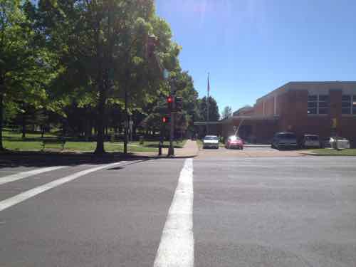
Looking East across Jefferson at Wyoming, May 2013. Benton Park on left, Cherokee Recreation Center on right
The distance between the two proposed stations is 4/10ths of a mile. Another 4/10ths North would be a Gravois station. The streets of Crittenden, Pestalozi, & Lynch would become no-crossing points. Another 4/10ths of a mile North to a station/crossing at Russell, with no-crossing allowed in between.
We should build North-South rail connection, but not at the expense of the street grid and the access it currently affords. Build modern streetcar on the Northside-Southside route. Keep the grid fully intact.
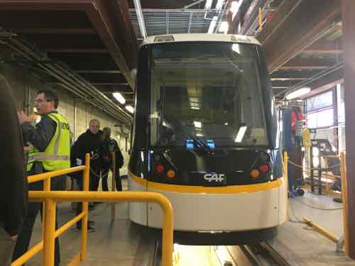
The study showed the current Siemens high-floor light rail vehicles in the new proposed street-runing lines. Not going to happen. In-street platforms and high-floor vehicles don’t work together.
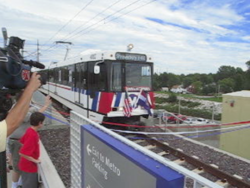
The Siemens SD-400 & SD-460 vehicles are a 1980s design, used in only three regions worldwide: Pittsburgh, St. Louis, and Valencia, Venezuela. Shown: Shrewsbury opening August 2006Upcoming modern streetcar lines in Cincinatti & Kansas City use the same 100% low-floor vehicles. (CAF’s Urbos 3/100)
The best solution to simplify platforms and make ADA-compliance easier is 21st Century 100% low-floor vehicles.
From Wikipedia — a list of cities with Urbos 70 and Urbos 100 vehicles:
Cuiabá, Brazil (40 ordered)
Salvador, Brazil
Belgrade, Serbia (30)
Seville, Spain
Granada, Spain
Cádiz, Spain
Debrecen, Hungary (18)
Edinburgh, Scotland (27)
Málaga, Spain
Besançon, France (19)
Nantes, France (8)
Zaragoza, Spain (21)
West Midlands, England (£40 million order for 20, with options for five)
Kaohsiung, Taiwan (9 ordered; ACR system built in; no need for catenary)
Cincinnati, Ohio, USA ($25 million for 5 trams)
Sydney, Australia. ($20m order for 6 trams; order subsequently expanded to 12 trams)
Freiburg im Breisgau, Germany (12 ordered)
Kansas City, Missouri, USA
Budapest, Hungary (47; €90m order for the 47 trams)
Utrecht, Netherlands (27 ordered; to be operational in 2018)
The beauty of modern streetcar vehicles is they can be used for light rail as well. So if the lines were to continue into North & South St. Louis County the same vehicles could travel at higher speeds on closed right-of-way.
When it comes to the actual transit design of Northside-Southside, the final 2008 study still remains. The 2013 was a look at development options — a good thing considering how we’ve failed to capitalize on existing light rail stations since the first line opened in 1993.
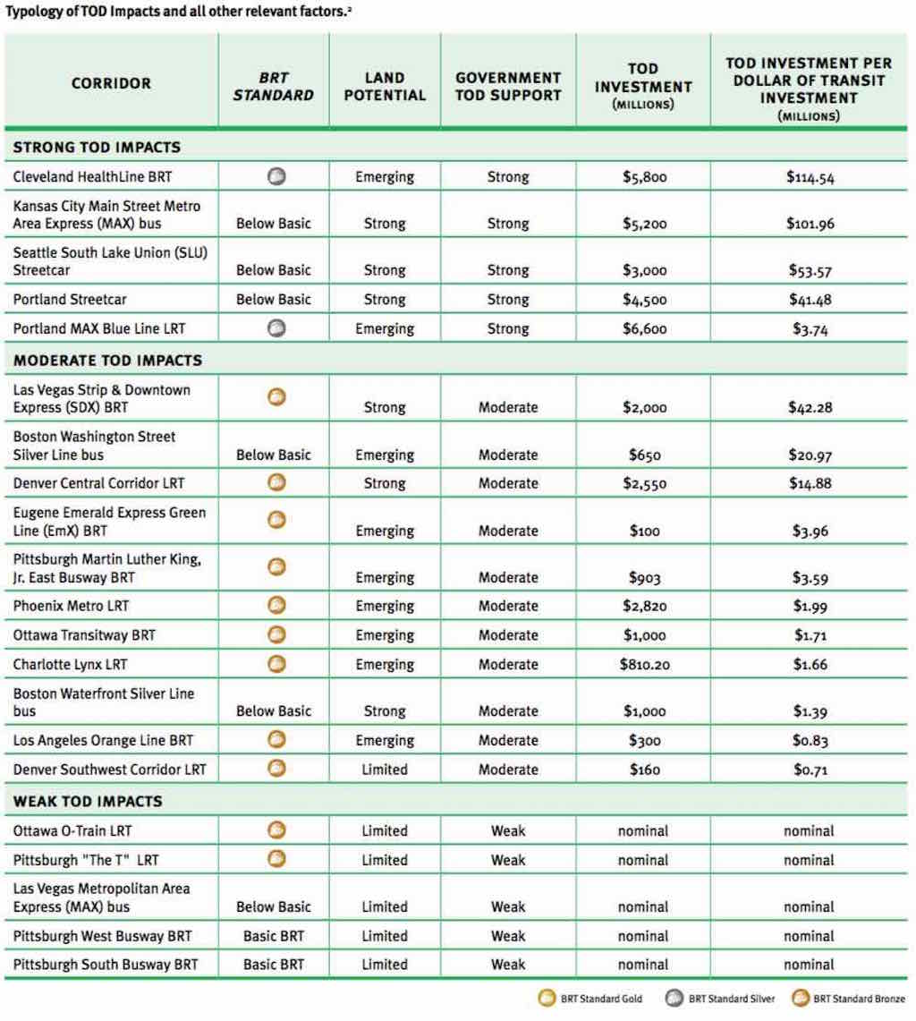
“Per dollar of transit investment, and under similar conditions, BRT can leverage more (development) investment than LRT or streetcars.”
For example, Cleveland’s Healthline, a BRT project completed on Cleveland’s Euclid Avenue in 2008, has generated $5.8 billion in development —$114 for each transit dollar invested. Portland’s Blue Line, a light rail project completed in 1986, generated $3.74 per dollar invested.
and…
The U.S. has seven authentic BRT lines in Cleveland, Las Vegas, Los Angeles, Eugene Ore., and several in Pittsburgh. None achieve the internationally recognized “gold standard” of BRT like Bogota’s TransMilenio line. But one planned for Chicago’s Ashland Avenue might.
“There’s no gold standard BRT in the U.S. yet,” Weinstock said, “but if we continue with the Ashland project on the current trajectory, Ashland could be the first gold in the U.S.”
I’ll address Chicago’s Ashland Ave in a future post. BRT — more development return than LRT or streetcars?
Long-time readers know I love rail — especially streetcars. Public transit was often about real estate development, to get people to a new project, developers would build a streetcar line to get them there. Cities would lease part of the public right-of-way (PROW) so they could operate. Cities, including St. Louis, would have multiple private companies providing public transit. Eventually cities would increase the fees for the track & overhead wires in the PROW or even require the operators to repave roads where they operated. This quickly made streetcar operations unprofitable. One solution, of course, was to abandon the track and use rubber tire vehicles — the bus.
Eventually governments bought up all the private systems — remaining streetcar lines and those that had been converted to bus. Remember, their origin was rooted in the development of real estate. With land developed these lines became strictly about moving people to/from. We need to retuning to the days of the connection between transit and development!
As you can see from the BRT, LRT, and streetcar limes above the return on investment is all over the board. In the top section (Strong TOD Impacts) we see the LRT cost more than the BRT or streetcar lines, but had significantly less development. A return of $3,74 on every dollar looks good until compared to $41.68 or more. Kansas City’s MAX bus line doesn’t even meet the basics to be BRT — yet it has had a return of $101.96 per dollar!
The report begins talking about the Metro subway system in Washington D.C. — a long & costly undertaking:
A growing number of US cities are finding, however, that metro or subway systems are simply too expensive and take too long to implement to effect significant changes in ongoing trends toward suburban sprawl. As such, cities are turning to lower-cost mass transit options such as LRT, BRT, and streetcars. These systems, which frequently use surface streets, are much less expensive and can be built more quickly than heavy-rail subways or metro systems. Over the past decade, some evidence has emerged that some LRT systems in the US have had positive development impacts. Outside of the US, in cities like Curitiba, Brazil, and Guangzhou, China, there is copious evidence that BRT systems have successfully stimulated development. Curitiba’s early silver-standard BRT corridors, completed in the 1970s, were developed together with a master plan that concentrated development along them. The population growth along the corridor rate was 98% between 1980 and 1985, compared to an average citywide population growth rate of only 9.5%. However, because bronze-, silver-, or gold-standard BRT is still relatively new to the US, evidence of the impact of good-quality BRT on domestic development is only now beginning to emerge and has been largely undocumented. (p14)
A detailed look at the Corridors with Strong TOD Impacts begins on page 110:
The analysis shows that all of the corridors in the Strong TOD Impacts category had Strong government TOD support and either Emerging or Strong land potential.
The only two transit corridors in our study that rate above bronze — the Cleveland HealthLine BRT and the Blue Line LRT — both fell into the Strong TOD Impacts category and were in Emerging land markets. The Blue Line LRT leveraged $6.6 billion in new TOD investments, and the Cleveland HealthLine BRT leveraged $5.8 billion, making them the two most successful transit investments in the country from a TOD perspective. Portland achieved this over a much longer time period and in a stronger economy than Cleveland did.
In the Strong TOD Impacts category, three corridors with below-basic-quality transit had Strong land development potential and Strong government TOD support: the Portland Streetcar, the Seattle SLU Streetcar, and the Kansas City Main Street MAX.
In each of these cases, local developers and development authorities did not feel that the transit investment was all that critical to the TOD impacts. Thus, we can conclude that if the land market is strong enough, and the government TOD efforts strong enough, a below-basic transit investment might suffice; but a higher-quality transit investment could have even greater impacts.
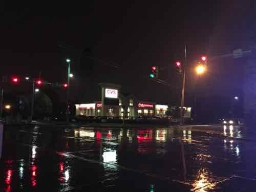
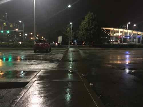
Not all of the investment along Cleveland’s Healthline is urban. We visited this CVS — built right after the line opened. The building is set back behind a fenced parking lot.
A typical suburban CVS is among the new development along Cleveland’s Healthline. Click image to view in Google Maps.Like most newer CVS stores, it has an ADA accessible route out to the public sidewalk. In this view from the entry pedestrians must go left to the intersection to reach the EB & WB stations. If the entry were at the corner less walking would be required.
As I noted previously. a lot of the new development was on college & hospital campuses — it would’ve happened anyway — but it faces the street rather than looking internal (like SLU, BJC, etc).
I’ve got to read the full report a few more times so absorb it all — while recognizing it was written with a pro-BRT viewpoint.
Any TOD effort is most successful when land-use planning and urban development efforts are concentrated around a high-quality mass transit corridor that serves land with inherent development potential. Assistance from regional and city-level agencies, community development corporations, and local stakeholders can help create more targeted policies to direct development to such transit corridors. Local foundations can be critical to the process of funding redevelopment and providing capital and equity for projects. Local NGOs, which can communicate the projects to the public to help broaden support, are also important.
Although cities in the US are still far from fully transforming their declined urban neighborhoods into high-quality, mixed-use urban developments, they are well on their way. Gold-, silver-, or bronze-standard BRT, when combined with institutional, financial, and planning support for TOD, is proving to be a cost-effective way of rebuilding our cities into more livable, transit-oriented communities.
Regardless of their bias, the above is true — we’ve invested hundreds of millions in light rail and have little TOD to show for it because of poor land-use planning.
Like streetcars & LRT, I think BRT is a great option to consider in the St. Louis region, We can argue about the mode, but we need to take action to have land-use planning that will strongly support transit-oriented development!
St. Louis has had very little success with transit-oriented development since our original light rail line, MetroLink, opened in 1993. From the start the Emerson Park station in East St. Louis, which opened in May 2001, was different. The station includes some storefront space and around the station homes & apartments have been added over the years, a recent addition is Eco Jazz, see New Senior Housing A Bright Spot In East Saint Louis.
Jazz Ensemble Market believes that food is the connection that brings us all together. When we sit at the dinner table, we share our moments with family, friends and food gives us opportunities to connect.
Serving the East St. Louis Community is our core business philosophy. We are locally owned. Any purchase that is made in the store, stays in East St Louis. We are locally operated. All employees come from within East St. Louis. We are neighbors serving neighbors, the way it should be.
Our community involvement is vast. We are partnering with local vendors, local producers, local outreach groups to give each other a helping hand up. We are working with other local organizations to develop and implement solutions to their challenging problems.
Jazz Ensemble Market will never be on the side lines of the community.
For far too long East St. Louis has been a food insecure area, and we are the foundation to turn that around.
Let’s take a look…
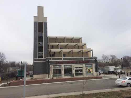
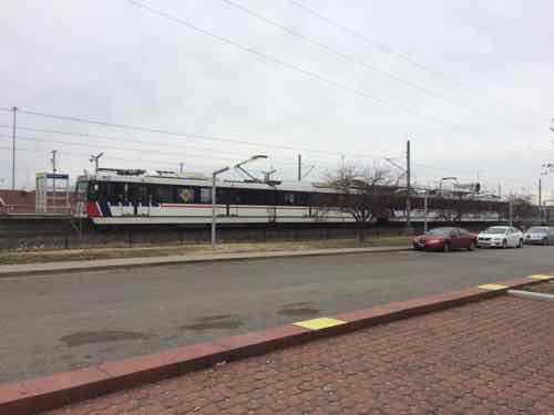
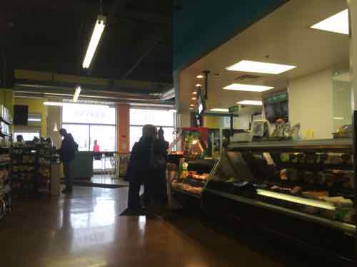
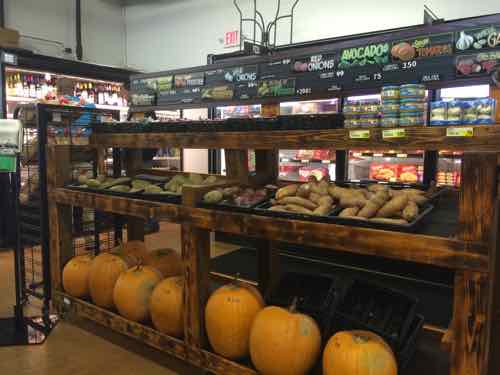
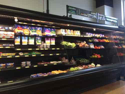
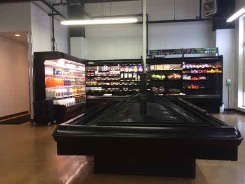
The Jazz Ensemble Market as seen from the MetroLink platform, it opened last Fall in the ground floor of the new Eco Jazz./Jazz at Walter Circle senior housing buildingLooking toward the transit station from the market’s door we see a WB trainInside the market has a small deliSome produce near frozen foodsMore produce next to dairyRoom for more produce!
The nearest larger grocery store is a Schnuck’s at 25th & State — a 1.5 mile/30 minute walk from the station. The number of people walking to/from the market and station was encouraging. A seating area up front lets you enjoy your deli purchase while looking at the station, the free wi-fi let’s you stay connected.
This adds up to be a great subject for Good News Friday (#gnf)!
AARP Livibility Index
The Livability Index scores neighborhoods and communities across the U.S. for the services and amenities that impact your life the most
Built St. Louis
historic architecture of St. Louis, Missouri – mourning the losses, celebrating the survivors.
Geo St. Louis
a guide to geospatial data about the City of St. Louis