Home » Old North St. Louis » Recent Articles:

Newish Book: ‘Growing Up In Old North St. Louis’, 2nd Edition by Patrick J. Kleaver

February 4, 2021 Books, Featured, North City Comments Off on Newish Book: ‘Growing Up In Old North St. Louis’, 2nd Edition by Patrick J. Kleaver

I receive quite a few new books from publishers throughout each year, but late last year I received an email from a self-published author. Patrick Kleaver invited me to check out the 2nd edition of his book from the library. I’m interested in the perspectives of people who grew up in St. Louis, especially in a neighborhood where I’ve lived so I reserved it and picked it up.

Like a book I posted about last year, ‘The Last Children of Mill Creek’ by Vivian Gibson, Kleaver’s book is a personal memoir about where the author grew up. Each tells the reader about their family while also describing their neighborhood & experiences. There are many similarities between these two book — especially growing up in a multigenerational home.

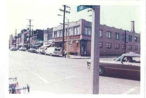
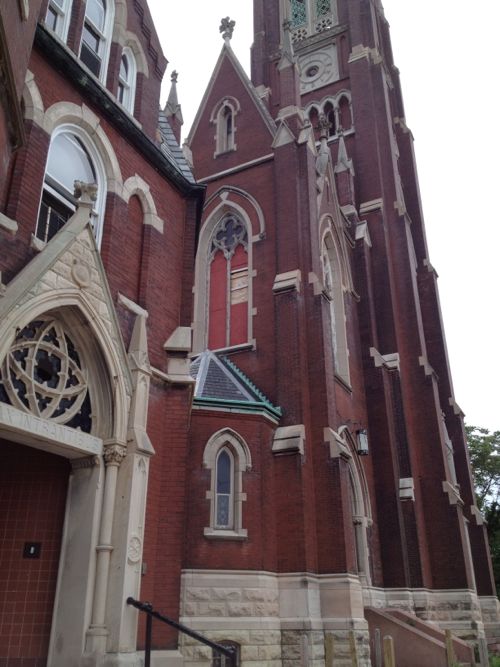
Join life-time St. Louisan Patrick J. Kleaver in this UPDATED AND EXPANDED version of his book GROWING UP IN OLD NORTH ST. LOUIS. He reminisces about the good and the bad in the first nineteen years of his life when he lived in that historic St. Louis neighborhood from its heyday in the mid-1950s to its decline in the 1970s. From a detailed description of his house to the neighborhood shopping district originally known as the “Great White Way” (with stops at various neighbors and churches along the way), you’ll feel like you’re entering his life and walking with him on a personally guided tour! In this SECOND EDITION, he includes MORE anecdotes, a MORE detailed history of Old North St. Louis and its historic Catholic churches, MORE photographs (including rarely seen historic ones of streetscapes and church interiors), a MORE DETAILED quick side trip to two other neighborhoods bordering his, and UP-TO-DATE INFORMATION about the status of the various people and buildings mentioned. (Google Books)

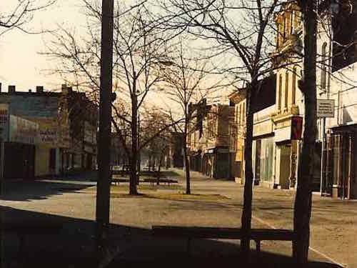
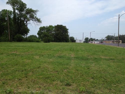
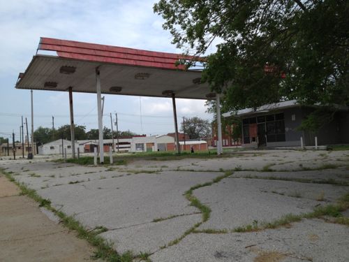
As Kleaver points out the city’s 1947 Comprehensive Plan considered the neighborhood obsolete, largely due to how few residences had modern plumbing. Thus, it’s “heyday” was well before the 1950s. Still, he lived in the neighborhood while it went from being highly populated to significantly reduced population either through those who moved, or those forced out by the demolition for the Mark Twain Expressway (aka I-70).

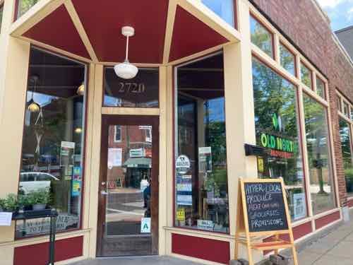
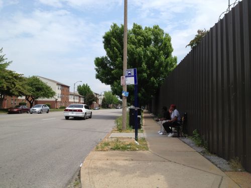
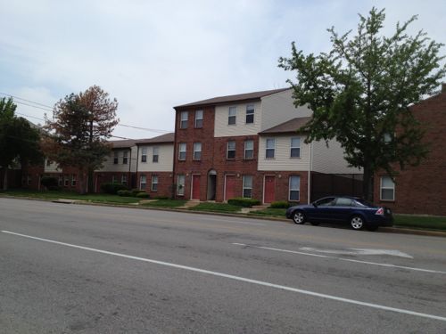
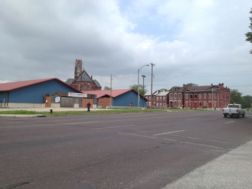
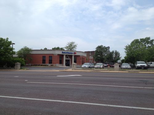
I moved to the neighborhood in the spring of 1991, some of my neighbors had moved their in the late 1970s. It’s very interesting reading the accounts of a person that lived in the neighborhood in the 50s & 60s.  One side of his family lived in Hyde Park, just to the north of Old North, while the other side is from where I live now, Columbus Square.

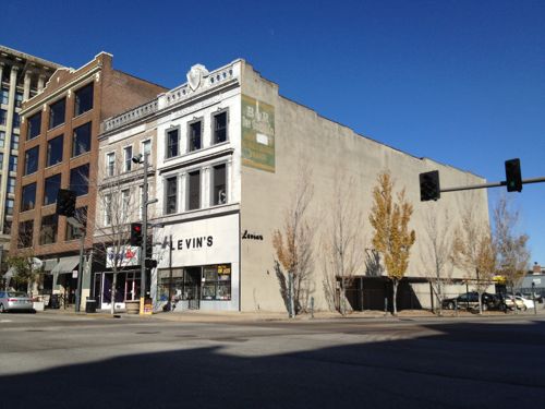
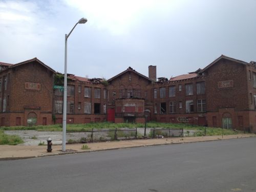
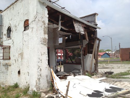
The Kleaver family lived on Tyler, which is near the southern edge of today’s boundaries for Old North. The house of one of his childhood friends was also one of my favorites. Was — past tense as so much has been lost.

This book is available from the St. Louis Library and online retailers.

— Steve Patterson


Decade Since The Failed 14th Street Pedestrian Mall Was Reopened in Old North St. Louis

October 29, 2020 Featured, Neighborhoods, North City, Pedestrian Mall Comments Off on Decade Since The Failed 14th Street Pedestrian Mall Was Reopened in Old North St. Louis

It has now been a decade since a 33-year mistake was corrected. During the 1960s & 1970s removing a street to create a “pedestrian mall” was a magic bullet tried by cities coast to coast. Almost fall failed.

In the early 1970s North 14th Street merchants began looking for solutions to a decline in sales as residents of the surrounding near north neighborhood left for better housing elsewhere.

From a May 1972 Washington University graduate thesis

The solution, they thought, was to mall 14th Street. Some buildings behind the street were razed to create large surface parking lots, so former residents could drive back to their old neighborhood to shop at chains like JC Penny & Woolworth’s and local businesses like Sobel’s Furniture.

Open air and enclosed malls were attracting more and more customers so remaking a decades-old neighborhood shopping district to emulate suburban malls would attract customers. Well, that was the theory that led to hundreds of streets nationwide being malled.

More like mauled.

The new 2-block long mall opened on March 2, 1977.  Two blocks of North 14th Street were closed to vehicles, from Warren Street on the south to St. Louis Ave on the north. The one cross street, Montgomery Street, was also closed. See current map.

By the time I first saw it in the Fall of 1990 very few businesses remained.

Looking south on 14th, Spring 1991

By the Spring of 1991 I was living in the Murphy-Blair neighborhood, the local group was working to rename it Old North St. Louis. The neighborhood located just north of downtown St. Louis was a separate village 1816-1841, when it was annexed by a growing St. Louis.

Two business that were were just beyond the mall were Marx Hardware (Est 1875) and Crown Candy Kitchen (Est 1913), both are still in business.

I left the neighborhood in August 1994, but others finally figured out how to put together a project to both renovate the buildings that remained and put back the street. I applaud all involved for their perseverance.

The ribbon cutting was held on July 29, 2010

After the ribbon cutting & celebration traffic didn’t immediately begin driving up & down 14th Street. The new streetlights were delayed, so the city’s Streets Dept wouldn’t let cars use the new street. Within a few months the lights and a few other punch list items were completed.

The former Woolworth’s at 14th & Montgomery in 2010.

In the decade since the reopening new occupants of the  storefronts have changed, retail is a struggle everywhere. The spaces aren’t empty, which is important.  The street trees have matured nicely.

Old North Provisions diagonally across from Crown Candy Kitchen in August. Click image to see their website in a new tab.

Some say the mall helped keep these buildings from being destroyed, but I think had the mall not been built the street might have been slowly brought back one business at a time, like others in St. Louis.

— Steve Patterson


Village of North St. Louis Founded 200 Years Ago Today

October 1909 Sanborn map shows 2 of 3 circles, click image to view full page

Twenty-Five years ago I’d just moved to the Murphy-Blair neighborhood, now known as Old North St. Louis. The tiny 3-room flat was significantly cheaper than the tiny efficiency I had on Lindell in the Central West End.

Prior to my arrival, neighbors had already been trying to get the neighborhood’s name officially changed. They thought playing off the history was better than being named after a public housing complex.

That history is the area was founded as a separate village — North St. Louis — on June 29, 1816. St. Louis was founded 50+ years earlier, in February 1764.

June 29, 1816:

A town was incorporated which rivaled its southern neighbor, St. Louis, for many years. The new town, founded by Maj. William Christy, was named simply “North St. Louis.” Its southern boundary line was Madison Street, then a considerable distance from the northern boundary of the city which Christy and his associates referred to as “St. Louis under the hill.”

Christy had come to St. Louis from Pennsylvania with advanced ideas about city planning. With two partners, he proposed a scheme for developing a city which would appeal to the settlers flocking in from the East. Street names reflected the founders’ interest in politics — Madison and Monroe; Benton for the young lawyer who would become one of Missouri’s first senators; and Warren, for a hero at Bunker Hill.  A boatyard was established, and inducements offered steamboats to land at North St. Louis instead of farther downstream. A ferry made regular runs between North St. Louis and Alton.  In 1841, just a quarter century after its founding, the city was absorbed into St. Louis. (Source: St. Louis Day by Day by Frances Hurd Stadler, page 122) 

bHere’s another quote, this from the City of St. Louis:

The first attempt to develop this area was made in 1816, when the Village of North St. Louis was incorporated by William Chambers, William C. Christy and Thomas Wright. It was bounded by the present Monroe, Hadley, Montgomery Streets and the Mississippi River. It continued as a village until 1841 when it was absorbed into the City of St. Louis.

A unique feature of the village layout was the provision for three circular public use areas. These were Clinton Place as a school site, Jackson Place for recreational and assembly purposes and Marion Place for a church and cemetery. A public wharf at the foot of North Market Street was called Exchange Square.

The Village was to provide sites for mills similar to those in the New England hometowns of the village’s first settlers.

The village was about a mile upstream above Roy’s Wind Mill, which marked the northern limit of the town of St. Louis at the foot of Ashley Street, and on the Great Trail which later became North Broadway. Other prominent roads of the north side were Natural Bridge Road, which was laid out in the 1840’s as a northwestward extension of Mound Street, and Florissant Road which was a northward continuation of 16th Street in a western addition to the village. 

Today, North St. Louis generally refers to everything North of Delmar — the Delmar Divide. North St. Louis has more poverty, crime, abandoned buildings, & vacant land than the rest of St. Louis. Will this always be the case, or will it change over time?

Readers who voted in the recent non-scientific Sunday Poll were optimistic:

Q: In 25 years, will North St. Louis be better or worse than today?

  • Substantially better 13 [24.07%]
  • Better 13 [24.07%]
  • Slightly better 14 [25.93%]
  • About the same 6 [11.11%]
  • Slightly worse 2 [3.7%]
  • Worse 4 [7.41%]
  • Substantially worse 2 [3.7%]
  • Unsure/No Answer 0 [0%]

Nearly three-quarters feel North St. Louis will be better within a quarter century. I wish I could share their optimism, but the last 26 years have used up all the enthusiasm I had for the future of St. Louis. I do have fond memories of my 3+ years living in Murphy-Blair/Old North St. Louis.

— Steve Patterson


North 14th Street Reopened To Traffic 5 Years Ago Today

Five years ago today people were able to do what they hadn’t in 33+ year — drive on two blocks of North 14th Street.

From 1977-2010 two blocks of N 14th was a "pedestrian mall". By Spring 1991 it was already long-dead.
From 1977-2010 two blocks of N 14th was a “pedestrian mall”. By Spring 1991 it was already long-dead.
After many years of trying to un-mall 14th, a ribbon cutting for the new street was held on July 29, 2010. But since new streetlights hadn't arrived, vehicular traffic wasn't allowed to drive down it.
After many years of trying to un-mall 14th, a ribbon cutting for the new street was held on July 29, 2010. But since new streetlights hadn’t arrived, vehicular traffic wasn’t allowed to drive down it.
The new streetscape is friendly to both pedestrians & motorists, need not be mutually exclusive
This photo is from a May 1972 thesis, taken before 14th was malled. Source: "A rehabilitation of a small commercial district: 14th Street in Murphy-Blair" by Norman Robert Spatz
This photo is from a May 1972 thesis, taken before 14th was malled. Source: “A rehabilitation of a small commercial district: 14th Street in Murphy-Blair” by Norman Robert Spatz

b

b

b

b


Potential Development Sites Along Proposed Streetcar Line, Part 3: 14th & Olive To North Florissant & St. Louis Ave.

In the first two parts of this series on development sites along a proposed streetcar route I looked at Olive from 15th-16th and Olive from 16th-18th. In both cases it was a small area and I looked a specific buildings and parcels of land. Heading to N. Florissant Ave. & St. Louis Ave. nearly everything is a development site.

Let’s start downtown and work our way north. At 14th & Olive you have the library on the NE corner and the library administration building & a charter high school on the NW corner. I think the library admin building has office space available for lease.

The parking lot at 14th & Locust is privately owned, a good candidate for new construction.
The parking lot at 14th & Locust is privately owned, a good candidate for new construction. Photo is from 2007 before the charter school added another floor to their space on the left.
1400 Washington has had numerous development plans, it is now becoming a parking lot, same owner as the previous lot across the alley.
I'd like to see these two buildings on Washington Ave west of 14th get renovated, along with a thin wedge between the east wall and 14th
I’d like to see these two buildings on Washington Ave west of 14th get renovated, along with a thin wedge between the east wall and 14th. Photo from 2011.

Before we go any further north it makes sense to look at the route on a map along with a development zone on each side of the line. Light rail has stations miles apart, whereas streetcars are more like buses by having more frequent stops along the route.

The blue line is the route, green about 660ft (1/8th mile) and the red about 1,320ft (1/4 mile). Click to view in Google Maps.
The blue line is the proposed streetcar route, green about 660ft (1/8th mile) and the red about 1,320ft (1/4 mile). Purple is the new bridge connecting into Tucker.
Click to view in Google Maps.

The area between the green lines is the immediate area that I estimate to be part of a special transportation district with slightly higher property taxes, pro-rated based on distance.  The red lines are a quarter mile distance, the usual distance a person is willing to walk.

Quite a bit of this area is in what will be one of the Northside Regeneration job centers.

Numerous parking lots occupy significant land north of Washington Ave, ideal candidates for new construction.
A former BarnesCare building built in 2001, is now vacant. With no pedestrian access and large setbacks from both MLK & 14th this building should be razed and a new urban building constructed on the site.
Hogan Trucking uses two city blocks, Carr St has been vacated. Interestingly the property owner is listed as Hogan Redevelopment Corp.
This site must legally remain  a public park, as it has been since 1842. Click for more information.
This site must legally remain a public park, as it has been since 1842.
Click image for more information.
Many would love to see the crumbling Carr School get renovated. Click image for more information on this 1908 structure.
7.9 acres ready for development, the original lot boundaries remain since they were never consolidated.
The 14th & O'Fallon St bus stop is always busy, but that hasn't spurred development to date.
The 14th & O’Fallon St bus stop is always busy, but that hasn’t spurred development to date. This stop is currently served by the #32 & #74 MetroBus routes
On the west side of 14th, south of Cass, is the O'Fallon Place Apartments owned by McCormack Barron Salazar.
On the west side of 14th, south of Cass, is the O’Fallon Place Apartments owned by McCormack Baron Salazar.
Looking NW on N. Florissant from 14th
Looking NW on N. Florissant from 14th, vacant land and mostly vacant buildings are all around.
The Mullaphy Emigrant Home at 1609 N. 14th could finally get renovated if the streetcar connects the near-north side to downtown. Click image for more information on this historic structure.
Looking back toward downtown we see evidence of disinvested in the area along N. Florissant near  Madison St.
Looking back toward downtown we see evidence of disinvested in the area along N. Florissant near Madison St. The city says property owners are responsible for sidewalks but in this case the city is the property owner.
The City of St. Louis is the legal owner of the 668 sq ft lot at 1458 Madison St.
The City of St. Louis is the legal owner of the 668 sq ft wedge-shaped lot at 1458 Madison St.
This small building at 2100 N. Florissant Ave was built in 1906, the owner is in St. Louis County.
A bank in Illinois owns the unfinished daycare at 1501 Clinton & 1500 Monroe. The buildings to the north are owned by several owners, including the LRA & Northside Regeneration.
A bank in Illinois now owns the unfinished daycare at 1501 Clinton & 1500 Monroe. The buildings to the north are owned by several owners, including the LRA & Northside Regeneration.
The mostly vacant St. Liborious complex at Hogan & North Market is a city landmark, it is privately owned. Click image for more information.
Vast open areas are prime for redevelopment along the proposed streetcar route. This is north of North Market on the west side of North Florissant
The vacant gas station at 2418 N. Florissant was built in 1972.
Two blocks north at 2618 N. Florissant is another vacant gas station, this building has been modified many times since 1938.
This building, owned by a person in Atlanta GA, needs to be replaced. The Church's Chicken could operate out of a storefront in a new building.
This building, owned by a person in Atlanta GA, needs to be replaced. The Church’s Chicken could operate out of a storefront in a new building.
This building from 1940 should be replaced.
This bank was built in 1993 after the urban bank at the corner of N. Florissant & St. Louis Ave was razed, despite neighborhood objections. This should be replaced with an urban building on the corner.
The NE corner of N. Florissant & St. Louis Ave. had a cute diner until 1998

With so much vacant land & buildings, this stretch of the proposed streetcar line has the greatest potential for redevelopment. It will also be a challenge initially to get projects funded. Once the line is open and Paul McKee builds one of his job centers near Tucker & Cass things will start to take off. Form-based codes requiring dense urban design will be key to getting the right kind of construction.

It’ll take at least a decade, if not two, for this to be built out.

— Steve Patterson

b


Advertisement


[custom-facebook-feed]

Archives

Categories

Advertisement


Subscribe