Home » Public Transit » Recent Articles:

Emerson Park MetroLink Station East St. Louis, Illinois

Yesterday I posted about the challenge of bringing back the area around the 5th & Missouri Station in downtown East St. Louis.Today I’m focusing on the next station to the east on the light rail line: Emerson Park.

Construction on the St. Clair County MetroLink extension from the 5th & Missouri station to the College station in Belleville began in 1998 and opened in May 2001. The extension added eight new stations and seven park-ride lots. The total project cost was $339.2 million, with the FTA and St. Clair County Transit District sharing the burden at 72% ($243.9 million) and 28% ($95.2 million), respectively. Local funding was provided by the St. Clair County Transit District as a result of a 1/2 cent sales tax passed in November 1993.

May 5th marks the 11th anniversary of the Emerson Park station and the area has seen considerable positive change, but planning mistakes were made.

The Good:

New housing, lots of it, has been built and more is under construction now. From last year:

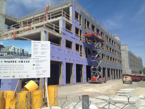
Today marked the groundbreaking of a $17 million development in East St. Louis adjacent to the Emerson Park MetroLink Station, Jazz @ Walter Circle. The $17 million development is a public-private partnership between the East St. Louis Housing Authority (ESLHA), Hampton Roads Ventures and Dudley Ventures, and is the first in the nation to combine public housing development funds from the U.S. Department of Housing and Urban Development with New Market Tax Credits. (NextStopSTL)

This station has seen a steady flow of new construction over the last 11 years.
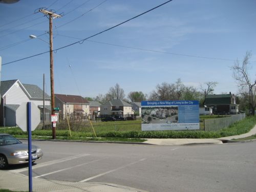
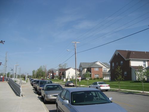
ABOVE: NW corner of Bowman Ave & N 15th St on April 27, 2007, click image for aerial in Google Maps
ABOVE: The same corner 5 years later on April 19, 2012 with Jazz @ Walter Circle under construction. Click image for more information on this project
ABOVE: Central City Apartments across Bowman Ave from the Emerson Park Station in April 2007
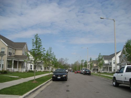
ABOVE': A typical street in the Parsons Place development just notheast of the Emerson Park Station, April 2007
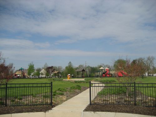
ABOVE: Park in the center of the Parsons Place development

I’m thrilled with how much has been built in the last decade around the Emerson Park Station. The new senior housing over storefronts will be outstanding for this neighborhood.

The Bad:

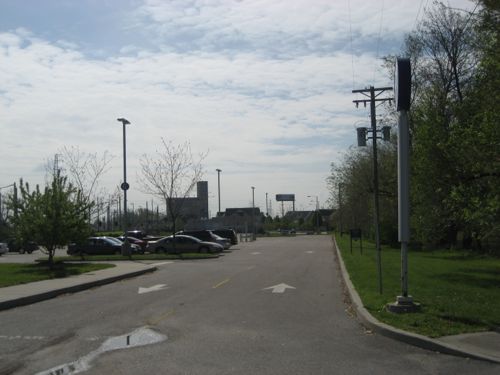
As you might expect, mistakes have been made in the past and that continues. Where to begin? Parking is a good place, this station has three parking lots with a total of 816 parking spaces! This is the 2nd highest number of spaces at Illinois MetroLink stations, Fairview Heights has the highest with 853 spaces. The parking is divided among three lots — the main lot and two overflow lots.
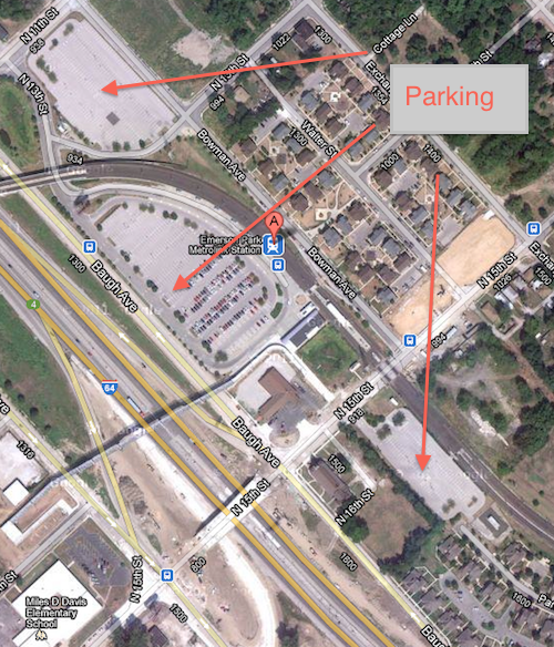
ABOVE: 816 parking spaces divided among three parking lots, click image to view aerial in Google Maps

The lot to the far right should go away immediately or at least be significantly reduced in size, it serves as a barrier between the new housing to the east of the station. I first noticed the disconnect when I drove there and walked around in April 2007 before I was disabled.
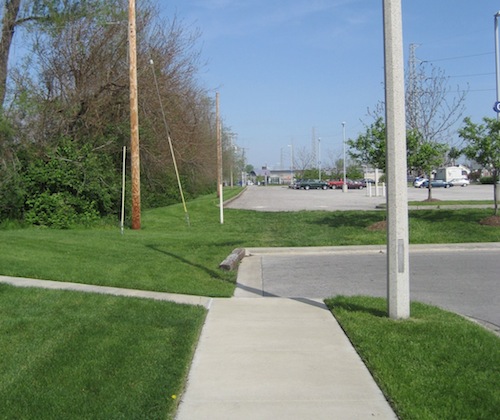
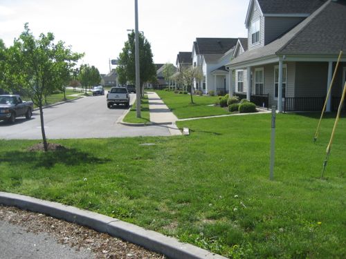
ABOVE: At the end of Parsons Ave looking across the parking lot at the Emerson Park station. Why doesn't the sidewalk continue? April 2007
ABOVE: Same location as viewed from the opposite side, not friendly to pedestrians, difficult pushing a stroller and impossible in a wheelchair. April 2007
ABOVE: Looking toward Parsons Place after leaving the Emerson Park Station. Not exactly inviting. April 2007
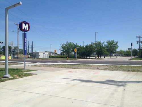
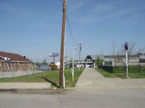
ABOVE: The walkway leaving the station is nice and wide but a newly built crosswalk across N 15th is off to the left rather than a direct line. April 2012
ABOVE: In April 2007 the connection was more direct, but the crosswalk and curb ramp was still indirect
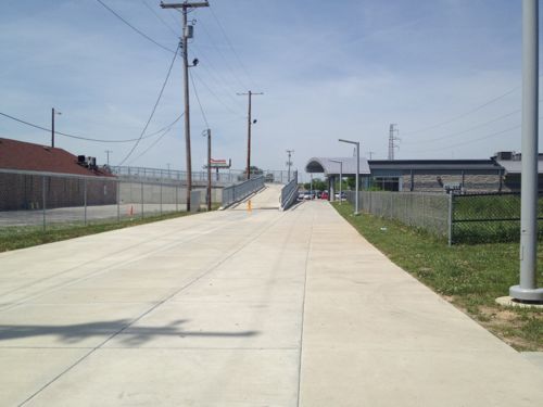
ABOVE: Now the amount of concrete is greater and a new pedestrian bridge takes pedestrians over the interstate. Bleak! Shade trees and seating would have been nice here.

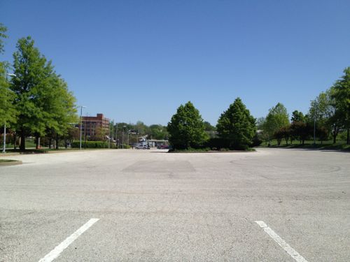
In 2007 this east overflow parking lot had a few cars but on my recent visit it had none. Even if it’s 100% full on days the Cardinals play at home it shouldn’t be allowed to separate the nice newer housing from transit. Huge fail. Who’s fault? No clue, but nobody figured out that a continuous sidewalk would figuratively and literally connect housing to the station.
… Continue Reading


5th & Missouri MetroLink Station East St. Louis, Illinois

I like East Louis, Illinois. Yes, it has been hit hard by abandonment but, oddly enough, that’s part of it’s appeal. There’s so much to be done!

East St. Louis is a city in St. Clair County, Illinois, United States, directly across the Mississippi River from St. Louis, Missouri in the Metro-East region of Southern Illinois. As of the 2010 census, the city had a total population of 27,006, less than one-third of its peak of 82,366 in 1950. Like many larger industrial cities, it has been severely affected by loss of jobs in the restructuring of the railroad industry and de-industrialization of the Rust Belt in the second half of the 20th century. In 1950 East St. Louis was the 4th largest city in Illinois. (Wikipedia)

Last week I visited the 5th & Missouri MetroLink Station twice (Monday & Thursday). Thursday was for the grand opening of Legends Restaurant & Sports Bar just a half block from the station. I’d met Mayor Alvin Parks before but I was a bit starstruck by Jackie Joyner-Kersee.

So now they’ve got a nice restaurant in downtown East st. Louis, there might be others but not that I’ve seen. Still, the most common elements around the light rail station are parking, vacant buildings and vacant land. Tomorrow I’ll post about the amazing development that’s taken place around the next station east, Emerson Park, but today is about the 5th &  Missouri Station area.

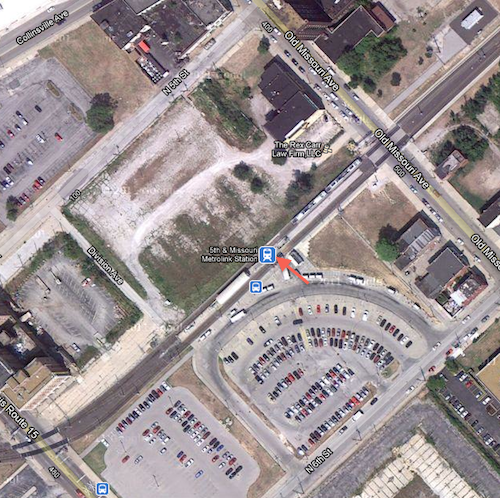
ABOVE:Aerial view of station, the arrow marks the entrance. Click to view in Google Maps

The station opened as part of the original MetroLink line on July 31, 1993, it was the east end of the line. “The station features 322 Park-Ride spaces, including 25 long term spaces.” (Wikipedia). Numerous bus routes serving St. Clair & Madison counties stop at the station.

Access to the platform is via a single point. 5th & Missouri is the intersection at the top of the above map so I’m not exactly sure how that intersection was picked as the name for the station. The railroad right-of-way that was used is equal distance between 5th & 6th, with the entry point facing 6th. The entry to the station is also halfway between Route 15 (Broadway) on the bottom left and Missouri Ave, upper right.

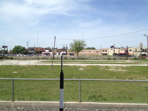
ABOVE: Looking east from the platform
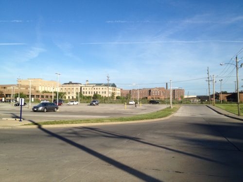
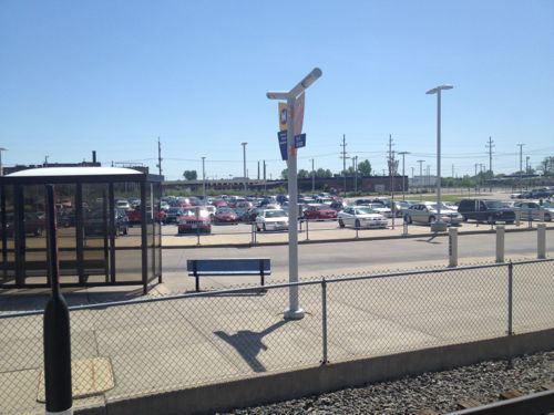
ABOVE: Looking west from the station across the park-and-ride lot
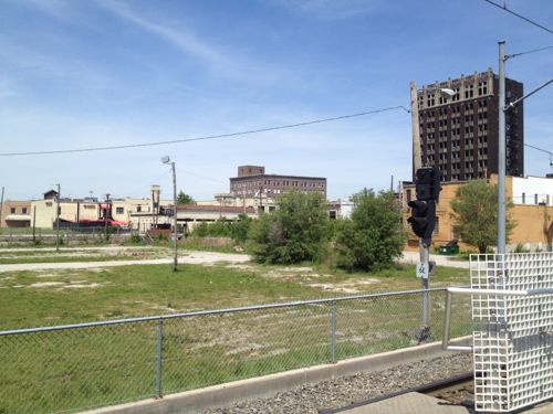
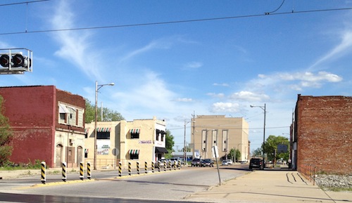
ABOVE: Looking west from the MetroLink platform past N 5th St. to buildings along Collinsville Ave.
ABOVE: Rotating at bit to the right the tall building you see is the Spivey Building at the literal 5th & Missouri.
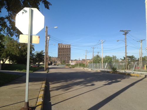
ABOVE: Looking north on N 5th St toward Missouri Ave
ABOVE: Looking east on Missouri Ave just north of the station. Legends restaurant has the striped awnings on the left

East St. Louis Mayor Alvin Parks and City Manager Deletra Hudson mentioned a downtown plan but I haven’t received a copy after making personal and email requests. Who knows if it’s any good or realistic?  The problems are serious, some beyond their control.

In August 2007, the Federal Emergency Management Agency (FEMA) announced its conclusion that the levees protecting a large area in Southwestern Illinois from flooding no longer meet the agency’s requirements. The result of FEMA’s conclusion is to change Southwestern Illinois’ flood insurance designation as part of its national Flood Map modernization process. FEMA’s actions would classify much of St. Louis’ Metro East as subject to flooding as if the levee system did not exist at all. This conclusion was based on a finding by the U.S. Army Corps of Engineers (USACE) that the agency had “reduced confidence” that the 74-mile levee system could protect against a flood that has a 1% chance of being equaled or exceeded in any single year (commonly referred to as a 100-year flood or a base flood) without the need for flood fighting. As a result, the American Bottom, an area of 174 square miles in Southwestern Illinois that is home to 156,000 people, 4,000 businesses and 56,000 jobs in 25 communities in Madison, St. Clair and Monroe counties, would be declared a Special Flood Hazard Area (SFHA), with dire consequences for our region’s economy. While we continue to dispute FEMA’s conclusion, we must take immediate steps to demonstrate that we can meet FEMA’s standards for flood protection. (The Southwestern Illinois Flood Prevention District Council)

I’m rooting for a comeback in East St. Louis, but the odds are good. Tomorrow I’ll show you a reason to bet on East St. Louis’ success.

– Steve Patterson


Can’t Decide My Preferred Metro Fare Increase Option

Nobody likes cost increases but they are a fact of life. Metro has asked transit riders to comment on three variations for increasing fares.

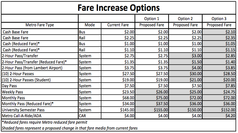
Options 1 and 2 maintain the current $2 (MetroBus), $2.25 (MetroLink) and $4 (Metro Call-A-Ride) cash fares without any change. Reduced cash fares for eligible seniors, children and customers with disabilities would also remain the same.

 Option 1 would increase the prices of Metro passes to more accurately reflect the number of boardings made using these passes. Monthly passes would increase from $68 to $75 ($34 to $37.50 for reduced fare); weekly passes would increase from $23.50 to $26; and the college semester pass from $145 to $155.

Option 2 retains the current cash fare but would increase the price of the 2-hour pass/transfer from $2.75 to $3 (reduced fare would increase from $1.35 to $1.50.) Option 2 would preserve a greater discount rate for the weekly, monthly, and semester passes than Option 1. Option 2 would increase weekly passes from $23.50 to $25; monthly passes would increase from $68 to $72 ($34 to $36 for reduced fare); and the college semester pass would increase from $145 to $150.

 Option 3 would implement an approximate 5 percent across-the-board increase for all fares including cash fares, passes and Metro Call-A-Ride fares.

The following chart shows what the changes look like:

ABOVE: Quick look at the 3 options, source: Metro. Click images to view larger version

This is tough because I switched to paying cash instead of buying a monthly pass. Thinking beyond myself to the typical riders using transit, what is the most fair…fare.

Option 1 those who buy weekly/monthly/semester passes are the only ones that will see an increase — 10%.With option 2 those who buy passes as well as those who uses transfers will see increases. Many, if not most, cash riders get transfers since more than one bus/train is often needed to reach their destination. Option 3 is a 5% increase across the board. This seems the most fair but riders used to paying $2.00 will now have to carry dimes since their fare will be $2.10. Same with transfers, option 2 is a simple $3.00 (up from $2.75) but option 3 is $2.85 — again a dime more.

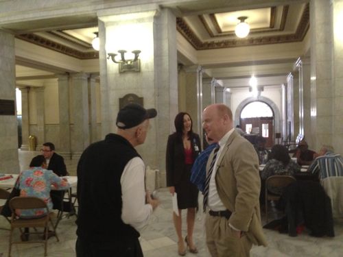
ABOVE: Metro CEO John Nation (right) speaking to a person that came to the informational meeting on Wednesday at St. Louis City Hall

I don’t know about you but I find change annoying. I’m a “reduced fare” rider so my fare w/transfer is $1.35, I’ve finally gotten used to making sure I’ve got the 35¢ I need for my transfer. Would it be worth it to me to pay $1.50 rather than $1.40 just so I only need to worry about carrying quarters? Maybe. But I often buy (10) 2-hour passes at the MetroRide Store on Washington Ave so option 2 would be a buck cheaper than option 3 and I pay with plastic when I buy the 2-hour passes.

– Steve Patterson


Readers Have Mixed Views On Loop Trolley Project

Interesting results on the poll from last week:
Q: The Loop Trolley Is:

  1. flawed, but a great way to reintroduce streetcars to St. Louis streets 61 [42.66%]
  2. great, can’t wait for it to open 39 [27.27%]
  3. a massive waste of tax dollars 30 [20.98%]
  4. unsure/No Opinion 4 [2.8%]
  5. Other: 9 [6.29%]

I agree with the top answer, this is a great way to dip our toes into building more streetcar lines in the road where transit is needed, as apposed to an abandoned rail line far removed from everything.

The other answers were:

  1. visionary
  2. A Start for a Streetcar System in St. Louis
  3. a great idea that seems to get worse with each update.
  4. A tourist line
  5. Connect to CWE and METRO and its a winner
  6. Good start. Now run some up and down Grand, Kings H, Hampton, etc.
  7. Flawed, but a “way” to reintroduce streetcars to St. Louis
  8. It has a lot of technical problems that may limit ridership and expansion.
  9. I’ll give it 4 years before it is is bankrupt due to non-use/

You can read the original post and comments here.

– Steve Patterson


Let’s Build Around Light Rail

The title of this post is from the title for an upcoming luncheon:  CMT’s Let’s Build Around Light Rail Luncheon to be held May 8th (ticket deadline April 26th). Guest speaker Katherine Perez is billed as a “national Transit Oriented Development Expert.” Awesome!

When I saw the invitation it got me thinking; “How are we doing at building around light rail?” The original line of our St. Louis MetroLink opened on July 31, 1994 1993, almost 18 19 years ago. I decided to visit two of those original stations that had the most opportunity for new development: Wellston & Rock Road.

Wellston Station

The Wellston Station is located in the very poor St. Louis County municipality of Wellston:

Wellston was incorporated as a city in 1909; due to “government difficulties” the city was dissolved three years later, only to be reestablished in 1949. The city was named for Erastus Wells.

During the early 1900s, the Wagner Electric Company, a manufacturer of small motors for appliances and transformers, began development along Plymouth Avenue in Wellston, growing to occupy the entire block and providing 4,500 jobs during World War I. North of the Wagner site, ABEX Corporation built a steel foundry that began operation in 1923.

In 1982 ABEX moved out of its Wellston location; the next year, the Wagner Electric Company closed its doors. After closure, it took 22 years, and millions of dollars in tax credits and development grants, for the St. Louis County Economic Council to demolish five buildings and clean up 15 acres (6.1 ha) of the Wagner brownfield land along the MetroLink so that it could be made marketable as the Plymouth Industrial Park. (Wikipedia)

An industrial park isn’t the most vibrant idea around transit but when you try to develop formerly toxic industrial land your options are limited, housing isn’t possible. So how’s that going around the Wellston Station? (Aerial)

The station itself isn’t much, two platforms and “243 park and ride spaces” (Source). That’s a lot of parking!

ABOVE: Park and ride lot on Monday April 9, 2012 at 1:39pm
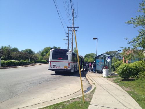
ABOVE: I arrived at the station via the #94 (Page) MetroBus, I got on the bus a block from my downtown loft. At Wellston Station a huge crowd waited to board the westbound bus
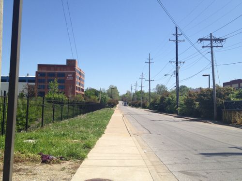
ABOVE: Looking east on Plymouth Ave after crossing the tracks, on the left is the MET Center

In 1994 the Metropolitan Education and Training Center opened in an existing building east of the MetroLink line at 6347 Plymouth Ave:

The MET Center is a strategic partnership created to stimulate the economic self-sufficiency of individuals living in low-income communities of the St. Louis region. The Center seeks to accomplish this mission by delivering focused, comprehensive, and accessible job training, placement, assessment, career development services and transportation services. We serve the underemployed, unemployed, and displaced workers, leading to sustainable work and a competitive regional economy. (MET Center)

Great, how do I get there? Their website says it’s “Centrally Located Near the Metro Link” but under location they offer a link to Metro’s Trip Finder but mostly they give driving directions. Wow, major TOD fail. But the low-income customers they serve know how to find MET.

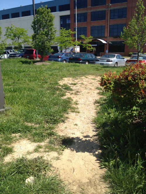
ABOVE: The MET Center doesn't have any route for pedestrians arriving on foot, the facility was designed to be driven to.

So the MET Center failed to grasp the idea of orienting to transit, how about the industrial park?

In order to obtain the state’s oversight and participate in the Missouri Department of Economic Development’s Brownfield Tax Credit program, the St. Louis County Economic Council enrolled the site in Missouri’s Voluntary Cleanup Program in 1997. The tax credits were sold to Ameren Corp. and Allegiant Bank, which earned the project $3.5 million. The site was also funded in part with $1.9 million by an Economic Development Administration grant for remediation and infrastructure and a County Industrial Development Authority loan. (2005 St. Louis Business Journal story)

Big bucks, must be great

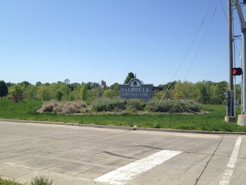
ABOVE: The entrance to the Plymouth Industrial Park along Page
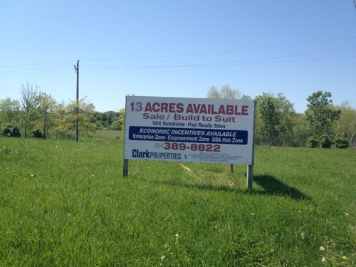
ABOVE: Sign marketing the Plymouth Industrial Park along Page, click image for Clark Properties website
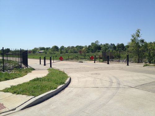
ABOVE: The road is gated off but the sidewalk on the east side of the road is open
ABOVE: Housing adjacent to the entrance road for Plymouth Industrial
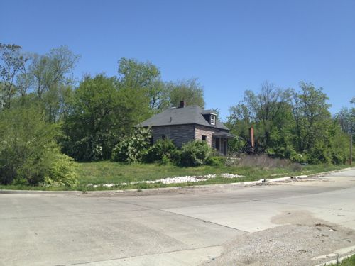
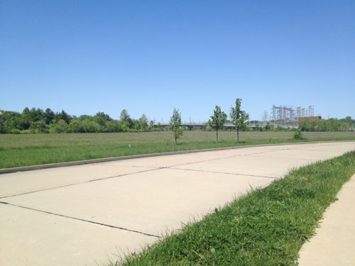
ABOVE: Nothing has been built yet, other than the closed road
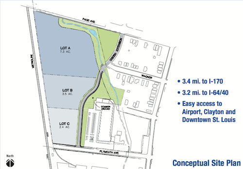
ABOVE: The site plan shows three parcels. Lot C is the nearest the station but a fence prevents true TOD.
ABOVE: Existing industry across Plymouth from the MET Center does provide some employment but it's not TOD

So not much east of the Wellston MetroLink Station, let’s go west and see if that nearly vacant park and ride lot has spurred development.

… Continue Reading


Advertisement


[custom-facebook-feed]

Archives

Categories

Advertisement


Subscribe