Home » STL Region » Recent Articles:

The 1876 City Limits Were So Far Out In The Countryside

From its founding in 1764 the city limits of St. Louis kept expanding as the city grew in population. Each time they annexed land in the rural fields surrounding the city.

The 1860 census recorded 160,773 residents — more than 100% growth from 1850s census figure of 77,860. The 1870 census saw the population nearly double again — to 310,864 (Wikipedia). When St. Louis divorced itself from St. Louis County in 1876 the limits where set far out in the countryside.  The leaders at the time must not have thought we’d reach those limits as quickly as we did, or leapfrog them as happened.

This marker at the St. Louis-Maplewood city limits is where
Entering St. Louis from Maplewood, where Manchester Rd becomes Manchester Ave

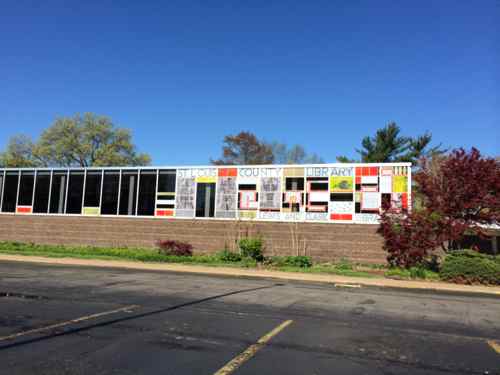
Though Maplewood wasn’t incorporated until the 20th century, people like James Sutton settled the area in the early 19th century decades before St. Louis split with St. Louis County.  From Maplewood’s history:

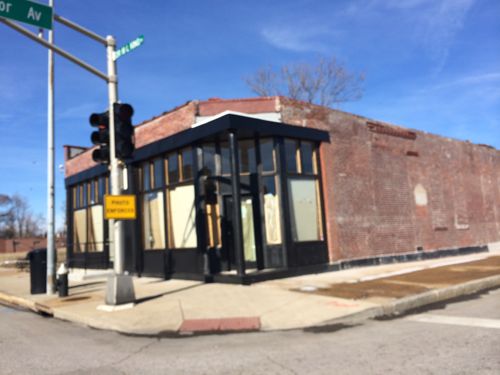
In 1876, the limits of the City of St. Louis were extended to their present location. This limit line shows no consideration for the buildings in Maplewood, but ruthlessly bisects many of them. It cuts off the eastern triangle of the Brownson Hotel and runs right through the middle of the old Maplewood Theater, (now gone) putting the projection booth in Maplewood and the screen in St. Louis.

On one street, however, the limits do not interfere with the house. This is along Limit Avenue which was plotted with half of its width on either side of the limits line (St. Louis on the east and Maplewood on the west).

This divorce bought change to the county left behind:

When the new county was organized, a Maplewood man, Henry L. Sutton, son of James C., was chosen as its chief executive officer, or presiding justice of the county court. The first three meetings of this body were held at the Sutton home on Manchester. Then in 1877, the patriarch of the neighborhood, James C. Sutton died. He left nine children and his land was divided between them. One of the daughters, Mary C. Marshall, seems to have been the first to think of selling her tract for a subdivision, for in 1890, she sold to a company organized by Theophile Papin and Louis H. Tontrup, two St. Louis real estate men, and managed by Robert H. Cornell.

If only we could bring the 1870s leaders into the present day to show them the consequences of their actions. If so, St. Louis would likely  be part of St. Louis County with limits out near the present-day I-270.

— Steve Patterson


The Streetsblog Network Expands By Adding Southeast US, Ohio, Texas, and St. Louis

January 30, 2015 Featured, Media, STL Region 3 Comments

The Streetsblog Network yesterday expanded into new territory: adding coverage in the Southeast United States, the states of Ohio & Texas, and the St. Louis region.

Streetsblog St. Louis launched yesterday.

From yesterday’s post announcing the expansion:

A little more than six years ago, we launched the Streetsblog Network as a way for people across the country writing about livable streets, sustainable transportation, and smart growth to band together and share ideas. There are many wonderful things about the Streetsblog Network, but I would put this is at the top of my list: It is both profoundly local, full of people working on the nitty-gritty of street design, transit service, and planning issues in their hometowns, and broadly distributed, with hundreds of members operating in cities all over the nation.

For a long time we’ve been thinking about how to build on these strengths. And today we’re going live with a new way to channel the energy of the Streetsblog Network and broadcast it to the world.

We are launching affiliate sites that combine the work of Streetsblog Network members in four regions: St. Louis, Ohio, Texas, and the Southeast. These sites are based on a different model than our other city-based Streetsblogs with full-time staff. Each Streetsblog affiliate syndicates material from several blogs in its region and runs a daily dose of headlines to satisfy the universal craving for morning news. Have a look. (Doesn’t it blow your mind to see the words “Streetsblog Texas” in a site banner?)

The post continues with a list of blog included for each new area, here’s the St. Louis list:

Streetsblog St. Louis:

I’m honored to have UrbanReviewSTL be included as one of four blogs representing St. Louis! Be sure to check out Streetsblog St. Louis at stl.streetsblog.org. Also visit Streetfilms for excellent videos.

— Steve Patterson


NFL/MLS Stadium A Better Fit In St. Clair County Illinois

It was recently suggested by former St. Louis Mayor Vince Schoemehl that a new NFL/MLS stadium be built across the river in Illinois. Over the last few years I’ve thought this as well, regular reader & prolific commenter “JZ71” has mentioned several times building a stadium specifically between the approaches to the MLK & Eads bridges. It would be visible from downtown St. Louis and be located adjacent to an existing MetroLink light rail station. I’ve thought that was too tight but knew there’s lots of vacant land there awaiting new use.

In June I got married at the beautiful Malcolm W. Martin Memorial Park — directly across from the Arch — maybe South of there? Or to the North of the MLK bridge approach? Looking at maps and serial images only gets you so far, so Saturday afternoon I drove around checking out the Metro East riverfront/bottoms.

I crossed the river on the Eads Bridge since it was direct, I quickly ruled out the land to the South of the Martin Memorial/geyser because of access issues and future CityArchRiver plans, wildlife, etc. So then I looked at the space between the Eads & MLK approaches — as I suspected it appears way too tight for a stadium with enough buffer to keep the bridges open game days.

Looking South on Front St with the MLK in the foreground, the Eads in the background, and the Arch to the right
Looking East from Front St, the MLK approach is to the left just out of view, the Eads approach on the right
Looking East from Front St, the MLK approach is to the left just out of view, the Eads approach on the right. Great location for a hotel(s) if a stadium were built to the North of the MLK
Just North of the MLK bridge approach
Just North of the MLK bridge approach, the land on the right is mostly vacant of structures
Looking East at a gravel road.  More on this later in this post.
Looking East at a gravel road. More on this later in this post.
East St. Louis Police shooting range head
Presumably this 80 year old pumping station is still operational
Very quickly the new SMVMB is in view past the levee
Industry at the end of the road, no access to I-70 or the new bridge -- yet.
Industry at the end of the road, no access to I-70 or the new bridge — yet.
Looking back at St. Louis across the Mississippi River

So access here kinda sucks too — but not for long. Since it opened in February 2014 I’ve driven across the new Stan Musial Veterans Memorial Bridge (I-70) many times, but this weekend was my first seeing how it connected to IL Route 3. Later this year will mark 25 years I’ve lived in St. Louis, I know the region pretty well, including the Metro East — but the new I-70 approach to the new bridge is very different than it has been. Connectivity is greatly improved and will get better.

The new I-70/Route 3 interchange has the start of a road heading toward the East St. Louis riverfront
It's unfinished but will soon provide easy access to the Casino Queen, Malcolm Martin Memorial, and anything else built here.
It’s unfinished but will soon provide easy access to the Casino Queen, Malcolm Martin Memorial, and anything else built here.
The blue line marks where the road will continue. Image from the New Bridge gallery, click to view.
Aerial shows how the new I-70/iL Route 3 interchange will connect to Riverpark Dr  leading Front St.
Aerial shows how the new I-70/iL Route 3 interchange will connect to Riverpark Dr leading Front St. Three potential sites here, the bottom left has good visibility from downtown St. Louis and the other two from the new I-70.

This is within St. Clair County, an analysis of future MetroLink light rail expansion into neighboring Madison County four of seven possible alignments would pass by to the East along the Route 3 corridor.  Additionally transportation officials are working to improve Amtrak speeds between Alton & St. Louis while also considering a new stop in St. Clair County. No historic buildings/districts razed, fewer/no businesses/residents displaced.

A new NFL/MLS stadium, light rail expansion into Madison County, and an Amtrak stop could transform this area and further connect the St. Louis region. Sorry Gov Nixon, Illinois make much more sense!

— Steve Patterson


Twenty-Fourteen In 63 Pictures

December 31, 2014 Featured, STL Region Comments Off on Twenty-Fourteen In 63 Pictures

The end of another year…so for the last post of 2014 I’ve selected 63 images from the 800+ I uploaded throughout the year. Enjoy, please be patient as they load.

JANUARY

Fields Foods at 1500 Lafayette Ave
Fields Foods opened at 1500 Lafayette Ave without pedestrian access, this was soon corrected after my post
14th St @ Washington Ave.: Stones pavers & concrete removed so a new bus shelter can be built.
At Taylor I noticed this new storefront because it stood out from how it looked for years
At MLK & Taylor I noticed this new storefront because it stood out from how it looked for years
Pipes burst in the YMCA/Centenary Tower building
Pipes burst in the upper floors of the YMCA/Centenary Tower building
Work was still wrapping up on the Tucker project
The Treasurer's office began testing different parking meters
The Treasurer’s office began testing different parking meters

FEBRUARY

The Stan Musial Veterans Memorial Bridge opened, thus was seconds after Illinois Gov Quinn & Missouri Gov Nixon cut the ribbon
The St. Louis flag turned 50 as the city turned 250
The wrap on the new buses looks like the original
The wrap on the new low-floor downtown trolley buses looks like the original

MARCH

IDOT officials held an open house at the Jackie Joyner Kersee Center in East St. Louis to get input into speeding up Amtrak from Alton to St. Louis
Some members of the First Presbyterian in Edwardsville IL opposed the sale of the property to the school district, the church would be leveled for parking. The congregation has worshipped on the same site since the early 19th century
Looking west toward Morgan Ford
New bike lane & pedestrian zone on Chippewa, looking west toward Morgan Ford
The Castle Ballroom in midtown was damaged in a storm, later razed.
The property to the north had a gate that blocked the public sidewalk, it was later removed
It was announced a park was planned for the north side of the Eads Bridge, to the right of the trucks parked in the alley,
To prep for a new Civic Center bus transfer facility, all the trees were cut down
Fields Foods pedestrian access
Fields Foods pedestrian access problem corrected
Metro showed of the first of  15 articulated buses they would receive in 2014, mostly for use on the #70 Grand route
Metro showed of the first of 15 articulated buses they would receive in 2014, mostly for use on the #70 Grand route
City police had out of town journalists park on the sidewalk during a basketball tournament because...homeland security
City police had out of town journalists park on the sidewalk during a basketball tournament because…homeland security
6th ward residents checked out the Participatory Budgeting project expo

APRIL

On April Fool's Day I got many people with the announcement of a Trader Joe's at Grand  & Olive
On April Fool’s Day I got many people with the announcement of a Trader Joe’s in a new mixed-use building at Grand & Olive
Inside the "Live" area of Ballpark Village the day before the home opener
Inside the “Live” area of Ballpark Village the day before the home opener
I proposed returning 9th & 10th north of Washington or Cole into two-way streets
Schnucks closed their North Grand location
After two years of not having a car, my then-fiancé and I bought a used car together.
The east facade of the branch of the St. Louis County Library which was planned to be demolished after a new library was built.
The east facade of the Lewis & Clark branch of the St. Louis County Library which was planned to be demolished after a new library was built.
On April 29th major equipment was ripping out the unloved center planters  on 13th Street between St. Charles St & Washington Ave
On April 29th major equipment was ripping out the unloved center planters on 13th Street between St. Charles St & Washington Ave

MAY

I took at look at the dire economic disinvestment in the north county area at Chambers & Lewis & Clark
I convinced Culinaria to stop filling the entire sidewalk in front of their 9th Street grocery store with cafe tables
Plans for the new Civic Center MetroBus transfer facility were made available.

JUNE

David and I exchanging our vows on Sunday June 8th, officiated by our friend Chris Reimer.
David and I exchanging our vows on Sunday June 8th at the Malcolm Martin Memorial park in East St. Louis, officiated by our friend Chris Reimer.
Our reception was brunch at Bevo Mill, Lydia S. drove us in her Tesla.
The Melvin Price Locks & Dam celebrated 20 years
I took a look at the unincorporated area of North County known as Spanish Lake, the Belle Parke Plaza strip mall shown here
Five years since Citygarden opened
Five years since Citygarden opened in 2009

For July through December click more below.
… Continue Reading


We Have Many Police Departments In St. Louis

This post is intended to help out headline writers from outside the St. Louis region. Last week many said St. Louis Police when they meant St. Louis County Police.

Recent headlines
Recent headlines all attributing a mistake to the St. Louis Police, rather than the St. Louis County Police

Not their fault, they likely don’t know our long history of fragmentation.

The St. Louis region is in two states — Missouri & Illinois. Sixteen-seventeen counties, half per state, make up the Greater St. Louis area. The St. Louis Police was originally formed in 1808. In 1861, during the Civil War, the Confederate-supporting state took control of the St. Louis Police since the city was pro-Union. St. Louis only got back full control from the state in the last year or two.

In 1876 the rapidly-growing City of St. Louis left St. Louis County, to avoid having to support the rest of the then largely rural county. St. Louis, through changes to the Missouri constitution, became an independent city-county. The City of St. Louis, as a city-county, also has a Sheriff’s department.

St. Louis County Police was formed in 1955, absorbing the St. Louis County Sheriff at that time.  You might think the St. Louis County Police patrol all of St. Louis County, but no. St. Louis County has 90 municipalities. Some, like Ferguson, have their own police force. Others, like Jennings, contract through St. Louis County. Jennings used to have its own force, but it was dissolved in 2011. A few other municipalities contract through a neighboring municipality for police services. Unincorporated areas of St. Louis County are, as you’d expect, covered by St. Louis County Police. One tiny municipality, Flordel Hills, recently started its own police force.

With 884 individual units of government, St. Louis ranks 3rd only to Pittsburgh and Denver among our peer regions in ratio of local governments to citizens. (Where We Stand)

I’m not sure how many of the 884 units of government are police, regardless, the St. Louis Police is different than the St. Louis County Police.

— Steve Patterson


Advertisement


[custom-facebook-feed]

Archives

Categories

Advertisement


Subscribe