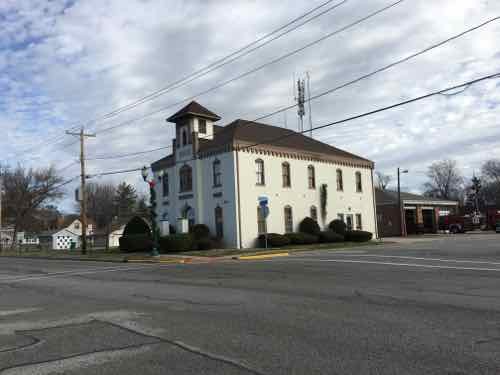
When City Hall Being For Sale Is A Good Thing
The right buyer can buy city hall — O’Fallon Illinois’ former city hall.
From their request for proposals:
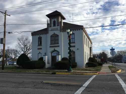
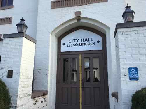
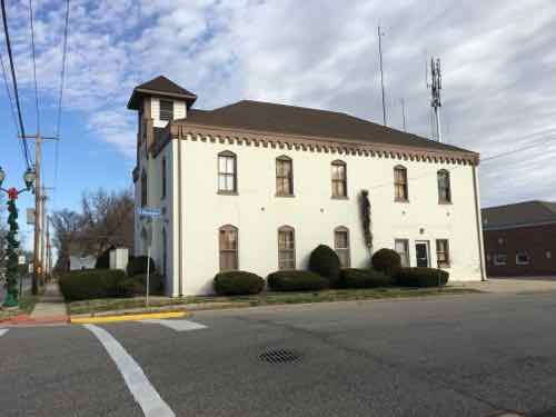
The City of O’Fallon is soliciting proposals from qualified developers and/or organizations willing to invest funds to purchase and improve Old City Hall and bring it back to a productive use that will integrate well into the neighborhood. Old City Hall is an approximately 4,500 square foot GFA, two-story brick building originally constructed in 1890. It is a locally designated landmark which requires review of changes to the exterior of the building, but does not affect remodeling of the interior of the structure. All proposals should seek to preserve and enhance the architectural character of the building. Proposals that involve demolition will not be considered. The building is located inside the Central City TIF district, created in June 2015 (more information available at www.ofallon.org/economic-development-division). As publicly-owned property, the site has no Equalized Assessed Value, which allows all property taxes to be considered increment.
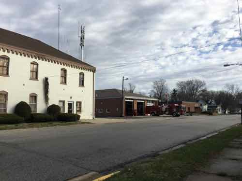
Currently, Old City Hall and O’Fallon Fire Station #1 are together on one parcel (PARCEL ID 04-29.0-120- 008). All proposals should note how much of the adjacent land and parking area, if any, is desired as part of the proposed redevelopment project. The City anticipates that the resulting lot would likely be no more than 0.27 acres (see attached map). The City also expects that the property will have to be rezoned from the current SR-3
(Single Family Residence District) to another appropriate district to accommodate the types of uses likely to be proposed as a part of this RFP process. It will be the responsibility of the selected developer to obtain any and all necessary zoning changes, variances, building permits, and other approvals to facilitate the development of this property.
Old City Hall most recently housed the O’Fallon Fire Department administrative offices, but has only been used for storage since 2009. As the property has been out of use for many years, the City does not have much definitive information about the current condition of the property. As mentioned in the Environmental Conditions section below, the City is aware of the presence of asbestos and mold. The building also has other issues including: degrading/rotting wooden windows, tuckpointing and masonry repair, necessary repairs and upgrades to bathrooms, HVAC, plumbing, and electrical systems. The property will be sold “as is.”
I’m glad demolition will not be considered! Hopefully they’ll get some creative proposals.
— Steve Patterson