Carr Square Tenant Management head Rodney Hubbard Sr. will announce later today that the nonprofit will finally renovate the crumbling Carr School.
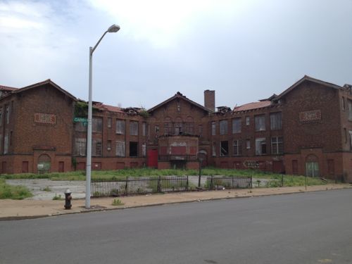
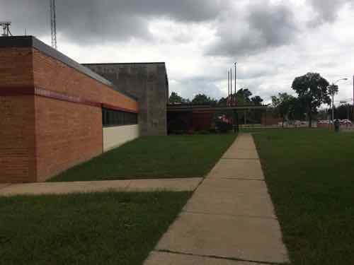
Carr School, built in 1908, has been vacant for decades. 2013 photo
After collecting fees from & suing actual developers, the Hubbard family is going to put on the developer hat. Securing permits won’t be a problem because Rodney’s daughter Tammika Hubbard is the alderman. Unless James Page defeats her at the polls on Tuesday.
Carr School is owned by Carr Square. The ground surrounding it is owned by NorthSide Regeneration, the Paul McKee-led effort to compile property in north St. Louis, in which Carr Square is partner. (Post-Dispatch)
Yes, the Hubbards will likely turn to their buddy Paul McKee for help. Their nonprofit helped McKee get his tax credits. Expect the project to proceed at the pace of other McKee’s NorthSide projects.
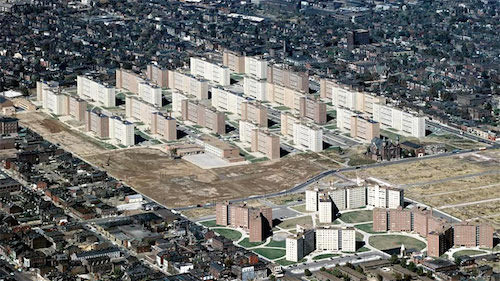
The old Pruitt-Igoe public housing site has been vacant since the 33 towers were razed in the 1970s. Some of the original 57 acres were used for a public school. Developer Paul McKee controls the rest.
The Pruitt-Igoe project in the background.
Work has resumed on his 3-bed hospital, and now a medical school may be next:
Ponce Health Sciences University announced plans Friday to construct an $80 million facility in north St. Louis and launch a doctor of medicine program.
The for-profit university is expected to break ground on the campus by the end of the year on the former site of the Pruitt-Igoe housing project, near a proposed three-bed hospital. The campus could begin teaching students in 2022 if it gains accreditation this summer.
A few years ago, David Lenihan bought the university and became its president. Ponce Health Sciences University is based in Puerto Rico and has a small campus in St. Louis that currently offers a master of science in medical sciences. (St. Louis Public Radio)
What’s not clear to me is how many acres the hospital and medical school will occupy. Will the site remain a monolith or will it have a grid of public streets? Hopefully the latter, but I’m not optimistic. If so retail, restaurants, housing, etc could be incorporated into the site.
Slightly more than half of participants in the recent non-scientific Sunday Poll think the site is good for a medical school.
Q: Agree or disagree: A medical school campus is a good use for the old Pruitt-Igoe site.
Strongly agree: 7 [30.43%]
Agree: 1 [4.35%]
Somewhat agree: 4 [17.39%]
Neither agree or disagree: 0 [0%]
Somewhat disagree: 2 [8.7%]
Disagree: 3 [13.04%]
Strongly disagree: 5 [21.74%]
Unsure/No Answer: 1 [4.35%]
I personally have no objections to a medical school using part of the site, my concern is the master plan for the full site. How will it connect to the area around it?
I need to see a site plan. I also want to know more about the corporation that owns Ponce Health Sciences University. I’d just hate to see it be another ITT Tech or Trump University.
Another medical school is coming to the St. Louis region.
Ponce Health Sciences University announced plans Friday to construct an $80 million facility in north St. Louis and launch a doctor of medicine program.
The for-profit university is expected to break ground on the campus by the end of the year on the former site of the Pruitt-Igoe housing project, near a proposed three-bed hospital. The campus could begin teaching students in 2022 if it gains accreditation this summer. (St. Louis Public Radio)
January 6, 2020Featured, North City, NorthSide ProjectComments Off on McKee’s 3-Bed Urgent Care Facility Should Not Be Named Homer G. Phillips
Last week it came out that Northside Regeneration developer Paul McKee wants to name his future 3-bed urgent care facility, being built on part of the former Pruiit-Igoe housing project site, after the historic Homer G. Phillips Hospital. Many were not happy about this.
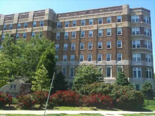
The historic Homer G. Phillips Hospital is now senior apartments. May 2010 photo.
When the hospital was first dedicated in February 1937 it was known as City Hospital #2, replacing an older City Hospital #2. City Hospital #1 didn’t serve African-Americans.
In 1942 it was renamed after the man who fought to get it built:
Homer Garland Phillips (1878–1931) was a black lawyer in St. Louis who was born in Sedalia, Missouri. Son of a Minister he was orphaned at birth and raised by his aunt. He is mostly known as a Republican political figure in St. Louis and is known for being the person who was tasked with securing $1 million to constructing a new hospital for African Americans on the city’s North Side called Homer G. Phillips Hospital. (Wikipedia)
It was closed by Mayor Schoemehl in 1979, after running on a pledge to keep it open. Four decades later the name “Homer G. Phillips” is synonymous with the historic hospital and The Ville neighborhood where it was located. It is also a man’s name.
At every turn Paul McKee has managed to make poor decisions.
Could you imagine McKee proposing a baseball field named Stan Musial Field without getting permission from Musial’s family? Of course not. Ok, Phillips has been deceased a lot longer than Musial, but respect for someone’s name doesn’t expire.
McKee needs to find a new name for his 3-bed urgent care facility at the former Pruitt-Igoe!
This got me thinking about healthcare facilities during the Pruitt-Igoe era. The 1974 Final Environmental Impact report offered the two options:
Pruitt-Igoe Medical Action Center, 2407 O’Fallon.
Offered medical treatment for minor illnesses and injuries, a weight reduction program, prenatal care and limited gynecological care. This facility, funded by Model City Agency, served Pruitt-Igoe residents almost exclusively, was closed during the relocation of Pruitt-Igoe tenants.
Jefferson Municipal Health Center, 1421 Jefferson.
Offers comprehensive child health care, prenatal classes, obstetrics and family planning, X-Rays and TB treatment. The boundaries of this facility, operated by the Health Division of the City of St. Louis, extend beyond the Pruitt-Igoe area. Service is still being provided to residents of the area.
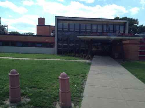
Neither was located within the Pruitt-Igoe site, but east & west, respectively. The city eventually closed the second and the site became the headquarters for the St. Louis Fire Department.
This building, on the SW corner of Cass & Jefferson was a medical facility before becoming the Fire Dept. headquarters. May 2012 photo.My only visit to the building was in October 2016.
McKee must be thinking that because Homer G. Philips Hospital was so important to St. Louis’ black community that taking that name will suddenly make his 3-bed urgent care as important. Sorry Paul, it doesn’t work that way. How about Rich White Suburbanite Trying To Woo Black Supporters By Appropriating The Name Of A Beloved Institution Urgent Care? Yes, too long — but very appropriate!
Even if McKee’s planned larger teaching hospital should eventually open it shouldn’t be named Homer G. Phillips. To learn more about the Homer G. Phillips Hospital check out The Color of Medicine documentary.
October 23, 2019Featured, NorthSide Project, Politics/PolicyComments Off on Readers Don’t Think McKee Will Come Through With Urgent Care, Hospital/Medical School
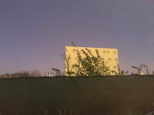
Only one wall of the urgent care facility started a couple of years ago is still standing on the West end of the old Pruitt-Igoe site. Photo from 6:41pm last night.
Paul McKee’s 3-bed urgent care facility had been under construction, but after a wall collapsed last year it stopped.
Given aldermen’s failure to do their jobs before Friday’s vote approving tax subsidiesfor McKee, St. Louis taxpayers can only hope those creditors will thoroughly scrutinize the viability of the two-phase medical-complex project McKee proposes for north St. Louis. The first phase of the project, a three-bed urgent-care clinic, will cost $21 million, with McKee having come up with only $8 million in promised credit. The second phase involves building a 103,000-square-foot hospital/medical school. McKee has no funding source in sight for the $73 million he’ll need for that.
Friday’s vote puts taxpayers on the hook for $4.6 million in subsidies to be drawn from tax-increment financing worked out years ago with McKee after he used shell companies and other means to acquire around 1,500 acres of dilapidated, abandoned north St. Louis properties. Instead of improving those properties, he allowed them to deteriorate while punting property maintenance to the city. McKee offered grand designs for housing projects and retail-office complexes surrounding the new site of the $1.75 billion National Geospatial-Intelligence Agency western headquarters. Those plans fizzled. (Post-Dispatch editorial)
In the recent non-scientific Sunday Poll readers were skeptical of McKee delivering:
Q: Agree or disagree: The 3-bed urgent care facility and the hospital/medical school will open by the promised deadlines.
Strongly agree: 1 [3.57%]
Agree: 0 [0%]
Somewhat agree: 0 [0%]
Neither agree or disagree: 3 [10.71%]
Somewhat disagree: 2 [7.14%]
Disagree: 7 [25%]
Strongly disagree: 14 [50%]
Unsure/No Answer: 1 [3.57%]
If I were a gambling man I’d say not only will he not deliver, but the deadlines will get extended and the subsidies increased. Twenty-three aldermen voted in favor of Board Bill 103, sponsored by Tammika Hubbard.
Ayes (23)
Ward Alderman
1 Sharon Tyus
3 Brandon Bosley
4 Samuel L Moore
5 Tammika Hubbard
6 Christine Ingrassia
9 Dan Guenther
10 Joseph Vollmer
11 Sarah Martin
12 Larry Arnowitz
13 Beth Murphy
14 Carol Howard
15 Megan E. Green
17 Joseph D Roddy
18 Jesse Todd
19 Marlene E Davis
21 John Collins-Muhammad
22 Jeffrey L Boyd
23 Joseph Vaccaro
25 Shane Cohn
26 Shameem C Hubbard
27 Pam Boyd
28 Heather Navarro
President Lewis E Reed
One voted “present”:
Present (1)
Ward Alderman
8 Annie Rice
Three were absent for the vote:
Absent (3)
Ward Alderman
2 Lisa Middlebrook
7 Jack Coatar
16 Tom Oldenburg
Only two had the convictions to vote “no”:
Noes (2)
Ward Alderman
20 Cara Spencer
24 Bret Narayan
Aldermanic courtesy, the process of rubber-stamping legislation in another ward, is alive and well.
AARP Livibility Index
The Livability Index scores neighborhoods and communities across the U.S. for the services and amenities that impact your life the most
Built St. Louis
historic architecture of St. Louis, Missouri – mourning the losses, celebrating the survivors.
Geo St. Louis
a guide to geospatial data about the City of St. Louis