Home » Accessibility » Recent Articles:

The Former 16th Street For Able-Bodied Pedestrians Only

In 1951 the Plaza Square urban renewal area was defined. More than a decade later, in 1962, six new apartment buildings finally opened on four city blocks that were completely razed, except for two churches, which remained. In addition to removing hundreds of existing buildings, 16th Street was also removed. Both churches and two of the six buildings fronted a new pedestrian-only walkway where 16th Street had been. For over 50 years this has remained mostly unchanged, and, I’ll argue, has been part of the reason behind the decline in the area.

First, some background provided by city staff highlighted in a 1970 report:

In 1951, shortly after the establishment of the Land Clearance for Redevelopment Authority, Plaza Square became a federally-assisted Title I Urban Renewal Project. A bond issue for the project was submitted to voters in 1953 and failed, but was approved later in that year. Execution began in 1954 and rebuilding was done by the Urban Redevelopment Corporation. The Federal Government defrayed two-thirds of the $2,618,000 loss incurred in the write-down and the City bore the remaining third. By developing a park and making street and utility improvements in the area, the City exceeded its required contribution by $114,500. This was applied as credit to the cost of another project at a later date.  

The present 16-acre, $20 million Plaza Square Apartment project completed in 1962, contains 1,090 apartments in six multi-story buildings. In addition, it includes two rehabilitated churches with expanded sites, a small park, shopping facilities, and a $2 million office building for the Blue Cross Group Hospital Service. The Plaza Project also has been a significant link in the concept for an East-West Axial Mall extending from Aloe Plaza eastward to the riverfront arch.   

In the mid-1960’s, occupancy lagged in the project. In 1966, in an attempt to alleviate this problem, the Bethesda Foundation took title to one of the buildings. The Bethesda Townhouse is now a non-profit residence for senior citizens who lease the dwelling units for life. By 1970, the occupancy rate had reached 88% in the Plaza Square Project.

The success of Plaza Square has had far reaching consequences since it was the first of its kind in the City. One of the most important aspects was the fact that Federally assisted renewal program encouraged private investment in the reconstruction of the City. Its success provided the stimulus for later revitalization projects such as the Civic Center redevelopment.(History of Renewal)

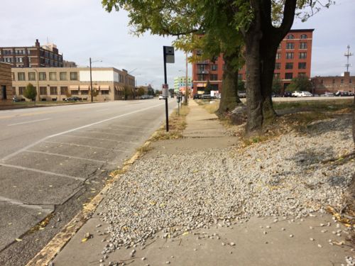
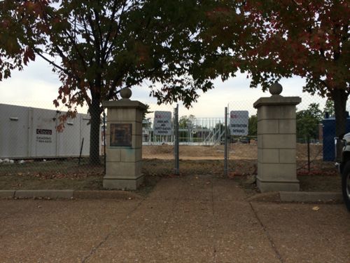
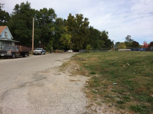
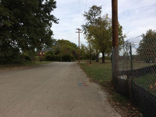
The non-profit building for seniors later became the Blu condos, many of which became rentals or were sold at auction. This post is a look at the pedestrian-only path left after 16th Street was removed. This matters to me personally because I live at 16th & Locust and need to reach the bus stop & city offices at 16th & Market (map).

For years there was no pedestrian signal or crosswalk to cross Olive at 16th.
For years there was no pedestrian signal or crosswalk to cross Olive at 16th. The walkway can be seen beyond the car
Sometime after May 2011 pedestrian signals were installed and a single crosswalk was painted on the east side of 16th. In this picture the new owner of the building on the left was cutting down old trees, blocking the narrow walkway.
In 2012 pedestrian signals were installed and a single crosswalk was painted on the east side of 16th. In this 2013 picture the new owner of the building on the left was cutting down old trees, blocking the narrow walkway.
Looking north at 16th from the south side of Olive
Looking north at 16th from the south side of Olive. Pedestrians wanting to cross from the west side of 16th must cross 16th first, or jaywalk.
Same view but further south on the former 16th, now church parking.
Looking north on the walkway  before renovation of the adjacent building began. This area became a haven for trouble once that building became vacant, the church had the fence installed then.
Looking north on the walkway before renovation of the adjacent building began. This area became a haven for trouble once that building became vacant, Centenary Church had the fence installed then.
The apartment building entry is getting rebuilt, it faces the Centenary parking lot
The fence keeps you from reaching the labyrinth and church entry. They're considering a gate once the apartment building is occupied again
The fence keeps you from reaching the labyrinth and church entry. They’re considering a gate once the apartment building is occupied again
Looking north from the labyrinth, with parking beyond. The labyrinth was built in the 80s or 90s.
Looking north from the labyrinth, with parking beyond. The labyrinth was built in the 80s or 90s as a meditative space before or after services.
During the renovations of this building the walkway is closed to the public. This building will be for "active adults", 55+
During the renovations of this building the walkway is closed to the public. This building will be for “active adults”, 55+
When you reach Pine there is no curb ramp to cross, besides you face the private auto  driveway for St. John's
When you reach Pine there is no curb ramp to cross, plus you face the private auto driveway for St. John’s. To cross Pine mid-block I must go to a driveway off to my right and go to the church driveway, then to west to continue.
From here there's no wheelchair access to the plaza in front of St. John
From here there’s no wheelchair access to the plaza in front of St. John. The bus stop and city office building is in the background
Looking the opposite direction we see the apartment entrance on the left
From the park looking across Chestnut there's no place to cross, not even a driveway.
From the park looking across Chestnut there’s no place to cross, not even a driveway.
From 16th & Market you can see where you want to go. The able-bodied can do it, but few do because it isn't a friendly walk.
From 16th & Market you can see where you want to go. The able-bodied can do it, but few do because it isn’t a friendly walk.
Once at Market you can see the bus stop and city offices.

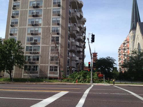
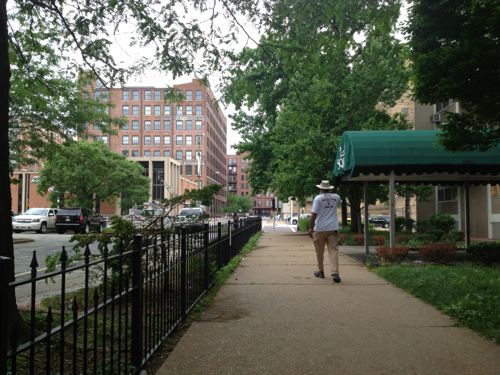
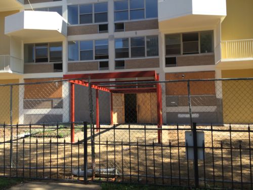
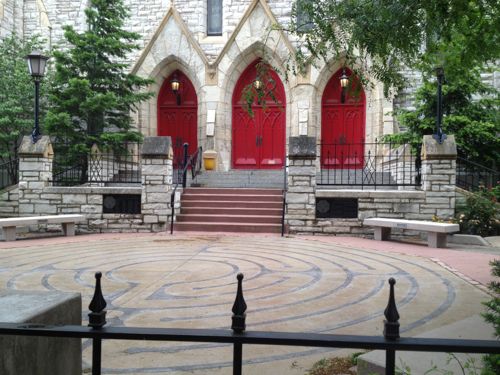
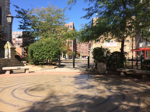
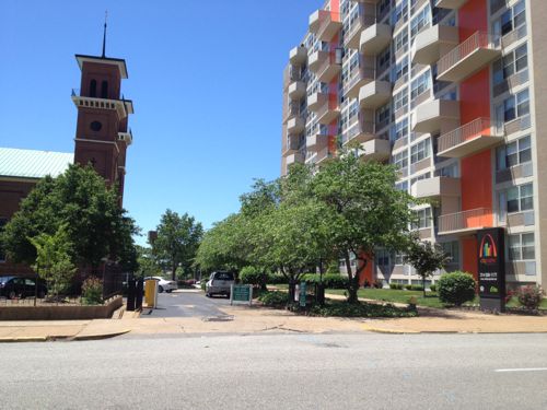
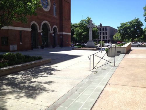
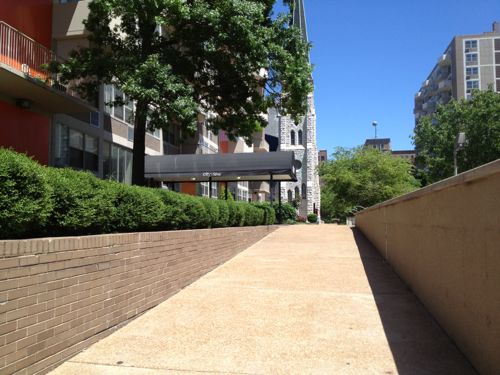
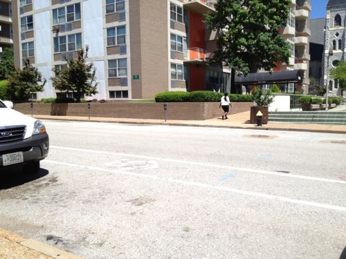
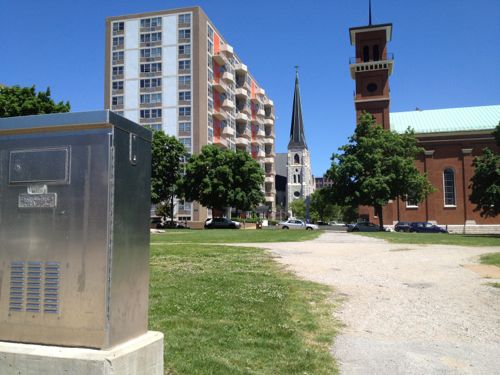
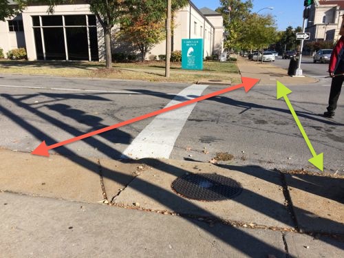
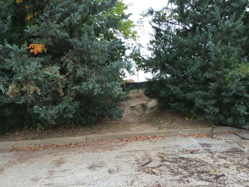
Few people use the former 16th Street walkway, it’s dark, narrow, uneven, and uninviting. I’m forced to take 17th, 15th or 14th instead. Like I said at the opening, I think this dead walkway has been a contributor to problems in the Plaza Square area.When the general public avoids an area and when a church erects a fence to keep out unsavory activity then you know a problem exists — a problem created by the poor design. It performs the opposite of how it was intended, a safe & pleasant car-free zone.

Cars are activity generators. The drivers are eyes on the street, police can drive down streets.

I’d like to see the community look at all options for 16th, including:

  1. Revising the walkway so it is ADA-compliant.
  2. Remaking the walkway so it is wider, more inviting and ADA-compliant.
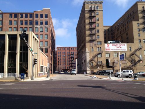
  3. Reopening 16th Street to traffic, on the same scale as north 14th in Old North. Both were a 60 foot public right-of-way.
  4. Making Chestnut and Pine two-way streets again

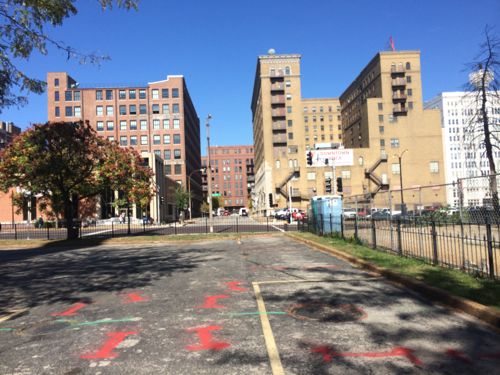
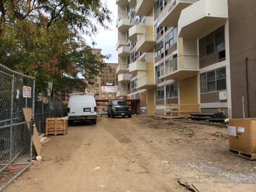
I met with clergy from both churches, neither likes the idea of losing parking or the space in front of each respective entrance. Meanwhile, the owner of four of the six Plaza Square buildings wants to build a parking garage between two of the buildings, without losing the historic designation needed for tax credits (via NextSTL).

— Steve Patterson


Gravel on Sidewalk Next to MetroBus Stop

For a couple of years I’ve  come across a problem that I hadn’t addressed, until now.

blah
Gravel from an adjacent lot spilled out onto the public sidewalk on Washington Ave just west of 21st St, click image for location.

The few times I’ve been through here I’ve gotten through without getting struck, it seems the sidewalk underneath the gravel is just fine. Still it’s annoying to me and I’m sure it is to any pedestrian trying to catch the bus, or visit the Downtown Children’s Center in the background.

I checked Google’s street view where this doesn’t appear but the lot has bare dirt. My guess is the gravel was placed on the dirt to prevent erosion. Well, the dirt isn’t washing away…

I’m going to send this to the Streets Dept and to Metro, hopefully between the two the gravel will get removed. If an adjacent property owner is at fault, I hope they get billed for the cleanup costs.

— Steve Patterson


ADA Ramp Behind Stop Line

Over the years I’ve been asked how I find things to write about, the answer is always easy: I go places like the grocery store, to dinner, or, yesterday, to buy a gallon of paint.

Able-bodied pedestrians follow the green line but those of us in wheelchairs must follow the red

When cars are stopped at the stop line they still block the curb ramp. This is similar to a situation on Magnolia at Grand, I posted about it in 2007 (St. Louis Crosswalk Ignores ADA Ramps). That got fixed quickly by moving the stop line back, but this seems a bit more complex. The sewer inlet and light post (just out of frame) make a ramp a tight fit. Curb bulbs like a few blocks north on Grand would provide the space needed.

— Steve Patterson


Future Gateway Mall ‘Civic Room’ Needs To Be Designed Without Curbs

Event areas shouldn’t have curbs! Yes, in most areas curbs are necessary for water flow and keeping cars off sidewalks. Yesterday I posted about a conflict between major events and transit access, primarily at 14th @ Chestnut. Today is about curbs — actually my wish for no curbs when a festival area gets designed in the Gateway Mall.

The problem with holding events in an area not designed for events is crowd control and accessibility. Here crowd control blocks access to the curb ramps
The two blocks of Washington Ave feature a mostly curb-free design

When the two blocks of Washington Ave from Tucker to 14th are closed for an event the design doesn’t present accessibility issues.

Of course there are many other issues to consider when designing a festival area: power distribution, lighting, sound, sanitation, etc.  Flexibility is important too. Event planners need to be a part of the planning & design process.

— Steve Patterson


New Wellston Child Care Center Under Construction, Adjacent To MetroLink Station

Construction workers are busy building a new child care center near the Wellston MetroLink station:

The Wellston Developmental Child Care Center is a key component of the Wellston Sustainable Neighborhood Initiative Masterplan. Located adjacent to a Metrolink Light Rail Sytstem (with which it will share parking) as well as being in close proximity to the Metropolitan Enterprise Center (a new job training center) will allow the Development Center to attain the goals of providing early childhood education in a depressed neighborhood, preparing children for the K-12 system, and providing day care assistance for parents training for new jobs.

The 14,650 SF building is oriented primarily on an E-W axis maximizing orientation for energy efficiency and daylighting. The building footprint had been placed on the site to minimize driveway length and take advantage of the adjacent public parking. Stormwater from the site will be handled by a series of micro-detention areas integrated with native landscaping. The program includes public, administrative, infant/toddler, classrooms and support spaces. (Hellmuth + Bicknese Architects)

I’ve requested the site plan & Wellston masterplan from the architects & county economic council, neither have been received.

Construction of the building in Powell Park, seen from the far end of the station's park-n-ride lot
Construction of the building in Powell Park, seen from the far end of the station’s park-n-ride lot
ABOVE: Over the last 19 years residents have worn a clear path across the open field...ur, park
Last year Powell Park was just a field that area residents cut through to reach the bus & train. Click image for post.
The long used shortcut is now blocked
From the parking lot we see the point where the shortcut comes through the greenery

The shortcut was the most direct path for pedestrians to reach public transit.  It wasn’t even paved, but since 1993 it was heavily used. However, I support building on the field — especially facilities that’ll benefit the community.

How will pedestrians now reach the station?

Rather than cut through the field to the right, pedestrians must now walk along Werley Ave
Just past the construction fence is the west edge of the large station parking lot.
Turning east we see the parking lot, the station is at the bottom of the hill. The stop for the #94 MetroBus is on the left

The new child care center will use the existing parking, rather than have a separate parking lot. Still, the parking lot remains a divider between train, bus, residents, and new child care center. It’s possible pedestrian routes will be constructed in the parking lot to connect these elements. Without pedestrian connections the new construction is just transit-ajacent, not transit-oriented.

Once I see an actual site plan I’ll post an update.

— Steve Patterson


Advertisement


[custom-facebook-feed]

Archives

Categories

Advertisement


Subscribe