It’s Friday so I like to end the week with some good news. This morning the Salvation Army will cut the ribbon on their 3010 Washington Apartments project:
For more than a century, the property at 3010 Washington Boulevard has been synonymous with transforming lives of those in the greatest need in St. Louis. Today, The Salvation Army will provide a pathway of hope, deterring homelessness for individuals with special needs in the St. Louis area with the development of 3010 Apartments.
Joining the Veterans’ Residence as a part of the Midtown project,3010 Apartments houses 58 one-bedroom units universally designedfor individuals with a variety of special needs. Each apartmentfeatures a full bathroom, kitchen and living/dining area.
The facility itself also includes amenities such as a computer lab,laundry and 24-hour security. Listed on the National Register ofHistorical Places and located near culture hub Grand Center,the 3010 Apartments will provide residents with a safe spaceto incorporate and build lifelong skills.
It’s nice to see a previously-shaddy emergency shelter becoming renovated apartments for the homeless.
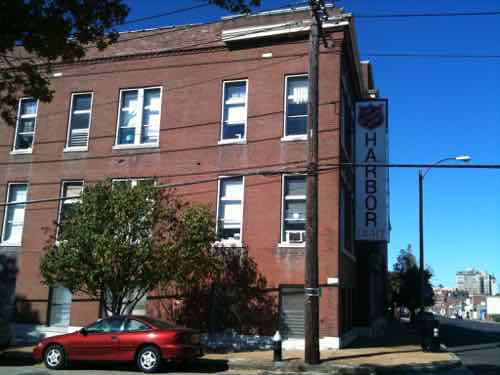
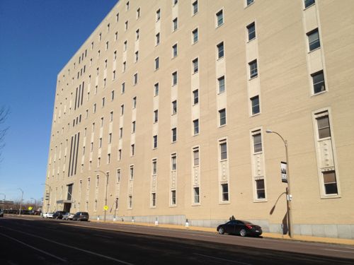
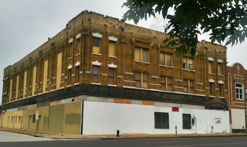
October 2011 photo of the former Salvation Army’s Harbor Light shelter, today is the grand opening of 58 apartments in the building
A home, now matter how small, is better than a temporary cot without security or privacy. I’m looking forward to touring this facility today.
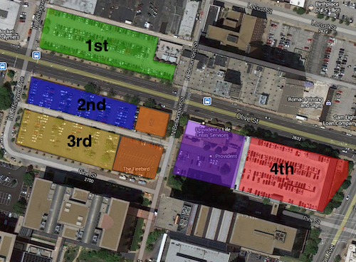
This is the fifth post in a series looking at potential development sites along the proposed initial route of the St. Louis Streetcar. The first four parts were:
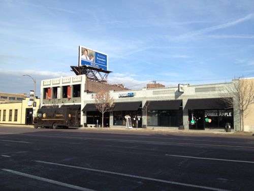
This post will cover the 0.6 mile stretch of Olive from Jefferson to Compton (map). Let’s start with the North side of Olive at Jefferson:
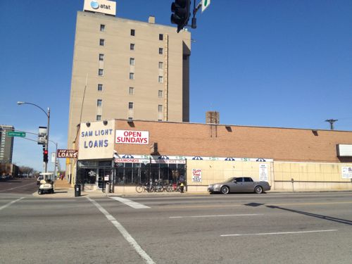
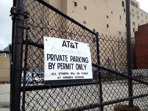
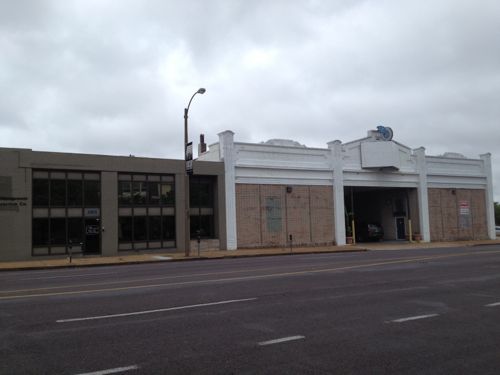
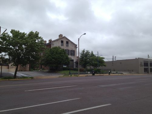
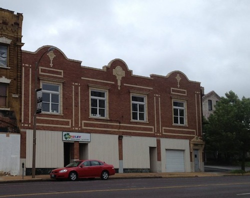
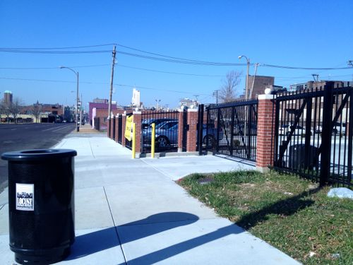
2601 Olive, well known as Sam Light Loans, was built in 1924, according to city records. I wonder if the building got a makeover in the 40s or 50s, it looks too modern foe the 20s.I posted about 2617 Olive in March 2012, it dates to 1883. Click image to see my prior post.AT&T recently built an addition on the long-vacant lot at 2621 OliveThat addition was on the east side of this AT&T Communications building at 2651 OliveThe small insurance office at Locust & Jefferson was built in 1956.AT&T owns much of the block on both sides of Locust, used for parking.Across the street is more AT&T parking on the left. Loft apartments on Washington Ave can be seen in the background.The Wells Fargo lot between Beaumont & Leffingwell could be easily developed if many employees begin riding the streetcar. Perhaps give them the option of a parking pass or a transit pass… More on Wells Fargo when I get to the south side of Olive below.The building on the left is from 1929, the one on the right from 1913. A vacant 30ft lot is to the right @ Leffingwell.2823 Olive was built in 1880, though set back from the street it would be an interesting contrast to keep this structure, while filling in on each side. The side on the left belongs to the next property to the west.This 1925 building at 2831 Olive would look even better with a new glass storefront….and a rooftop restaurantThe Castle Ballroom should get renovated with a streetcar right out front. Click image to see my post from 2011.These buildings in the 29xx block of Olive no longer look like they did 100+ years agoThe Locust Business District recently completed a fenced surface parking lot, this needs to be replaced ASAPThe Treasurer’s parking lot at 3019 Olive also needs a building, not a garage.At Cardinal Ave we have a one story structure from 1997, too new to replace right awayThe last buildings on the north side of Olive before Compton
Some existing buildings aren’t as tall as would be nice but their age/height will be a nice contrast to the new construction we should see go up over the twenty years. In short, lots of opportunities for new construction on vacant land.
OK, let’s cross Olive at Compton and return east to Jefferson. It would be impossible to look at this section of the proposed route without discussing the urban renewal clearance of Mill Creek Valley:
By World War II, Mill Creek’s tenements and faded town houses were home to nearly 20,000 people, many of them poor blacks who had migrated north from the cotton fields. More than half the dwellings lacked running water, and 80 percent didn’t have interior bathrooms.
Tucker proposed knocking over nearly everything and starting over. In 1955, city voters overwhelmingly approved a $10 million bond issue for demolition, on the promise that the federal government would reimburse most of it. The local NAACP endorsed the idea. Work began on Feb. 16, 1959, at 3518 Laclede Avenue, where a headache ball smashed a house that dated to the 1870s.
The bulldozers swiftly transformed the city’s “No. 1 Eyesore” into an area derided as “Hiroshima Flats.” Among the few buildings spared was the old Vashon High School, now part of Harris-Stowe State University. When work began in 1961 on University Heights Village apartments, only 20 original families still called Mill Creek home. (stltoday.com – A look back • Clearing of Mill Creek Valley changed the face of the city)
The area from Union Station to Grand was cleared. This area got new construction like the A.G. Edwards HQ, now Wells Fargo Advisors, LaClede Town (razed), Heritage House senior apartments, and the “flying saucer” gas station on Grand at Forest Park, now a Starbucks. n
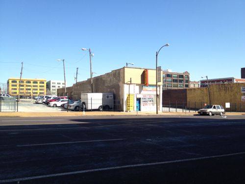
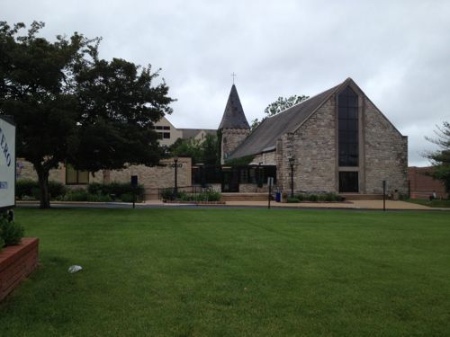
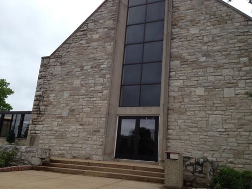
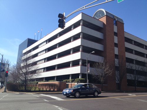
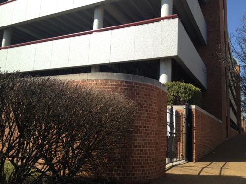
The block between Cardinal & ComptonThis facade was built after the front of the building was removed when Olive was widened. I’d like to see this endureA pocket park along the route would be nice, if it could be accessed.The former Berea Presbyterian Church is now a SLU event spaceThe central glass on the front of this church always looked too modern but I never knew the story.February 1909 Sanborn Map showed the stone (blue) church at 3015 Pine (vacated), between Garrison (vacated) on the east and Cardinal (dead end) on the west. The end facing Olive today was the back! Click image to see more of this map.I’d like to see Pine St replatted from Jefferson to Compton, it would go right through here.Sigma-Aldrich owns the land from the old church to Ewing. Given how the land is platted and fenced it appears they’re leaving a strip along Olive for future development.Ewing Ave looking south toward Market. Wells Fargo Advisors on the left, Sigma-Aldrich on the right. This too-wide street should be lined with storefronts catering to employees of both businesses, as well as students, faculty, & staff at Harris-Stowe, and residents at Heritage House.A non-propfit was formed in 1964 to build & operate low-income senior apartments, Heritage House opened in 1967.The building is well maintained but not well connected to OliveI’d like to see an addition between the sidewalk and tower with underground parking, street-level retail, 2nd floor apartments.An alley remains between Olive & Pine. I can imagine both sides being infilled over the coming decades, see diagram below.My thought of the order Wells Fargo might instill parking lots and finally raze a parking garage. The two orange squares are owned by the Beffa family, the purple by Provident.A parking garage for Wells Fargo Advisers dominates the intersection of Jefferson & Olive.A brick wall sorta hides equipment
I’m excited about the possibly having a modern streetcar line a block away from my loft, but the redevelopment potential in midtown is phenomenal. I’ve been losing sleep for the past week as I picture what this could look like at full build out. The vision must come before the bricks and mortar.
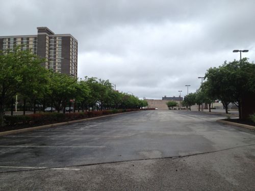
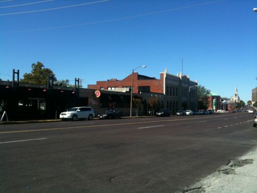
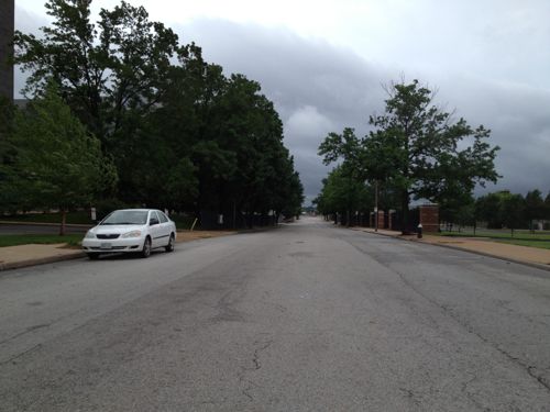
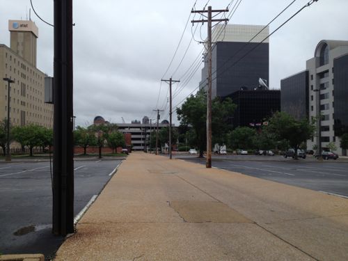
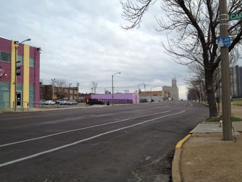
Most days Olive St. is pretty much deserted even though it’s a major east-west arterial.
ABOVE: Looking eastbound on Olive from Cardinal St. at 10:52am on Thursday December 6, 2012
In each direction you have a parking lane, a bike lane, and two travel lanes. I don’t know the posted speed limit but the road design is for much higher speed. Any savvy urban cyclist will use Locust St a block north even though it lacks dedicated bike lanes because Locust is narrower and has much slower traffic.
Former director of planning Rollin Stanley had suggested a green median where you could jog down the middle of Olive St. I could never figure out why someone would want to do that.
If the Partnership for Downtown St. Louis has their way Olive St. will once again have a streetcar line. Their aggressive timeline calls for it to be operational by 2016. Great if it can happen but I’d be happy with 2020. Actually I ride the #10 MetroBus often along Olive and Lindell and I’m pretty happy with it.
Much of the potential new development along the eastern part of the route could happen between Jefferson Compton avenues. If the right land-use controls are put into place first this will be very urban a decade from now. If not, we’ll have an expensive streetcar line passing by vacant/underdeveloped land.
It’s still warm out but nothing like the heat we had in the last week. In the hot summer weather the last thing I want to think about doing is leaving my air conditioned loft and drink beer outside. But in the early 19th century modern air conditioning didn’t exist. In 1823 shade, a breeze, and a cold brew were the best ways to beat the heat:
June 10, 1823: St. Louisans avoided the heat by visiting the city’s first beer garden, the Vauxhall Garden on Fourth between Plum and Poplar. St. Louis is credited with being the first city in America to develop outdoor restaurants and theaters. But it wasn’t until 1854 that the beer garden came into it’s own, when Franz Joseph Uhrig built a garden restaurant and theater in a wooded tract containing a cave for the natural cooling of beer.
The garden, known as Uhrig’s Cave, was at Washington and Jefferson avenues, a site later occupied by the Coliseum and still later by Jefferson Bank. First-run entertainment for all ages was provided, with some of the earliest American performances of Gilbert and Sullivan operettas and more serious dramatic pieces. Schnaider’s Garden was another popular spot, providing opera and the music of a grand promenade orchestra. Kuhn’s Brewery, the Lemp Brewery, Cherokee Cave, and Winkelmeyer’s were similar, and all gave the city a pleasant air during the hot summer months. (From the book St. Louis Day by Day by Francis Hurd Stadler)
See my posts on the Coliseum here and Jefferson Bank here. For more info on Vauxhall Garden click here. These old beer gardens may be gone but the tradition continues today.
ABOVE: Urban Chestnut Brewery’s new beer garden in Midtown Alley
What was once a parking lot is now a beer garden. Urban Chestnut leased the parking lot next door to their brewery at 3229 Washington Ave. Rather than use the parking lot to provide places for free customer parking the asphalt was ripped up and the beer garden was created. The owner of the former parking lot and building to the east, a high tech firm, will create parking for their employees on the vacant lot across the alley to the north.
ABOVE: View looking east in 2011 with the entrance to the parking lot on the leftABOVE: Same view nowABOVE: The beer garden at early evening
I’d like to see more parking lots ripped up and put to better use than in storing cars. Our streets are wide, use the space for on-street parking rather than the land between our buildings. More spaces like Urban Chestnut and we can connect downtown to midtown without interruption.
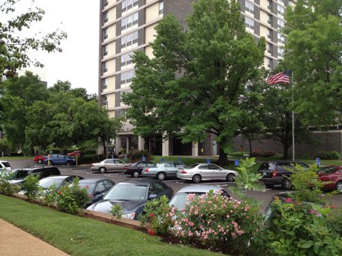
In the 21+ years I’ve been in St. Louis I’ve watched Harris-Stowe State Universitygo through name changes and a major expansion of their campus.
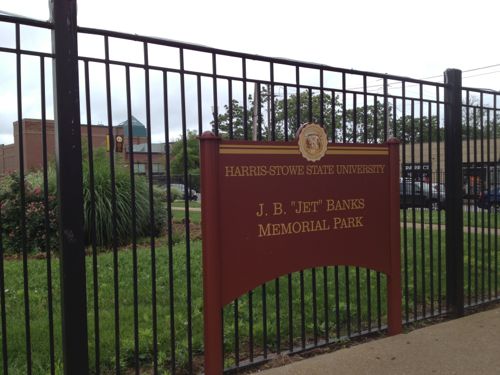
ABOVE: Backside of entrance marker to Harris-Stowe State University WB on what was once Laclede Ave, facing Compton Ave & Saint Louis University
This was done under the leadership of university president Dr. Henry Givens Jr., now retired:
Givens managed to grab the LaClede Town housing project land – valued at roughly $17 million – for $10 after the federal government shut it down and turned it over to the city in the 1990s. His hard work and relentless political negotiating got him the old Vashon Community Center and three surrounding acres for another $10. The historically black college for teachers kept adding buildings – along with students and degree programs – and eventually earned full-fledge university status in 2005. (West End Word)
In 2006 Harris Stowe added their first dormitory.
ABOVE: Gillespie Residence Hall opened in 2006
In August of last year they opened a second  residence hall:
Harris-Stowe State University celebrated the opening of its second residence hall and new student dining facility on Friday, August 12. The university named the recently completed 65,000-square-foot, four-story structure in honor of attorney Freeman R. Bosley Jr., the first African-American mayor of the City of St. Louis and long-time advocate of the university and its mission. (St. Louis American)
Combined the two residence halls house 428 students.
ABOVE: Bosley Residence Hall
With two residence halls and more and more academic buildings just south of the emerging Midtown Alleydistrict:
Boutique hotels and trendy restaurants today are sprinkled among [marketing] agencies with names like “Scorch,” “Four Alarm” and “Spoke.” The development makes it difficult to envision that barely ten years have passed since the Thoelkes brought their shop specializing in cultural events and institutions to Midtown. (STLtoday.com)
What an exciting environment to have adjacent to a college campus! The closest establishment to campus is the hugely popular Pappy’s Smokehouse but also close is The Good Pie, The Fountain on Locust and opening this coming Saturday, Hamburger Mary’s. The students must walk to Midtown Alley all the time. Well, I’m sure they would  if they could.
ABOVE: Harris-Stowe's fence prevents pedestrian access to the sidewalk along the east side of Cardinal AveABOVE: A locked gate blocks access to the sidewalk on the west side of Cardinal Ave, seen here looking south toward campus, leading directly to Pappy'sABOVE: Looking south from Cardinal Ave toward campus we see that buildings were located to block this natural access point.
To be fair to Harris-Stowe, when they acquired the LaClede Town land the area now known as Midtown Alley had yet to begin developing. In planning their campus they used the same failed logic as Saint Louis University — the area outside of the campus border has nothing now nor will it ever so it’s best we just turn out backs and keep the students safe from the big bad world.
ABOVE: Harris-Stowe campus on bottom, Cardinal Ave center and Hamburger Mary's upper right. Click to view in Google Maps
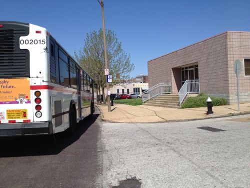
TOKY Branding + Design opened on Olive just east of Compton in 2002.  Two years later the Emerson Performance Center (lower left, above) opened permanently blocking access to Cardinal Ave and Olive St.  Just reaching the bus stops at that intersection is a challenge for students.
ABOVE: Harris-Stowe's official campus map shows access to Grand via Laclede but SLU closed that route
b
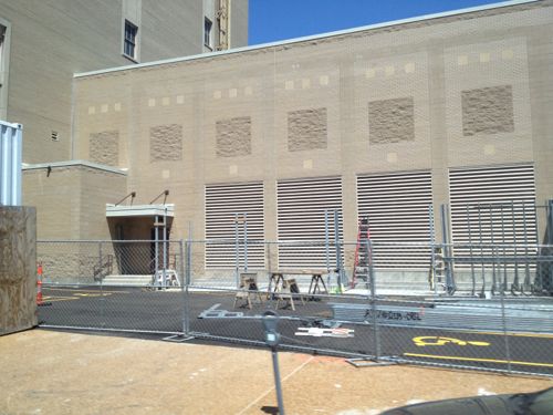
ABOVE: Garbage dumpsters for Emerson Performing Center are located where a strong pedestrian connection on campus should lead to the city beyond
b
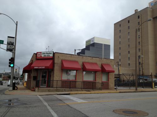
ABOVE: You can't miss Hamburger Mary's on Olive, it opens on Saturday.
Hamburger Mary’s will likely draw huge crowds starting Saturday. I’m afraid students or others will get hurt trying to cross Olive St at Cardinal Ave to reach the new bar & grill. A strong campus connection at Cardinal Ave would have made pedestrian signals at Olive easier to justify. I cross at Compton Ave but I doubt others will go out of their way to do so.
Like Saint Louis University to the east, Harris-Stowe State University has very nice buildings, green grass and an orderly campus. Both fail at connecting to the city. – Steve Patterson
AARP Livibility Index
The Livability Index scores neighborhoods and communities across the U.S. for the services and amenities that impact your life the most
Built St. Louis
historic architecture of St. Louis, Missouri – mourning the losses, celebrating the survivors.
Geo St. Louis
a guide to geospatial data about the City of St. Louis