Home » Public Transit » Recent Articles:

Poll: How Should St. Louis County Reduce Traffic Congestion Between Mid & South County?

St. Louis County is still trying to make it easier to get from Hanley to Watson Rd., now through what’s being called the South County Connector. Various schemes have been around for decades:

A plan for an improved connection from south St. Louis County to central St. Louis County has existed since the late 1950s. The original concept was for a freeway “inner belt expressway” to provide better north-south access through the St. Louis suburbs. This freeway concept became Interstate 170 north of Interstate 64/U.S. Route 40. Originally, Interstate 170 was supposed to continue south into the southern part of St. Louis County to provide improved access between Interstates 44, 64 and 55. After much deliberation, area leaders decided in the 1990s not to pursue a southward extension of Interstate 170 due to public concerns. Although this option was abandoned, St. Louis County, the Missouri Department of Transportation (MoDOT), and other local agencies continued planning efforts to identify potential options for north-south access improvements in south St. Louis County. (source)

Here’s a summary of the current proposal:

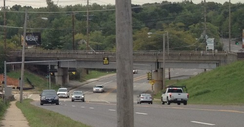
John Hicks, the county’s Transportation Development Analyst, says the county is now presenting two alternatives to the public, but both roughly follow a route from River Des Peres Boulevard at Watson Road, through a portion of the Shrewsbury MetroLink parking lot, across I-44, into Big Bend Industrial Court, crossing Deer Creek Center and ending at Hanley Road near Flora Avenue. (KMOV)

A good portion would be elevated roadway.

South Hanley ducks under railroad tracks.
South Hanley would be widened where it ducks under railroad tracks near Deer Creek Center.

Proponents say the project is needed to address projected increases in traffic, critics say the focus should be on transit, biking, and walking solutions.  They also say the widened/high-speed intersections would be dangerous to bikers and pedestrians.

I want to know what you think about it, the weekly poll is in the right sidebar. Cast your vote and share your thoughts below.

— Steve Patterson


Transit-Oriented Planning Eliminates 22nd Street Interchange, Reconnects Street Grid

For years I’ve been accused of being a naive dreamer, coming up with big plans without the existing market to implement. I’ve just smiled and continued sharing my long-term vision for St. Louis.

In June 2007 I wrote:

The 22nd Street Interchange, part of an abandoned highway concept from a few decades ago, needs to be ripped out with the land returned to active tax-paying use. The Missouri Dept of Transportation (MoDOT) should rework the interchange at Jefferson Ave to allow for on/off ramps in both directions and therefore eliminating the need for the current ramps at 22nd. MoDot could sell the land to fund the revisions to the highway ramps. (St. Louis Should Abandon Linear Gateway Mall Concept)

Then in December 2008 I wrote:

I picture a new bridge at I-64/40 and Jefferson Ave — one with a single point urban interchange (SPUI) and both East & West on/off ramps. Build that and then remove the 22nd interchange completely. Bring in form-based zoning codes to require a denser urban environment. Make a strong connection through the back of Union Station (between the shed & highway) so that pedestrians from this newly developable land have the opportunity to walk to Metrolink and the 14th street transit station beyond that. The fact that much of this area is already excavated and free of utility lines would simplify the construction of underground parking in new buildings. (MoDOT Needs To Put The 22nd Street Interchange On Any Wish List For Funding)

By May 2009 I noted that St. Louis’ 22nd Street Interchange Part of McKee’s Plan so it elimination would need to be worked out with him. Presumably MoDOT agrees with McKee because they’re replacing the Jefferson bridge over I-64/40 with no plans for on/off ramps to/from the east.

Then, last month, at an St. Louis Regional Transit Oriented Development Study presentation around the Union Station & Civic Center Metrolink stations the Denver-based consulting firm suggested largely what I had outlined years earlier.

Preliminary plan around Union Station, the Drury (former YMCA) and other existing buildings should be shown in the final presentation.

Ok, they still have on/off ramps for I-64/40 to the east, but they are compact and feed into the reconnected street grid I had advocated. The above image is preliminary, I pointed out it was missing buildings like the Drury Inn on 20th, formerly a YMCA and later a gay bar/hotel/bathhouse. Hopefully their final will be more accurate than the draft shown at the last meeting.

Still they see what I and others saw, the need to repair the street grid and fill in the gaps in the urban fabric.

Only part of a planned highway loop around downtown was built, a huge waste of land to the west of Union Station.
The 22nd Street interchange is just on/off ramps.
1958
1958 aerial of the area west & north of Union Station

This is not about trying to recreate the buildings and feel of the area prior to the demolition for the highway interchange. This is a forward-looking vision to create a walkable/urban environment for those interested in such. Some prefer the look & feel of new buildings, new sidewalks, new trees, etc. This is an opportunity to create an entirely new neighborhood largely from scratch yet have access to existing transit.

Per McKee’s plans, a few new employers could anchor the neighborhood. Workers & residents would attract restaurants, dry cleaners, and other services.

None of this is rocket science, it’s Urban Planning 101. St. Louis still needs lots of basics to rebuild the connections that were ripped out in the 20th Century.

— Steve Patterson


Potential Development Sites Along Proposed Streetcar Line, Part 1: Olive 15th-16th

The proposed streetcar from St. Louis’ central business district (CBD) to the Central West End (CWE) along Olive/Lindell is moving forward. Regular readers know I’m a streetcar advocate because of how it can increase development activity in a way no bus route ever can. I thought I’d take a close look at potential sites along the proposed route, starting with the area nearest my loft.

The block on the north side of Olive between 15th and 16th is nothing but two surface parking lots.

Looking west from 15th Street
Looking west from 15th Street, YMCA at right

The larger lot with entrance on 15th serves the building the occupies the block to the east. This building contains the administrative offices for the St. Louis Public Library and the Confluence High School. That building contains parking underneath as well as some surface parking within that block. The library owns the building and this surface parking lot.

The surface lot, shown above, doesn’t get much use. Once the streetcar line starts running there won’t be as much need for automobile parking, hopefully the library can sell the large surface overflow parking lot to a developer for new construction. This is currently subdivided into 4 parcels with addresses 1501 Olive, 1507 Olive, 1509-1529 Olive, and 1527 Olive with a total area of 26,964sf or 0.62 acres. See map.

The west end of the block is a smaller privately-owned public surface parking lot, legally divided into two parcels with addresses 1531-1533 Olive and 1535-1537 Olive. The total area of these two parcels is 11,676sf or 0.27 acres. Combine all six parcels owned by two entities and you have 38,640sf or 0.89 acres.

Purple is the smaller privately-owned lot, blue the lot owned by the library and the red outlines the building with library offices and charter high school.

The only structures on this city block are The Campbell House Museum and the 10-story YMCA. The 100 upper floor apartments have been vacant for at least 5 years now, hopefully a streetcar line will get someone interested in taking on the project. Other buildings in the area range from 1-10 floors, but most are greater than 5.

A stop is highly unlikely at 15th because the streetcar line will have a major connection at 14th, but I’d like another stop at 16th or 17th.  Even if the next stop isn’t until 18th or 19th I can see this block filled in with apartments and/or condos along with new ground-floor restaurant/retail space.

— Steve Patterson


County Voters Approved Proposition A For Transit Three Years Ago

ABOVE: The westbound #32 MetroBus on Chouteau just barely west of Grand. The Pevely bldg is to the left, for now.
The westbound #32 MetroBus on Chouteau just barely west of Grand.

It was three years ago today that St. Louis County voters approved Proposition A, activating a sales tax previously approved by voters in St. Louis City.

Proposition A, a ½-cent sales tax in St. Louis County, passed on April 6! It will provide revenue needed for continued operation and expansion of the transit system including MetroLink, Metrobus and Call-A-Ride services for the disabled. The County tax will raise approximately $75 million annually – and now triggers a matching quarter cent sales tax that was passed in the City of St. Louis in 1997 which will add an additional $8 million a year to the program. (source)

In the last three years Metro has been able to restore MetroBus service to areas where it had been cut due to lack of funding. St. Louis County is holding back some of the tax revenue generated  each year, to use for local match for an expansion of MetroLink light rail.

But where?

  • South from the Shrewsbury end?
  • North along I-170?
  • Out to Westport Plaza?

I haven’t kept up with the long range planning so perhaps the next route has been selected already, anyone know?

— Steve Patterson


Study: Connection Between Transit and Real Estate Value

A study released this month looked at five regions and found a connection between home values and transit:

From the Executive Summary:

Overall there was a substantial decline in average residential sales prices in the study regions between 2006 and 2011. However, in all of the regions, the decline in average residential sales prices within the transit shed was lower than in the region as a whole or the non-transit area. Across the study regions, the transit shed outperformed the region as a whole by 41.6 percent. Figure 1 shows the percent change in average residential sales prices in the transit shed and non- transit area relative to the regional percent change in price.

Within a given region, heavy rail, light rail, and BRT transit sheds held their value best. In addition to having higher frequency service and better transit connectivity, these types of fixed-guideway transit stations also tend to be located in areas that are more walkable, have higher residential density, and better access to jobs. Commuter rail sheds also saw a smaller decline in average residential sales prices than the region as a whole.

Percent change in average residential sales prices relative to the region, 2006-11
apta-nar2
Click cover image to view the 39-page study from the American Public Transportation Association and the National Association of Realtors.

From the Conclusion:

Transit type also had an effect on the resilience of property values, which benefited more from transit that was well connected and had a higher frequency of service. Although most commuter rail transit sheds still saw a smaller decline in average residential sales prices than the region as a whole, heavy rail, BRT, and light rail transit sheds outperformed commuter rail transit sheds within and across regions. Heavy rail transit sheds had significantly higher levels of transit access, as measured by the Transit Connectivity Index and the Transit Access Shed, than the commuter rail sheds. Average monthly household transportation costs were also substantially lower in the heavy rail than the commuter rail sheds, indicating that the heavy rail sheds had not only higher levels of transit service, but were more location efficient overall. For most property types, the transit shed outperformed the region; however, unlike with transit type, there were no consistent trends across regions.

In addition to providing consumers and planners with information, the findings support investment in transit and encourage development in location efficient areas. The presence of fixed-guideway transit not only benefits individual property owners, it also supports a more resilient tax base.

I read about the study here. This is no surprise to many of us, but others won’t believe the results. “Everyone aspires to a McMansion in suburbia and driving everywhere” they’ll proclaim.

It’s 2013, not 1963!

– Steve Patterson


Advertisement


[custom-facebook-feed]

Archives

Categories

Advertisement


Subscribe