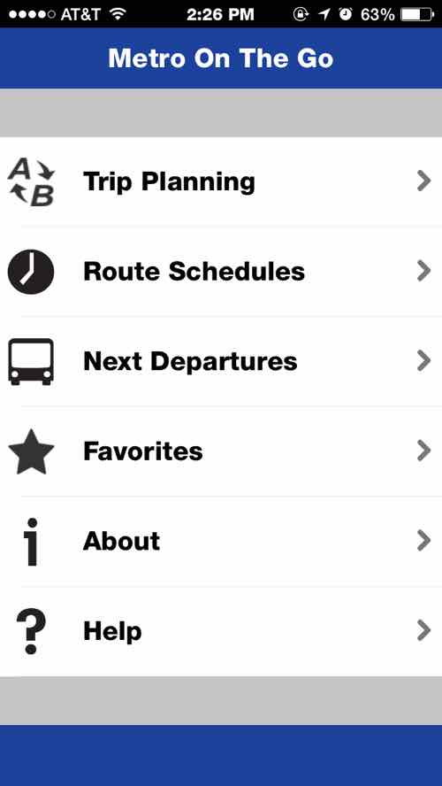
Last week our transit agency, Metro, released its first mobile app — called Metro On The Go:
You asked for a Metro app — and now you have it! Metro On The Go, the official mobile application of Metro transit, is now available. You can download it for free from the Apple App Store and the Google Play Store.
Metro On The Go lets you plan your trip on Metro transit, check schedules for MetroLink and all 75 MetroBus routes, and tap into real-time vehicle data so you can see when the next bus will arrive — all from the palm of your hand. (NextStopSTL)
The app is available for Android & iOS mobile devices. I’ll share my thoughts on the iOS version later in this post, but first I want to bring up an issue before others do. Some may say things like “not everyone has a smartphone”, “not everyone can afford a smartphone”, “this is elitist”, etc. These people likely have broadband at home and choose to not have a smartphone — for others the reverse is the case:
10% of Americans own a smartphone but do not have broadband at home, and 15% own a smartphone but say that they have a limited number of options for going online other than their cell phone. Those with relatively low income and educational attainment levels, younger adults, and non-whites are especially likely to be “smartphone-dependent.” (Pew Reseach — U.S. Smartphone Use in 2015)
From the same source:
Lower-income smartphone owners are especially likely to use their phone during a job search. Compared with smartphone owners from households earning $75,000 or more per year, those from households earning less than $30,000 annually are nearly twice as likely to use a smartphone to look for information about a job — and more than four times as likely to use their phone to actually submit a job application.
Similarly, “smartphone-dependent” users are much more likely to use their smartphones to access career opportunities. 63% of these smartphone-dependent users have gotten job information on their phone in the last year, and 39% have used their phone to submit a job application.
Young adults (85% of whom are smartphone owners) are also incorporating their mobile devices into a host of information seeking and transactional behaviors. About three-quarters of 18-29 year old smartphone owners have used their phone in the last year to get information about a health condition; about seven-in-ten have used their phone to do online banking or to look up information about job; 44% have consumed educational content on their phone; and 34% have used their phone to apply for a job.
The app can be useful, but is it? In short — yes! In just days my initial complaint has already been addressed.
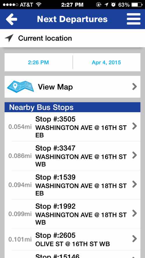
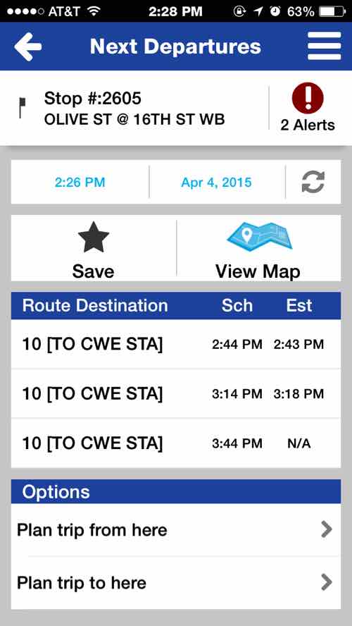
The main menuFor me the “Next Departures” is the most helpful. When I downloaded the app on the first day the stops didn’t list the bus direction — which is important to know — so I’m glad they listened to feedbackBeing able to see if a bus is on time or running late is very helpful
I wasn’t able to test the Android version, my husband went back to iOS in the Fall of 2013. The ‘Trip Planner’ isn’t as responsive as the Google Maps app. Still, for most of my transit use I need to know the next departure of the #10 at 16th & Olive or the #97 at 16th & Washington. This will come in handy when I’m at places and want to know when the next return bus home arrives. Thanks Metro!
I’ve been a regular rider of public transit in St. Louis for a few years now, I’ve never felt unsafe or witnessed any crime. Still, a recent assault on a train has many concerned.
Talking to people over the years some would only ride MetroLink light rail, they’d never consider MetroBus. I’ve asked [white] people if they’d ridden public transit, a common answer was “Yes, MetroLink.” Most are shocked when I tell them I use MetroBus far more often than MetroLink.
The vote count Sunday was low, but I liked the fair results:
Q: Which mode of public transportation do you think is the safest in St. Louis?
Tie/equal 11 [45.83%]
Bus (MetroBus) 6 [25%]
Light rail (MetroLink) 5 [20.83%]
Unsure/no answer 2 [8.33%]
Despite the hysteria on the local news, both MetroLink & MetroBus are largely safe modes. I’d be more worried about driving on I-270 than being assaulted on public transportation. I’ll leave it to others to dig through piles of data.
Five years ago today St. Louis County voters approved a tax increase to support public transit:
By a wide margin, county voters approved a half-cent increase to the transit sales tax to restore lost bus and Call-A-Ride service and, eventually, expand the reach of mass transit farther into the St. Louis suburbs. (Post-Dispatch)
This ballot victory triggered a previously-approved sales tax increase in the city. Attempts in 1997 & 2008 were rejected by St. Louis County voters.
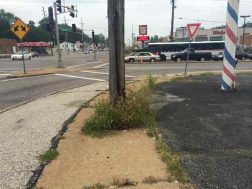
The 57x MetroBus on Clayton Rd. between Woods Mill & Hwy 141. Click image to view the 57X route & scheduleThe #61 MetroBus in the background is heading WB on Chambers at W. Florissant in Dellwood. Click the image to view the #61’s route & schedule.
After the fall 2008 defeat transit advocates approached the 2010 campaign differently, producing outstanding results:
The measure passed by a monstrous 24 point margin. The St. Louis Tea Party focused its energy on defeating the civic project, calling the campaign a test run for defeating Democrats in this fall’s midterm elections. So it’s a setback for them.
But it’s good news for those wanting to get around the St. Louis metro area. The “proposition A” measure will restore bus lines that had been de-funded, pay for more frequent buses, prevent future cuts, and, eventually, expand the reach of transit further into area suburbs. (Grist)
The greatest support came from north county voters, the highest users of transit in the county.
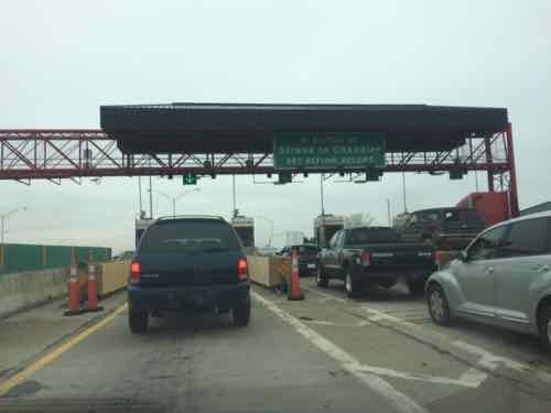
We did a 3-day weekend trip to Oklahoma City last weekend so my husband could meet more of my family — including two in from Northern California. For cost reasons we decided to drive rather than fly. We kept detailed records on costs — fuel and tolls. We drove I-44 the entire way — in Oklahoma it is a toll road. I think the results will make for an interesting conversation about fuel taxes and tolls.
Those of us not using a prepaid PIKEPASS had to stop at toll plazas to pay in cash. Those using PIKEPASS save time and 5%. Those with a PIKEPASS can also use it in Northern Texas (Dallas-Ft. Worth) and Kansas.
Our roundtrip was 1,129 miles (585 were in Missouri, 544 in Oklahoma) — 51.8% vs 48.2%. We used 31.861 gallons of gasoline — 69.54% of which was purchased in Missouri. Our 2007 Honda Civic, with over 100k miles, averaged over 35mpg on mostly highway miles, the government rating on our vehicle is 36mpg highway. We stayed a traveled a few MPH over the posted speed limit of 70 un Missouri and 75 in Oklahoma.
Our total cost for fuel & tolls was $21.48, but even though only 48.2% of our miles were in Oklahoma that state received 82.17% of our money, Missouri the remaining 17.83%. In total state fuel taxes & fees we paid $3.83 to Missouri, $1.65 to Oklahoma. We paid Oklahoma a total of $16 in tolls — $4 per toll plaza stop. Missouri collects 17.3¢/gal in fuel taxes & fees, Oklahoma a little less at 17¢/gal. Oklahoma has ten toll highways thoughout the state!
If Missouri is unwilling to increase our fuel taxes to fund our infrastructure needs then we should consider tolls. This has allowed Oklahoma to fund roads & bridges while keeping fuel taxes among the lowest in the country. Oklahoma gets visitors passing through their state to pay for the privilege. Of course, if you ask Oklahomans about tolls they’ll say they don’t like them.
Critics of fuel taxes say increasing efficiency of vehicles causes shortfalls in state revenues, electric vehicles like a Tesla don’t pay any fuel taxes. Tolls are the great equalizer though — a Tesla would’ve paid $16 in tolls just like we did.
Before Michael Brown was shot & killed last August, community planning had been completed to improve parts of Ferguson & neighboring municipalities. In 2011 Great Rivers Greenway District completed the Maline Greenway Concept Plan, in June 2014 East-West Gateway Council of Governments completed the West Florissant Avenue Great Streets Master Plan — both included extensive community participation along their linear boundaries.
The boundaries of each plan, coincidentally, intersect at the burnt out QuikTrip (9420 W. Florissant Ave). The 1.14 acre site, on W. Florissant Ave, is bordered by Maline Creek on the South. Next week I’ll post about the Urban League’s intentions for this site and how they ignored two published plans with extensive community involvement. Today more detail on both plans.
The Vision for West Florissant Avenue comes from community and stakeholder input received through multi-faceted outreach efforts. These have included public workshops and virtual walking tours, interviews with community leaders, input from the Community Committee and Technical Advisory Committee, an Agency workshop, and an online survey and mapping tool. The Vision Statement has distilled this community and stakeholder input, with the most significant community values expressed as how the corridor should look, feel, and contribute to the community’s future.
The Maline Greenway Concept plan presents the findings of a yearlong planning process that involved inventory, analysis and recommendations. Input from residents within communities along the greenway helped shape the plan. The report includes background information on the District, summary of existing conditions, review of public input, description of the Maline Greenway concept, implementation overview and a summary of recommendations that include not only the trail alignment opportunities but also recommendations that address the social, economic and environmental quality of life for the communities. The Concept Plan helps to guide partnership opportunities, provides an analysis of the corridor, identifies community connections and alignment opportunities.
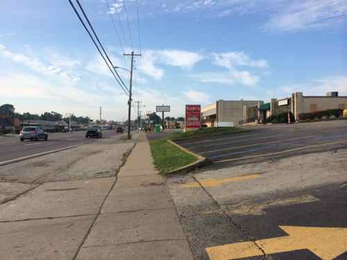
The West side of W. Florissant is very similar to the East. lots and lots of paving. August 2014
Ferguson’s zoning was updated as recently as 2011 and includes a downtown form-based code. Ferguson’s guiding comprehensive plan document is the Vision 2015 Plan Update that dates to 1998.
Page 24:
Although sidewalks are provided on both sides of West Florissant Avenue along most of the corridor, the pedestrian realm is generally uninviting and often unsafe. Buildings are spaced too far apart to walk, sidewalks are interrupted by frequent driveways and parking entries, and there are few pedestrian amenities or street trees.
Page 25 talks about transit and possible Bus Rapid Transit (BRT):
West Florissant also carries transit, specifically MetroBus Route 74 (Florissant line), and though the headways are long (30 minutes), Route 74 is one of Metro’s heaviest-used lines, with over 1.1 million boardings in 2013. West Florissant is crossed by MetroBus Route 61 (also in Metro’s top ten heaviest-used routes, with 800,000 boardings) at Chambers Road. The heavy transit use along the corridor results in a correspondingly heavy pedestrian demand. There is a clear opportunity to encourage transit- and pedestrian-oriented development at this intersection of West Florissant and Chambers Road.
While the current roadway configuration works relatively well for those traveling by automobile, and offers a transit option, other modes and users are largely shortchanged. West Florissant Avenue’s auto-dominated character and design, width, and traffic speeds, as well as the lack of any bicycle facilities, make it hostile to and unsafe for cyclists. Conditions for pedestrians are somewhat better, with the presence of sidewalks, but the pedestrian experience in many places along the corridor is unpleasant and unsafe.
With new high-quality transit service given priority along the corridor, and with rush-hour headways of 10 minutes, the opportunity exists to remake West Florissant Avenue into a transit-first street, with transit-oriented, pedestrian-scale development clustered around some key stations along the corridor. The corridor has a relatively wide right-of-way, which will make allocating space efficiently to serve the multi-modal needs of all its users easier than if the street were narrower.
New infill development should be guided by new zoning and guidelines that require buildings and entrances to be built up to the sidewalk, forming a consistent street wall. Until redevelopment occurs, individual property owners should be encouraged to beautify the edges of existing parking lots that front the avenue, so that the pedestrian experience is improved.
The study area of West Florissant Ave is long, but you have to start somewhere. From the Executive Summary:
Project construction should start at the south end, where there is high potential for redevelopment projects such as new housing, retail and mixed use projects. Thus investing public funds in this zone first follows a strategy that looks to catalyze private investment as soon as possible. Maline Creek is also planned to be reconstructed, so developers will be attracted to the critical mass of activity which will result in an appealing place for housing to be developed. Putting the South Gateway into construction in the first phase will also help create a rationale for the street design and use of medians and access management, simply because these street treatments are already in place immediately to the south, at Buzz-Westfall Plaza.
Maline Creek was identified as the point where the commercial development stops and residential begins, the former QuikTrip is on the residential side of Maline Creek.
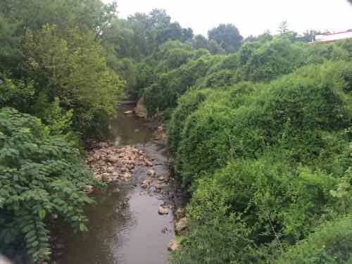
Looking East at Maline Creek from West Florissant, the QT site on the left. August 2014
Numerous park and open space areas exist along the proposed Maline Creek corridor which could potentially function as trailheads and Greenway amenities. Creating attractive linkages between parks and open spaces will promote public use and create the opportunity for the greenway to become a regional attraction. (p1.5)
After the trail leaves Ferguson’s Forestwood Park
Continuing east, the trail is planned to be located in open space at the north side of Maline Creek to West Florissant Avenue. From West Florissant Avenue the trail is planned to proceed south across the creek and then go east on the south side of the creek for approximately 2000 feet. A pedestrian bridge is planned in this area to cross the Maline Creek to reach the north side open space and continue east to Lucas and Hunt Road near Westview Middle School (p1.9)
The QuikTrip site could, perhaps, allow the trail to stay on the North side of Maline Creek.
In the interest of transparency and community involvement I think the community should share in setting the vision for the use of 9420 W. Florissant Ave. More next week.
AARP Livibility Index
The Livability Index scores neighborhoods and communities across the U.S. for the services and amenities that impact your life the most
Built St. Louis
historic architecture of St. Louis, Missouri – mourning the losses, celebrating the survivors.
Geo St. Louis
a guide to geospatial data about the City of St. Louis