Home » Transportation » Recent Articles:

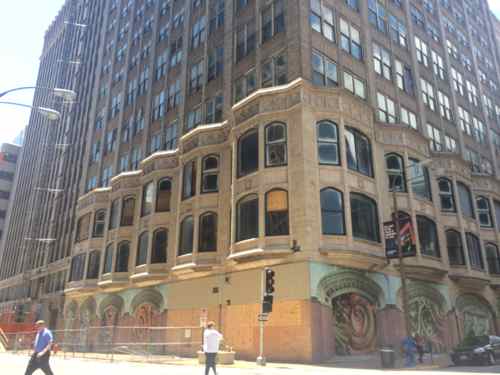
Forget TOD, Apparently Parking Critical To Financing Redevelopment of Arcade-Wright Building

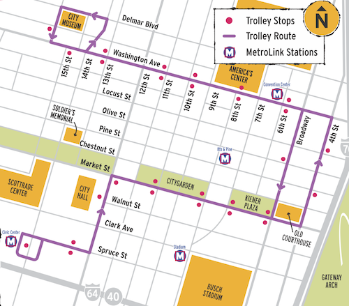
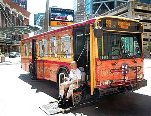
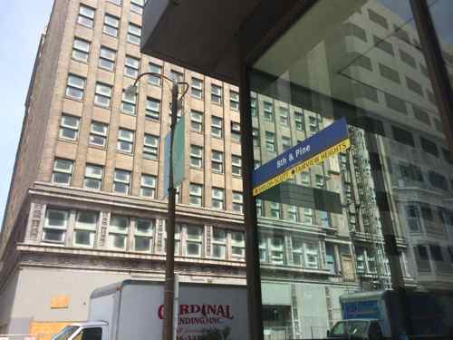
July 31st marks 21 years since the 8th & Pine MetroLink light rail station opened downtown, the Arcade-Wright building on that corner remains undeveloped.  For nearly 20 minutes at the June Parking Commission meeting Otis Williams (SLDC: St. Louis Development Corporation) & Steve Stogel talked about a variety of downtown development issues, including why a lease for parking spaces in the 7th Street garage was critical.

The Arcade portion of the Arcade-Wright, 8th & Olive
The Wright portion of the Arcade-Wright, 8th & Pine
The Wright portion of the Arcade-Wright, 8th & Pine, entry/exit to station (WB) next to building
The Arcade-Wright across 8th Street from the 8th & Pine MetroLink light rail station
The Arcade-Wright across 8th Street from the 8th & Pine MetroLink light rail station (EB)
The city-owned 7th Street parking garage

During the 18 minute discussion many details about the proposed redevelopment are revealed.

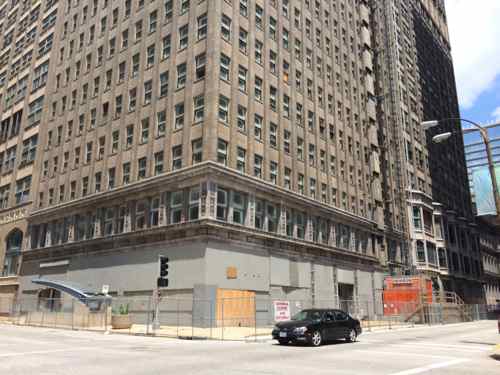
The Arcade-Wright building:

  • is owned by the LCRA (Land Clearance for Redevelopment Authority), for about 5 years
  • is one of the last buildings awaiting redevelopment downtown.
  • has roughly 500,000 square feet
  • Webster University will lease the 1st floor, mezzanine & 2nd floor, 55,000 sq ft. Their campus will be about 90,000 sq ft total
  • Upper floors will be a combination of (202) affordable and (80) market rate apartments
  • $118 million dollar project
  • LCRA bought the Arcade-Wright building for $4,500,000 after John Steffen’s Pyramid Constriction firm collapsed with 7-9 downtown buildings
  • Mortage was held by Bank of America. Total for this mortgage and several other buildings was $32 million
  • Interest had accrued and property taxes hadn’t been paid on the properties
  • Development will let the LCRA get reimbursed for all expenses
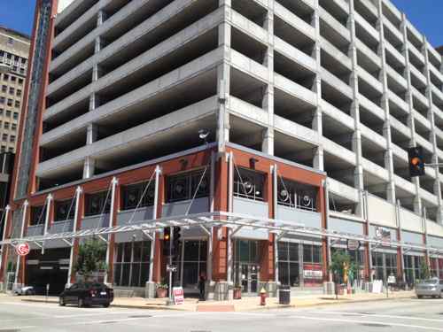
  • Not enough parking in the building, “the 200 affordable units have to park somewhere”, seeking long-term lease in the 7th street garage so the residents in the affordable units have parking

Other:

  • Redevelopment of the Chemical building at 8th & Olive will move forward once the Arcade-Wright is underway
  • The owner of the Laclede Gas Building is planning a renovation once Laclede Gas moves out
  • Jefferson Arms is the other building that was held by Steffen in 2008 that hasn’t been renovated yet
  • April 23, 2008 John Steffen asked Steve Stogel to help him liquidate. (Note: Pyramid shut down on April 18, 2008)
  • The Chemical building is 160,000-180,000 sq ft

This was on June 12th, I’ve not seen any announcements since. I recorded (audio) of the nearly two hour meeting, you can listen to the last 18 minutes about the Arcade & development here.

Further reading:

So all 202 affordable (subsidized) apartments at a MetroLink stop need a parking space in the garage a block away to finance the redevelopment. It’s unclear if parking at Dominium’s Leather Trades & Metropolitan is included in the base rent or an additional charge. I’m not sure anyone involved realizes the building is adjacent to an underground light rail station — one people would need to walk past to reach the parking garage! Enterprise CarShare also operates downtown, for times when residents need wheels.

— Steve Patterson


Downtown Trolley Route To Reach Union Station, Downtown’s Pedestrian Wayfinding Information Outdated

On Monday I posted about how the downtown trolley route hadn’t changed in its first four years of service, the only significant change being the addition of one stop. After my post I learned, not via any reply to my emails, that the trolley route will be changing — it’ll connect with Union Station. This is due for a couple of reasons. First, the upcoming Civic Center MetroBus Transit Center expansion project and the new owners of Union Station want to be connected to the rest of downtown and the trolley is popular with local tourists.

Started on July 1, 2010, the trolley route hasn't changed except the addition of one stop on Spruce at 14th.
Started on July 1, 2010, the trolley route hasn’t changed except the addition of one stop on Spruce at 14th. Union Station is just outside this view to the left of the Scottrade Center.

How the trolley will get to Union Station is still unknown, as is how it’ll make its way back east. My guess is a loop that includes Clark, 18th, Market and 14th. This could also include stops at the Peabody Opera House and Scottrade Center.

The CVC's downtown pedestrian directories
The CVC’s downtown pedestrian directories

Besides not showing the downtown trolley,  the information shown on the downtown wayfinding is already out of date:

  • Macy’s is shown, it closed in August 2013.
  • Ballpark Village isn’t listed, it opened earlier this year.
  • Numerous hotels have closed or changed names
I'd think the Cardinals & Cordish would want Ballpark Village listed as a downtown attraction
I’d think the Cardinals & Cordish would want Ballpark Village listed as a downtown attraction
The list of hotels has several obsolete listings

Of course it is impossible for the pedestrian wayfinding to remain 100% current all the time, I’m curious how often the CVC plans to update.  It’s clearly not every year.  Hopefully not more than ever two years.   Sadly, the CVC’s website still shows an active listing for the Roberts Mayfair, closed for months and reopening next month as the Magnolia Hotel.

Screenshot of the closed Mayfair Hotel on the CVC website. Retrieved July 8th

Hopefully they’ll get these wayfinding directories updated once the Downtown Trolley is extended to Union Station.

— Steve Patterson


Triangle Park Plaza Is Useless Public Space, In Poor Condition

In May I posted about the upcoming Civic Center MetroBus center revisions, see: Civic Center Transit Center Sans Trees, Awaiting Redo. Since then Metro held two open houses on the same day, presenting the design as I showed previously.

Sign announcing expansion project
Click image to view larger version on Scribd

My main criticism remains the useless plaza at the clark, right above. The “Triangle Park Plaza” is lifeless and in very poor condition. I think the plaza needs to be replaced with one or two small kiosk/buildings with outdoor seating. I understand these aren’t in Metro’s current budget, I’m sure fixing the plaza isn’t either.  Let’s take a look:

Looking east toward the plaza
Looking east toward the plaza, in 1993 the metal boxes were light/steam sculptures but the haven’t been on in years
The material used for the narrow decretive strips has failed
It looks very bad, unkept
This creates a hazard for pedestrians
It has failed throughout the plaza, plus the Jersey barriers along Clark are tacky!
All the paving has settled, creating trip hazards that exceed ADA maximums
Another issue is the settling creates places were water pools. This looks bad and creates places for mosquitoes to breed.
Another issue is the settling creates places were water pools. This looks bad and creates places for mosquitoes to breed when wet.
More areas where water has collected in the past
The ramp at 14th & Clark isn't directional for crossing Clark, also too narrow. The paving here creates a serious trip hazard.
The ramp at 14th & Clark isn’t directional for crossing Clark, also too narrow. The paving here creates a serious trip hazard.

The “Triangle Park Plaza” is low-quality left over space, a negative rather than a positive. Clark has an increasing number of pedestrians.  This is a good opportunity to build something to hold the corner. Ok, the budget doesn’t include anything here — I get that. But, plan ahead so when when work is done on the bus transit area you don’t prevent something better for the plaza space.

Apply for grants, work with local non-profits on incubator space, try something to find the money to redo this space so it’s a positive.

— Steve Patterson


Only Change To Downtown Trolley Route Addition Of One Stop, Online Marketing Materials Inaccurate

The brightly colored Downtown Trolley MetroBus debuted four years ago. In the last four years service was expanded to seven days a week, it originally didn’t include Sunday. More recently the original buses used were replaced with new low-floor buses.

The original Downtown Trolley used a short bus with steps & wheelchair lift.  Photo by Jim Merkel, Suburban Journals
I’m exiting the original Downtown Trolley after the initial ride on July 1, 2010. Photo by Jim Merkel, Suburban Journals.

Last September I complained the new pedestrian wayfinding downtown lacked any reference to the Downtown Trolley (See: Downtown Trolley Ignored By Metro, CVC, & Downtown Community Improvement District). I expected the official response to be something like ‘Oh you’re right, we totally overlooked the Trolley.’

The CVC's downtown pedestrian directories don't show the trolley route or stops.
The CVC’s downtown pedestrian directories don’t show the trolley route or stops.

Instead the official responses were “it’s a moving target”, meaning they don’t want to print the route & stops on directories because that would require reprinting all as changes are made. I fully agree that we don’t want to present obsolete information to downtown visitors. While most MetroBus routes change often, the Downtown Trolley route hasn’t changed at all in the last four years.

For 3+ years the route & stops haven't changed. Well, except the stop shown at 15th & Washington is actually 14th & Washington
The route used is exactly the same as it was on July 1, 2010. One stop moved a block in the first week, another was added later.

In fact, in the last four years, only one stop moved and one was added. The one stop that moved from one block to the next likely just had the sign installed at the wrong spot.

Worker installing the special trolley stop sign on Washington Ave, just west of 15th, on June 30, 2010 @ 6:30pm.
The next day I took this pic of the signs.

Within a week after the Downtown Trolley began service these signs were moved to the next block east. As the colorful map shows, the stop was intended to be between 14th & 15th, not 15th & 16th. So not really a moved stop, more a correction on the placement of the sign. In the last four years other stops may have been moved to another post within the same block, but no other has moved to a completely different block. The only route change I’ve found is the addition of a stop on eastbound Clark just east of 14th.

Added trolley stop on Clark
Ironically the route map on the sign at this stop doesn't even show the stop! Really?
Ironically the route map on the sign at this stop doesn’t even show the stop! Really?

I expect the pedestrian wayfinding throughout downtown to show the trolley but the three partners can’t even get the signs at the stops correct. It gets worse, the trolley page at the Partnership for Downtown St. Louis still lists the original press release from four years ago, including:

The new downtown trolley service will operate from 5:30 a.m. to midnight Monday through Friday and 7 a.m. to midnight on Saturday. Service will reach each stop every 10 minutes from 10 a.m. to 2 p.m. daily, and every 20 minutes the rest of the time.

So? Remember, the service was expanded to include Sunday service. You’d never know it from their website! In fact, the colorful graphic with the route map also shows the days and hours without Sunday — not updated since July 2010. Because they’ll very likely finally update the page after this post, you can read a PDF version from last night to show how out of date it is. The graphic is here.

The “moving target” line was complete and total BS, the CVC & Partnership seem to be deliberately sabotaging the Downtown Trolley.  As a taxpayer into the special downtown community improvement district I’m highly displeased. I’m going do a new round of emails hoping to get action on adding the downtown trolley to the next printing of the pedestrian wayfinding as well as current and consistent marketing materials.

— Steve Patterson


Eads Bridge 140th Anniversary

July 4, 2014 Downtown, Featured, History/Preservation, Transportation Comments Off on Eads Bridge 140th Anniversary

One hundred forty years ago the Eads Bridge opened after seven years of construction:

The structure was dedicated 4 July, 1874. It had a double deck structure. The upper deck extended over the entire width with a vehicular roadway and two pedestrian walkways. In 1947, this deck was replaced with concrete filled “I Beam Lok” and the roadway was widened to 41 feet. The original highway deck had consisted of treated gum flooring and wood stringers supported on steel floor beams. There were two “street car” tracks at floor level. The trolleys stopped running on the bridge in 1935, and the track work was removed in 1942. (St. Louis History — recommended!)

Wow, wood flooring!

2011
Looking east, May 2011
Eads Bridge with the Admiral in early 1991

Hopefully civic leaders will come up with a great way to celebrate the Eads Bridge on its 150th a decade from now. Happy Birthday America & Eads Bridge!!

— Steve Patterson


Advertisement


[custom-facebook-feed]

Archives

Categories

Advertisement


Subscribe