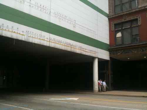
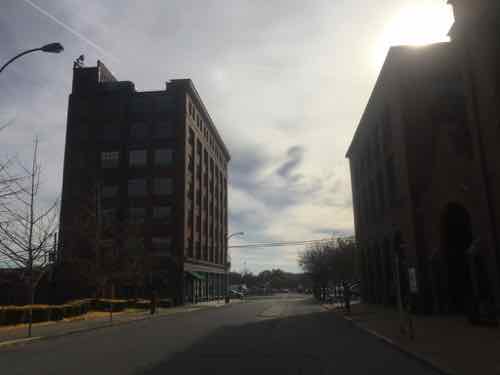
Ten years ago today work began on reversing a mistake that had been in place for 25 years prior — the pedestrian bridge over Washington Ave created a dark environment at the sidewalk level.
Taken two days before the bridge bash you can see how dark it was underneath
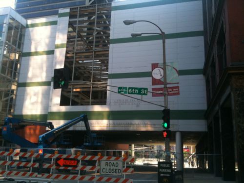
The “Bridge Bash” event started with comments from numerous white men, followed by Mayor Slay operating the wrecking ball, pyrotechnics made breaking glass a little more exciting. Here’s the video I uploaded from the scene — the action starts at 8:45.
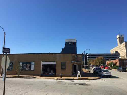
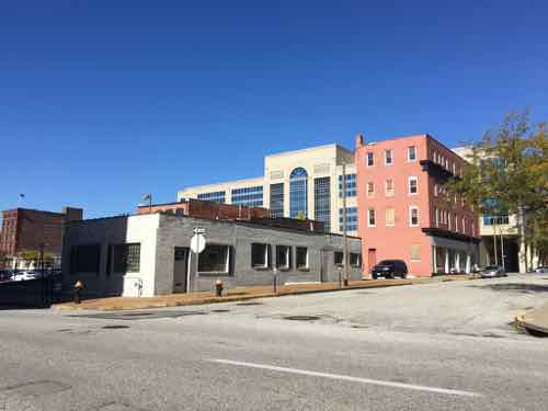
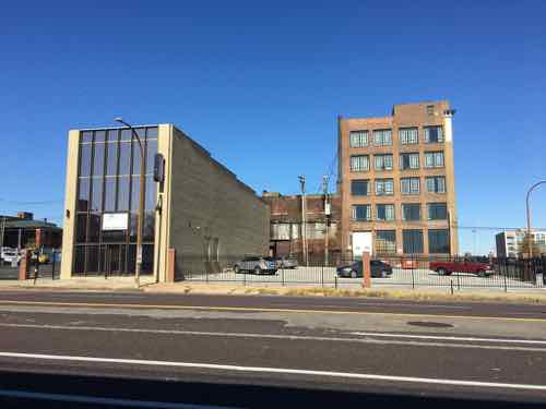
St. Louis Centre was part of the ‘bring the suburbs to the city’ movement. The inwardly focused mall was a killer to the sidewalks downtown — especially under the Washington & Locust wide bridges connecting to Dillard’s & Famous-Barr, respectively.
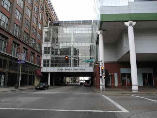
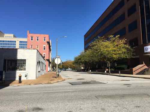
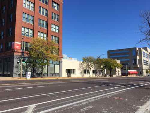
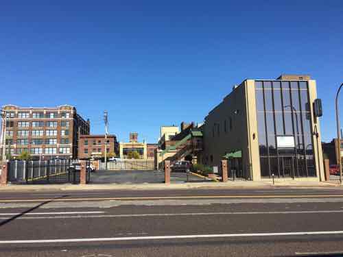
Looking west from 6th Street May 2010Looking east along Washington Ave from 7th, February 2006Same view after the bridge was removed
Removal of this oppressive bridge and facing the ground level retail of the MX (formerly St. Louis Centre) has done wonders for this part of downtown. If only we hadn’t wasted decades trying to be like the burbs.
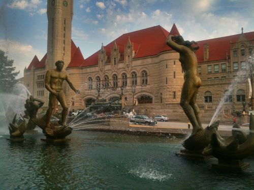
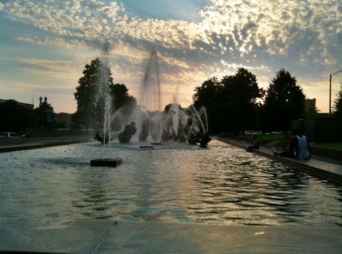
Eighty years ago today the nude sculptures in the Aloe Plaza fountain across Market Street from St. Louis Union Station were formally unveiled. The other figures in the fountain were unveiled the previous night.
Carl Milles’ ‘Meeting of the Waters’ is the focal point of Aloe Plaza
Artist Carl Milles attended, Edith Aloe (1875-1956) did the unveiling.
Edith Aloe, 64, was the widow of the man who two decades earlier pushed to raze buildings across from St. Louis Union Station — former president of the Board of Aldermen Louis P. Aloe (1867-1929). Mrs. Aloe was instrumental in Milles being selected to create the fountain.
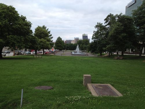
Since then the plaza has largely remained unchanged. A wheelchair ramp was added years age to access the plaza from Market Street and a decade ago awful spot lights were installed. Why awful? The resulting light from overhead is so bright it overpowers the lighting within the fountain — prison yards likely have similar lighting schemes. Incredibly uninviting.
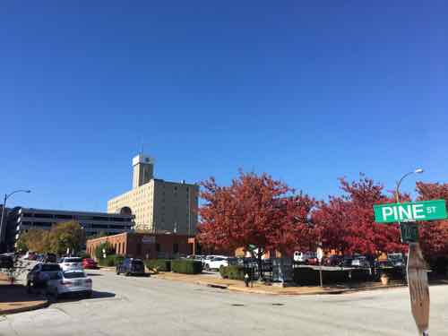
Aloe Plaza across from Union Station cleared away “undesirable” buildings, followed by decades more demolition creating the largely failed Gateway Mall
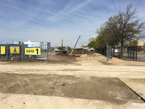
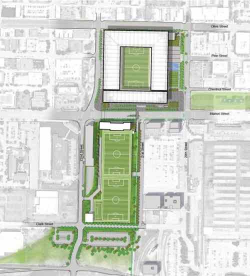
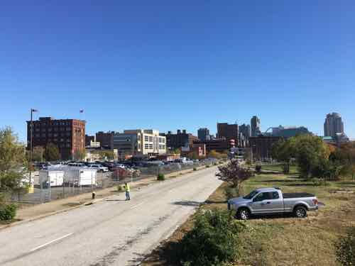
The view above is looking West from 18th Street in June 2013. Right now the new Major League Soccer (MLS) stadium is being built on the West side of 20th Street.
Looking West from Aloe Plaza as crews remove the old highway interchange and begin work on the stadium. April 24, 2020
The stadium will give the Gateway Mall a proper terminus, but will Aloe Plaza remain unused, unchanged?
We should begin thinking & talking about a major renovation of the 2-block long plaza. The fountain & sculpture are sacred, in my view. Everything else is negotiable.
Why?
Union Station has made major investments in replacing the failed train shed mall, uh, festival marketplace with an indoor aquarium & outdoor Farris wheel. The MLS stadium is an even bigger investment. Both will draw huge crowds. Aloe Plaza is located between them.
Aloe Plaza was designed as a tranquil passive space in a growing city of 800k plus. 2011 photo
The first question is if the space should remain passive or if it needs activity areas?
Obviously I think it needs a redesign with opportunities for programmed activity. But what activities? Would programming & activities compliment or distract from the fountain?
Too bad the Gateway Mall Advisory Board was disbanded.
— Steve Patterson
SOURCE: May 11, 1940 (page 3 of 16). (1940, May 11). St.Louis Post-Dispatch (1923-2003) Retrieved from link.
PS: The 1940 census shows 64-year old widow Edith Aloe living in the Park Royal Apartments, 4605 Lindell Blvd. — apartment 414. Her rent was $125/month. Her 24-year old single maid Evelyn Iffrig also lived there. Evelyn married in 1946, so Edith would’ve needed a new maid. Evelyn died in 1995, her husband lived until 2006.
In parts 1-3 I looked at the areas south, north, and east of the coming soccer stadium. Today a look at the area west of the new stadium.
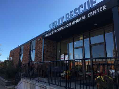
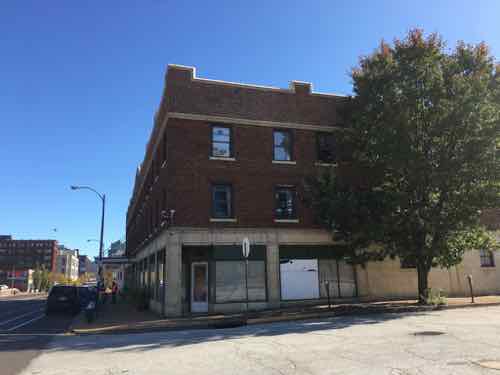
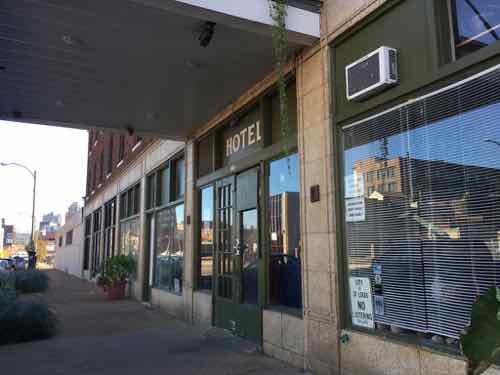
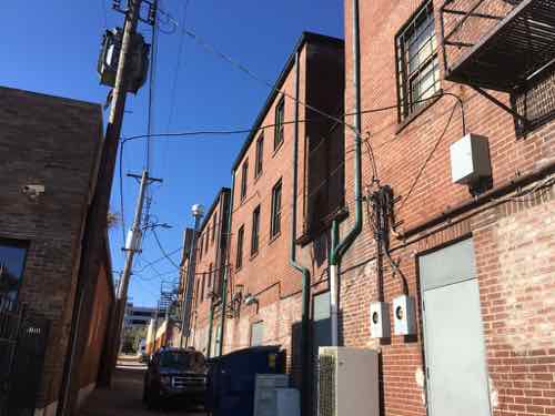
The site plan has the stadium at the top, bounded by Olive on the north, 20th on the east, and a new 22nd Street on the west. Pine will be closed between 20th and 22nd. Team offices and two practice fields will be south of Market.This image shows the two block long section of Pine that’ll be vacated. Surveyors were working the day last fall that I was out photographing.The tallest structure in the area west of the stadium is the Pear Tree Inn, 2211 Market Street. Built in 1965 it’s unfortunately set back from Market Street in a very suburban manner. There’s no pedestrian accessible route…just an automobile parking lot. I’d like to see the space between the tower and street infilled over time to urbanize Market Street. It seems wasteful to raze the entire property and start over, but that would likely produce a better product — good for another 50+ years.The back of the Pear Tree, at 23rd & Pine, a low rise parking garage also built in 1965. The site is a full city block, it is underutilized.Across Pine from the Pear Tree Inn’s garage is a building type more typical of the area — boring single story infill. 2229 Pine was also built in 1965.Across 23rd from the Pear Tree garage is a little warehouse building from 1948, currently used as a resale shop.View of the northwest corner of 23rd & Pine, as seen from the southeast corner.The St. Louis American newspaper leases the 1964 one-story building at 2315 Pine.Across Pine is Stray Rescue at 2320 Pine, built in 1964. They own this building and the 1948 warehouse shown earlier. Owning their building will help insulate them if demand for the area increases dramatically in the coming decades.Moving north to Olive we have the Firestone tire & auto at 2310 Olive — built in 1964 (seeing the pattern?)On the southeast corner of 23rd & Olive is the Lincoln Hotel, 2222-2230 Olive. Built in 1928, this is the oldest structure directly west of the new stadium.The Lincoln isn’t a fancy boutique hotel, it’s an SRO — single room occupancy. I fear the new stadium will put economic pressure on the owner to turn it into an expensive hotel, reducing the number of SRO rooms in the city.The Lincoln as seen from the rear alley.
It appears in the 1960s nearly every building west of the new highway ramps was razed and replaced. Thankfully they left the street grid, though Pine is one-way westbound to Jefferson.
This couple of blocks of Pine between the new stadium at 22nd and Jefferson will need to be returned to 2-way traffic. This will need to include a signal change or removal at Jefferson — likely planned as part of the changes to Jefferson being made to help workers get from I-64 to the new NGA West headquarters being built at Jefferson & Cass.
I suspect the west side of the stadium along 22nd will be the back side, but maybe those functions will be part of the underground access. Hopefully it’ll be presentable.
Expect the area bounded by 22nd, Market, Jefferson, and Olive to look very different 30+ years from now, maybe much sooner.
Today I continue my detailed look at the proposed Major League Soccer (MLS) stadium site plan and surroundings. In part 1 I looked at the stadium and practice fields to the south of Market Street. In part 2 I looked at the need for a pedestrian crossing at 21st & Olive, plus the development potential north of Olive.
The planned MLS stadium (top) would be bounded by Olive (top), a new 22nd Street (top left), Market Street (center), and 20th Street (top right)
Today I’ll look at the area east of the stadium, including 20th Street itself. As you can see above, the stadium is set back from 20th Street to create an urban plaza for events. The problem is the other side of 20th isn’t urban at all. It’s either an open plaza (Aloe Plaza) or surface parking.
Aloe Plaza across from Union Station cleared away “undesirable” buildings, followed by decades more demolition creating the largely failed Gateway Mall. This 2013 view is looking west from 18th Street.Meeting of the Waters by Carl Milles.
Parking lanes are fine if the corners are “bulbed” to reduce crossing distances, but unacceptable if they’re marked as “no parking.” If the outside parking lanes aren’t going to be used for parking then the space needs to be sifted from unused roadway to pedestrian space. The site plan looks like it is trying to reduce crossing distance, hopefully we’ll get some detail soon on their plan for 20th.
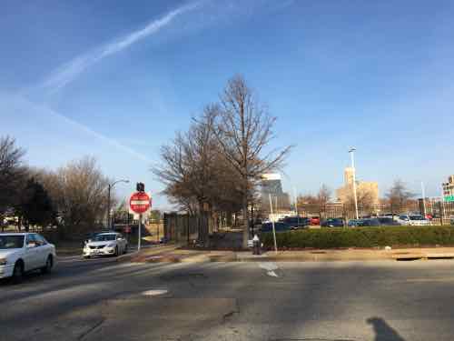
Looking West from 20th & Chestnut in this 2016 image shows how wide 20th is — 2 drive lanes plus 2 parking lanes.
A plaza across from a plaza. I’d like to see Aloe Plaza get completely redone — the 1939 Meeting of the Waters sculpture/fountain is the only thing significant about the two block space. At the 20th Street end I’d place a new park building with a restaurant and rooftop dining. This would help create a sense of urban feel at 20th & MarketChestnut. Perhaps the space isn’t one restaurant, but several with shared dining space? A way to serve as restaurant incubator space for up & coming chefs? A 2-story building is needed facing 20th between Market & Chestnut — food makes the most sense.
Back to 20th & Chestnut, specifically the block on the NE corner.
Looking north from 20th & Chestnut — fenced surface parking for tenants of apartments in an old historic building facing Pine.The apartment building is the only structure left on the entire city block, 19th Street was even vacated for use by the newer building in the block to the east.
The only way to urbanize this is the same as the west end of Aloe Plaza — at least a 2-story building. This wouldn’t need to be deep, it could be a shallow liner building.
There’s nothing that jump-starts a place people will love to walk like liner buildings. It doesn’t matter whether you’re helping a place recover from sprawl or building a new neighborhood center; liner buildings get far more bang for the buck and make things possible today that would be completely impossible until years in the future using conventional mixed-use building types.
Liner buildings are very thin buildings that line the edge of a street, plaza, square, or other public space. They can be as little as 8-10 feet deep for retail uses and 12-14 feet deep if they include residential uses. They may be a single story high, or they may be several stories tall.
Liner buildings are a great way to build affordable housing, especially for those who don’t have a car.
Ideally the apartment owner would build underground or above grade structured parking for their tenants to make much better use of the large site. That said, no open parking garage should face Aloe Plaza — it should be closed with mechanical ventilation if across from the park. My guess is they won’t want to block views from the apartment’s windows. It could be great from an urban perspective, but would be challenging for a private for-profit owner.
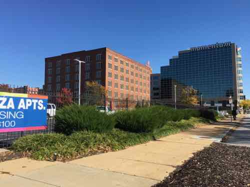
The block to the north (bounded by Pine, 20th, Olive, and 19th) will likely see the most change in the next 10-20 years.
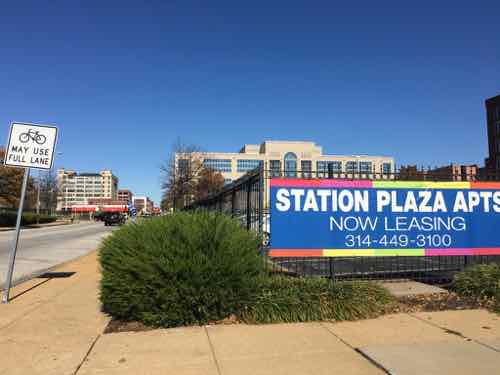
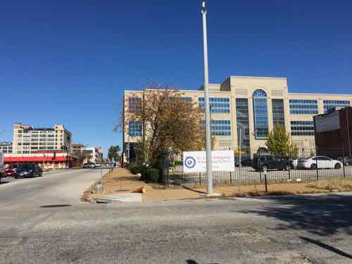
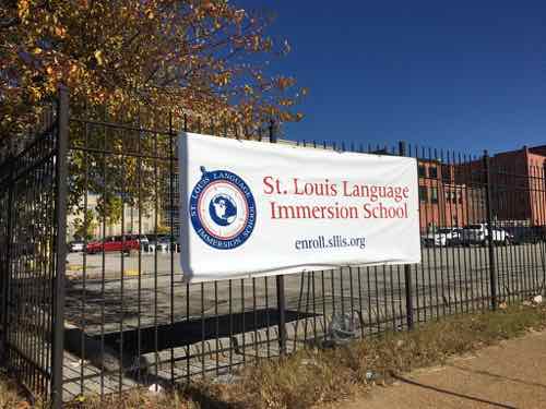
Looking north from 20th & Pine. Police headquarters is in the background, across Olive.The banner marks the fact the lot is now owned by the St. Louis Language Immersion charter school. The school recently moved into a building in the next block east.The rest of the block is a few smaller buildings on the east end.Looking north at 19th, from PineThis former office building turned charter school was built in 1987. Another entrance on Olive doesn’t have steps
Like the other directions, there will be some who wish to raze & pave, others who want to go up. These are mutually exclusive as surface parking devalues land to the point it doesn’t pay to build up nearby.
The area to the east includes areas that need development, but current ownership means that might not occur for many years, if ever. The next part will look at building back 22nd Street and the blocks to the west of the proposed soccer stadium.
Two weeks ago I began a critical look at the site plan for the proposed Major League Soccer (MLS) stadium with a look at the area to the south of Market Street(see Part 1). This area includes practice fields with parking below, new streets, and development sites that have been highway ramps for decades.
Today I’ll look at the area to the north of the stadium site.
Site plan
The north side of the stadium will border on Olive Street, left to right on the top of the site plan above. The blocks facing Olive and to the north are very different than the area south of Market. This area contains both rehabbed buildings, but also vacant parcels just waiting for new infill construction.
Olive Street is major east-west corridor, connecting downtown to midtown and beyond. The stadium will have a two block-long facade along Olive Street, from 20th to 22nd. So let’s begin in the middle — at 21st Street.
Looking north at 21st & Olive from the mid-point of the proposed MLS stadium. The Schlafly Tap Room is on the left, offices on the right, lofts in background at Washington Ave. Click image to view area in Google Street View
The site plan shows a crosswalk at 21st Street to the south, across Market Street. Given this stadium is surrounded by an urban street grid a crosswalk every block makes perfect sense. Unfortunately, the site plan doesn’t show a crosswalk at 21st Street, across Olive Street.
Will people coming to the stadium from the north go to 20th or 22nd to cross 4 travel lanes of traffic on Olive? No, they won’t. Those coming toward the stadium from the north on 21st will attempt to cross at 21st. If this intersection isn’t designed to stop traffic for pedestrians people will get hit, some killed. Why would anyone use 21st Street to head south toward the stadium?
21st & Locust looking south toward Olive and center of future stadium21st & Olive, looking east toward 20thA former Imo’s Pizza on the NW corner of 20th & Olive.This 2-story building at 2011 Olive was built in 1919.Two 2-story buildings on Olive between 21st & 22nd have been renovated into offices.
There are lots of lofts, restaurants, and such in the three blocks between Olive & Delmar. All the streets from 20th to 23rd connect to Olive, it’s reasonable to expect people to use all these streets to walk toward the new stadium. Some may come from lofts/apartments, with others parking on the streets.
There is also vacant land in this area, some state-owned. Ideally new multi-story residential buildings will fill in the gaps over the next 10-20 years. Ideally St. Louis would limit/ban surface parking in this area. Businesses like Schlafly’s Tap Room already has surface lots occupying more land than their building. A shared-use parking garage with an active ground floor (restaurant, retail, etc) with enclosed walls & ventilation would be acceptable in this area.
Hopefully the non-contributing single story buildings between Olive, Delmar, 18th, & Jefferson will be replaced with two to five story structures. If this area is to become a thriving urban neighborhood it needs to keep surface parking to a minimum. It’s already bad along Olive heading west toward Jefferson.
The apartments in the background use the NW corner of 23rd & Olive for parking.The building at 2209-11 Olive, built in 1906, has its own parking. Not sure when this building was “modernized”.The building on the NE corner of 23rd & Olive was built in 1922.At the NW corner of 23rd & Olive a large surface lot for the building on Locust detracts from Olive’s importance as an urban corridor.
No doubt the area north of Olive will change once the new stadium opens. It remains to be seen if this change will be positive, negative, or neutral. Without a consensus on the future direction, enforced through form-based zoning, my bet is on the negative.
AARP Livibility Index
The Livability Index scores neighborhoods and communities across the U.S. for the services and amenities that impact your life the most
Built St. Louis
historic architecture of St. Louis, Missouri – mourning the losses, celebrating the survivors.
Geo St. Louis
a guide to geospatial data about the City of St. Louis