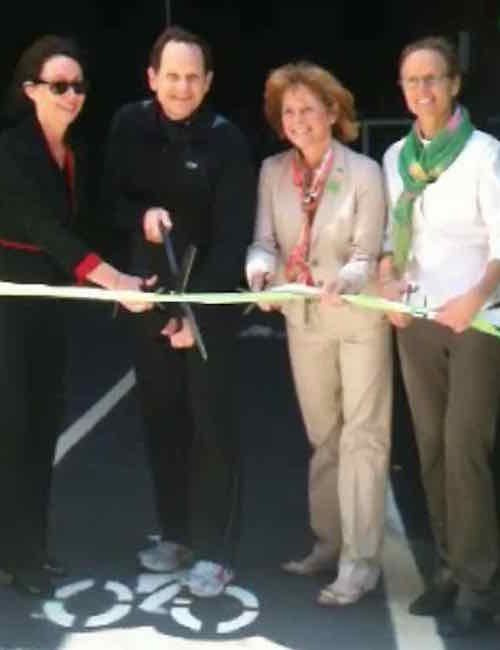
Five years ago today the ribbon was cut on a new concept in St. Louis — a bike station. A place where a bike commuter can shower and change clothes before going into his/her office.
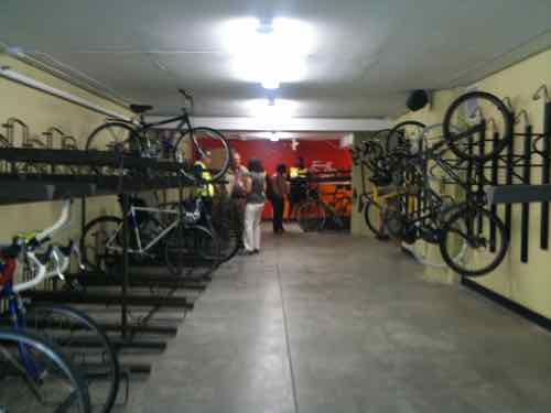
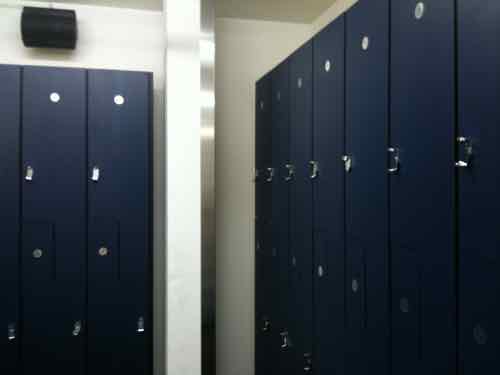
The ribbon was cut just after 10am on April 28, 2011Then we got to go insideSecure area for storing your bike during the dayLockers and showers are in the back,
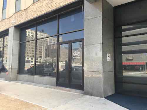
The Downtown Bicycle Station is a project of Trailnet, which is located upstairs in the same building.
The Downtown Bicycle Station offers secure 20-hour access and features over 120 bike racks, showers and locker rooms, and is ideal for bicyclists commuting to work or looking to exercise on their lunch break.
Memberships are $20/month or $150/year. Corporate memberships are $1,000/year for 10 users. A day membership is $5 — enter via Big Shark Bikes next door (limited to their hours).
Bike facilities have increased in these last five years, the data center at 210 N. Tucker includes a secure bike parking area inside the building.
Hopefully more and more young people will be attracted to high tech and other jobs downtown — walking, biking or riding public transit to/from work.
The non-scientific Sunday Poll asked about transportation finding:
Q: Current state & federal fuel taxes aren’t enough, pick two alternatives:
Index fuel taxes to inflation 21 [32.31%]
Tax miles driven 20 [30.77%]
Tax roads (tolls) 16 [24.62%]
Tax cars (registration, etc) 6 [9.23%]
Tax barrels of oil, not gasoline/diesel 2 [3.08%]
Unsure/No Opinion 0 [0%]
As you can see, three got double digit responses. I personally like all three. Let’s look at some pros & cons of each:
Index fuel taxes to inflation
PROS: simple, easy to understand. An improved version of what we’ve had for decades
CONS: electric vehicles don’t contribute to road maintenance
Tax Miles Driven
PROS: fair to all drivers (internal combustion & electric), drive more — pay more
CONS: privacy concerns about monitoring devices, fraud prevention a challenge
Tax Roads
PROS: no privacy issues
CONS: those who drive non-highways wouldn’t pay
Conclusion
The way we’ve been funding transportation hasn’t worked for a long time. Going decades with raising the fuel tax is foolish — it ignores inflation. We’ve also built too many roads and not enough public transit.
We can get out of this, but it involves changing the way things are done. We must recognize inflation and technology requires us to change. The first step is to raise state & federal fuel taxes and to index them to inflationism. The next step is to look at way to document miles driven that do need create privacy concerns.
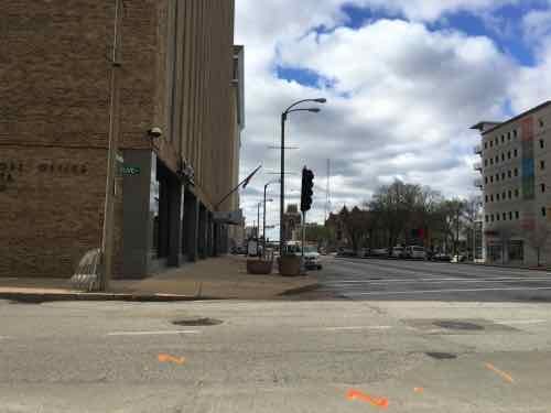
The intersection of two major downtown streets — Olive St & Tucker Blvd — is poorly designed for pedestrians. The are a number of problems, but this post is about poor communication to pedestrians that puts them in harms way. Specifically, vehicles that get a left-turn arrow from Tucker to Olive are on a collision course with pedestrians that don’t realize cars will be turning left into their path.
Vehicles traveling Northbound & Southbound on Tucker each get a dedicated left-turn lane onto Olive, Westbound & Eastbound. respectively. Each gets a left arrow, so drivers assume they have the right-of-way. “What’s the problem?” you ask. Pedestrians can also think,due to a lack of pedestrian signals, they have the right-of-way.
At the start of the cycle SB vehicles on Tucker get a green light, left onto EB Olive get an arrow.
After a bit the arrow goes away and NB traffic gets a green.
Later the SB traffic gets a red and those going NB get a left arrow onto WB Olive.
Pedestrians & vehicles can’t both have the right to be in the same place at the same time!
You might be thinking “pedestrians should just look at the vehicle signals to know when it’s OK to cross Olive.” For SB pedestrians on the East side of Tucker & NB pedestrians on the West side of Tucker the vehicle signals don’t indicate vehicles have a left-turn arrow.
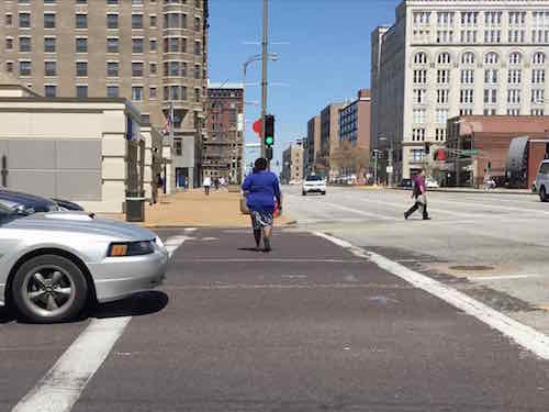
SB on the East side of Tucker we can’t see the signal on the right — it’s turned toward cars in the left-turn lane.NB on the West side of Tucker we see a woman crossing with the green. What you can’t see ifs the left-turn lane has an an arrow to turn right in her path!
So the first should be a relatively easy to get to achieve minimally acceptable communications — turn the signal head so pedestrians can see the green & left arrow. But the second isn’t as simple.
If possible, the bare minimum would be to change the signal head so it includes an arrow. The problem with this is the arrow might suddenly appear as a person is halfway across Olive. This really needs a pedestrian signal with a countdown timer. Another option is to redo the signal configuration — allow both left turns to happen simultaneously — then give them a red while NB/SB vehicles get a green.
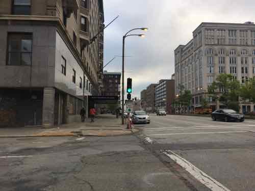
Ok, so one intersection — fix it and move on, right? If the woman in blue in the 2nd image keeps waking North she’ll encounter the same conflict one block up at Locust St!
As at Olive, the signal is green but pedestrians walking North don”t know a left-turn arrow is going to send vehicles into their path.
These are just a few examples of the dangers designed into our auto-centric system. I’ve been through these intersections many times, but had never noticed the conflict — because I’m familiar with the vehicle flow. A downtown visitor, however, might not be confused, or worse, became a pedestrian death statistic. If a pedestrian is hit by a left-turning car in these examples it’s no “accident” — it’s by design! Sadly, these conflicts have likely existed for years — perhaps even decades!
Every intersection in the city/region needs to be critically evaluated to catch conflict by design. Prioritize then and then set about correcting them. I pointed out the conflicts at Olive to St. Louis’ new Bike/Pedestrian Coordinator, Jamie Wilson, last week as we walked/rolled to lunch.
I’ve volunteered to:
Start a custom Google map where I can catalog problems I encounter.
Go out with him and other, upon request, to demonstrate the problems with out pedestrian infrastructure
Below is time-lapse video looking South and then North
At state & federal levels, money for transportation infrastructure is running out; fuel taxes haven’t been raised in years, vehicles are more fuel efficient, electrics are set to go mainstream, etc. States, like Illinois are looking at other ways to fund construction & maintenance:
There is a proposal in Illinois for the state to put a device on cars to see how many miles citizens are driving.
The state would take that data to use in order to charge a tax on drivers depending on miles driven. It’s all in an effort to make money because the state is losing out on gas tax revenue thanks to more fuel efficient cars on the road. (KMOV)
Other states are testing the same idea, driving more miles costs you more. Which brings us to today’s poll — using alternatives listed in the WSJ:
The poll answers are in random order, open until 8pm.
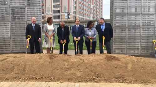
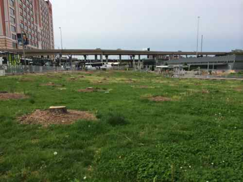
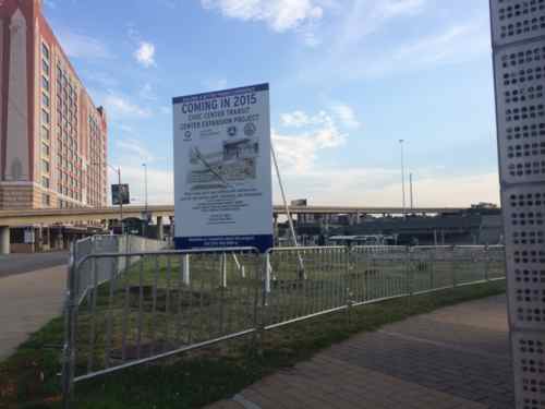
The Civic Center MetroBus Transit Center, at 14th & Clark, is now closed for the next 18 months. It will be redone to handle more buses — and longer buses.
Tuesday 4/19 dignitaries each tossed a shovel of dirt to kick off the new project.
Construction will expand the Civic Center Transit Center and triple the current number of bus bays, which will allow MetroBus passengers to connect with all of their bus routes inside the transit center and out of vehicular traffic on 14th Street. A new building will also be constructed on the site that will feature new passenger amenities, including public restrooms, an indoor waiting area, digital boards with MetroBus arrival times, a concession area and a Metro Public Safety substation.
“It is our duty to ensure that residents, workers, tourists and visitors can travel safely and efficiently throughout the bi-state region,” said Ray Friem, Executive Director of Metro Transit, “and that they enjoy the best possible transit system and experience we can provide.”
Metro successfully secured federal funding to rebuild the Civic Center Transit Center, and those funds will support 80 percent of the total project cost of $10.5 million. “The competition for federal transit dollars is intense,” said Mokhtee Ahmad, Regional Administrator for the Federal Transit Administration, Region VII. “Bi-State Development and Metro are to be commended for being so diligent and fiscally conscientious in maximizing federal transit funds to get taxpayers the highest return on their investment.”
b
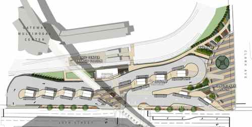
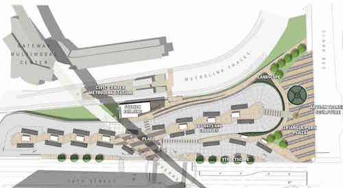
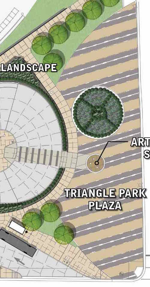
The design has changed.
Latest plan, click image to view larger PDF on Scribd
The ramp down to the MetroLink platforms is much more direct — but steeper than previously drawn. The other changes are at the North end. There’s now an accessible route from the center bays/canopies to Triangle Park. The “park” is also different — the metal panels (shown in first photo, above) will go away. A 2nd sculpture is shown right in front of the accessible route — a potential problem.
Close-up of Triangle Park
I also don’t get having a new sculpture next to the existing one.We’ll see how it turns out in 18 months.
AARP Livibility Index
The Livability Index scores neighborhoods and communities across the U.S. for the services and amenities that impact your life the most
Built St. Louis
historic architecture of St. Louis, Missouri – mourning the losses, celebrating the survivors.
Geo St. Louis
a guide to geospatial data about the City of St. Louis