Home » Transportation » Recent Articles:

Metro Makes Long-Needed Changes at 18th & Clark, Still Violates ADA

In a couple of weeks Metro’s new North County Transit Center will open, so many MetroBus routes will see major changes:

Metro’s quarterly service change on March 14 will impact the operations of 48 MetroBus routes in the St. Louis metropolitan region, including the introduction of nine new MetroBus routes and discontinuation of service on eight routes. This service change will also introduce a new and completely redesigned MetroBus service plan for North St. Louis County, made possible with the opening of the new North County Transit Center in Ferguson, Missouri on March 14. (Metro)

On that same day, changes will take place in downtown (technically Downtown West):

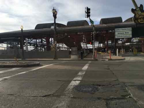
The Civic Center Transit Center is scheduled to be closed down for construction activity shortly, at a date to be decided. In advance of the closure, Metro has prepared bus stops at 18th Street & Clark Street, adjacent to the Union Station MetroLink, to provide the same system connectivity. 

The routing and schedules of the routes serving the Civic Center Transit Center have been modified to serve 18th Street & Clark Street to ensure the same connections with the other MetroBus routes and MetroLink at Union Station instead.

Please note that till the closure of the Civic Center Transit Center, these routes will continue to serve the Civic Center Transit Center. Public Announcement of the closure of the Civic Center Transit Center will be made in advance of the event. (Metro)

The following MetroBus routes will change to include 18th & Clark.

  • 10 Chippewa
  • 32 ML King-Chouteau
  • 41 Lee
  • 73 Carondelet
  • 80 Park-Shaw
  • 94 Page
  • 97 Delmar
  • 99 Downtown Trolley
  • 40X I-55 Express
  • 58X Twin Oaks Express
  • 410X Eureka Express

When I need to catch the #10 Westbound I do so at 16th & Olive, but starting March 14th it’ll use 18th rather than 14th Street. Same goes for the #97  — I usually catch it at 16th & Washington but it’ll turn on 18th.  Those who ride the #94 & #97 to Washington & 14th, then catch the #99 Downtown Trolley to take them the rest of the way into the Central Business District (CBD), will need to figure out an alternates. Perhaps catching the Trolley bus at Civic Center/18th & Clark? That’ll require more time though — years ago more bus routes entered the CBD.

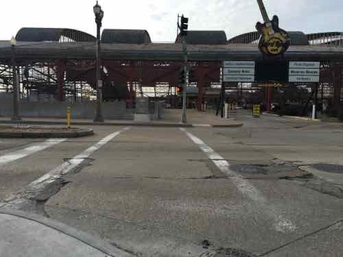
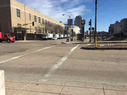
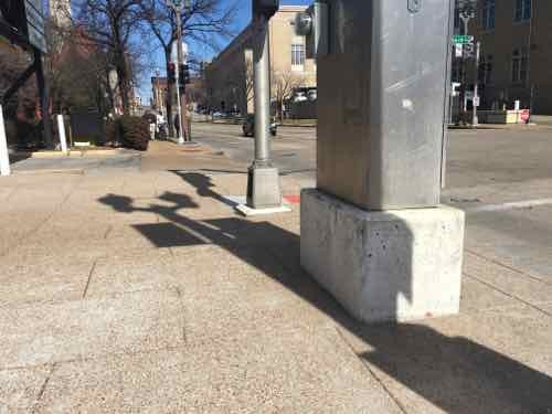
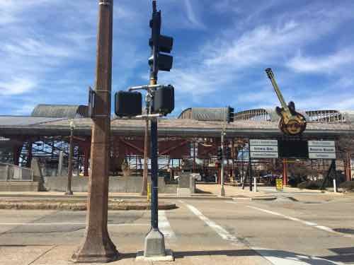
For a few months now I’ve been watching the changes at 18th & Clark. I posted about the upcoming Civic Center changes in 2014, see Civic Center Transit Center Sans Trees, Awaiting Redo.

Before I get into the recent changes along Clark I want to show you the before conditions, in October 2011 & August 2012.
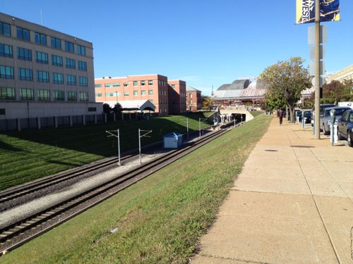
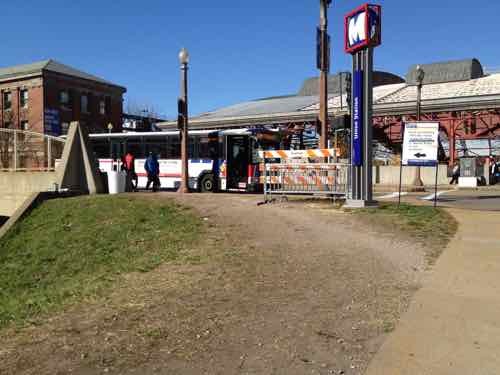
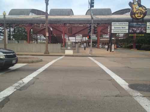
Looking west toward the Union Station MetroLink Station from 16th & Clark, October 2011.
At 18th pedestrians had worn a more direct path since MetroLink opened in 1993, October 2011
The crosswalk to Union Station led directly to a curb, those of us in wheelchairs had to go outside the crosswalk and use the auto exit, at right -- a clear ADA violation for years, August 2012
The crosswalk to Union Station led directly to a curb, those of us in wheelchairs had to go outside the crosswalk and use the auto exit, at right — a clear ADA violation for years, August 2012

Ok, so now you’ve seen the before. In December last year I began seeing work going on so I braved the cold one day to get some pics:
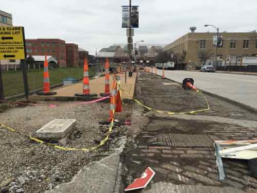
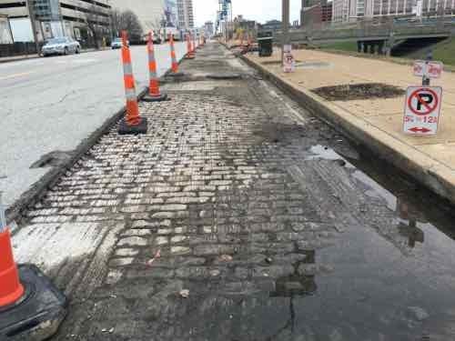
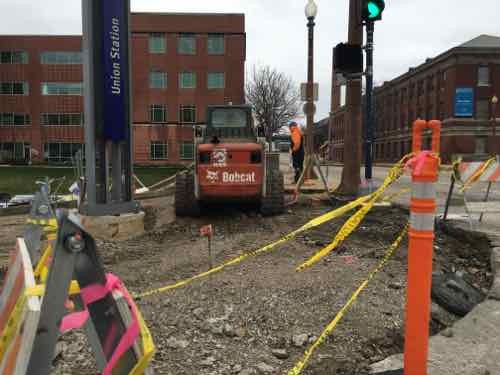
The asphalt in the parking lane was removed, sidewalk & curb ramp at 16th also removed, December 2015
The old bricks were visible, street trees gone, December 2015
The corner was completely opened up, forms were placed for new concrete, December 2015
Looking West across 18th you can see the curb & sidewalk have been removed, December 2015
From the West side of 18th looking back, December 2015

I was encouraged seeing the West end of the crosswalk completely removed — a fresh start so it’ll be done correctly! I returned a month later, in late January:
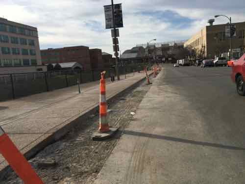
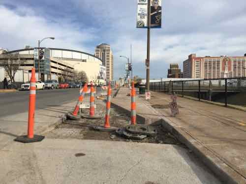
Now we can see the sidewalk has been widened, replacing half the parking lane, January 2016
About halfway between 16th -18th the extra sidewalk narrows to the original width, January 2016
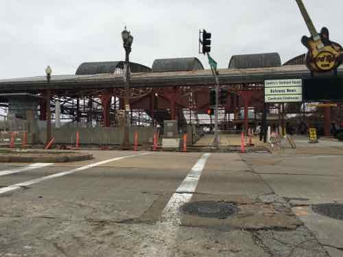
Looking across 18th we see at the end of the crosswalk --- A NEW CURB! WTF!?!
Looking across 18th we see at the end of the crosswalk — A NEW CURB! WTF!?! January 2016
Pedestrians taking the direct route from MetroLkink East across 18th, with the ramp on the left, January 2016

I returned again, a month later, on February 26th:
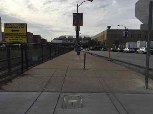
The widest park, near 16th
The widest park, near 16th, February 2016
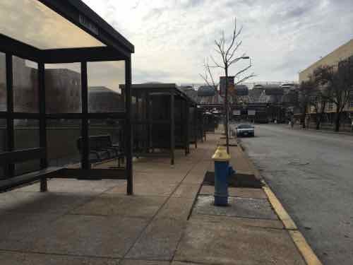
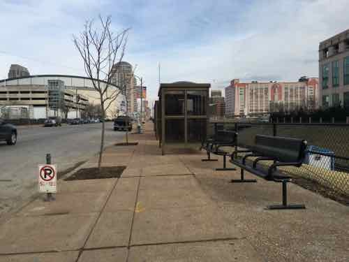
Temporary bus shelters added in the narrow section makes it tight, February 2016
There are new benches in places , February 2016
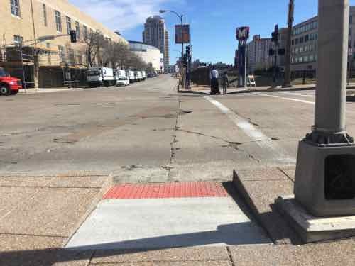
Crosswalk not yet changed to include the new curb ramp, February 2016

The ramp location behind the crosswalk is a head scratcher, for sure. I resisted the urge to post it to social media — opting to wait until the project is closer to completion.  I even went back yesterday to see if the crosswalk had been changed. It hasn’t. I also discovered another problem: pedestrian signal location.
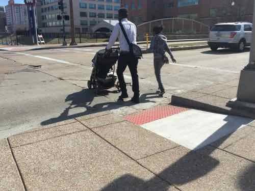
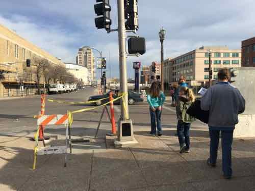
I arrived on the West side just as people pushing a stroller used the ramp to cross 18th
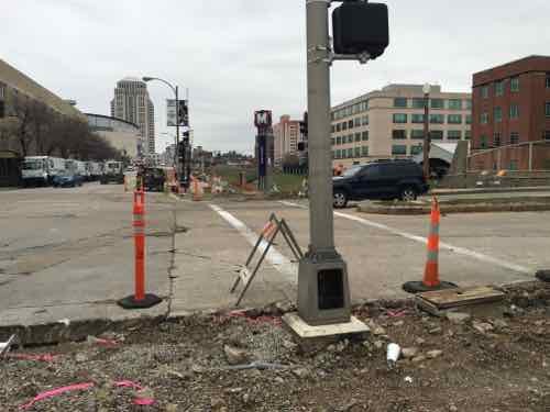
That's when I noticed the pedestrian signs, far right, wasn't visible. The ramps also aren't aligned, but we already knew they wouldn't.
That’s when I noticed the pedestrian signs, far right, wasn’t visible. The ramps also aren’t aligned, but we already knew they wouldn’t.
The pedestrian signal is visible only when way South pf the ramp & crosswalk
From the same spot you can see the ramp. My chair is very fast so I was able to wait for the walk signal then move to the ramp & cross -- but not everyone can move so quickly
From the same spot you can see the ramp. My chair is very fast so I was able to wait for the walk signal then move to the ramp & cross — but not everyone can move so quickly
From the East side you can see the back of the pedestrian signal and how it doesn't relate to the other side
From the East side you can see the back of the pedestrian signal and how it doesn’t relate to the other side

The best words that come to mind are gross incompetence. Both sides were completely opened up — all new concrete. That was the time to move pedestrian signals so they align with the crosswalk, to build the new ramps so they also align. I’m not sure if St. Louis’ new bike-pedestrian coordinator reviewed this, but other civil engineers did see it on paper. This is yet another thing making me realize I need to live in another city.

— Steve Patterson
 

Another Local Example of In-Street Light Rail

A couple of weeks ago I posted about a local example of light rail in center of a street, which was largely misunderstood. Objections to my Meramec Ave & Forest Park Parkway example included:

  • Cars could never cross here
  • Pedestrians have no reason to cross here
  • Several cities have light rail systems without concrete walls, have pedestrian crossings

True, true, and true. No argument. My point was many existing cross streets would no longer be able to cross streets like Natural Bridge or Jefferson if we built light rail in the right-of-way. Places to cross by car, bike, or foot would be limited.

Some of the examples people mentioned included Minneapolis and Houston. I have no personal experience with either so I turned to the internet.

Houston’s original Red Line, opened in 2004, had few obstacles. The tracks were in the street with very little dividing it from traffic (example).  Similar for their 2013 Red Line extension (example). The Green & Purple lines, opened in May 2015, are different. The Purple line has fences & barriers (example) but does provide pedestrian crossings between stations (example). Houston usually has 3-6 accidents per month, but had 17 in July.

Besides accidents, these can be slow. From 2014:

Residents of the Twin Cities greeted the opening of the new Green Line light rail link last month with joy and excitement, finally able to take advantage of a train connection between downtown Minneapolis and St. Paul. The 11-mile rail line runs through a relatively densely populated area, serves two business districts, and travels through the heart of a university.

It’s also alarmingly slow. Green Line trains are taking up to an hour to complete their journeys, and even optimistic schedules released by the local transit agency put running times at 48 minutes, or less than 14 mph on average.

Of course, the Twin Cities are hardly alone in their predicament. Recent transit lines elsewhere in the country feature similarly leisurely travel times. The new Houston North Line, for example, is averaging 17 mph. Los Angeles’ Expo Line is slightly quicker at 18 mph. Bus rapid transit and streetcar projects popping up virtually everywhere are often significantly slower. Only the Washington, D.C. Metro Silver Line, which will extend that region’s subway deep into the Virginia suburbs, will speed commuters along at an average of 32 mph. It will do so while only stopping at 5 stations, all of which will be located in the middle of expressways.

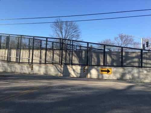
Our MetroLink, which operates in exclusive right-of-way, has an average speed of 24,7mph, according to Wikipedia. How does Metro achieve higher speeds? Less conflict points mean the vehicles can get to higher speeds between stations.  Which brings me to another local example of how Metro builds light rail to reduce conflicts/accidents. Forest Park Parkway & Des Peres Ave., prior to the Blue Line, was as signalized intersection allowing cars, bikes, and pedestrians to cross the busy roadway.

The intersection is still signalized  — and cars coming from the North can still cross here, as can pedestrians & cyclists. It’s roughly halfway between the Skinker & Forest Park stations — a mile apart.

Northbound traffic on Des Peres Ave can't cross the high-speed tracks
Northbound traffic on Des Peres Ave can’t cross the high-speed tracks
Cyclists & pedestrians must use ramps to cross over the tracks.

Anyone who thinks Metro St. Louis will build an in-street light rail system — operated at expected light rail speeds — with easy pedestrian crossings between stations is naive. It’s not going to happen — and it shouldn’t. St. Louis has enough pedestrian deaths as it is!

I think we should improve North-South public transit in the region, through the city.   I’m just looking at how Metro builds light rail and thinking it isn’t what people want.

— Steve Patterson


Autonomous Cars, Urban Planning, Public Transit

February 25, 2016 Featured, Planning & Design, Politics/Policy, Transportation Comments Off on Autonomous Cars, Urban Planning, Public Transit

Two weeks ago today I attended a Economic Club of Chicago luncheon — the guest speaker was Lex Kerssemakers, President & CEO of Volvo Car USA. His words got me thinking about driverless cars and the implications for cities in the future.

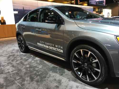
Volvo S60 with pedestrian detection at the 2016 Chicago Auto Show, click image to see Volvo's vision for autonomous cars
Volvo S60 with pedestrian detection at the 2016 Chicago Auto Show, click image to see Volvo’s vision for autonomous cars

In December Elon Musk said in two years a new Tesla will be able to drive itself.

As I began to research the topic I found varying thoughts on the future:

Whether self-driving cars reduce harmful emissions or the amount of land, energy, money, and other resources consumed by the transportation system depends largely on whether they reduce car ownership and driving. Optimists envision a future where driverless cars lead to a revolution in shared urban mobility. Why own a car when you can summon one to pick you up while avoiding the worries of parking, insurance, or maintenance?

In this scenario, the shift in ownership will also encourage payment based on miles driven and time of day rather than lumpy vehicle purchases, insurance fees, and parking. Instead of thinking about how much gas is in the tank, travelers will now consider the full marginal cost of a car trip when deciding whether to walk, bike, drive, or take transit. Transit service may also improve as a result of shared cars and minivans operating on fixed and flexible routes.

The biggest opportunity for improvement is in cities and neighborhoods where densities are currently too low to justify frequent bus or rail service. If shared or public, self-driving cars will dramatically reduce the demand for parking. Even privately owned vehicles will drop off passengers at front doors before driving off-site or behind a building to park, thus decoupling parking from other urban land uses. This would allow cities to dedicate more space to housing, shops, and offices, as well as stormwater management, street trees, and other sustainable features.

Pessimists, by contrast, see vehicle automation as one more technology that makes driving more comfortable and convenient and thus increases the amount that people drive. In this scenario, most households will own one or more self-driving cars, send their vehicles to run errands, circle to avoid paying for parking, and treat travel as if it had zero or very low time costs.

Many cars may become full-time mobile offices, whisking people between meetings, and the number of workers commuting between metropolitan regions will almost certainly increase. Making long commutes more productive will support the growing trend in long-duration commutes. Between 1990 and 2010, the proportion of commuters traveling more than 60 minutes and more than 90 minutes to work increased from six to eight percent and 1.6 to 2.5 percent, respectively.

Self-driving cars will also expand personal mobility for the third of the population without drivers’ licenses and the tenth of households without cars due to age, disability, low income, or preference. A demonstration video of one of Google’s prototype self-driving cars features a legally blind man riding to a Taco Bell in a self-driving vehicle.

Expanded access to cars may be particularly important for the nation’s elderly, many of whom live in and would like to remain in car-dependent communities. In this scenario, even if self-driving cars double existing capacity, this capacity will fill quickly — encouraging dispersed development and greater land consumption, which would further erode any sustainability benefits from increased efficiency. (When Autonomous Cars Take to the Road — American Planning Association)

No doubt there will be unintended consequences — both good & bad. Even as the technologies get closer to reality few cars on the road will be so equipped. It’ll be interesting to watch changes as more and more cars can drive themselves.

Further reading:

You can watch Lex Kerssemakers talk to the Economic Club of Chicago luncheon here — was on 2/11/16.

— Steve Patterson


A Decade Since Locust Street Returned To Two-Way Traffic

February 16, 2016 Downtown, Featured, History/Preservation, Planning & Design, Transportation, Walkability Comments Off on A Decade Since Locust Street Returned To Two-Way Traffic

A decade ago I was still living in South St. Louis, but I posted about a street I would move to within 2 years:

What a difference! Today I drove the full length of Locust Street from 14th west to Teresa (just shy of Grand). For the first time since I’ve lived in St. Louis, I was able to drive eastbound on Locust. It was like a totally different street!

Heading westbound from downtown you see new markings on the street when you are approaching 14th Street behind the library. The right lane becomes a right-turn only lane while the left lane is forward or a left turn. Ahead you can see temporary two-way signs that will likely stay around until people have adjusted to the change.

Driving down the street I noticed myself not wanting to drive as fast. With only a single lane in my direction and cars coming the other way in their lane it just didn’t seem like a high-speed escape route anymore. I knew if would feel different but it was more profound than I had anticipated. Locust St. Now Two-Way West of 14th!

That was ten years ago today — here are a few of images from that post:

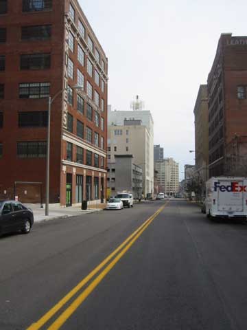
In November 2007 I bought a loft in the building on the left.
Looking West from 14th & Locust. This signalized intersection still doesn't have crosswalk markings. Click image to see recent post on crosswalks.
Looking West from 14th & Locust. This signalized intersection still doesn’t have crosswalk markings. Click image to see recent post on crosswalks.
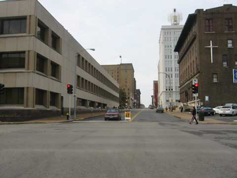
Looking West from 17th

I can imagine  how awful these last eight years would’ve been if Locust St had remained one-way Westbound. Hopefully we’ll get around to changing Pine & Chestnut back to two-way traffic West of Tucker (12th) – 14th.

— Steve Patterson


Local Example of Light Rail in Center of Street

For a while now I’ve been trying to convey how disastrous light rail in the center of Natural Bridge & Jefferson would be. I kept trying to think of a local example, but then the 2006 light rail extension in the center of Forest Park Parkway in Clayton came to mind.

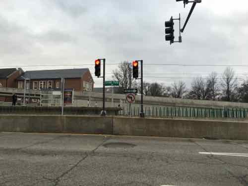
Southbound traffic on S. Meramec in Clayton see a wall and right turn only signs at Forest Park Parkway
Southbound traffic on S. Meramec in Clayton see a wall and right turn only signs at Forest Park Parkway. Click to view in Google Street View
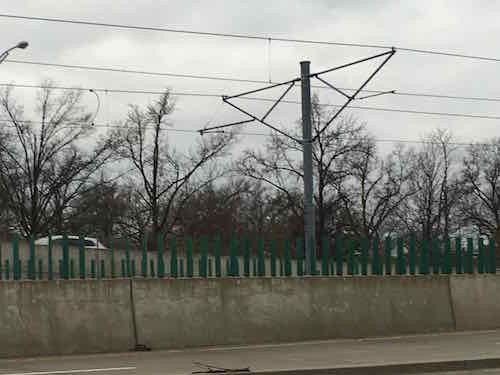
To achieve higher speeds,places to cross would be reduced through the use of concrete walls.

Such walls preventing pedestrians, bicyclists, and motorists and crossing the street except at a few points would be horrible for the surrounding neighborhoods. Do as I did — go to the interception of Meramec & Forest Park Parkway and see if you think that would be good for Natural Bridge or Jefferson.

— Steve Patterson


Advertisement


[custom-facebook-feed]

Archives

Categories

Advertisement


Subscribe