Home » MVVA Team » Recent Articles:

Park Over Highway Useful For Boulevard Concept (Updated)

Last week the public was updated on the CityArchRiver project. Much of the presentation (pdf) focused on getting to the Arch from downtown.

From the press release:

In December, the US Department of Transportation announced a $20 million TIGER grant for work on the I-70 corridor connected to the CityArchRiver 2015 plan. With matches and other resources, $57.2 million has been secured for work on I-70 connections surrounding the Arch Grounds making it possible for a critical piece of the project—the park over the depressed lanes of I-70 between the Old Courthouse and the Arch grounds—to move forward.

“Visitors will now have a tree-lined green space to traverse between the Old Courthouse and the Arch without a stair step in their way,” said Ed Hassinger, St. Louis area district engineer for the Missouri Department of Transportation (MoDOT). “Not a single stoplight or dangerous intersection will hinder visitors between Fourth Street in front of the Old Courthouse and the Arch Grounds.”

In his remarks to community members, Gullivar Shepard, associate principal for the lead design firm Michael Van Valkenburgh and Associates, identified the crucial role the park over I-70 has in achieving the project’s full potential.

“A park over the highway is probably the most important piece of the whole puzzle,” said Shepard. “It is a great big move, which humanizes and strengthens the link between the city and the new Museum entry, and a central tenet of what the original Arch designers, Eero Saarinen and Dan Kiley, wanted to achieve. Following on this move, projects on the Arch Grounds, especially the reflecting ponds and north gateway landscapes, will also enhance the experience of the Arch grounds for everyone.”

Work on the park over the highway is already taking place. MoDOT has solicited engineering proposals and expects construction to be completed in connection with the new Mississippi River Bridge well in advance of October 2015.

Despite this park over the existing highway I’m not giving up on the idea of replacing a mile stretch of highway with an at-grade boulevard. But the lid will be in the way of this vision? Shouldn’t we stop the lid and push for the boulevard? I’m not so sure. Here’s why.
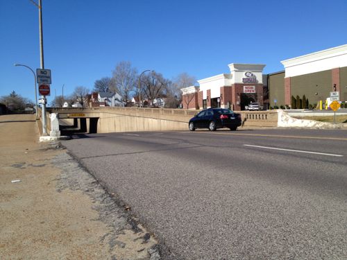
ABOVE: Chippewa goes under railroad lines to avoid conflict

The boulevard that replaces the highway can simply dip under the park just as Chippewa & Gravois go under railroad lines and how Forest Park Ave goes under Grand Ave. I still picture the elevated highway over Washington Ave/Eads Bridge removed.
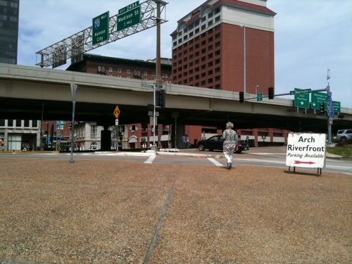
ABOVE: A woman leaving the Arch grounds faces the elevated highway lanes

To me the intersection at Washington is far more critical than at Market or Chestnut. The view entering downtown on the Eads Bridge without the elevated highway will be excellent, enough so I’m personally ok with the park space to connect to the proposed new Arch museum entrance.

UPDATE 1/30/2012 @ 11:45am CST:

My friends at CitytoRiver sent me a link to when they discussed this issue in late 2010 — click here to read it.

– Steve Patterson
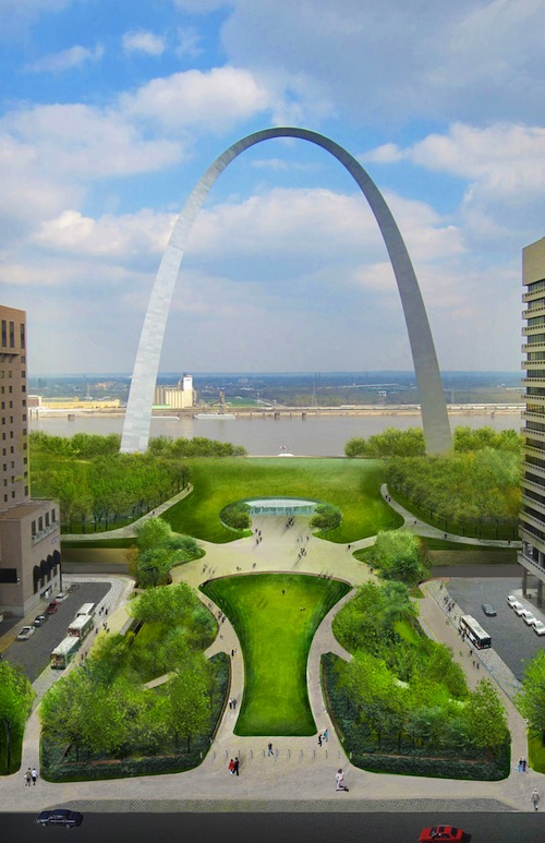
 

Gateway Mall Advisory Board Approves Kiener Plaza Concept

January 31, 2011 Downtown, Parks 12 Comments
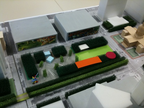
ABOVE: Model of Kiener Plaza

Last Wednesday the Gateway Mall Advisory Board held it’s quarterly meeting. On the agenda was a presentation from the firm Michael Van Valkenburgh Associates (MVVA), landscape architects.  The presenter was Senior Associate Nate Trevethan.

MVVA used the last 90 days to detail their vague proposal.  Here are some of the points that stood out to me:

  • No longer proposing underground parking to serve the Arch. Instead they want to fill up the many vacant parking garages downtown, including the two garages across Chestnut St from Kiener Plaza.  One new above grade garage may be built, but the site hasn’t been determined.
  • The distance from the Kiener garages to the new museum entrance facing the city is the same as from the current Arch garage to the north leg of the Arch.
  • Wayfinding will direct visitors to garages. This will put Arch visitors into downtown at the beginning & end of their Arch visit.
  • Pushing the “hallway” south so people can see past the Old Courthouse.
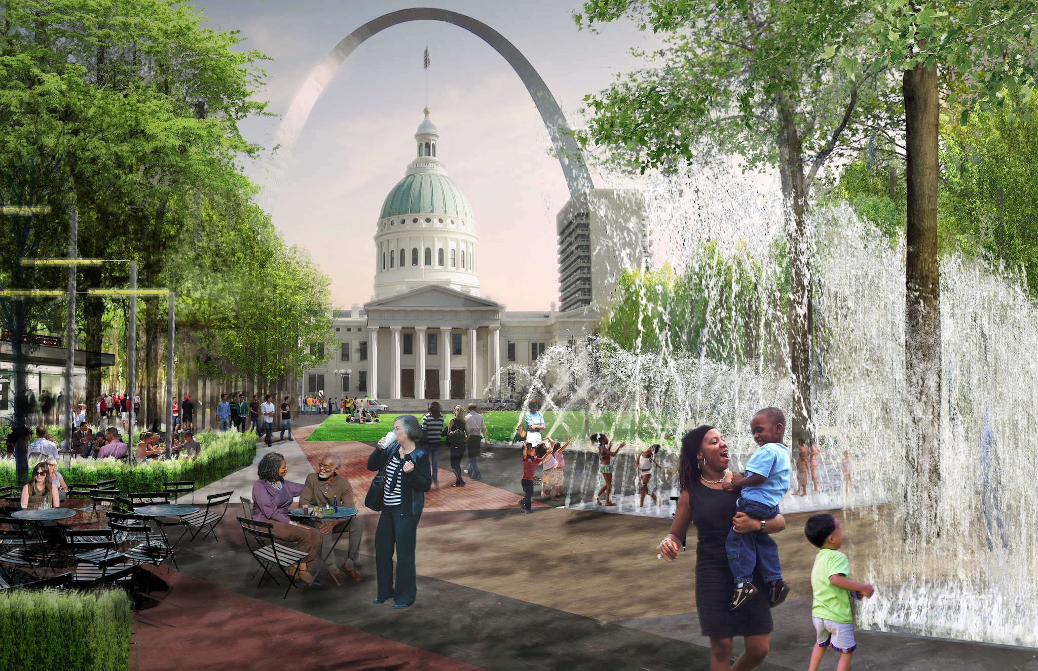
  • The eastern end will have a large lawn area that can hold thousands while the western end will have a cafe, beer garden and a series of loop fountains you can walk under.
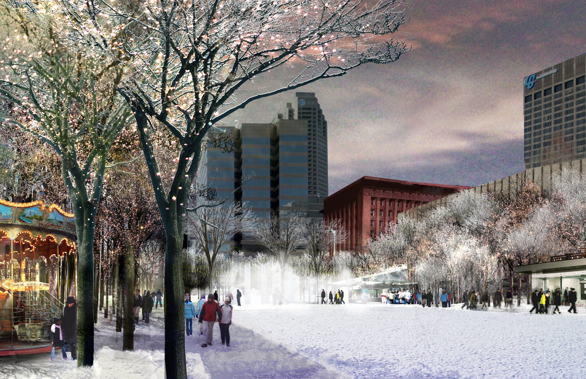
  • A carousel will be in the SE corner (red above).

The role of us on the Advisory Board is to ensure new work on the Gateway Mall is in keeping with the Master Plan, approved in 2009. Here is what the master plan has to say about the space:

Kiener Plaza will continue to be the principal grand civic gathering area for the residents of St. Louis to come together for celebrations and events. Unlike the current design of divided spaces, the new program for the Plaza will create  a unified space that may be used for multiple smaller events or provide a contiguous space for larger events. A redefined, redesigned Kiener Plaza, appropriately programmed, can become a destination for Arch Grounds visitors, helping to draw a larger percentage of these visitors into the downtown. This effort, in turn, helps make the case for creating an improved connection to the Arch Grounds.

It is important that the redesigned Kiener Plaza consider a new performance pavilion that rises above grade, providing a unique architectural statement that is significant both during the day and evening. This will help connect the space more intimately to the city.

The new architecturally significant pavilion on the western edge could combine a performance stage, visitor’s center, restrooms and café. A large performance plaza with seating and a hard-surfaced edge could expand the pavilion’s capacity by extending eastward to the block’s midpoint. Conceptually, it could be enhanced with playful and artful paving that incorporates in-ground lights for nighttime interest, the northern and southern edges will be defined by rows of trees and sculptural light masts that provide performance lighting and light displays. Throughout the Plaza, there should be areas for informal seating, unstructured play and gathering. Adjacent to the light armatures, a series of perimeter gardens could enhance the garden edge along Chestnut and Market Streets. The center of the Plaza provides an excellent location for a skim fountain or other water feature that can be turned off during large events to provide additional space. Textures play a major role in the redesign, with a combination of hard and soft surfaces. The Old Courthouse and the Gateway Arch serve as the backdrop for the eastern edge of the Plaza.

The Gateway One building, situated within the Mall, is accepted as being a part of the landscape. However, any future design changes to this block should consider bringing the portion of the existing raised plaza to the sidewalk level on Market Street, thereby continuing the band of the Hallway.

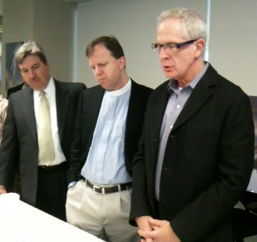
ABOVE: Steve Smith (Lawrence Group, Mike Kinman (Christ Church) & Chair Andy Trivers (Trivers Associates) looking over model
ABOVE: Steve Smith (Lawrence Group, Mike Kinman (Christ Church) & advisory board chair Andy Trivers (Trivers Associates) look over model following presentation

While MVVA doesn’t have a large pavilion at the western end they do have a smaller one near the center. We unanimously approved the concept, feeling it was in keeping with the spirit intended in the master plan.

ABOVE: winter view of Kiener Plaza with view of upper floors of the Wainwright Building. Click to view larger image
ABOVE: Summer view of Kiener Plaza
ABOVE: Summer view of Kiener Plaza showning lawn, fountains & movable furniture

Kiener Plaza will be the first element to be completed in the $578.5 million dollar CityArchRiver project with a goal of the fall of 2013. Specifics on costs for this piece are not known yet.

I question the use of the Kiener garages.  They are empty because they are dark, old and falling apart.  They are also privately owned

– Steve Patterson


Gateway Arch Topped Out Forty-Five Years Ago Today

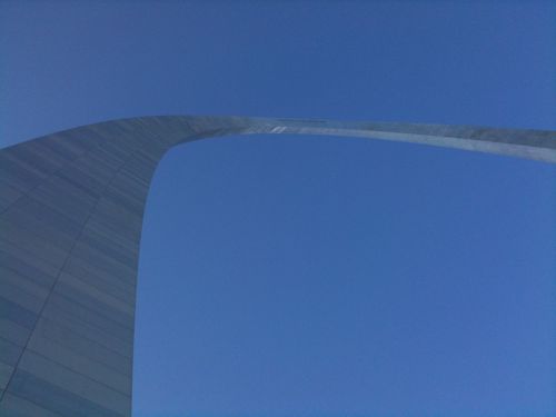
img_1031Forty-five years ago Saarinen’s Arch was completed:

“During a nation-wide competition in 1947-48, architect Eero Saarinen’s inspired design for a 630-foot stainless steel arch was chosen as a perfect monument to the spirit of the western pioneers. Construction of the Arch began in 1963, and was completed on October 28, 1965, for a total cost of less than $15 million. The Arch has foundations sunk 60 feet into the ground, and is built to withstand earthquakes and high winds; it sways up to 1 inch in a 20 mph wind, and is built to sway up to 18 inches. A Grand Staircase leads from the St. Louis levee up to the base of the Gateway Arch.” (NPS)

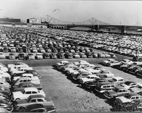
It would be a number of years before the landscaping around the Arch would be completed but for decades the site looked like this:

cars-on-jnem
Image courtesy of JNEM/NPS

Of course before it was a parking lot it was 40 city blocks of the original St. Louis.

Five years from today we will celebrate the 50th anniversary of the Arch.  Civic leaders hope to show off revised access to the Jefferson National Expansion Memorial, I hope they succeed.

– Steve Patterson


Readers Not Positive About Proposed Solutions For Connecting The City To The Arch

mvvawaterfront

Last week readers voted on their thoughts on the winning proposal in the City+Arch+River competition. While the top individual answer shows support (with changes) the overall sentiment is negative:

Q: Now that you’ve had a chance to review the MVVA proposal (for City+Arch+River), what do you think?

  1. With a few changes it will work 41 [29.5%]
  2. Few elements aren’t bad but otherwise not impressed 39 [28.06%]
  3. Very disappointed, my least favorite 24 [17.27%]
  4. Doesn’t matter, very little will get built. 18 [12.95%]
  5. Very excited, best of the five finalists 7 [5.04%]
  6. Other answer… 4 [2.88%]
  7. Don’t like or dislike it 3 [2.16%]
  8. Unsure/no opinion 3 [2.16%]

The other responses were:

  1. the arch is decaying, fix that first!
  2. Will this really make the riverfront more vibrant and connected to the city?
  3. Disappointed, this is the doable design, not the inspired vision design.
  4. The only do-able option

Hopefully in five years we will be impressed by the final outcome.  Here is the MVVA video:

httpv://www.youtube.com/watch?v=ArNdigN48Kg

– Steve Patterson


MVVA’s Winning Concept To Finish Destroying Riverfront Street Grid Pt2

Yesterday I looked at MVVA’s plan to close Washington Ave between the river and I-70. Today I will look at proposed changes an the edge of the Mississippi River.

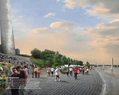
“Our proposal removes the existing waterfront streetscape in order to reinstate the full form of the cobblestone levee. Sculptural river gauges mirror the monumentality of Saarinen’s river walls and frame the use of the levee surface in relation to the fluctuating river edge. The single central stage is replaced by a gentle swell in the cobble surface that can accommodate a broader spectrum of markets, concerts, and seasonal attractions.”

Consultants had this to say:

This design would improve connectivity for pedestrians and bikes at the north and south ends, but reduce vehicular connectivity overall with the closure of Washington Avenue and Poplar Street. Gates would be added to the arches under Eads Bridge, removing vehicular access to Leonor K. Sullivan Boulevard from the north. In addition, moving the garage entrance closer to the river would result in diminished access due to frequent flooding.

mvvawaterfront
ABOVE: Artist rendering from Page 17 of MVVA narrative

The drawing looks good but the reality will be quite different.   Like the many failed pedestrian malls we’ve had in the US, removing cars is no guarantee pedestrians will fill the space. In fact, removing auto access makes it more difficult for some to reach the location.  So do I think it should remain unchanged?  Hardly.  I’m an advocate of mixing all modes of transportation — pedestrians, bicycles, transit, and vehicles.

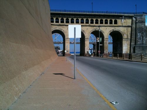
Like the stretch of Washington Ave next to Eads Bridge, Lenore K. Sullivan is excessively wide.

img_0519
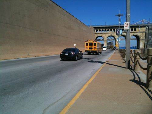
ABOVE: The current Lenore L. Sullivan Blvd looking north at Eads Bridge

img_0510
ABOVE: the blvd is way too wide for the low volume of traffic

img_0508
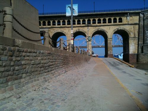
ABOVE: view of Eads from the levee below Lenore K. Sullivan Blvd.

img_1647
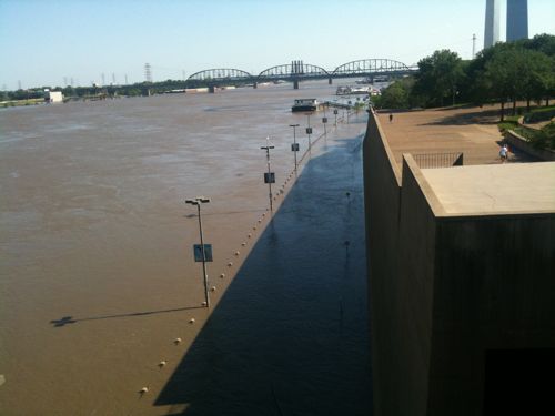
ABOVE: raising the level of the levee/road makes sense to reduce the amount of time it is flooded.

img_0511

I personally would like to see a very narrow street remain, too narrow for tour buses & trucks.  Include pockets of on-street parking on both sides but include bulb-outs between the pockets so the main curb to curb is narrow, even if no cars are parked.  For events the street can be closed as has always been the case for years.

The stated goal of the competition was connectivity, closing off streets does the opposite.

– Steve Patterson


Advertisement


[custom-facebook-feed]

Archives

Categories

Advertisement


Subscribe