What Will Become of the Historic Former Arsenal Site Once the National Geospatial-Intellegence Agency Relocates?
The battle over where the National Geospatial-Intellegence Agency (NGA) will relocate intensified recently when Illinois Gov. Bruce Rauner stepped late in the game with a bid across the Mississippi River:
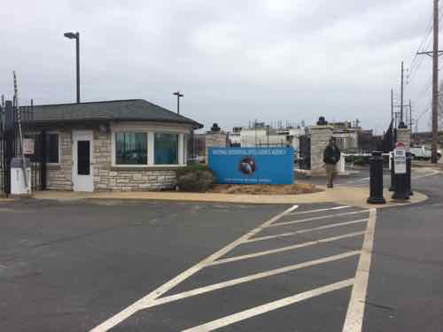
St. Clair County has agreed to donate land near Scott Air Force Base and MidAmerica Airport to the combined defense and intelligence agency, which provides mapping support for the U.S. military and employs 3,000 people locally.
The agency is also considering two sites in St. Louis County and one in north St. Louis as it looks to move from its current location near the Anheuser-Busch brewery in Missouri. (KMOX)
Here’s more about the NGA:
NGA is headquartered in Springfield, Va. and has two major locations in St. Louis and Arnold, Mo. Hundreds of NGA employees serve on support teams at U.S. military, diplomatic and allied locations around the world. (NGA)
I’ve questioned the wisdom of the city site from a design viewpoint, see St. Louis’ Low Standards Turns A Once-Proud City Into A Suburban Office Park. Keeping these jobs in the city makes sense financially, though employees who also live in the city will still pay earnings tax.
This post, however, isn’t about the new site — it’s about the current site and what will become of it once the NGA relocates.
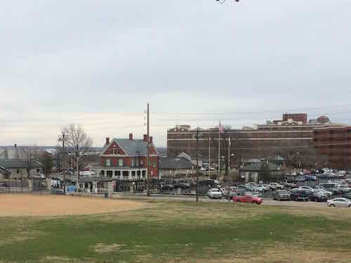
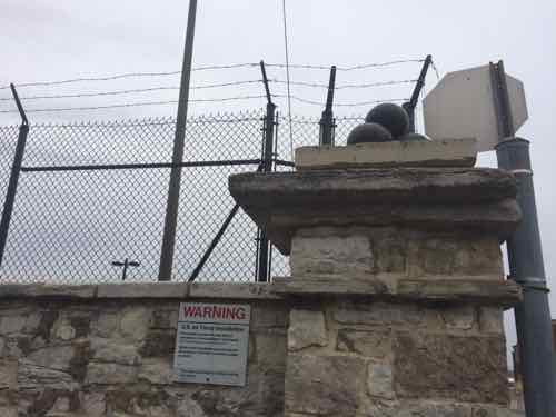
City records don’t list any information about any of the buildings on the site — makes sense since it’s a spy agency located on Air Force property. Thankfully the St. Louis Air Force Station was listed on the National Register of Historic Places in January 1975.
Within the confines of this acreage are ten buildings with erection dates from 1830 to 1906. These buildings are of Federal architecture, and are arranged in such a manner that gives an excellent example of the building prac tices and a remnant layout of a major arsenal of the early 19th Century.
Of particular interest are buildings #4 and #5, which are two of the oldest and best preserved buildings on base. Both are constructed of limestone walls over stone foundations, and their site and architectural integrity has not been altered since they were built in the l830’s. These buildings are built in the Federal style of architecture, which characterizes the majority of the other buildings except buildings 20 and 22 which are of modified Federal architecture. A further exception to this style is evident in building #25, which was constructed in 1906, and is believed to be of modified French Colonial architecture. It should also be noted that building #1 has lost its architectural integrity through extensive modification, but it was of modified Federal architecture before remodeling.
Site alterations have occurred to buildings #12 and #13. Each were originally built as three separate buildings in the form of a “Cross”, but during the early 1920’s, the middle building was removed, rebuilt, and connected in a straight line with the other two buildings. The integrity of the end sections of each building was maintained. Also, building #1 had considerable architectural alteration in January 1963. The building origin ally had three floors, but the second and third floors were rer.ovedj and the first floor was rebuilt. Site integrity was preserved. (St. Louis Air Force Station nomination)
One large multi-story building on the site was built after 1975. What will become of this property once the NGA vacates?
— Steve Patterson
Great question! Have you checked out the aerial photos of the site? http://www.bing.com/maps/#Y3A9MzguNDkzNDAxfi05MC4zODI2OTgmbHZsPTQmc3R5PXImcT1icm9hZHdheSUyMCUyNiUyMGFyc2VuYWwlMkMlMjBzdCUyMGxvdWlzJTJDJTIwbW8= . It appears to be completely surrounded by heavy industrial uses, so the most logical use(s) would be industrial IF the federal government decides to declare the property surplus, which, in itself, is an extended, politically-charged, process: http://en.wikipedia.org/wiki/Base_Realignment_and_Closure . The other half of the equation is, obviously, the historic nature of the site and its structures. The only two base closures that I’m familiar with (in Colorado) were able to repurpose their historic structures, but both those sites were not in primarily-industrial areas and are both much larger than this site: http://www.lowrydenver.com/ and https://www.auroragov.org/CityHall/ActiveCityProjects/FitzsimonsRedevelopment/index.htm
I looked at the link showing the aerial view. You can really see how parking impacts human living space. No wonder society is crazy living in subhuman environments.
Anyway I’m not sure this site would need to be industrial. Turns out the property along the river is part of the larger site, it’s just leased to the City of St. Louis, who in turn I guess leases to someone else. In any case the site is an isolated core that runs from South Broadway and the area is large enough that it can probably be isolated further from their neighbors.
It merits a close look at potential uses for the site, in any case I’m not sure how a large office building would fit into an industrial site.
Finally, not sure how much space they need, but it looks like there is plenty of room to do something interesting where they are, not to mention the river location is more secure than proposed alternatives.
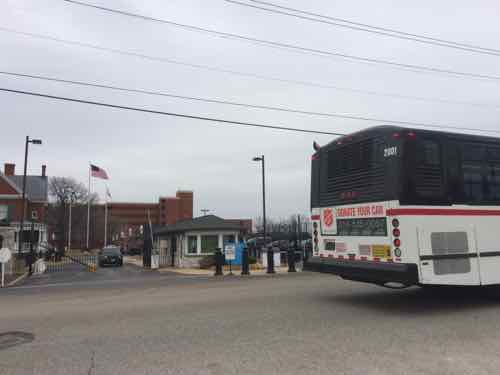
Yes, making this historic site into an anonymous industrial wasteland would be short-sided. The Western half at 2nd St has a great stone & iron fence and the historic structures. The eastern half includes newer office buildings.
This large site can accomodate a variety of uses — perhaps a bed & breakfast in the old house…
I did better than look at aerial photos — I visited the site and surrounding area. From the street you’ll see it isn’t as industrial as aerials would lead you to believe. To the immediate south is a Sigma Aldrich facility that’s technically industrial, but in a new high-tech way: http://www.sigmaaldrich.com/safc/facilities/saint-louis-cherokee.html
My preference would be for other Federal jobs to make their way to the site…. ones that wouldn’t need as much security and could accommodate public tours with a museum, etc. and be part of a enriched General Nathan Lyon Park.
Agreed, combine federal offices with startups, civil war related firms & tours, etc.