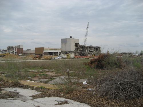
Forest Park Ave from Kingshighway to Grand (map) is 1.6 miles long with the potential to be a dense urban corridor. Developers, however, would like to make it a typical low-density big box chain retail corridor. I’d like to show you why I believe two big box retail developments at Forest Park Avenue & Vandeventer are out of character, why these will undo the work others have done recently.
I had enough photos of various buildings along Forest Park Ave to write this post, but Saturday I spent about 90 minutes taking around 150 photos as I traveled the entire length in my wheelchair. Why go to such trouble? I believe cities can’t be properly understood driving through in a car, or worse, relying on Google street view. You’ve got to hit the pavement to really get what an area is about.
I got off the bus on Forest Park Ave at the first stop east of Kingshighway and returned downtown from the Grand MetroLink station, about 2 miles of travel. Don’t worry, I’m only going to show you a small percentage of the images I took.
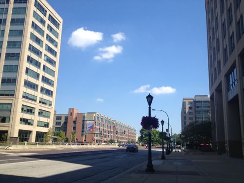
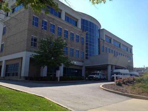
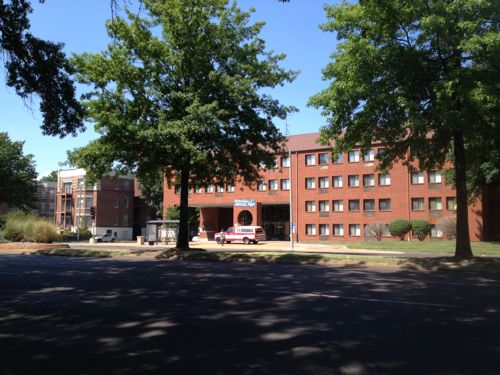
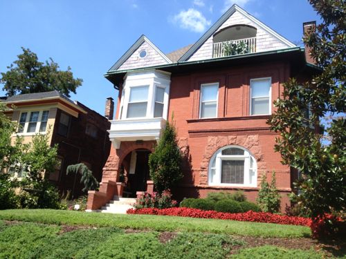
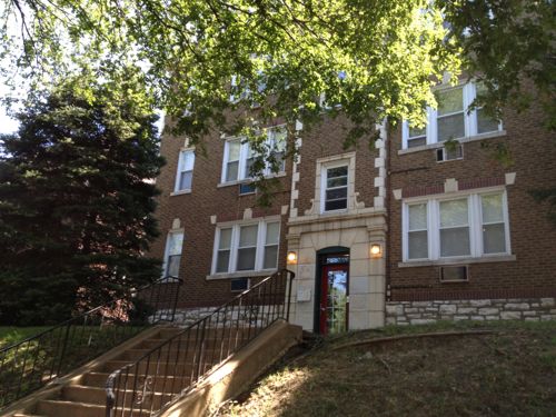
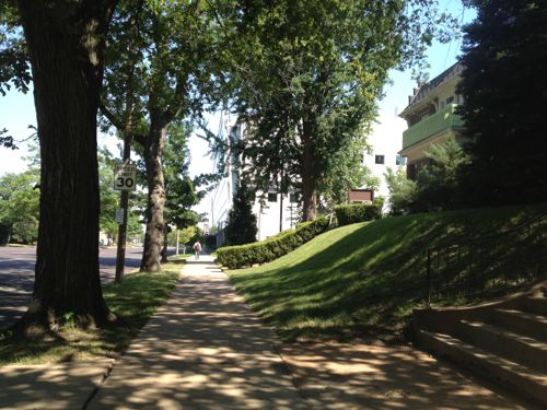
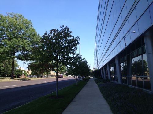
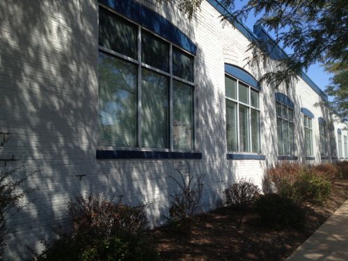
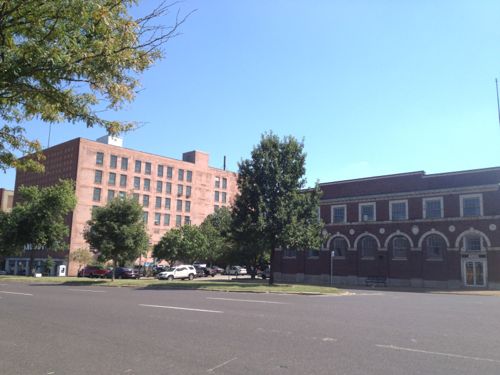
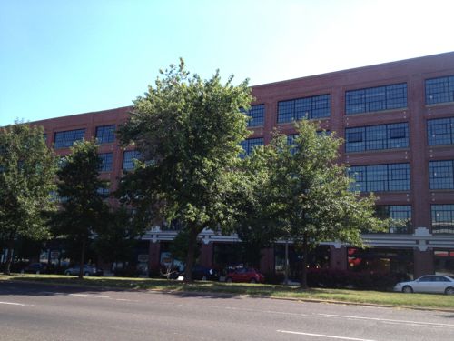
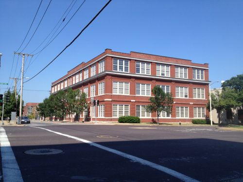
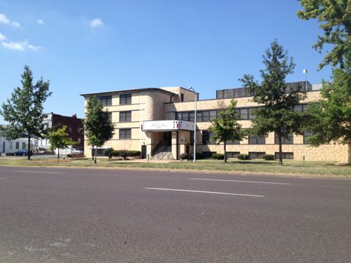
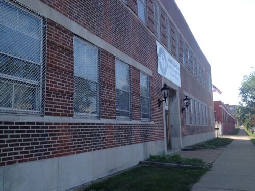
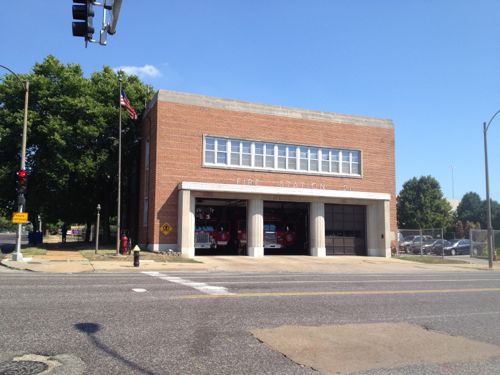
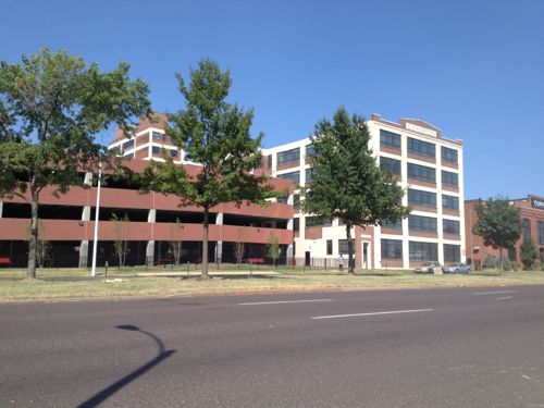
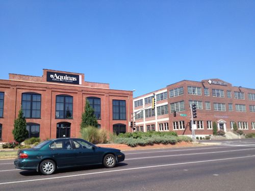
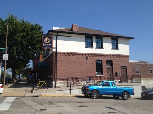
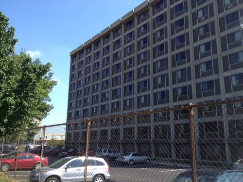
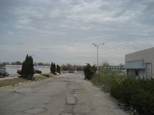
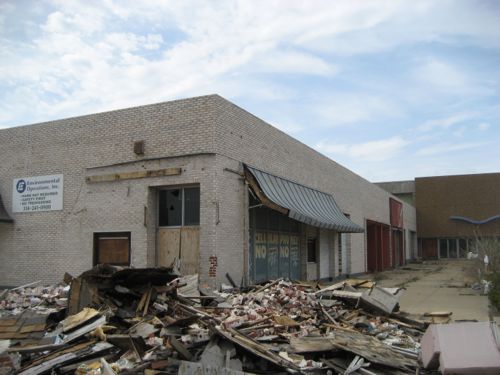
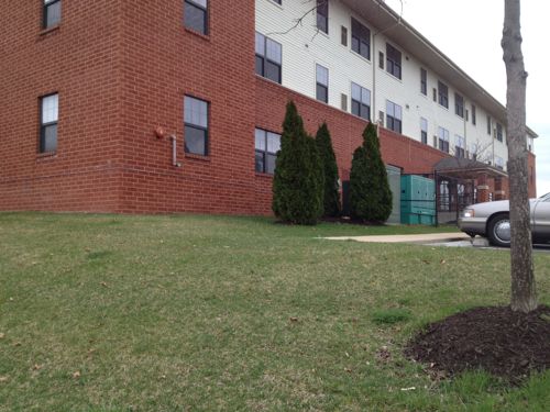
Looking east toward Euclid Ave we see numerous multi-story buildings, including medical, hotel, & apartments, all recent structuresOne low-rise strip center exists on the NE corner at Taylor Ave. If the St. Louis Streetcar gets built expect this 1985 building to be replaced with something more denseThe 1972 Parkview Apts next door contain 192 units on a lot just 65% bigger than the strip center.This 3-story apt building was built in 1930, it contains 24 units. The building next door was built in 1908Across Forest Park is the Rehab Institute, I had some outpatient physical therapy here.Back on the north side of Forest Park we have a 242 unit building built in 1977This block contains older buildings as well, all 2-3 storiesSame is true on the south side of Forest Park AveThis is a very pleasant place to be a pedestrian even with many cars passing byThe 3-story Cortex building from 2006 faces Forest Park AveUnfortunately this 2-story structure at S. Boyle, built in 1919, will be razed for a wide pedestrian mall leading to a new MetroLink station to be built 2 blocks southAcross the street a similar building was successfully renovated for an independence center and upscale resale store. This was built in 1931.One of the few 1-story buildings, this one dates to 1912 and has many windows on the street-facing facade. Currently used as a dialysis center.The general rule, however, is 2-levels up to 6 or more at times. All front Forest Park AveFormer Ford plant is now apartments with street-level retailTwo of the four storefronts are still available.The 3-story warehouse from 1901 is now part of the Center for Emerging TechnologiesA long-time Salvation Army facility, 3-stories facing Forest Park AveA 2-story Laclede Gas buildingThe 2-story firehouse at Vandeventer was built in 1965A former warehouse facing Forest Park, and another facing Laclede, are apartments geared toward SLU students. The parking garage was set back enough to permit a shallow liner building.At Spring Ave millions have been invested in existing urban buildingsMicrobrewer Six Row is in the urban building on the SE corner at Spring AveFinally at Grand we have one of SLU’s residence halls, though not oriented to Forest Park Ave
As you can see each block for the last 1.5 miles from Kingshighway has buildings fronting Forest Park Ave, nearly all 2 or more floors. Seems like every decade since the early 20th century new buildings have followed this pattern. But now Pace wants to change the pattern drastically, a new vision.
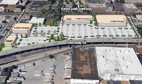
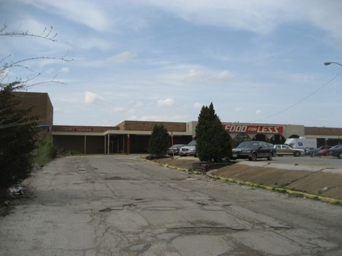
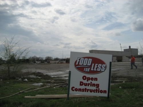
Pace Properties wants to build a retail center, called Midtown Station, on Forest Park Ave. between Vandeventer and Spring.
Pace says the site is ideal because of its proximity to St. Louis University and Washington University, as well as major employers like Ameren Missouri, BJC and Wells Fargo. (KSDK)
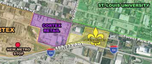
Pace wants to have the backs of big boxes facing Forest Park Ave & Vandeventer AveThis big box development (yellow) coupled with another to the west (purple) will completely undo the hard work and investment of others along the Forest Park Ave corridor
Next to Saint Louis University should be walkable retail shops, not the blank walls of the back of big boxes. I’m not opposed to retail, I’m opposed to the form these developments will likely take. I’m gathering examples of how this could be done much better, look for another post next month.
I don’t want this new suburban big box vision to reverse the urban corridor.
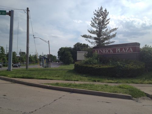
I’m not a fan of Walmart, but this post isn’t an attack on the Walmart business model. Instead the purpose of this post is to show how the redevelopment of Kenrick Plaza (map), proposed by G. J. Grewe, as presented, will not meet the minimum requirements of the Americans with Disability Act of 1990 (ADA).
First let’s take a quick look at the area:
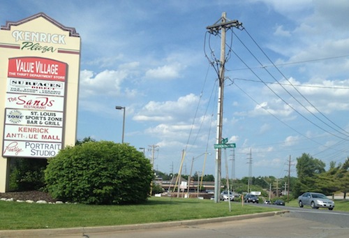
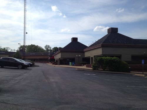
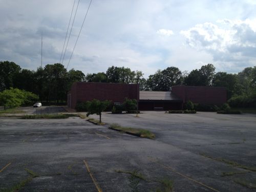
Sign for Kenrick Plaza at Watson Rd and Trianon Parkway Drive, looking eastSign at Trianon Parkway Drive, looking westbThe now-closed Kenrick Cinema is located on the west side of Trianon Parkway.
A report prepared by PGAV details how Kenrick Plaza is in bad physical condition, the layout doesn’t work well (former Burger King blocks views of retail space behind, etc.) and it doesn’t work for people with disabilities.
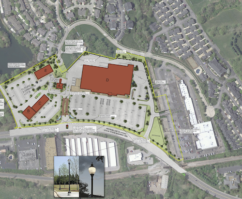
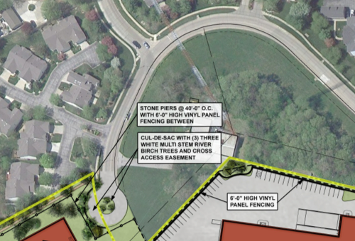
Here’s the proposed site plan, which includes cutting off public access to Watson Rd for many houses, leaving one entrance off of Laclede Station as the sole way in and out, with an exception for cutting through the private “lower Kenrick Plaza” area.
Proposed site plan, click image to view larger version on Scribd.
The Comprehensive Plan for the City of Shrewsbury (the “Comprehensive Plan”) dated March 1970, designates the land use for the Area to be commercial. The Comprehensive Plan, drafted as the Kenrick Seminary lands became open for development, envisioned the land uses immediately adjacent to Watson Road as a commercial corridor that would bring the City’s percentage of commercial land up to 10.4% from a meager 3%. The City was heavily dominated by residential and institutional uses and lacked significant commercial acreage.
The Comprehensive Plan was followed in the original construction of Kenrick Plaza as a commercial district supporting the surrounding residential development that largely lacked retail, entertainment, and restaurant options within close proximity. Also accommodated in the Comprehensive Plan was the construction of one or more television towers. This redevelopment plan maintains the Area as commercial land use consistent with the Comprehensive Plan and accommodates the existing television tower. The map depicting future land use included in the Comprehensive Plan specifically and clearly designates the Area for commercial land use.
Oh good, it complies with the 1970 “Comprehensive Plan”! Apparently nothing in Shrewsbury has changed in the last 43 years. I want to point out a few big red flags about this proposal:
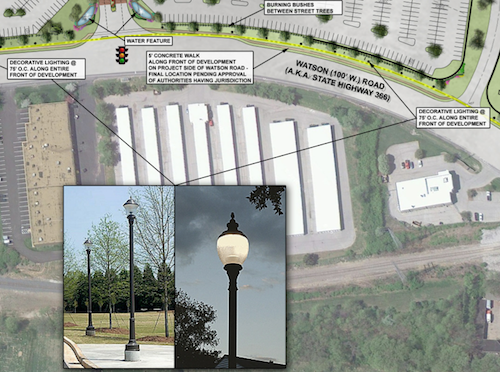
A sidewalk along Watson Rd with “decorative lighting” every 75 feet but you must walk in the auto driveways if you want to shop.Residents used to driving/walking to Watson Rd will no longer be able to do so, nor can they or their kids/grandkids walk to the store to get bread & milk.View looking south toward Watson along Trianon Parkway from the last side side street before access to be cut off.
Shrewsbury should be requiring more connections, not fewer.
206 Accessible Routes
206.1 General. Accessible routes shall be provided in accordance with 206 and shall comply with Chapter 4.
206.2 Where Required. Accessible routes shall be provided where required by 206.2.
206.2.1 Site Arrival Points. At least one accessible route shall be provided within the site from accessible parking spaces and accessible passenger loading zones; public streets and sidewalks; and public transportation stops to the accessible building or facility entrance they serve.
EXCEPTIONS:
1. Where exceptions for alterations to qualified historic buildings or facilities are permitted by 202.5, no more than one accessible route from a site arrival point to an accessible entrance shall be required.
2. An accessible route shall not be required between site arrival points and the building or facility entrance if the only means of access between them is a vehicular way not providing pedestrian access.
Advisory 206.2.1 Site Arrival Points. Each site arrival point must be connected by an accessible route to the accessible building entrance or entrances served. Where two or more similar site arrival points, such as bus stops, serve the same accessible entrance or entrances, both bus stops must be on accessible routes. In addition, the accessible routes must serve all of the accessible entrances on the site.
Advisory 206.2.1 Site Arrival Points Exception 2. Access from site arrival points may include vehicular ways. Where a vehicular way, or a portion of a vehicular way, is provided for pedestrian trvel, such as within a shopping center or shopping mall parking lot, this exception does not apply.
206.2.2 Within a Site. At least one accessible route shall connect accessible buildings, accessible facilities, accessible elements, and accessible spaces that are on the same site.
EXCEPTION: An accessible route shall not be required between accessible buildings, accessible facilities, accessible elements, and accessible spaces if the only means of access between them is a vehicular way not providing pedestrian access.
Advisory 206.2.2 Within a Site. An accessible route is required to connect to the boundary of each area of sport activity. Examples of areas of sport activity include: soccer fields, basketball courts, baseball fields, running tracks, skating rinks, and the area surrounding a piece of gymnastic equipment. While the size of an area of sport activity may vary from sport to sport, each includes only the space needed to play. Where multiple sports fields or courts are provided, an accessible route is required to each field or area of sport activity. (2010 ADA Standards)
In short this says it is ok to require pedestrians to use an auto drive to a facility like a Starbuck’s but that exception isn’t applicable to a shopping center. Elsewhere in the same link as above, the term “shopping center” is defined as:
(A) A building housing five or more sales or rental establishments; or
(B) A series of buildings on a common site, either under common ownership or common control or developed either as one project or as a series of related projects, housing five or more sales or rental establishments. For purposes of this section, places of public accommodation of the types listed in paragraph (5) of the definition of “place of public accommodation” in section § 36.104 are considered sales or rental establishments. The facility housing a “shopping center or shopping mall” only includes floor levels housing at least one sales or rental establishment, or any floor level designed or intended for use by at least one sales or rental establishment.
Developer G. J. Grewe and Architect TRi should be ashamed for submitting such a plan, this isn’t 1970 despite the fact Shrewsbury’s comprehensive plan hasn’t been updated.
As I was finishing this post yesterday I received an email from Shrewsbury Mayor Felicity indicating “accessibility is being addressed with sidewalks from the bus stop to the stores.” The site plan on the Shrewsbury website is a preliminary concept. I requested an updated copy but I have not received it.
UPDATE 5/22/2013 @ 3:30pm:
At 3pm I received from Shrewsbury Director of Administration, Jonathan Greever, a PDF copy of “of the current special use permit site plan. This document is limited in that it does not address the entire site and its intended use is not for construction. The purpose for this document is different than that of a fully engineered plan. As stated previously, the final engineered plans have not been generated.” You can view it on Scribd here.
River Roads Mall was located in the north St. Louis County municipality of Jennings, MO:
Opened in 1962, the mall originally featured St. Louis-based Stix, Baer & Fuller as its main anchor store, as well as a Kroger supermarket and a Woolworth dime store. Walgreens operated a store in the mall as well. A 1970s expansion brought JCPenney as a second anchor store. Dillard’s bought the Stix, Baer & Fuller chain in 1984, converting all Stix, Baer & Fuller stores to the Dillard’s name. However, the River Roads Mall store was closed not long afterward in 1986 at the end of the lease. JCPenney converted its store to a JCPenney outlet in 1984. Woolworth closed the River Roads location (along with locations at West County Mall and in South St. Louis City) in early 1991 during one of the chain’s earliest rounds of store closures. By the early 1990s, the mall was briefly renamed St. Louis Consumer Center. (Wikipedia)
Two decades after opening it was already in decline. The surrounding residential neighborhoods remain a decent place to grow up.
Homes facing the former mall remained tidy in 2007
I love that sidewalks were provided, those didn’t exist in the 1960s subdivision where I grew up, but they’re meaningless because the sidewalks didn’t lead anyone to nearby retail. You see in the 1960s America thought driving everywhere was the future. Cart the kids around until they get a license then they can drive themselves.
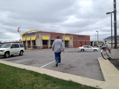
A March 2007 view looking south to Jennings Station Rd from River Roads Mall showed no consideration for pedestrians.When I visited the site in March 2007 the mall had been closed for over a decade but the attached grocery store remained open during the demolition process.They had to place signs to make it clear they were openA corner of the former mallThe mall was located far from Jennings Station & Halls Ferry, not designed to welcome pedestrian shoppers
But we know better now, right? We need to design places to accommodate multiple modes of mobility: car, bike and foot. So you’d think the few new buildings that have been constructed in the last 5-6 years on the edge of the site have improved things for area residents. Well, you may not think so but I expected to see an improvement.
Boy was I disappointed on my first visit in 6+ years.
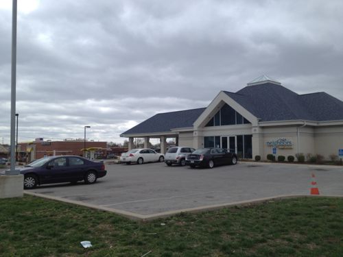
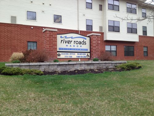
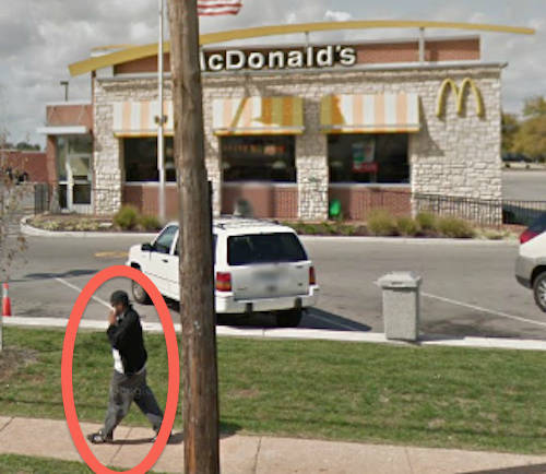
Pedestrians heading to McDonald’s (customers & employees) must go over curbs, through grass and navigate cars. Wheelchair users must use the auto entrances/exits, bicyclists must improvise to secure their bikes.Neighbors wanting to visit Neighbors Credit Union shouldn’t walk since they’ve made no provisions for customers to arrive on foot.Surely senior apartments with accessible units will have a good connection to the sidewalkThe River Roads Manor website lists being near public transit as an amenity, too bad residents can’t get to it without walking in/out auto driveways.
River Roads Manor was a Pyramid Properties project, completed prior to the collapse of the company on April 18, 2008 (see Five Years Since Pyramid Properties Ceased Operations). The McDonald’s & Neighbors Credit Union were started. So John Steffen’s Pyramid Properties is to blame for not raising the bar in this area.
I just hope Stacy Hastie of Environmental Operations, the entity that now owns the mall site, will take pedestrian access into consideration in the future. I also hope Jennings will realize their residents do walk places and that new construction should include provisions for them as well as for motorists.
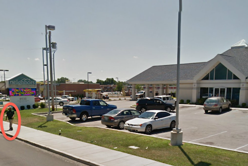
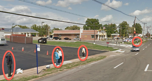
Some of you will say nobody walks, everyone drives. Why then is the area serviced by MetroBus is everyone drives? All we have to do is take a look at Google Street View to spot pedestrians.
Pedestrian in front of Neighbors Credit UnionPedestrian in front of McDonald’sMany pedestrians waiting to catch the #16 MetroBus
Massive efforts go into accommodating motorists, from municipal codes to vast amounts of paving and land. I just want a pedestrian connection to adjacent streets, I think that’s fair.
Based on comments on Monday’s post (Walking To The “Flagship” Dierbergs & Schnucks Locations In Des Peres, MO) many of you think the auto-centric suburbs will never be walkable. Well, you’re wrong. They’ll likely never be ideal urban settings but they can be retrofitted to enable people to function without having to drive. This is important because we need to walk more:
There is a growing recognition that Americans must increase physical activity, including walking or bicycling, if we are to nudge the needle on ballooning health care costs, reducing obesity and overweight, cardiovascular and other chronic illnesses linked to a lack of exercise. Over the last decade, a growing number of communities have gotten the message, and begun to retrofit their more dangerous roadways to be safer for people on foot, on bicycles and in cars.
Still, most Americans continue to live in places where walking is risky business for their health and safety, where roads are designed solely to move speeding traffic and where pedestrians are viewed as an obstacle.
This has left us with a dilemma: Public health officials encourage Americans of all ages to walk and bike more to stem the costly and deadly obesity epidemic – yet many of our streets are simply not safe. Americans get to pick their poison: less exercise and poor health, or walking on roads where more than 47,000 people have died in the last ten years. (Dangerous by Design 2011)
Des Peres and other St. Louis suburbs have had sidewalks along major roads for years, yet few pedestrians. The lack of connection from the public sidewalk to the businesses set back behind parking lots has been a major hurdle. When these older commercial buildings are retrofitted or replaced we have the opportunity to make incremental improvements to improve the walkability. For example, the location of the old Schnucks grocery in Des Peres.
Schnucks was there for over 40 years but, like the new location, it didn’t have any pedestrian route to the store. Now the building has a new facade and two new retailers and a pedestrian access route.
ABOVE: An auto entrance to the former Schnucks in Des PeresABOVE: In the reuse of the vacant grocery store, a sidewalk was added to so pedestrians had an access route.ABOVE: The new pedestrian access route gives pedestrians a safe way to get from the public sidewalk to the businesses.ABOVE: A crosswalk is provided where the access route crosses the auto drive.ABOVE: The view looking south toward Manchester Rd. at Lindeman Rd.ABOVE: Pedestrians have a route to the new free-standing fast food restaurant on the property.
This is not great urbanism, nor is it my idea of walkable. But, I was able to easily get to the businesses without feeling like I might get hit by a careless motorist. It’s incrementally more walkable than it’s been for the over four decades. Walkability doesn’t happen overnight. Des Peres will not become a great walkable community by 2014, but it might by 2032.
I’ve posted the following video before but it’s worth watching over and over. Ellen Dunham-Jones shows us ways to retrofit the suburban sprawl few like but that many call home. Well worth 20 minutes of your time.
httpv://www.youtube.com/watch?v=yPkalOtT6i4
Continuing with a laissez-faire development strategy will, however, guarantee Des Peres and similar suburbs won’t be much different in 20 years. In 20 years the marketplace will pass up suburbs that require an automobile to function. Within the next two decades those communities where various modes of mobility are embraced will be the desirable “location, location, location” places. This includes walking, biking transit and yes, driving.
THF Realty, a major developer of Walmarts and other big-box stores, is sniffing around the Orchard Lakes subdivision just north of Creve Coeur and near busy Olive Boulevard and Interstate 270.
A company representative met with subdivision trustees on June 3 to discuss a potential buyout of the entire subdivision, according to a subsequent letter from the trustees to subdivision homeowners. (STLToday)
Not surprising since vacant highway-adjacent parcels no longer exist. The subdivision of 256 single family homes is adjacent to I-270, extending more than half the distance from Olive to Page.
ABOVE: Blue box indicates Orchard Lakes, click to view map in Google Maps
THF Realty wants to make sure all those motorists driving on I-270 can see the generic big box development they are planning.
ABOVE: View of I-270 from Orchard Lakes subdivision
I knew where the subdivision was located but had never driven any of it’s streets, so last month I drove each street in the subdivision.
ABOVE: Orchard Lakes entrance sign
I grew up in a subdivision of similar vintage as Orchard Lakes. From a check of St. Louis County records these houses were built between 1961-66. Â There is nothing particularly unique about the homes or the subdivision itself. With a few exceptions, all the homes looked well maintained. Many have newer windows and roofs.
The ranch houses of Orchard Lakes are typical of others from the period in the St. Louis region.
Few sidewalks exist in this subdivision, it’s not at all urban. Not rural either, decidedly suburban. There is no orchard, probably never was.
ABOVE: The only "lake" at Orchard Lakes is a decent pond at best.
There are lots of very nice mature trees though.
ABOVE: Leaving Orchard Lakes to the south the sign reads: Creve Coeur welcomes you.
Orchard Lakes is in unincorporated St. Louis County – barely. Creve Coeur has annexed commercial property along Olive Blvd but they didn’t want the adjacent residential areas. For a while now Creve Coeur has been planning to remake Olive & Ballas into their downtown.
In April 2002, the City of Creve Coeur adopted the Comprehensive Plan. Together, with the Pedestrian Plan and Design Guidelines, these plans set a standard for protecting community assets and strength- ening community character. Among the numerous recommendations made in the Comprehensive Plan are several for the Central Business District. Specifically, the Comprehensive Plan recommends the creation of a downtown (or town center) in the vicinity of the Olive-New Ballas intersection. (Plan PDF)
Orchard Lakes is just north of their proposed downtown/central business district:
The strong real estate market in Creve Coeur is anticipated to continue to be a basis for strengthening residential areas while at the same time stimulating major reinvestment in aging or underutilized commercial areas.
Clearly Creve Coeur’s planners didn’t envision the surrounding residential getting replaced by high traffic big box. To a degree this is what Creve Coeur gets for incorporating only the commercial areas along Olive, but not the adjacent residential to the north. Will be interesting to see if either gets built.
AARP Livibility Index
The Livability Index scores neighborhoods and communities across the U.S. for the services and amenities that impact your life the most
Built St. Louis
historic architecture of St. Louis, Missouri – mourning the losses, celebrating the survivors.
Geo St. Louis
a guide to geospatial data about the City of St. Louis