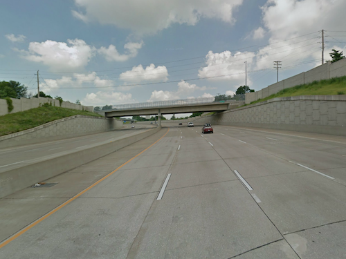
For years it was just a controversial highway proposal, but a decade ago phase one of the Page Ave. Extension (aka I- Route 364) opened, connecting the Westport area of St. Louis County to St. Charles County. Years before the opening I participated in efforts to derail the project, including attempting to pursuede St. Louis County voters to reject a land swap allowing the road project to cut through Creve Coeur Lake Memorial Park. Originally planned in 1969, construction began in 1997.
Looking west on I-364 Source: Google Streetview
Before construction could begin a land swap had to take place to permit the selected route through the south edge of the park:
Opponents say the extension not only will destroy the park but also will add a fourth bridge to hasten the exodus of the middle class from St. Louis and aging St. Louis County suburbs to the greener pastures of St. Charles, Lincoln and Warren counties.
“If it goes through, it’s the turning point for the downslide of St. Louis County,” said state Rep. Joan Bray, D-University City, who helped a group called Taxpayers Against Page Freeway gather more than 40,000 signatures to put the referendum before voters.
Bray said the money slated for the project would be better spent to upgrade existing roads and to expand MetroLink. (source)
Voters, unfortunately, 60% approved the measure in November 1998. Highway advocates spent $800,000 vs $160,00 from the opposition (source).
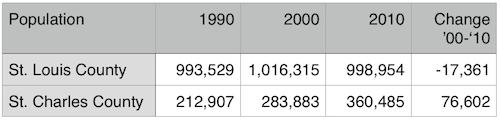
Following the opening, St. Louis County experienced a population decline for the first time since St. Louis City left in 1876
Many factors are at play in the population decline of St. Louis County and increase in St. Charles County but I have no doubt I-Route 364 played a role. Ground was broken on the third and final phase on May 22, 2013.
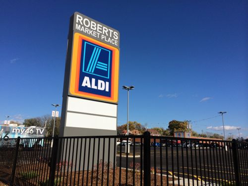
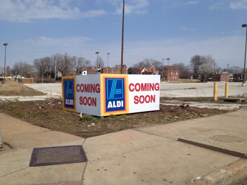
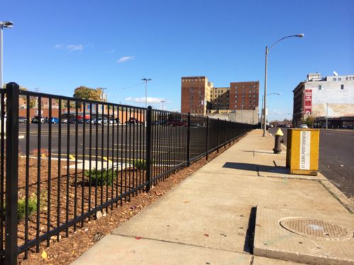
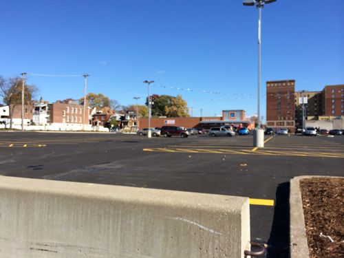
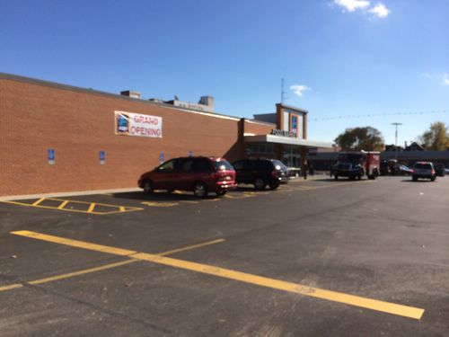
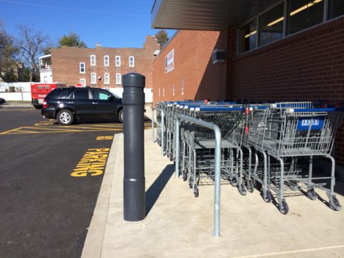
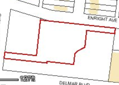
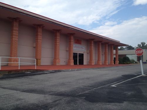
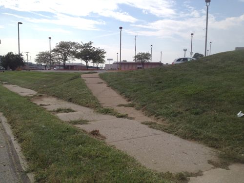
The Roberts Market Place has opened at Kingshighway & Delmar, the site of a former Schnucks. Discount grocer ALDI, the only business so far, is the anchor. Unfortunately, it is designed to be driven to, not walked to.
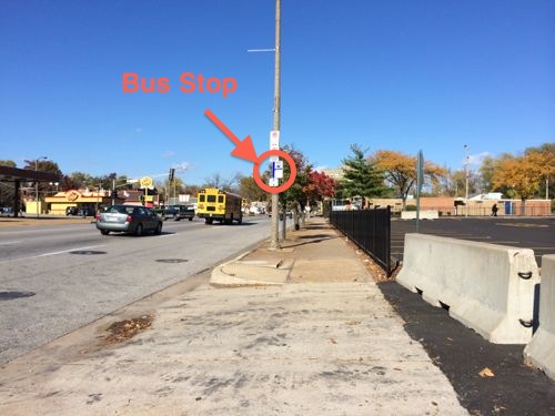
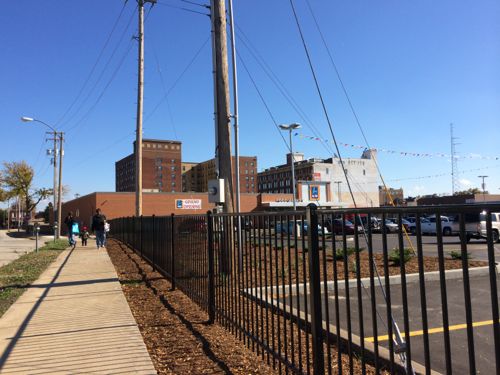
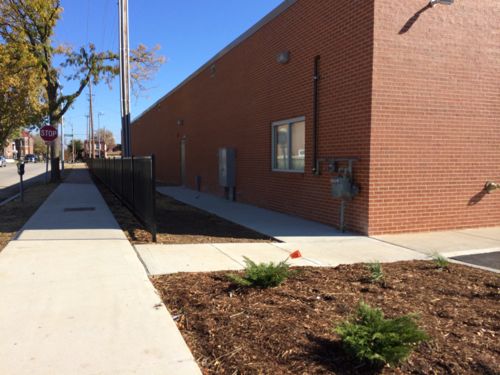
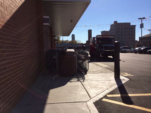
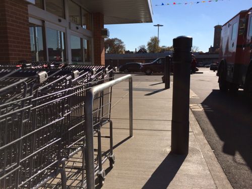
Roberts Market Place on the NE corner of Kingshighway & Delmar, click image for map linkThe same corner back in AprilLooking east along DelmarLooking north along Kingshighway, a stop for the #95 MetroBus is circled in red. Concrete barriers block the auto driveway.The fencing blocks pedestrian access, except at the auto driveways. Not welcoming at allLooking east along Enright Ave we see a family leaving ALDIAn opening in the fence at the auto driveway.At least a walkway was provided at one pointNot a straight shot or wide enough if you meet someone, but as a bare minimum it works…except…Who fits between the carts & bollard? Certainly nobody using a cane, walker, scooter, or wheelchair! #adafailLooking back at the problem from the opposite sideLooking west toward KingshighwayLooking south toward DelmarGetting closer toward Delmar we can see the fence forces pedestrians to enter/exit via the auto driveway
Seriously? The one minimal pedestrian route from a secondary road is blocked by a bollard!?! As I mentioned in April, the site has been divided into three parcels.
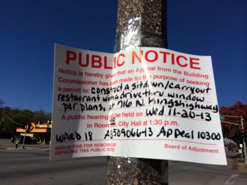
Outline of the ALDI parcel, the other two are just parking right now.A hearing will be held on the 20th for a drive-thru fast-food restaurant at the Kingshighway & Enright parcel
It would’ve been relatively easy to plan a north-south sidewalk through the site connecting Enright to Delmar, with a perpendicular walk connecting to the bus stop on Kingshighway. This would’ve provided a pedestrian route to all three adjacent streets and to all three parcels. Instead we’ve got another development that ignores pedestrians almost entirely.
The #97 (Delmar) bus and #95 (Kingshighway) bus generate lots of pedestrian traffic at this location. Many customers & employees of ALDI, a new drive-thru, and a third place will arrive on foot. Development in our neighborhoods should be designed to welcome motorists, bicyclists, and pedestrians. This must be mandated, developers aren’t going to do it on their own — especially not in low-income areas where they do as little as possible.
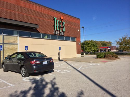
I’d never heard of Tee’s Golf Grill until Monday when I was driving around the Chesterfield Valley, it closed in July 2012:
The 10,400-square-foot golf center opened in early 2011 at 103 Chesterfield Valley Drive. “We’re doing a full-service sports bar and grill,” Ben Rassieur IV, Tee’s owner with Phil Harris, told Sauce magazine at the time. In addition to the bar and grill, Tee’s had 330-square-foot golf simulators that visitors used to practice their swings. (St. Louis Business Journal)
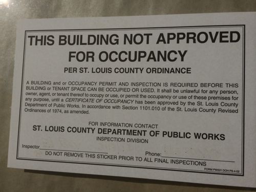
I’m not sure if the building was constructed new for this tenant, or a previous tenant. I also don’t know why this business closed so soon, but I found a number of issues that should be addressed by the owner before the next tenant leases the space.
Paper over the windows, only car is my rental. But look, no ramp to access the front door! Click image to view on Google Maps. The ramp is off to the side, requiring the disabled to go into the driveway to access it. I prefer ramps when walking with my cane, so do folks who use walkers.There’s a ramp & crosswalk out to the sidewalk that connects to other development, but no ramp to access it.We can see the walk to the entry is minimal width.This sticker was affixed to both entrances to this building. I wonder if the City of St. Louis uses something like this to improve compliance?
This building shares the same site with a multi-tenant building to the south, yet there isn’t an ADA-compliant accessible route connecting them, as required.
I will attempt to share the above issues with the owner and St. Louis County.
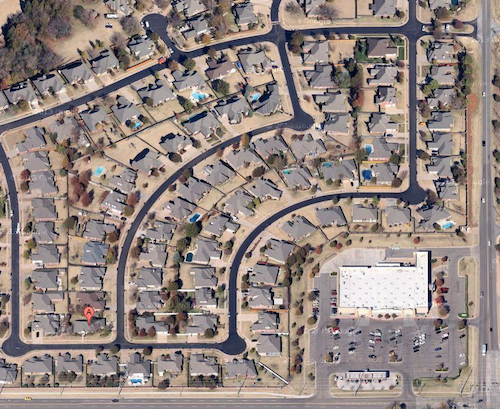
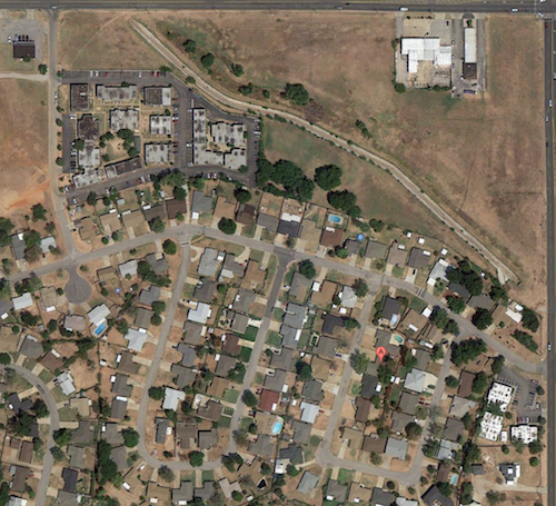
Today cul-de-sac subdivisions are designed exclusively for the automobile. For example, my brother’s gated subdivision in Oklahoma City has internal sidewalks that don’t lead you outside the gates. A major grocery store occupies one corner on the outside, but you need a car to get there.
My brother’s house “A” is so close to a large grocery store, but you can’t walk there. One of the two gates is in the upper right corner. Source: Google maps
My parents built a new custom home in 1965-66, moving in just months before I was born. I was told the streets of the new subdivision in the former farm field were still getting paved as our house was being built. Unlike where my brother lives now, we could at least reach a convenience store from a street connected to our subdivision. Had more commercial been built on land set aside by the developers we would’ve had many more options.
I grew up in a 1960s subdivision that lacked sidewalks, but there was a small store I could walk/bike to (upper left), and room for more commercial development that has never materialized.
However, many in the St. Louis region grew up in a 1950s subdivision that planned for walking, with sidewalks and a shopping center connected to the housing. I posted yesterday about the Carrollton subdivision decimated for runway expansion at Lambert International Airport, today is a look at the thought and planning that went into it.
The following is from page 547 of the 1970 book This is Our Saint Louis by Harry M. Hagen:
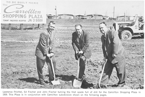
Ground breaking for the Carrollton Shopping Plaza in 1959, click image for map
When “Johnny Came Marching Home” at the close of World War II, he found one thing to his advantage, prosperity and jobs, and one disadvantage, a tremendous shortage of housing. For many returning GI’s and their prides, their first home was a rented room or shared quarters with their in-laws.
The building industry, stopped by the priorities of war, was turned loose, and developers looked to the suburbs for the land they needed to build homes. There was land, lots of land, and many home builders built square little box-like homes marching in soldierly fashion down square little streets. These houses sold as fast as they could be completed since young marrieds and young families were desperate for adequate housing.
With the convenience of the automobile, no location in St. Louis County was too distant. Sub-division after sub-division sprung up and was quickly populated.
Out of this building frenzy, one team emerged with a visionary approach to suburbia. Ed and John Fischer, along with brother-in-law Lawrence Frichtel added a dimension to home building that won national acclaim for their firm, Fischer and Frichtel. Instead of building several blocks of homes in in regimented manner, they built a community.
The firm amassed a large tract of land in northwest St. Louis County and in 1956 opened Carrolton, a planned community with gently curving streets, cup-de-sacs and open space. Instead of one or two home models, they offered a variety so that every other home would not look the same. They did not utilize every square foot for homes –they planned areas for churches, schools and parks that were built and used as the population grew. To make the community as self-sufficient as possible, they constructed a small shopping center so that necessities of living could be purchased within walking distance. And to complete their community, they built a swimming pool and a large recreation building, bringing free-time activities practically to the front door of residents.
Carrollton had a mixture of award-winning homes–and it was a community that offered residents more than any other single housing development in the area at that time. It was planned to make living in the suburbs enjoyable for the entire family — and its departure from the conventional set the standards followed by other developers.
Fisher and Frichtel was probably the number one home-building firm of the post-war era — and the reason for its success was simply that it gave the grass-cutting, snow-shoveling, house-painting, leaf-burning, tree-pruning public a product that was both excellent in quality and different in setting. The firm has been recognized and published in every major magazine and newspaper relating to homes, neighborhoods and conventional living throughout the country. Unquestionably, these men and their organization represent and give tribute to the great spirit of St. Louis.
Self-sustaining? Walking distance to necessities? Yes, single-family homes on cul-de-sacs can be walkable. Well, at least they tried in 1956.
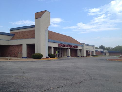
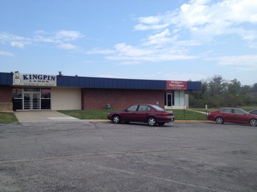
The original Carrollton Shopping Plaza has had face lifts since the early 60s and the neighborhood it served is now vacantThis bowling alley & retail space (now a pizza parlor) was built at the same time as the original Carrollton Shopping PlazaA couple of years later a Schnucks grocery store was added to the shopping centerThe sidewalks connecting the houses to the commercial remain. Though not ideal, or ADA-compliant, this was way better than most subdivisions of the 1950sIn 2005 Schnucks closed the Carrollton store and opened a bigger store on St. Charles Rock Rd at Lindbergh
However, decade after decade since Carrollton was platted, subdivisions have gotten progressively more hostile to pedestrians. I’m not sure how this happened, my guess is each subsequent generation got used to their environment and eventually only grandpa remembered walking to the store for milk.
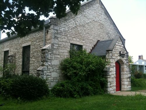
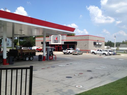
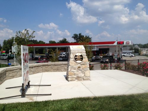
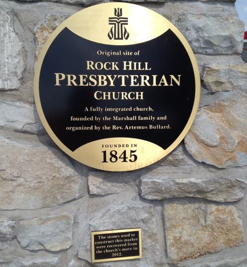
For more than a century a modest stone church stood in what later became the City of Rock Hill. Built by slaves in the 19th century, it couldn’t compete with a gas station + convenience store in the 21st century.
Rock Hill Church, 2011Same view two years laterNow on the corner a sign displays gas prices and a monument notes the history that was lostClose up of the plaques on the stone monument
I’ve been told the church was “fully integrated” because the Marshall family required their slaves to attend the church they built. A little feel-good revisionist history?
There’s nothing to feel good about on this site. This is now a sprawl corner like thousands of others in St. Louis County. What once made a positive contribution to the sidewalk experience has been reduced to a monument few will read as that would require exiting their car and actually walking a bit.
AARP Livibility Index
The Livability Index scores neighborhoods and communities across the U.S. for the services and amenities that impact your life the most
Built St. Louis
historic architecture of St. Louis, Missouri – mourning the losses, celebrating the survivors.
Geo St. Louis
a guide to geospatial data about the City of St. Louis