Home » Parks » Recent Articles:

Carl Milles’ Meeting of the Waters in Aloe Plaza
June 23, 2011 Downtown, Parks 8 Comments
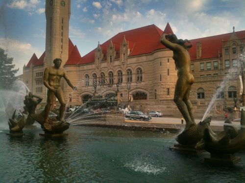
ABOVE: Carl Milles' 'Meeting of the Waters' is the focal point of Aloe Plaza

The Swedish-born sculptor Carl Milles was born on this day in 1875.  Milles, as you probably know, designed the beautiful sculptural fountain “Meeting of the Waters” in Aloe Plaza, located across Market St. from Union Station.
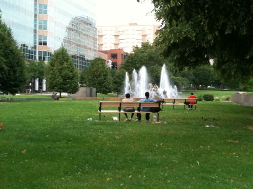
ABOVE: visitors to Aloe Plaza enjoy the work of Carl Milles

Aloe Plaza was named in honor of Louis P. Aloe, who died in 1929. He served as President of the Board of Alderman from 1916 to 1923 and led the movement for passage of the [1923] bond issue” that funded many St. Louis projects. But Aloe never met Milles:

Edith Aloe, Louis P. Aloe’s widow, became acquainted with the work of the Swedish sculptor, Carl Milles, at an exhibition of modern art held by the St. Louis League of Women Voters in 1930. The idea of commissioning Milles to build a fountain in Aloe Plaza grew out of her enthusiasm for his work.

But the country was in the middle of the Depression so her idea was put on hold until January 1936 when Mrs. Aloe gave a dinner in her home for the sculptor,Carl Milles, and members of the St. Louis Art Commission. She officially presented her check for $12,500.

The City signed a contract with Milles in 1936. Milles designed and cast the bronze statues for the fountain in his studio at the Cranbrook Academy of Art, Cranbrook, Michigan. The fountain was completed in November 1939, but remained veiled until its dedication on May 11, 1940 before a crowd of 3,000 persons.

The fountain, originally named “The Wedding of the Rivers,” depicts the union of the Missouri and the Mississippi Rivers, represented by the two central figures. Accompanying the two main figures and forming a wedding procession are 17 water spirits, symbolic of the smaller streams that empty into the two major rivers.

An uproar arose over the nudity of the male figure, reprenting the Mississippi River and the female figure, the Missouri River. In deference to the criticism, the name of the fountain was changed to ,”The Meeting of the Waters.” (source)

Oh yes the horrors of a nude male sculpture, we can’t use the word marriage when nudity is involved. Perhaps we should rename the fountain as Milles originally intended? Perhaps for the 75th anniversary in 2015?
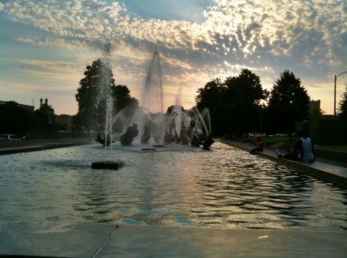
ABOVE: a family enjoys the sunset at Aloe Plaza

Here is more info on Louis P. Aloe:

Louis P. Aloe was the president of the highly successful business created by his father, A. S. Aloe & Company, which manufactured and sold optical, surgical, and photographic equipment. Elected to the highest city office achieved by a Jew in St. Louis, Louis was president of the Board of Aldermen from 1916 to 1923. In 1917 he became acting mayor during Henry Kiel’s illness and was widely acclaimed for his leadership during that critical period and in the effort to pass the 1923 bond issue. He suffered a severe stroke in 1926, a year after his defeat for the office of mayor, and died in 1929. His son-in-law, Howard F. Baer, took over leadership of A. S. Aloe at Louis’s death. The fountain was finished in November 1939, but the dedication was delayed until the spring, when some three thousand people gathered to witness the unveiling.Lighting and landscaping were added to the area in 1954. During the renovation of Union Station in the mid-1980s, Aloe Plaza and Milles Fountain, just across the street, also underwent some refurbishing. (source)

Howard Baer built a new headquarters for A. S. Aloe & Company just two blocks north of Aloe Plaza. Sadly that building was razed in 1996.  For pictures and more information see Built St. Louis here. Without a doubt, this fountain, created by Carl Milles, is the finest in St. Louis.

– Steve Patterson


Saturday in Tower Grove Park

May 7, 2011 Parks, South City 1 Comment
ABOVE: Tower Grove Park, April 2011

St. Louis has many beautiful parks, large & small.  Tower Grove Park must be ranked among the top parks in the city.

Tower Grove Park was first authorized by a state law passed on March 9, 1867, and came into existence on October 20, 1868, when Henry Shaw conveyed his lands to the City of St. Louis, by deed of gift. It is governed by a Board of Commissioners appointed under the authority of the Supreme Court of the State of Missouri. The Director of the Missouri Botanical Garden is one of these Commissioners, by virtue of his office.

Under the terms of the 1867 act of the General Assembly of the State, the Park Board has the “full and exclusive power to govern, manage, direct and control” the park, “to pass ordinances” for its regulation and government, and, generally, has “all the power and authority … conferred upon or possessed by the Corporation of St. Louis in respect to the public squares and places” in St. Louis. The Commissioners submit an annual report to the Board of Alderman of the City.

Fulfilling the contractual obligations assumed in 1868, when the Mayor and Henry Shaw jointly signed the deed, the City supplied funds for the improvement of the land, and each year since then has placed funds in the hands of the Board, to be expended upon the Park at the discretion of the Commissioners.

For twenty years as the work of improving the Park land proceeded, Mr. Shaw gave his services as Comptroller and general supervisor, and during that period of devotion to the public welfare, he personally donated to the Park three noteworthy bronze statues and other works of art.

Tower Grove Park is a nearly rectangular tract 7,676 feet long and 1,550 feet wide, as originally platted. The area granted by Mr. Shaw’s deed was 276.76 acres, but the outer border, 200 feet wide, containing 74.74 acres, was reserved for leasing for villa residences, but this never materialized. Problems involved in the effort to carry out this provision resulted in many years of negotiation. In 1925, a satisfactory solution was reached, and this surrounding strip was legally merged in the Park.

There still remained a privately owned strip of land adjoining the Park at the northwest, known as the Payne Tract and containing about eight acres, which Mr. Shaw had desired to include in the Park. Through purchase and condemnation, this land was acquired before the end of 1926, and became in all respects a part of the Park.

Tower Grove Park is now a unit enclosed by four streets, and contains 289 acres. It is the second in size in St. Louis, and exceeds the next largest local park by more than 100 acres.

Should we demand local control?

ABOVE: Tower Grove Park, April 2010

Get out and enjoy Tower Grove Park if you haven’t in a while.

– Steve Patterson


25 Year Old Gateway Parking Facility To Be Razed

ABOVE: Arch garage at the north end of Arch grounds

The multi-level parking garage at the north end of the Gateway National Expansion Memorial site will be razed as part of the City+Arch+River work to better connect the Arch to it’s surroundings.

While I agree the structure needs to be razed, it never should have been constructed in the first place.  More shocking is the structure is only 25 years old.

ABOVE: Gateway Arch Parking Facility Constructed 1986 plaque

I guess I knew the garage dated to 1986 but I forgot until I saw the above plaque last week. The garage was a joint effort of the city, National Park Service and Bi-State Development (now Metro).

ABOVE: Top level of the Arch garage, August 2010

The garage is a major barrier between the Arch and the Eads Bridge, MetroLink and Laclede’s Landing.

ABOVE: an suv exits the Arch garage onto Washington, October 2010

But isn’t it sad that we are having to undo decisions made just 25 years ago?

ABOVE: pedestrians from Laclede's Landing and MetroLink are directed to the Arch via this recent path, Oct 2010

– Steve Patterson


May Amphitheater On Leased Land

March 19, 2011 Downtown, Parks 11 Comments
ABOVE: Morton May Amphitheater at Kiener Plaza

The west end of Kiener Plaza containing the Morton May Amphitheater was built long after the east end, the city only owns a small amount of the land, the rest of the west block is owned by the Southern Real Estate & Financial Co, presumably established by the May Co.  The land is leased by the City of St. Louis.

– Steve Patterson

 

Gateway Mall Advisory Board Approves Kiener Plaza Concept

January 31, 2011 Downtown, Parks 12 Comments
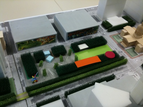
ABOVE: Model of Kiener Plaza

Last Wednesday the Gateway Mall Advisory Board held it’s quarterly meeting. On the agenda was a presentation from the firm Michael Van Valkenburgh Associates (MVVA), landscape architects.  The presenter was Senior Associate Nate Trevethan.

MVVA used the last 90 days to detail their vague proposal.  Here are some of the points that stood out to me:

  • No longer proposing underground parking to serve the Arch. Instead they want to fill up the many vacant parking garages downtown, including the two garages across Chestnut St from Kiener Plaza.  One new above grade garage may be built, but the site hasn’t been determined.
  • The distance from the Kiener garages to the new museum entrance facing the city is the same as from the current Arch garage to the north leg of the Arch.
  • Wayfinding will direct visitors to garages. This will put Arch visitors into downtown at the beginning & end of their Arch visit.
  • Pushing the “hallway” south so people can see past the Old Courthouse.
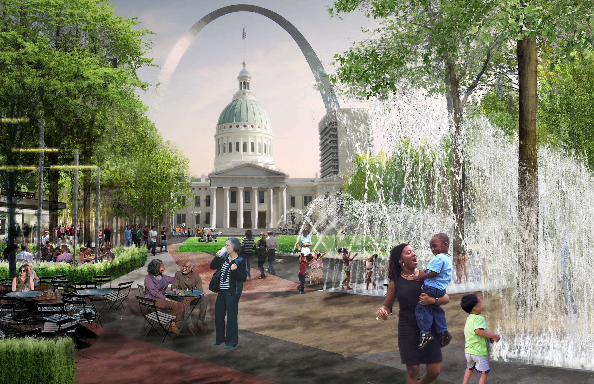
  • The eastern end will have a large lawn area that can hold thousands while the western end will have a cafe, beer garden and a series of loop fountains you can walk under.
  • A carousel will be in the SE corner (red above).

The role of us on the Advisory Board is to ensure new work on the Gateway Mall is in keeping with the Master Plan, approved in 2009. Here is what the master plan has to say about the space:

Kiener Plaza will continue to be the principal grand civic gathering area for the residents of St. Louis to come together for celebrations and events. Unlike the current design of divided spaces, the new program for the Plaza will create  a unified space that may be used for multiple smaller events or provide a contiguous space for larger events. A redefined, redesigned Kiener Plaza, appropriately programmed, can become a destination for Arch Grounds visitors, helping to draw a larger percentage of these visitors into the downtown. This effort, in turn, helps make the case for creating an improved connection to the Arch Grounds.

It is important that the redesigned Kiener Plaza consider a new performance pavilion that rises above grade, providing a unique architectural statement that is significant both during the day and evening. This will help connect the space more intimately to the city.

The new architecturally significant pavilion on the western edge could combine a performance stage, visitor’s center, restrooms and café. A large performance plaza with seating and a hard-surfaced edge could expand the pavilion’s capacity by extending eastward to the block’s midpoint. Conceptually, it could be enhanced with playful and artful paving that incorporates in-ground lights for nighttime interest, the northern and southern edges will be defined by rows of trees and sculptural light masts that provide performance lighting and light displays. Throughout the Plaza, there should be areas for informal seating, unstructured play and gathering. Adjacent to the light armatures, a series of perimeter gardens could enhance the garden edge along Chestnut and Market Streets. The center of the Plaza provides an excellent location for a skim fountain or other water feature that can be turned off during large events to provide additional space. Textures play a major role in the redesign, with a combination of hard and soft surfaces. The Old Courthouse and the Gateway Arch serve as the backdrop for the eastern edge of the Plaza.

The Gateway One building, situated within the Mall, is accepted as being a part of the landscape. However, any future design changes to this block should consider bringing the portion of the existing raised plaza to the sidewalk level on Market Street, thereby continuing the band of the Hallway.

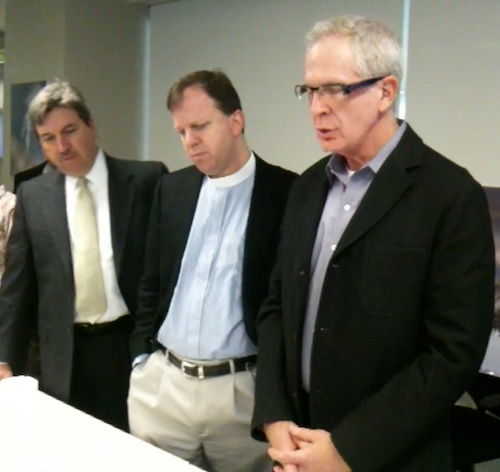
ABOVE: Steve Smith (Lawrence Group, Mike Kinman (Christ Church) & Chair Andy Trivers (Trivers Associates) looking over model
ABOVE: Steve Smith (Lawrence Group, Mike Kinman (Christ Church) & advisory board chair Andy Trivers (Trivers Associates) look over model following presentation

While MVVA doesn’t have a large pavilion at the western end they do have a smaller one near the center. We unanimously approved the concept, feeling it was in keeping with the spirit intended in the master plan.

ABOVE: winter view of Kiener Plaza with view of upper floors of the Wainwright Building. Click to view larger image
ABOVE: Summer view of Kiener Plaza
ABOVE: Summer view of Kiener Plaza showning lawn, fountains & movable furniture

Kiener Plaza will be the first element to be completed in the $578.5 million dollar CityArchRiver project with a goal of the fall of 2013. Specifics on costs for this piece are not known yet.

I question the use of the Kiener garages.  They are empty because they are dark, old and falling apart.  They are also privately owned

– Steve Patterson


Advertisement


[custom-facebook-feed]

Archives

Categories

Advertisement


Subscribe