New Park/Garden Under Construction Next To Eads Bridge
When Great Rivers Greenway announced six years ago they were going to build a park on the north side of the Eads Bridge many of us scratched our heads — there’s already huge park (90+ acres) on the south side of Eads Bridge — the Gateway Arch National Park. Why build a small park next to a big park?
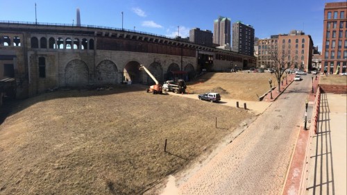
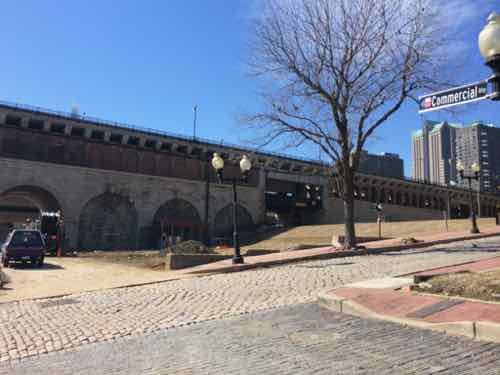
Here is their initial press release:
Feb. 27, 2014 (St. Louis) – With the transformation of the Riverfront and Gateway Arch grounds underway, the Great Rivers Greenway District is pleased to announce the purchase of a historic property that will provide a safer and more accessible connection between Laclede’s Landing and the revitalized Riverfront.
The lot is situated directly north of the Eads Bridge between First and Second streets on Laclede’s Landing. It is the site of the former Switzer Licorice Building, which was demolished in 2007.
“We are very pleased to have acquired this property,” says Susan Trautman, Executive Director of Great Rivers Greenway District. “Not only will it provide a universally accessible connection to the Arch grounds, it has the potential to create larger connections across the region and spur future development.”
The District aims to transform the property into a park or other compatible development offering food, restrooms, or other services to enhance the visitor experience while providing a seamless transition between the revitalized Gateway Arch grounds and Laclede’s Landing.
“The site offers endless possibilities for connection,” says Trautman. “It is steps away from the Eads Bridge Metrolink station, four blocks south of the North Riverfront Trail, and around the corner from the new trails being built on the Arch Grounds and along the Riverfront. It is fitting that the ‘front door’ of this property is a soaring arch beneath the historic Eads Bridge.”
The District purchased the property from St. John’s Bank for $350,000. The property’s appraised value was $390,000.
I didn’t catch this six years ago, but the site isn’t actually “between First and Second streets” — it’s between First and Lenore K. Sullivan Blvd (originally Warf).
What we often get in press releases about planned projects is statements meant to reduce possible objections to a decision. Who’d have a problem with safer and more accessible, right? Keep reading.
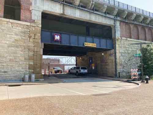
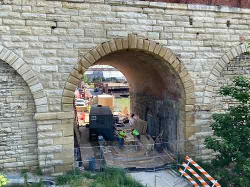
The Missouri approach to the 1874 Eads Bridge is brick & stone, but has five openings to allow people and vehicles to easily reach the other side: Warf, First, Second, at two alleys in between the streets. They knew in the 19th century that closing off parts of the street grid wouldn’t be a good idea so they make sure every street & alley could continue unimpeded.
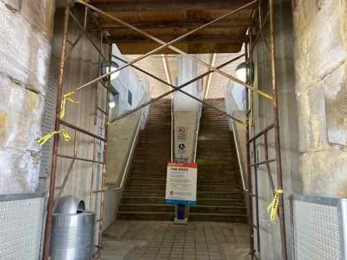
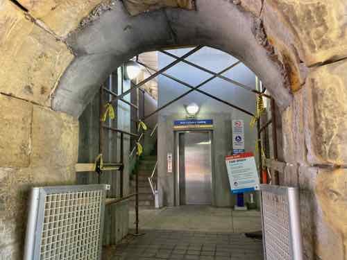
For anyone arriving at Laclede’s Landing via MetroLink light rail can exit to either First or Second streets — assuming they’re physically able to do so as only the Second Street exit has an elevator. Due to elevation changes, the Second Street exit also has significantly fewer steps than the First Street exit.
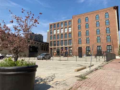
Second Street is the primary street in Laclede’s Landing, it has the most restaurants and such. First Street is ok a block further North, but right at the bridge it’s desolate — mostly surface parking and a old flood-prone parking structure down the hill.
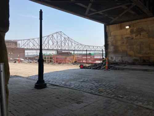
The west side of this new park is bounded by First Street, therefore adjacent to the First Street entry/exit for MetroLink. As a wheelchair user I can’t use the First Street exit. This park may prove popular, perhaps especially with cyclists and those looking for restrooms.
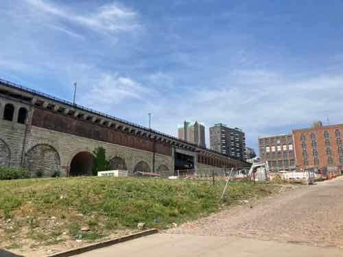
I personally would’ve liked to have seen new buildings, rather than more open space. That’s a big part of the problem with Laclede’s Landing — too few buildings, far too much open space. Sure, this will be green open space instead of asphalt open space. Hopefully the parking to the North & West can get replaced with new buildings — this would give this park nice walls.
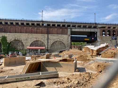
The new park is not named after the building that occupied the site for decades, Switzer licorice. No, follow the money out to Ladue.
The Katherine Ward Burg Garden is the first step in this long-term plan to redevelop the St. Louis Riverfront north of the Eads Bridge and Gateway Arch. Situated adjacent to the Eads Bridge, the half-acre plaza will be a welcoming spot once people exit the MetroLink at the Laclede’s Landing stop. It is bordered by North 1st street on the east, Lucas Avenue on the northern edge, the Mississippi Greenway (Commercial Alley) on the east and the Eads Bridge to the south.
Thanks to a generous bequest from the estate of Katherine Ward Burg, the garden has been designed to create a flexible and welcoming open space which attracts visitors north from the Arch grounds to explore Laclede’s Landing or to the Arch grounds from the Landing. It incorporates an iconic trellis, stepped terraces and curving seatwalls offering a comfortable spot for respite, a meeting place to start an adventure and a site that can be adapted for special events and programs. The gently sloped landscape allows for accessible ramp access from First Street down to Commercial Street, a way for all people to move down toward the river, eventually connecting to the Mississippi Greenway.
Construction is underway and expected to be complete in Spring 2021. (Great Rivers Greenway)
If you were looking for a post with uncritical approval with artists renderings you’ve come to the wrong blog. Hopefully my skepticism will prove unfounded, the garden will become a huge success.
We’ll find out how it looks and functions next year and if it’s a success after a few more years.
— Steve Patterson