Of course, no mention of MetroBus.
Posted by UrbanReview ST LOUIS on Thursday, June 13, 2019
City Residents Please Consider Using Public Transit (Bus &/or Rail) To Get Downtown For The Blues Parade Tomorrow
Yesterday I shared a Metro post, criticizing their lack of mentioning MetroBus.
Fr0m their post:
MetroLink will have extra trains ready to go on Saturday as hundreds of thousands of Blues fans head downtown to celebrate with the Stanley Cup Champions, the St. Louis Blues.
With five downtown MetroLink stations a block or two away from the Stanley Cup Parade, MetroLink is the perfect option while avoiding road construction, traffic and parking issues.
What about residents of North & South city that don’t yet have light rail?
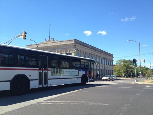
Yes, MetroBus is a good option. Since Metro’s marketing folks don’t seem to want to suggest their own service I decided to step up and show you some suggested routes. Those of us who live in the city are well-served by transit, if we take it downtown that’ll ease congestion for everyone downtown. We’re not all served by light rail.
My focus is on MetroBus routes that enter downtown, though other routes could connect you to say the Forest Park MetroLink station — the 90 Hampton MetroBus serves both North, West, & South city. Of course the busiest MetroBus route, the 70 Grand, is an excellent option to reach MetroLink.
Because the Civic Center Transit Center is on the south edge of downtown (Downtown West technically) the south routes have less disruption from downtown events. However, most should be good, assuming you get downtown prior to street closures.
From South City:
- 8 Bates-Morganford winds its way through the city on streets like: Loughborough, Holly Hills, Tower Grove, Shaw, Russell, 12th/Tucker, and — Bates & Morganford. On Saturday this bus runs every hour, the last bus before the parade arrives at Civic Center at 11:40am.
- 10 Gravois-Lindell originates at Gravois & Hampton, cutting a diagonal path through south city along Gravois. Saturday morning this bus runs every 30 minutes.
- 11 Chippewa runs every 40 minutes on Saturday morning, from the Shrewsbury MetroLink Station along Landsdowne, Chippewa, and Jefferson. Normally the EB bus heading into downtown goes up to Market but tomorrow it’ll use Chouteau to 14th to avoid the parade.
- 20 South Broadway serves South County & South City including South County Mall, Jefferson Barracks, far south city, & Soulard. On Saturday it runs every hour.
- 30 Arsenal is another route running through south city between Shrewsbury MetroLink and Civic Center Transit Center in Downtown West. It primarily uses Arsenal for the East-West portion and Broadway for the North-South. The 30 runs every 40 minutes on Saturdays.
- 31 Chouteau connects the Maplewood/Manchester MetroLink Station to Civic Center via Manchester in both the county & city, and Chouteau. It runs every hour on Saturdays.
- 73 Carondelet serves both south county & city, every 30 minutes on Saturdays. Streets include: Michigan, Virginia, Osceola, Meramec, Cherokee, Lemp, and Truman Parkway.
- 80 Park-Shaw connects the CWE MetroLink to Civic Center via south city. Similar to 8 above, but the route is different. Every hour on Saturdays.
From North City — most will have a reroute in the downtown area due to the parade.
- 4 Natural Bridge travels mostly along Natural Bridge, then using Parnell/Jefferson, usually to Market. Due to the parade it’ll reroute by staying on Jefferson to Chouteau to 14th to Civic Center. The 4 runs every 40 minutes on Saturdays.
- 19 St. Louis Ave connects the Rock Road MetroLink to Civic Center, through the heart of The Ville. It runs every 40 minutes on Saturdays. Because 14th will be closed for the parade it’ll reroute to Olive, Jefferson, Chouteau, 14th — if you take this bus to the parade I suggest exiting at 14th & Olive. The 19 runs every 40 minutes on Saturdays.
- 32 ML King also connects Rock Road to Civic Center, a little further south than the 19. It uses ML King & Cass for East-West and 9th/10th for North-South. At Washington & Tucker it will due a massive reroute along Washington to Jefferson, to Chouteau, to 14th. Avoid the reroute and exit before Tucker. The 32 runs every 40 minutes on Saturdays.
- 40 North Broadway connects Riverview to downtown, primarily along Broadway. Like the 32 it reroutes along Washington from Broadway to Jefferson — avoid all that and get off at Broadway & Washington! The 40 runs every hour on Saturdays.
- 41 Lee runs every 40 minutes between Riverview and downtown/Civic Center on streets like Thekla, Emerson, Lee, Kossuth, 20th, Carr. Like other bus routes, avoid the very long reroutes by exiting at 14th & Olive.
- 74 Florissant runs every half hour connecting north county to downtown via West/North Florissant. Like others, exit at 14th & Olive to avoid the long reroute.
From West City:
- 10 Gravois-Lindell was mentioned above on the South City section, but for those in midtown it’s a good option to get to Civic Center. It’ll reroute at Jefferson to Chouteau so either stay on the bus to Civic Center or exit at Olive & Jefferson and walk to the parade start at 18th & Market. Or take it WB to the CWE to catch the train downtown.
- 94 Page runs every 40 minutes on Saturdays connecting Westport Plaza via Wellston to Civic Center. In the city it primarily uses Page, 18th, Market. Because of the parade it’ll reroute at 18th & Olive to Jefferson, Chouteau. Either get off at 18th & Olive or continue to Civic Center.
- 96 Market Street Shuttle runs every hour on Saturdays. This is an option for SLU/Harris Stowe students. It’ll reroute at Jefferson to Chouteau.
- 97 Delmar connects Clayton to Civic Center via the Delmar/Loop MetroLink, running every 30 minutes on Saturdays. In the city it primarily uses Delmar, Compton (briefly) and Washington. Due to the parade it’ll reroute at Washington to Jefferson, to Chouteau.
The links above are to the regular map for each route, for a list of all MetroBus routes click here. Again, if you live in the city and plan to attend the parade please walk, bike, or use transit — bus and/or rail. The cash fare each way is $2 — have $1 bills because you can’t get change on the bus. If you need to take more than one bus or bus plus rail you’ll need $3 each way for a transfer. For exact times, stop locations, etc use Google Maps, Apple Maps, the Transit App, or Metro’s Trip Planner.
Street parking isn’t free on Saturday, and lots will be charging a lot. Uber/Lyft will likely have surge pricing, plus will have to deal with lots of traffic. Take transit — light rail or MetroBus.
— Steve Patterson