This Friday, May 5th 2023, St. Louis native Andy Cohen will get a star on the St. Louis Walk of Fame:
The late-night TV talk show host and executive producer will be inducted into the St. Louis Walk of Fame at 5 p.m. Friday, May 5. A live ragtime band will begin performing at 4:30 p.m.
The ceremony is free to the public and will take place in front of the Moonrise Hotel at 6177 Delmar in The Loop.
Cohen was born and raised in St. Louis and graduated from Clayton High School in 1986. He is best known as the host and executive producer of Bravo TV’s “Watch What Happens Live with Andy Cohen.” He was also an executive producer for “The Real Housewives” franchise and hosted numerous specials.
Cohen’s roots in St. Louis go back a very long time, as detailed in January 2021 on PBS’ program Finding Your Roots (Against all Odds, S7E2). NPR’s Nina Totenburg was the other guest.
If you missed this episode, or want to watch it again, it will be shown again tonight on Finding Your Roots, 9.1 7pm CST in St. Louis.
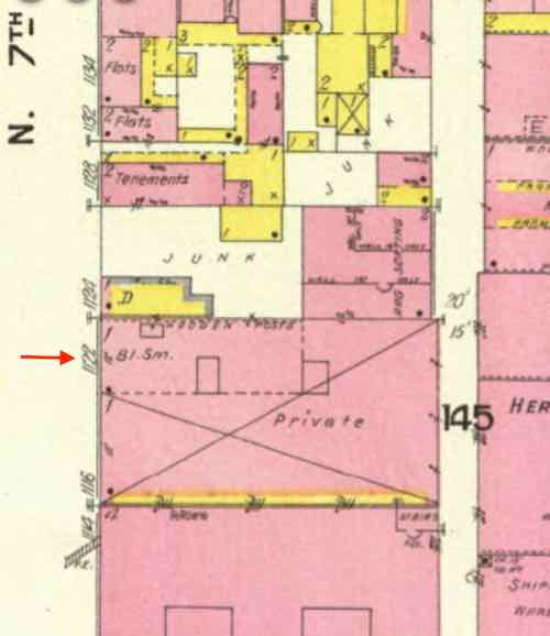
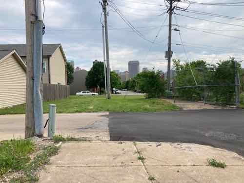
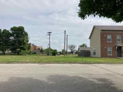
In the above clip Cohen reads about a paternal great great grandfather, Russian peddler Simon Kruvant, injured in a horse/carriage accident in 1889 at South Broadway & Koeln Avenue. We also learned Kruvant and his wife lived at 1122 N. 7th Street.
1122 North 7th Street was a one story non-residential building, seen here in a 1909 Sanborn Fire Insurance map. Either the newspaper article gave the wrong address, or this immigrant couple were living in a commercial space.
Given that Kruvant was a peddler a commercial space with room for goods, cart, and horse makes sense. This wasn’t in the Post-Dispatch archives so it must’ve been another newspaper.
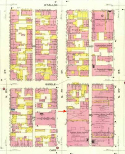
The red arrow center toward the bottom shows where 1122 N 7th was. Pink is masonry, yellow is wood frame. Neighbors include industrial, tenements, and Father Dempsey’s Men’s Hotel.
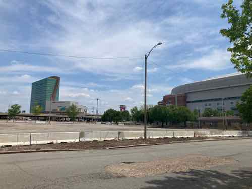
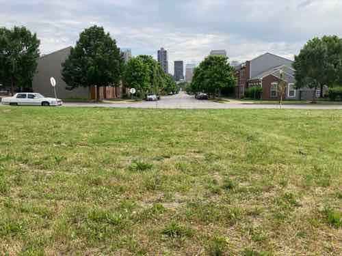
Today 1122 North 7th Street is part numerous vacant blocks just north of the dome.
This area was known as Near North for a long time, but officially it is part of Columbus Square. Before Neighborhoods Gardens and Cochran Gardens were built the neighborhood contained the highest concentration of tenements in the city.
This neighborhood welcomed the poorest immigrants, including: Irish, Jewish, Italian, and blacks escaping the Jim Crow south.
See Andy Cohen tonight on Finding Your Roots and receiving his star Friday in front of the Moonrise Hotel.
— Steve ———————————————————————— St. Louis urban planning, policy, and politics @ UrbanReviewSTL since October 31, 2004. For additional content please consider following on Facebook, Instagram, Mastodon, and/or Twitter.
Monday’s post was about reconnecting the pedestrian grid at 8th Street, just south of Cass Ave — see 8th Street Walkway Needed To Fill Missing 110’ Connectivity Gap. Today’s post is about exploring options for new housing on the large lot known as 801 Dickson Street — it stretches a full block along the north side of Dickson, between 8th & 9th streets. This vacant land is owned by the St. Louis Housing Authority.
First we’ll look at the site, conditions, etc. and then some of the various configurations I’ve considered. You may have others.
801 Dickson is owned by the St. Louis Housing Authority, zoned D Multi-Family Housing. The strategic land use is NPA — neighborhood preservation area. The long sides are 292.52 feet, the east/right short side is 110 feet, and the left/west short side is 120 feet. Click to view in Google Maps — sans boundary lines.
Site characteristics:
Faces south-southwest.
Gentle slope south from alley.
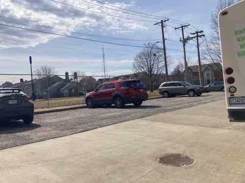
The parking for 12 cars at the alley has been in place for 70 years, it lacks an accessible space and adjacent loading zone.
The Youth & Family Center on the north side of the alley was built in 1982. It was previously called Cochran Youth & Family Center. It has entrances onto Cass and the back alley. It has no parking on its site at 818 Cass Ave. Nobody ever parks on Cass Ave, even though it isn’t marked as no parking.
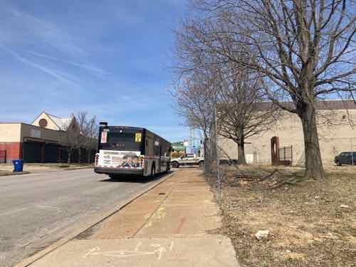
A northbound bus stop (#32) is on the short side, on 9th Street.
Overhead electric enters the site on the east side, about 20 feet south of the alley. The poles and overhead wires stop just before 9th Street (left side).
Some mature trees exist along the alley, 9th. Smaller street trees exist along Dickson Street. The trees next to the alley have been trimmed so as to not interfere with the overhead power lines.
The west end had part of Cochran Gardens tower C-9 from 1951 until about 2005, the west end was part of a Cochran Gardens playground. Presumably the building foundations were fully removed. Potentially 19th century remnants remain buried.
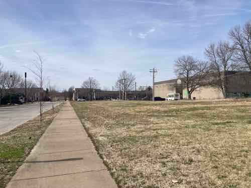
Looking west at 801 Dickson
Looking north on 9th, at Dickson. The #32 bus frequently stops here to drop off a rider, or let one board.
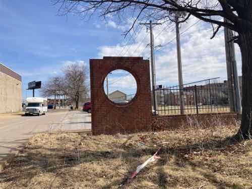
Looking back east from 9th, the brick circle is all that remains from Cochran Gardens. Parking & electrical poles are visible.
A direct view of the parking from the alley. Again, the overhead electric is visible.
Before getting into the various options for new construction please understand this post isn’t concerned with who would build any housing, or how it would be paid for, demand, market economics, etc. The purpose here is to see the various options for constructing additional housing on the site — what does & doesn’t physically fit on the site. Ideally I’d like to avoid a curb cut/driveway off both Dickson & 9th streets.
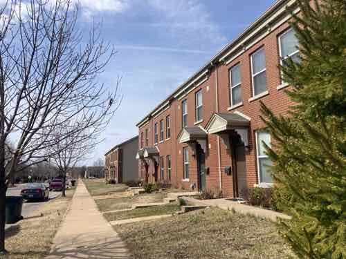
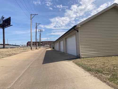
A good plan to start with ideas is to look at the context, the housing around the site. To the east of where I want a new 8th Street pedestrian walkway the dimension between 8th and 7th is just a few feet wider. It has two buildings, each with four townhouses. Along the alley are two garage buildings, each with a 2-car garage — one for each of the 8 total townhouses. When Cochran Gardens was replaced all the new construction, like my apartment, is rental — but each of the 8 townhouses are privately-owned, owner-occupied.
Row houses 7xx Dickson
Garages behind 7xx Dickson
The problem is the aforementioned parking spaces off the alley, on the west end of the site. If the trees along the alley were removed you could building one group of four townhouses, with garage. You could do a second if the parking were removed, but that’s not ideal.
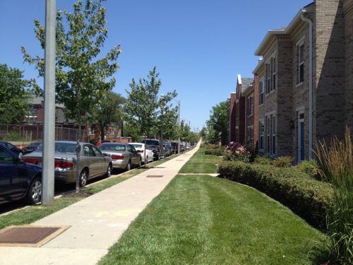
Directly across Dickson Street are more townhouses, these are mixed-income rentals with a common shared parking lot behind. Theoretically it may be possible to put a shallow parking lot behind townhouses.
This is a 2012 view of townhouses on 9th Street, the ones facing Dickson are similar.
The other contextual option is a building with garden apartments. The Cambridge Heights garden apartment buildings each contain 12 apartments — 3 floors, six units per two entrances/breezeways. Like townhouses, parking might be possible behind. One such building could fit. A variation with 18 units with three entrances/breezeways could potentially fit.
What about going higher than 3 floors? While elevators are expensive, and costly to maintain, a 4-5 story building could work as you get more units in the same space. The scale of an old 5-story building on 7th seems fine in the neighborhood. I’d love to see a lot of accessible units as the need for low-income housing for the disabled is needed — especially near downtown. With an existing bus stop adjacent it would be great for many people who don’t drive or own a car, this would make it easier to not have any off-street parking. Perhaps the site is arranged so a small parking lot is located off the alley, on the east end of the site.
It would be nice if an elevator building had a retail space at the corner, perhaps part of a live/work unit.
Another option would be groupings of tiny homes (300sf) or small homes (800sf). Some could front onto the 8th Street walkway I’d like to see get built. Since the site is a block long there’s nothing to say it all has to be the same, some combination of ideas can be used.
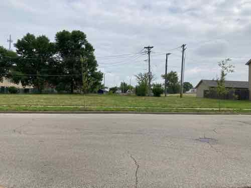
The parking at the alley for the Youth & Family Center should probably be separated from the main lot, or a formalized easement. It would also be nice if the overhead electric was buried. The St. Louis Housing Authority also owns a larger lot between 8th & 9th, on O’Fallon Street (map), but kids often use this for ball, frisbee, etc.
The vacant land in my neighborhood, owned by the housing authority, is ideal for affordable/low-income new housing — perhaps by a developer seeking a tax break on a big project in the central corridor.
When cold water flats and tenements were cleared just north of downtown for St. Louis’ first high-rise public housing project, Cochran Gardens, several blocks of 8th Street were erased from the grid. Six decades later 8th Street was rebuilt* when the mixed-income Cambridge Heights apartments & townhouses replaced Cochran Gardens’ towers.
* 110 feet of 8th Street wasn’t replaced!
This short missing piece is a connectivity problem for those of us who live here. Later, when Cass Ave over I-44 (aka I-70) was raised as part of the Stan Musial Veterans Memorial Bridge project 7th Street got disconnected from Cass Ave. So now neither 7th or 8th connect to Cass. Getting to/from the bus at Cass Ave & Broadway is likely the primary reason for needing access here, it would also be nice when we go to Shady Jack’s or walk/roll up Broadway.
A little bit of the original 8th Street exists south of Cass Ave, but it quickly ends at an alley. Jersey barriers exist to keep drivers from going straight ahead.
From the broken sidewalk on the east side of 8th you can see a clear route to 8th Street 100 feet further south. The west side of 8th, unfortunately, has no sidewalk.
In the field you can see beyond Dickson Street to 8th Street
At the public sidewalk you can look south along 8th Street to downtown. 8th Street is the center of Cambridge Heights.
Motorists use the alley south of Cass to get to/from Cass Ave, but pedestrians often walk though vacant land where 110 feet of 8th street should be. As you’ll see, putting in street, curbs, drainage, etc would be challenging & costly — all that’s needed is a 110 foot long sidewalk and a couple of curb ramps.
Looking toward Cass Ave from the SW corner of 8th & Dickson streets.
Looking toward Cass Ave from the SW corner of 8th & Dickson streets.
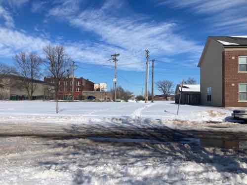
The same view after a recent snowfall. Two desire lines where people walked are clear. A community center is visible on the left, but no good way to get there directly.
This is needed because going between the neighborhood and Cass Ave is challenging as a pedestrian. I’ve thought so for the 3+ years I’ve lived here. I’ve also seen a woman at least 15 years my senior (so 70+) walking though the grass with a cane. The trail through the snow earlier this year was also a clue.
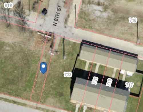
You might be thinking this land is vacant do it can be developed for more housing. Let’s take a look at the property lines.
The blue dot marks a 15 foot wide parcel owned by the St. Louis Housing Authority (725 Dickson Street). They also own the land from here to 9th Street. 723 Dickson Street is 64.26 feet wide, includes the 22 foot wide end of 3 townhouses.
My assumption is the 15 foot wide parcel known as 725 Dickson (map) is there to prevent anyone building over utilities, like sewer, under the old 8th Street. The end row house has a lot of extra land beyond their fence. Basically there’s more than enough width to create a generous pedestrian path. There are some obstacles near the alley.
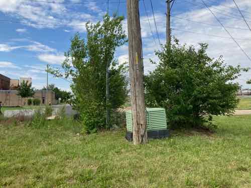
From the alley you can see a little bit of concrete and some useless chain link. And an electric utility pole.
From the lot you can see the pole and an electrical box (transformer?). There are also wires to help keep the pole upright on the private land side.
There’s room to fit a 5′ wide walkway at the alley to then toward 8th & Dickson streets, we just need to figure out property lines, utilities, easements, etc. City mowers have a hard time during the summer keeping the back area cut — a private home owner would get a violation letter from the city for such conditions. The elevation is slightly higher at the alley than south at Dickson Street.
The need exists, much of the land is owned by the housing authority. Cost wouldn’t be that substantial. I’d love to see fruit trees planed on both sides of a walkway so the public can access free fruit.
Urban highways & interstates allow drivers to get from point A to point B quicker than had they taken surface streets, but they’re also a major divider between the existing neighborhoods they cut through. In the late 1950s the downtown’s 3rd Street Parkway was being extended north, eventually connecting with the new Mark Twain Expressway (aka I-70/I-44) in July 1961.
I live on the west side of the highway, but I can stand in my kitchen and see Broadway & Cass, on the east side of the highway. I know first hand how the highway divides the historic north riverfront from my neighborhood, Columbus Square.
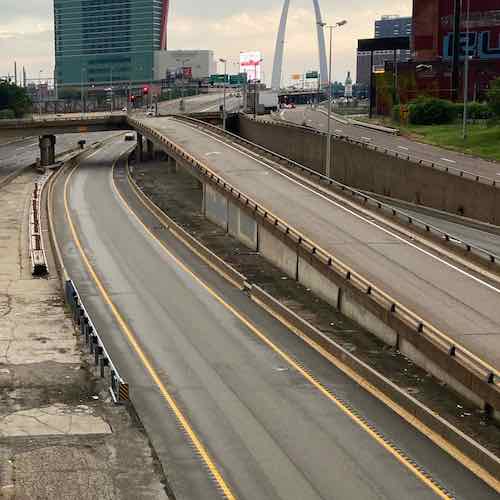
Looking south from the Cass Ave bridge over I-44, June 2020. The lane center is a southbound express lane, to the right is the express lane exit ramp to southbound Broadway.
Ideally we’d remove urban interstates and weave our neighborhoods back together, but that’s never going to happen. What should happen is when we rebuild crumbling infrastructure we add connections civil engineers in the 1950s never considered at the time the highways were planned.
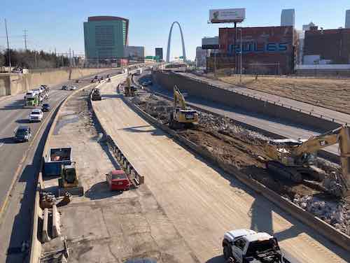
The same view Monday with southbound Broadway bridge and the exit ramp gone.
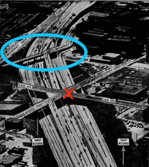
The blue oval is the southbound Broadway bridge, the red X is where Csss & 7th were connected until construction began for the Stan Musial Veterans Memorial Bridge. Post-Dispatch July 9, 1961, p161.
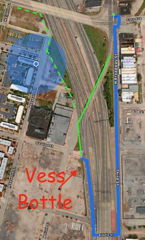
The distance from Broadway & Cass to Broadway & O’Fallon is only 2/10 of a mile, but the distance required for the last 60 years has been double that — 4/10 of a mile.
The Missouri Department of Transportation supports pedestrian facilities:
MoDOT works with planning partners to create transportation facilities that work for all users because we value bicycle and pedestrian travel. Accommodating for bicyclists or pedestrians may be as simple as providing a well-designed road that all road users share or as complex as a separate-grade structure, such as a bridge. Developing appropriate facility design for nonmotorists depends on a variety of geometric and operational factors that are inter-related, such as available right-of-way, projected traffic counts and adjacent roadway design speeds.
We strive to integrate nonmotorized travel into the existing system to provide connections where none exist to promote efficiency and to focus on a primary concern—the safety of those who depend on walking or bicycling to reach their destinations. (MoDOT)
Unfortunately MoDOT failed to accommodate the needs of cyclists and pedestrians in the replacement. This is a huge mistake — it’ll be another 60+ years before we get another chance to reconnect these areas.
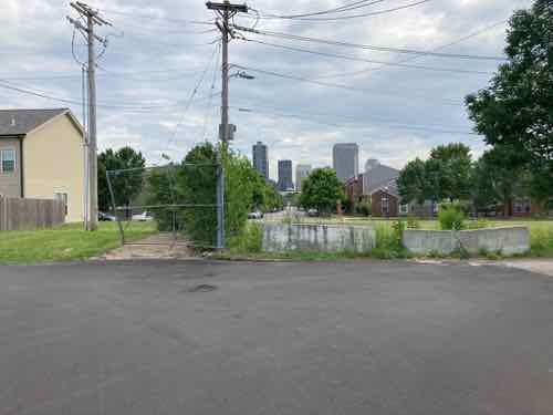
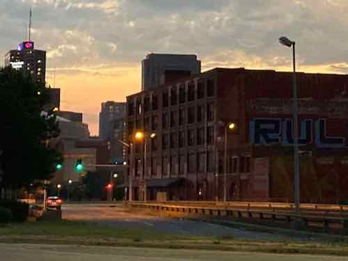
View from Broadway near Cass looking SW toward Broadway @ O’Fallon (just beyond building), June 2021
The buildings on the right are part of a National Register Historic District.
You might be thinking it would be too difficult to include a pedestrian sidewalk. The old bridge, removed over the weekend, couldn’t have easily been retrofitted. But when building the new bridge entirely from the ground up it is actually pretty easy.
Here’s the overview:
The blue circle is my location. The blue line represents the route required to walk from Broadway @ Cass to Broadway @ O’Fallon — twice as far as the direct route shown in solid green. The dashed green line is how to connect Cass to 7th & 6th streets. Apple Maps
Now let’s take a look at the old bridge and highway exit ramps.
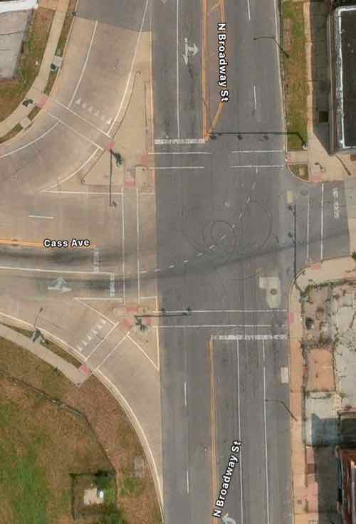
Broadway is only one lane per direction north of Cass, but it widens to 2 right turn lanes onto westbound Cass and 2 southbound lane to continue across the highway. One lane expands to four! Apple Maps
So 2 lanes of Broadway continued over the highway. The express lane exit is one lane but the Broadway exit is 2 lanes. Four lanes continue toward Cole before getting reduced to 2 further south.
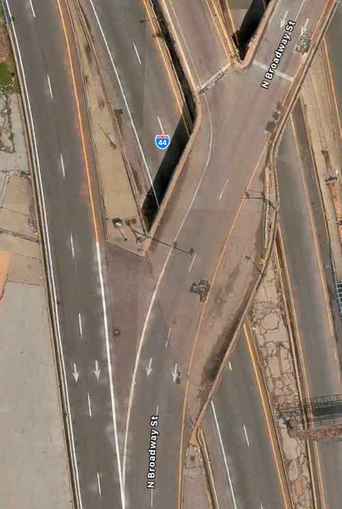
The solution is the one southbound lane of Broadway splits into 3 before Cass — one left, one right, one straight ahead. This means the same width bridge can also accommodate bikes & pedestrians. The traffic exiting the southbound express lane and the highway have plenty of length for drivers to decelerate. Rumble strips (or similar) can be used to communicate to the driver to slow down as they approach Broadway. The 2 highway exit lanes can narrow to one before Broadway. Not sure if signals are necessary or just a flashing red light and notices to yield to pedestrians.
I would like to see Broadway south of Cole to return to two-way traffic in the future, so I’d like the new bridge to accommodate 2-way traffic and pedestrians on one side.
Again, I’m trying to connect two areas that have been separated for over 60 years. Both have enormous potential for redevelopment — new construction & adaptive reuse to the south and mostly captive reuse to the north. I’d love to see football fans have pre-game drinks at Shady Jack’s Saloon and then walk down to the Dome to see the St. Louis Battlehawks when the XFL returns under new ownership.
My previous post on the convention center was back in July, see: The St. Louis Region Needs to Consider No Longer Chasing Big Conventions. Basically I said leave just a little and tear down the rest. This would allow new private development and reconnect the neighborhood north of the complex to the downtown central business district (CBD) — 6th, 7th, and 8th streets have been closed for years and 9th will close if the current plan moves forward. In September the CEO of Clayco Construction, Bob Clark, proposed another alternative to the current plan.
The current plan adds more lipstick to our nearly 45 year-old pig, fixing problems created by prior applications of quick fix solutions: ballroom next to the kitchen, improved loading docks, more space, adjacent outdoor space, etc. The goal is to go after conventions that have eluded us due to inadequacies in our facilities.
My solution was to simply stop chasing after them and reconnect a neighborhood that was intentionally cut off. It is also the neighborhood where I live. So in September I was happy to see an influential CEO weigh in on the topic, but go the opposite direction.
St. Louis should scrap its $210 million convention center addition in favor of a larger, $800 million plan that would see the current downtown facility and Dome demolished, Clayco CEO Bob Clark said.
Clark said he’s pitched the larger plan to area officials for two and a half years, but is going public now because federal infrastructure money could be coming to St. Louis and a potential settlement with the National Football League looms over the Rams’ 2016 exit to Los Angeles. And Clark thinks the state of Missouri could contribute to the more ambitious proposal, solving a funding problem that limited the current plan’s scope. (St. Louis Business Journal via KSDK)
Late last month St. Louis (city of St. Louis, St. Louis County, and the Regional Convention and Sports Complex Authority) settled with Kroenke/NFL, with the former receiving $790 million dollars (before attorney’s fees).
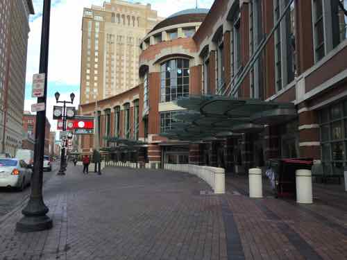
The current main entrance at 8th & Washington Ave. was part of a major 1993 expansion to the 1977 original.
Over the years, St. Louis has missed a lot of great opportunities to revitalize its downtown neighborhoods. From losing out on railroads to Chicago to failing to merge the city with St. Louis County, so many things have happened throughout the city’s history that still prevent it from being as good as it can be. With renewed attention on reimagining the downtown convention center, I’m calling for a larger, more ambitious plan to be considered that would completely transform the city for the better.
With additional funding opportunities coming from federal infrastructure spending, a potential settlement with the NFL, and additional state funds, we have a real chance to think bigger and put forth even better ideas for America’s Center, like my proposal to build a convention center that would boost business and better connect north city neighborhoods to downtown.
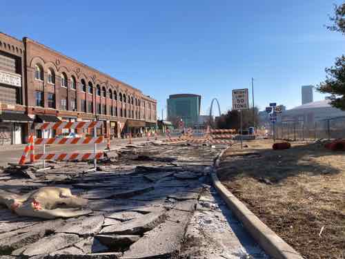
Modeled after the convention center in Nashville, Tennessee, our plan envisions a modern convention center for the future that would occupy a three-block footprint near the Bottle District stretching from Carr Street south to Convention Plaza. It would provide more exhibit and meeting space and also connect to the NoW Innovation District that is already generating positive results for job growth and the local economy. And it would also play a part in keeping the city safer, since it would provide better access between the city’s northern neighborhoods and southern neighborhoods going right through downtown.
This is a project that gives us a great opportunity to build a better city for St. Louisans and share what we have to offer with visitors from all over the world. It would help solve some of the most pressing issues we face as a city, and I’m urging our local elected officials to consider it further.
Clark is correct that just adding on more space to be able to check boxes isn’t the right approach if we actually want to be seriously considered for some convention business. Yes, I’ve posted about how cities keep wasting big bucks chasing conventions, see Convention Center Follies: Politics, Power, and Public Investment in American Cities by Heywood T. Sanders from 2014. It seems to me it’d a bigger waste of money to keep attempting to make a half-ass facility into a competatibvr .
The current configuration occupies 12 city blocks (11 plus a privately owned garage surrounded on 3 sides). If the current plan goes ahead it’ll add a 13th city block. While it may then be able to check off boxes on convention event planner’s must have lists the reality is it’ll still be a spread out mess that separates the city with a huge monolithic mass with Broadway (5th Street) on the east and 10th Street on the west.
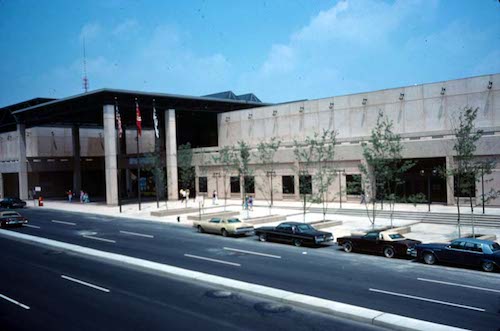
Our original 4-block Cervantes Convention Center, which opened in 1977, is still in the center of our current facility.
To the north of this mass only 8th street is closed, occupied by apartments. Sixth, 7th, and 9th all still exist in the neighborhood. The most recent plan for a north-south light rail plan includes a little bit of 9th, so the planned route would have to change.
So I’m agreeing with Bob Clark, if we want convention business we should start over with a clean slate. I haven’t been to Nashville since the Music City Center was constructed, but I looked at the website, photos, interior 360º views, aerial, and Google Streetview. Nashville’s convention center is 3 blocks long, 2 blocks wide. One city street continues through/under the building — I walked through via streetview. From the outside you cannot see the loading docks, one side is highly approachable with outdoor seating and businesses that can serve convention attendees as well as locals.
The main takeaway of Nashville’s center relative to Clark’s proposal is the street that continues rather than being vacated. In. St. Louis that allows a 3-block long convention center to orient north-south, next to the dead space known as the elevated I-44 interstate. Another is building up, not out. We’re a city, downtown buildings shouldn’t largely be single story.
View of Bob Clark’s proposal, click image to see larger view.
I’m not advocating we build Clark’s idea, I’m suggesting we start over from scratch. We’ve added on and altered the convention center built 45 years ago to the point it’s a sprawling mess. The Nashville center can’t compete with Chicago’s McCormack Place in terms of size, but it has the same light-filled open airy feeling. Our current facility will never have that. Never.
Here’s what I like about Clark’s proposal:
Fresh start, better for 21st century needs.
North-south orientation along Broadway (5th).
Better connection to Laclede’s Landing.
Cole Street (east-west) continues uninterrupted.
Sidewalk-level opportunities for storefronts around entire building, including along Cole.
A big massive building doesn’t separate the downtown CBD from the neighborhood north of Cole.
The long-vacant land north of Cole Street is utilized.
Vacant land to the west can be filled with new buildings, users, opportunities, tax revenue.
Here’s what I don’t like about Clark’s proposal:
The outdoor event space (Baer Plaza) between Broadway and I-44 is horrible. Conventioneers attempting to cross Broadway would get hit by the speeding one-way traffic. Broadway should be 2-way and this land should have hotel, apartments, condos, etc. Some of any new residential should be workforce housing and low-income housing.
7th, 9th, and 10th streets all need to be rebuilt/continue uninterrupted between Washington Ave and Cole — for pedestrians and vehicles.
Not sure keeping the existing curved entrance is a good idea.
No green roof or solar panels like they have in Nashville.
Convention Plaza needs to return to its previous name: Delmar.
The important thing is to put the brakes on the current expansion plan and take a fresh look at what it means to offer a convention center — not just how can we make a nearly half century old place less objectionable to convention planners. If we move forward with the current expansion plan we’ll be stuck with a bloated pig for at least another 20-30 years.
AARP Livibility Index
The Livability Index scores neighborhoods and communities across the U.S. for the services and amenities that impact your life the most
Built St. Louis
historic architecture of St. Louis, Missouri – mourning the losses, celebrating the survivors.
Geo St. Louis
a guide to geospatial data about the City of St. Louis