Home » Travel » Recent Articles:

A Look At Kansas City’s New Modern Streetcar

Last week leaders in the St. Louis region argued publicly over future pubic transit:

St. Louis Mayor Francis Slay has made clear his support for a north-south MetroLink expansion, saying it’s a top priority in his final year in office. But a recent push for money to plan such a route has met with strong resistance from St. Louis County Executive Steve Stenger.

Stenger, in a letter to the Federal Transit Administration, said he will not endorse the north-south route until other proposed routes are studied. (Post-Dispatch)

At the other end of the state, in Kansas City, there’s also a disagreement about the expansion of rail-based public transit. The local non-profit behind the new KC Streetcar wants to expand South on Main Street, while another is pushing a light rail plan.

[Clay] Chastain argues his plan gives Kansas City residents a real choice and a much more extensive rail transit system, from the airport to the Cerner Trails campus under construction in south Kansas City and from Union Station to the stadium complex. 

He estimates it would cost $2 billion to build, or about $45 million per mile, although some light-rail systems have cost considerably more than that per mile. He assumes the federal government would provide $1 billion of that amount.

The local match would come from a 3/8-cent sales tax increase for 25 years, plus 3/8 cents that currently go for the bus system, once that tax expires in 2024. (Kansas City Star)

Anyone who has flown in/out of KC’s airport knows it is a long distance from downtown KC. It’s a 20-25 minute drive, but takes over an hour by bus. Frankly, they need to do both — expand the new streetcar and build light rail to far off destinations like their airport and stadiums.

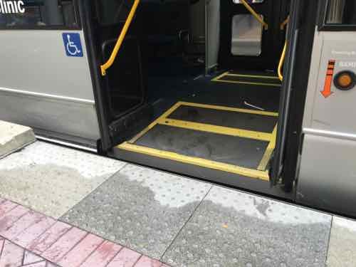
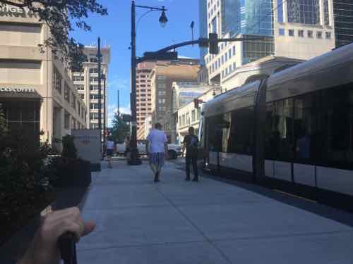
Kansas City was without rail-based public transit from 1957 until May 6, 2016 — the day the 2.2 mile starter streetcar opened.

THE FUNDING:

  • Cost to build: $100 million — $37 million from the federal government, $63 million from bonds.
  • Cost to operate: $4 million annually to be paid by a combination of sales & property taxes within the transportation district.
  • Fare:  $0 — free
  • Local comparison: Our Loop Trolley vintage streetcar project. also 2.2 miles long, is costing $51 million to build. The 8-mile cross-county MetroLink extension that opened in 2006 cost $430 million.

THE VEHICLES:

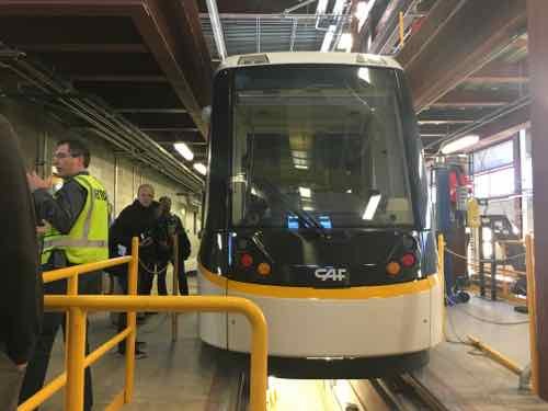
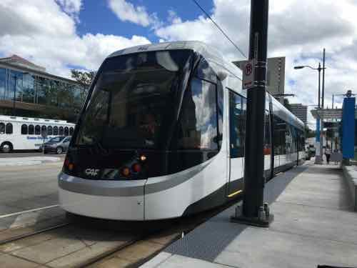
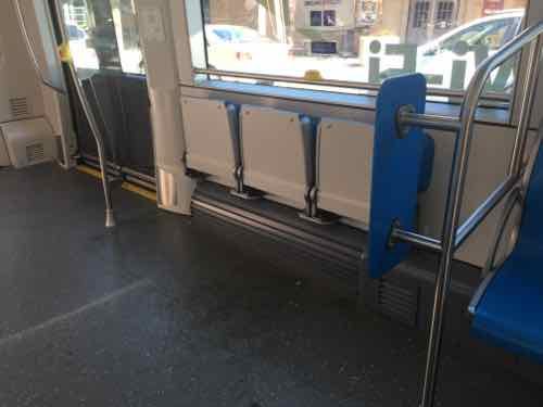
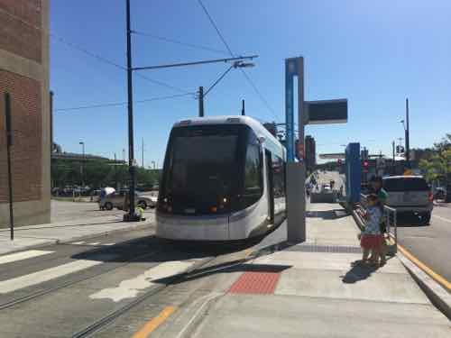
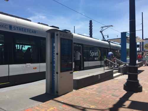
  • “Each vehicle is 77 feet and 8 inches long; 78,000 pounds; and 12 feet tall.”
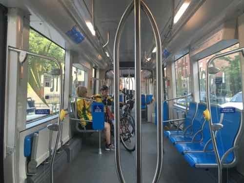
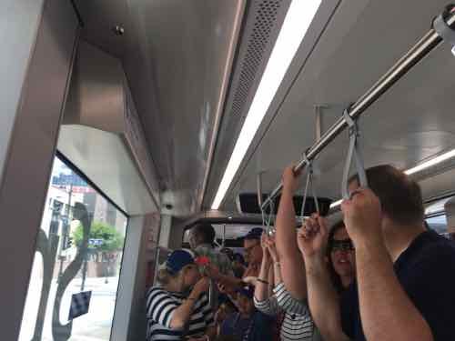
  • “Each vehicle capacity is approximately 150 riders and is bi-directional (can run both directions). There is a combination of sitting and standing within the streetcar.”
  • “There are three “cars” in each streetcar vehicle, with 4 sets of doors (one on each end and two in the middle car).”
  • Each of the four vehicles cost $4.39 million each (source).
  • Same as vehicles used in the Cincinnati Streetcar opening later this year.
  • Model: CAF Urbos 3 100% low-floor
  • Manufactured in Elmira NY by CAF USA, a subsidiary of a Spanish company.
  • To meet US crash-standards the body is made of steel
  • Comparison: our 4-car light rail vehicles are 90 feet long; capacity of 72 seated plus 106 standing
Each end is identical
The lights change depending upon direction of travel. The step on this end of the Union Station platform is annoying.
This view gives you an overview of the three cars in each vehicle -- middle and two ends. Wheelchairs, strollers. bikes, the middle car, the door on each end has a step
This view gives you an overview of the three cars in each vehicle — middle and two ends. Wheelchairs, strollers. bikes, the middle car, the door on each end has a step
The center car is very open, the ends are filled with fixed seating. The floor is level throughout,
The center car has two areas with theater seats. My wheelchair fit here and my husband could sit on one seat.
It got packed to capacity a few times we were riding

THE ROUTE:

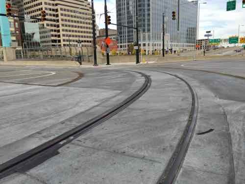
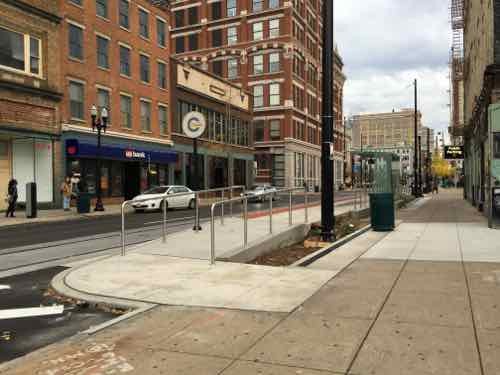
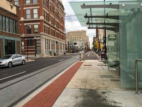
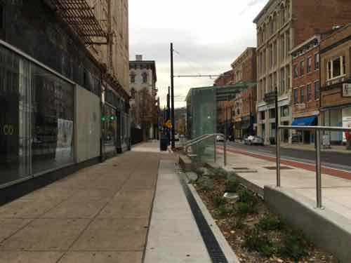
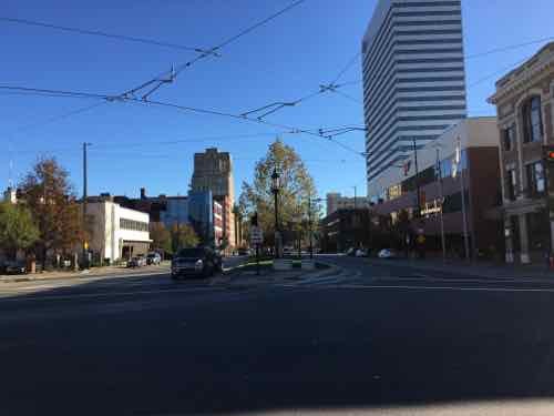
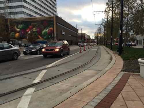
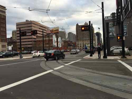
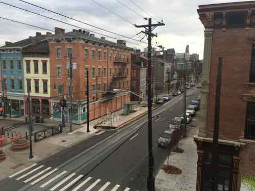
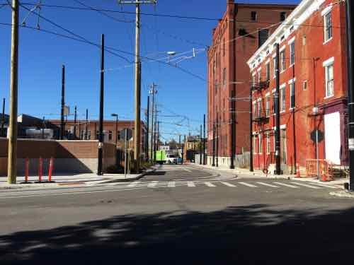
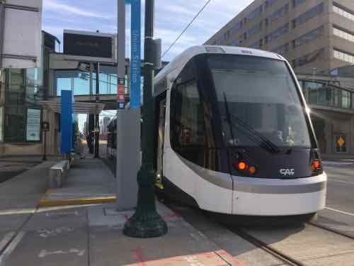
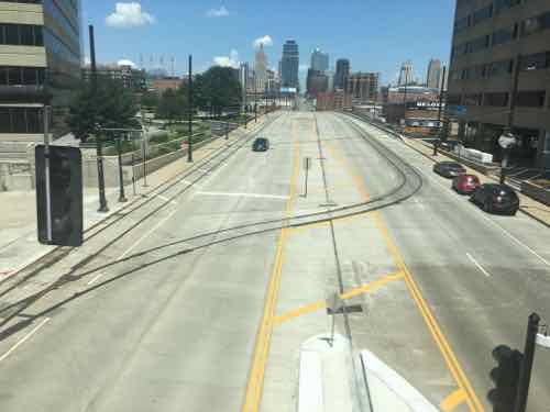
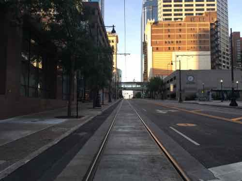
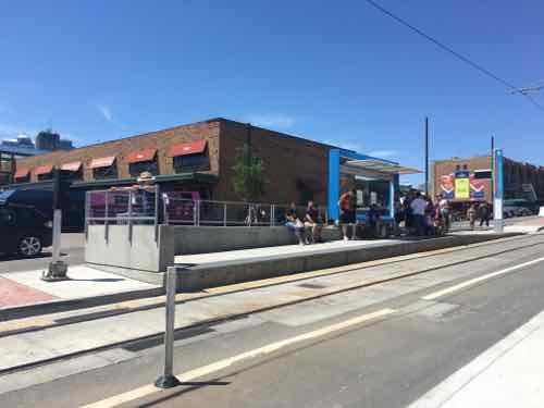
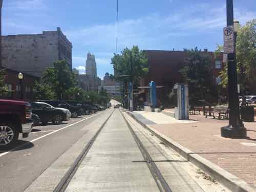
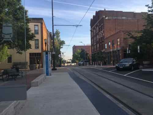
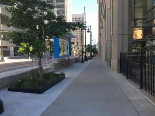
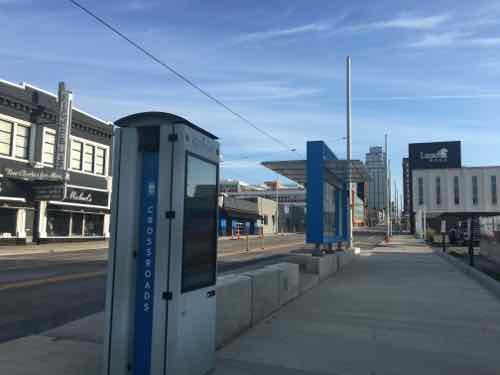
Kansas City is lucky to have Main Street as a central arterial. We have Olive/Lindell, but they’re very different. The 2.2 mile route does a loop on the North end around their River Market area. It goes down Main and ends at Union Station.

The route is 2.2 miles long and travels along Main Street in downtown Kansas City from the River Market to Union Station/Crown Center. The route also includes a loop around the City Market and runs on 3rd St on the north, Delaware on the west, 5th St on the south, and Grand on the east. (KC Streetcar FAQ)

An extension to continue South on Main Street is already being planned.

Looking North on Main St toward Downtown Kansas City
Looking North on Main St toward Downtown Kansas City.
Looking South in the CBD

See a route map here.
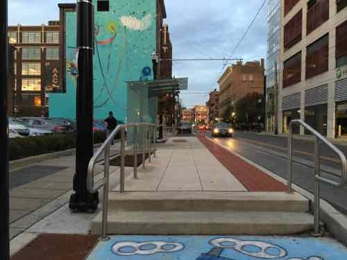
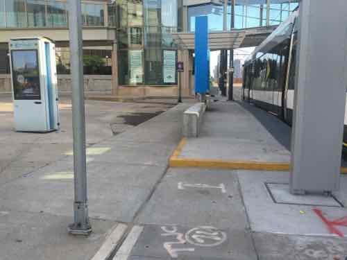
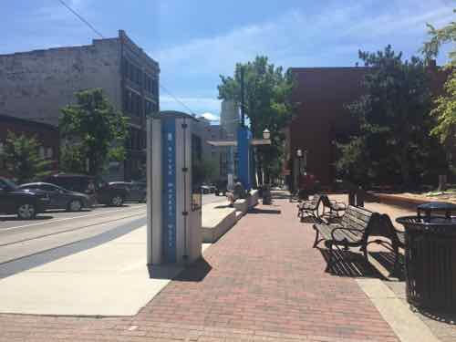
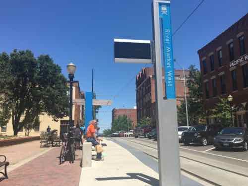
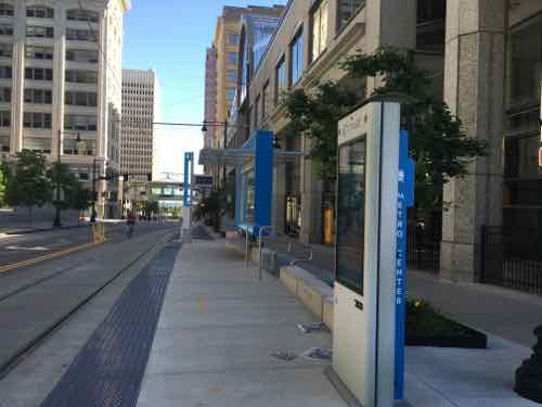
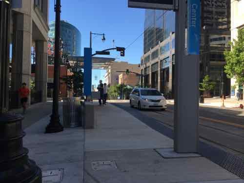
THE STOPS:

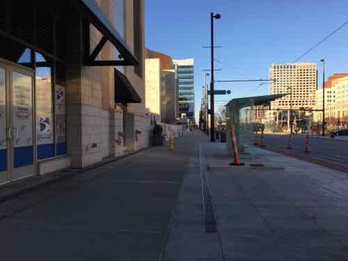
Stops are every few blocks, over the 3-day weekend I rode the streetcar a few times but also traveled the route on the sidewalk. For the most part. the stops are built out into the parking lane — leaving the sidewalk unblocked.
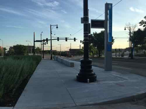
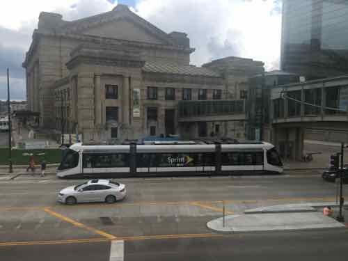
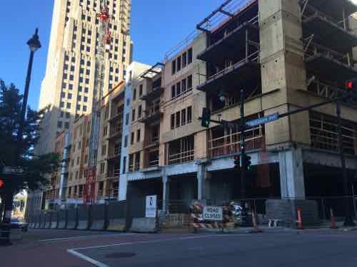
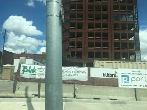
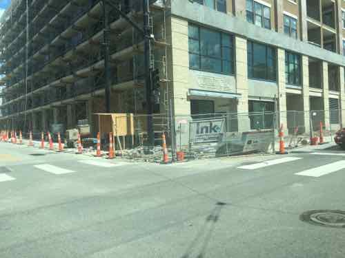
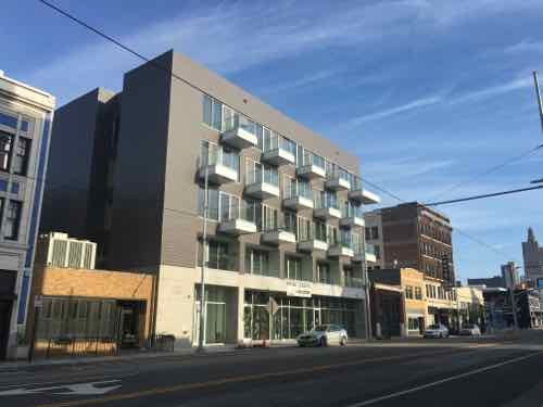
Another view of the Union Station stop
The River Market North stop is the only stop in the middle of traffic
Another view of the River Market North stop
Next stop is River Market West
The view from the sidewalk
Looking North you can see the streetcar coming around the corner in the background
People gathering for the next streetcar, we tried to get on here a couple of times but it was too full from the two prior stops
North Loop is the most unusual stop, as it's mostly parking lots
North Loop is the most unusual stop, as it’s mostly parking lots
Looking West from the stop
Sidewalk next to Northbound Metro Center stop
Same stop, same direction -- just out near the curb
Same stop, same direction — just out near the curb
Opposite view
Opposite view
Southbound Metro Center stop
Streetcar at SB Power & Light stop
NB Crossroads stop
NB Crossroads stop

NEW CONSTRUCTION:

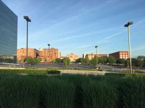
New construction is everywhere in Kansas City, especially near the streetcar route.

New construction at 13th & Baltimore, one block West of Main
Rehab on E 19th, just East of Main
New construction E 5th & Grand
New infill on Main Street between 19th-20th

VIDEO:

I put together a brief video of various clips I took:

FINAL THOUGHTS:

Their streetcar isn’t meant to be a regional system, at least not initially. CAF makes very similar vehicles for use in higher-speed light rail applications, so if they ever do a light rail line the vehicles could look just like their streetcar.

The main problem we experienced was crowds — but it was a nice holiday weekend in the first month of service.  Would like to ride it on a regular weekday. We did speak to a retired couple that recently moved from the suburbs to new construction downtown — the streetcar was one reason,

Being right there it helped add life to the street. It’ll be interesting to see if they’ll be able to expand.

— Steve Patterson


Reduced Fare Smart Card For Chicago, Still Waiting On St. Louis

Metro St. Louis is busy working on smart cards for paying transit fares, some have been testing the new technology. Meanwhile, we’ve been using the Ventra smart card for nearly 2 years when visiting Chicago. See Contactless Transit Smart Cards from February 2014. Last month I finally decided to apply for a reduced fare card.

Full fare Ventra card (top) and my reduced fare card (bottom)

Both cards are now on one online account, allowing me to login to add value. My husband will use the full fare while I use the reduced fare with my picture. I applied in person in Chicago and the card was mailed to me in about a week. Both are “contactless” which means the user just taps it at the reader, both have a magnetic strip on the back. The same card works for all three Chicagoland systems: CTA, Metra, & Pace. It doesn’t appear my new reduced fare card can be used as a debit card — that won’t matter to me but it might to others.

In St. Louis, our Metro isn’t going to have a debit card connection — deemed too costly. I’m told existing reduced fare ID holders like myself will automatically receive a new reduced fare smart card — once ready. New applicants will apply in person but leave with the card rather than have it mailed. Since my current Metro reduced fare ID expires in February 2016 I’ll need to renew it once more before I get a smart card version.

— Steve Patterson


Cincinnati’s Modern Streetcar

Last month I visited Cleveland to check out the best Bus Rapid Transit (BRT) route in the country, see Cleveland’s Healthline Bus Rapid Transit (BRT), Part 4. Earlier this month I was back in Ohio, this time in Cincinnati.

During my 3-day visit for a Streetsblog meeting we checked out the upcoming Cincinnati Streetcar. Expected to be operational by the end of September 2016, the tracks, overhead wires, & platforms are all in place.

My first sighting of their streetcar project was the tracks near The Banks (development between stadiums) turning to cross the highway and enter the central business district.
My first sighting of their streetcar project was the tracks near The Banks (development between stadiums) turning to cross the highway and enter the central business district. Second St to Main St
The platform here is little more than the sidewalk.
Most platforms are higher than the adjacent sidewalk, but very close
The platforms, built within the parking lane, are higher than the sidewalk to allow for level boarding.
Same platform from the other direction. This platform had ramps at both ends, some only have one ramp.
Warning signs are up to alert cyclists to the danger of the tracks.
A colorful welcome at one platform
Looking east
Looking east
The overhead wires are visible in this view, looking East along Central Parkway from Race St
Looking West on Central Parkway from Walnut, the streetcar track cut into the median to make the turn into the near land on Walnut. At numerous intersections cameras are able to detect the streetcar, causing the traffic signals to go into a special mode to stop all traffic -- in this case allowing the streetcar to turn right across several lanes of traffic.
Looking West on Central Parkway from Walnut, the streetcar track cut into the median to make the turn into the near land on Walnut. At numerous intersections cameras are able to detect the streetcar, causing the traffic signals to go into a special mode to stop all traffic — in this case allowing the streetcar to turn right across several lanes of traffic.
On Walnut the streetcar turns into the right travel lane
This platform on Elm @ Elder is next to Findlay public market, 1.5 miles from The Banks. The streetcar will connect these points and everything in between.
The far end of the initial line is Henry St., now closed to cars because streetcars will enter/exit maintenance yard to the left. This is at the edge of Cincinnati's Brewery District
The far end of the initial line is Henry St., now closed to cars because streetcars will enter/exit maintenance yard to the left. This is at the edge of Cincinnati’s Brewery District
The maintenance facility is a new structure.
End of the maintenance building as seen from the yard,
End of the maintenance building as seen from the yard
They've received their first of five vehicles, #1175. Their last streetcars ended in #1174. Each costs $2.9 million
They’ve received their first of five vehicles, #1175. Their last streetcars ended in #1174. Each costs $2.9 million

Their streetcar will run north-south on their grid of streets. Where we’ve butchered our grid, theirs remains largely intact, albeit mostly one-way couplets. I traveled over a mile on each of four parallel streets: Elm, Race, Vine, & Walnut. Their rights-of-way are also much narrower than ours are now — they didn’t have someone like our Harland Bartholomew aggressively widening streets by forcibly taking the front bay of buildings.

What we call a trolley or streetcar, Europeans call a tram.  Same thing, different name.

The vehicles are CAF Urbos 3, which are 100% low floor. If Cincinnati decides to do a light rail line out to the suburbs in the future they can use the same vehicles. Yes, modern streetcars use the same vehicles as light rail. The difference comes in how the route is designed. Kansas City is using the same vehicle for their streetcar line, which will also open next Fall.

If we do street-running light rail, or a streetcar, these would be in consideration. To meet requirements for federal projects, they have at least 60% US content.

Like most cities, Cincinnati had streetcars in the 19th century, a subway was started but abandoned. Cincinnati hasn’t had rail transit in decades. See their official stteetcar page here.

— Steve Patterson


Streetsblog Meeting in Cincinnati

November 10, 2015 Featured, Site Info, Travel 3 Comments

In January the Streetsblog  network expanded into new areas, including a Streetsblog St. Louis. In April many of us gathered in Dallas to discuss urban blogging, followed by the 23rd Congress for the New Urbanism conference.  Later this week we’ll meet again, this time in Cincinnati. Three weeks after taking Megabus to Cleveland via Chicago I’ll be back on Megabus to Chicago and across Indiana into Ohio.

I’ve driven past Cincinnati several times over the years, but I’ve never stopped. Like many my age, I grew up watching WKRP in Cincinnati. To this pre-teen, in Oklahoma City, Cincinnati looked more like what I thought a city should be — based solely on the show’s opening sequence.

With Thanksgiving coming up I had to include a clip from a classic episode.

I’m sure Cincinnati today is nothing like 1978 sitcom Cincinnati, I’ll have three nights to explore. I don’t know much about the city, only what I’ve read. I’ll check out Fountain Square:

Fountain Square has been the symbolic center of Cincinnati since 1871. The square, which replaced a butcher’s market, was a gift from Henry Probasco in memory of Tyler Davidson. Probasco traveled to Munich and commissioned a bronze allegorical fountain from Ferdinand von Miller named The Genius of Water. Originally, the square occupied a large island in the middle of Fifth Street with buildings to the north and south, much like nearby Piatt Park. A 1971 renovation of the square included slightly moving and re-orienting the fountain to the west, and enlarging the plaza by removing the original westbound portion of 5th Street and demolishing buildings to the north. It is used for lunch-breaks, rallies, and other gatherings. (Wikipedia)

Of course I’ll read a lot on the UrbanCincy blog, also part of the Streetblog network. I’ll check out their public transit — including the route of the modern streetcar line opening September 2016. Their never completed subway sounds fascinating. Few things I love more than seeing a new city for the first time, thank you Streetsblog!’

— Steve Patterson


Cleveland’s Healthline Bus Rapid Transit (BRT), Part 3

In Part 1 I introduced you the best Bus Rapid Transit (BRT) in America — Cleveland’s Heathline BRT, in Part 2 I looked at where it missed points in international rankings, scoring 76/100. Today I want to look at areas where it should’ve scored lower: pedestrian streetscape, & wheelchair access.

Many intersections along Euclid Ave pedestrians must press a button to get a walk signal. This was not requited elsewhere. This is an unnatural extra step that most pedestrians ignore. Decidedly less pedestrian-friendly!
The streetscape is only 7 years old but many of the curb ramps & detectable warnings were in disrepair. On the plus side they didn't hold water like so many in St. Louis.
The streetscape is only 7 years old but many of the curb ramps & detectable warnings were in disrepair. On the plus side they didn’t hold water like so many in St. Louis.
In some spots the new sidewalks were too narrow, we passed through here often meeting people trying to walk side-by-side. When meeting others only wide enough for single-file.
At some stations I entered via the front door via a typical low-floor bus fold out ramp
But it often didn't work so the operator had to lift it manually.
But it often didn’t work so the operator had to lift it manually.
Manual ramp operation is a benefit of low-floor vs high-floor buses. There's no manual mode for a high-floor lift that doesn't work.
Manual ramp operation is a benefit of low-floor vs high-floor buses. There’s no manual mode for a high-floor lift that doesn’t work.
Other stations meant I had to enter/exit on the driver's side so I had to use the first left-side door. The gap is too wide, the built-in power ramp only worked once.
Other stations meant I had to enter/exit on the driver’s side so I had to use the first left-side door. The gap is too wide, the built-in power ramp only worked once.
Most of the time the driver had to grab the portable ramp for me to enter/exit.
Another time before the ramp was in place
Ramp ready now
Ramp ready now
Exiting
Exiting

Bus Rapid Transit is supposed to deliver a light rail-like user experience. Maybe in other BRT systems around the world they’ve figured out accessibility but for me this was a standard bus experience. Maybe that’s a fair trade-off — most get a better experience.

I can still use donations to help cover the costs to visit Cleveland — click here to donate $5+ dollars.

— Steve Patterson


Advertisement


[custom-facebook-feed]

Archives

Categories

Advertisement


Subscribe