Home » Travel » Recent Articles:

Travel: Elevated Highway Removal In Oklahoma City Part 2

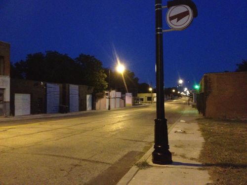
Yesterday I ended part 1 with the following photo showing Oklahoma City directing people from downtown, past where the old elevated I-40 was, through a desolate area toward the new I-40 and the Oklahoma River beyond.
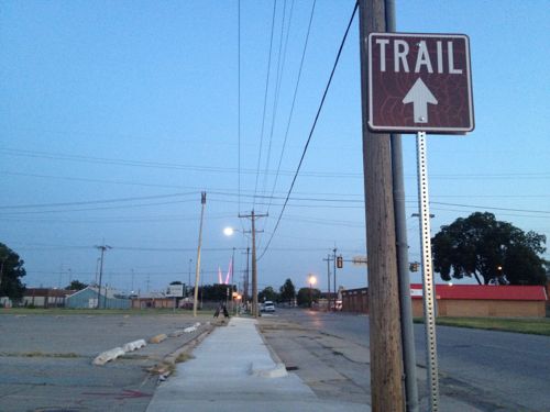
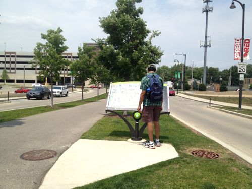
ABOVE: A sign indicates a trail, directing people southward through no-man’s land toward the new highway and the Oklahoma River beyond.

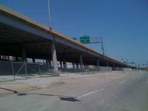
The new I-40 is a half mile south of the Myriad Botanical Gardens, a recently revamped space occupying a superblock made up of four city blocks. The Myriad Gardens now has many spaces along the lines of those at Citygarden, for example, interactive water features. The half mile space between the gardens and the new highway is pretty much a wasteland, long cut off from downtown by the old I-40. The river and waterside trail system is an another half mile south of the new highway, through a very low income neighborhood.
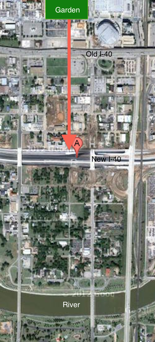
ABOVE: Aerial image showing the location of the Myriad Botanical Gardens at the top center and the suggested route south to reach the river trail, following Harvey Ave. Click image to view in Google Maps.

Does Oklahoma City really think people will walk through these areas? The two nights I did it I saw many people: individuals, couples & families.  In time the half mile zone between the old highway and the new highway will be redeveloped and occupied. The removal of the old elevated highway is allowing development to spread whereas before it was contained. Why are people walking there now you ask? The major roads that cross over the new I-40 all have generous sidewalks but a pedestrian-only bridge was also constructed where Harvey Ave reaches the new highway.
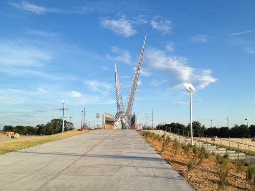
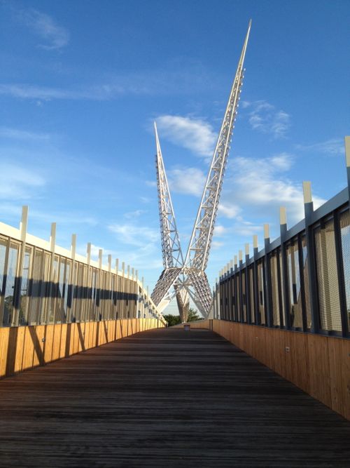
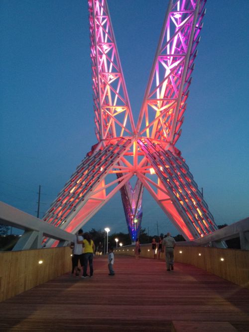
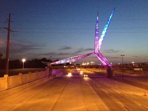
ABOVE: A larger-than-life 105 ton scissor-tailed flycatcher sits on top of the Skydance bridge rising 192 feet above the highway, attracting many pedestrians. Oklahoma City built it interesting and people come.

I saw the pedestrian bridge the first time as my train pulled in a night. At the time I wasn’t sure what it was but I asked my brother right away, it was just too intriguing not to be curious. The next day we drove under it as we returned downtown. The also allowed me to experience the new I-40 alignment.
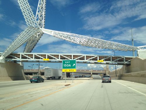
ABOVE: You can’t help but notice the Skydance pedestrian bridge
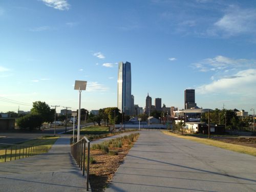
ABOVE: Looking back north toward the downtown Oklahoma City skyline dominated by the Devon Tower.
ABOVE: The bridge features a wood floor and sides
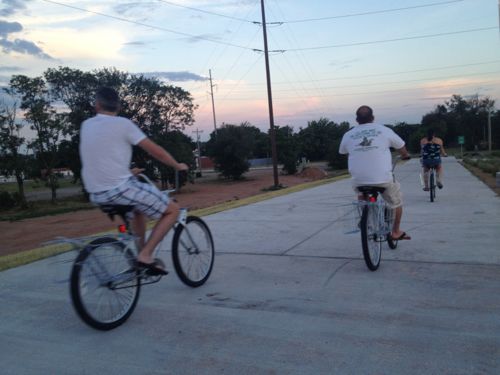
ABOVE: On my first visit a group of four on rental bikes from downtown passed me heading to the river trail.
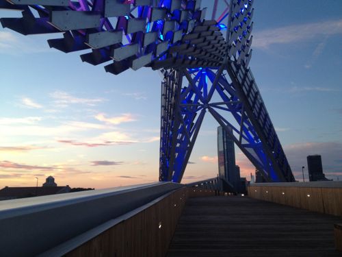
ABOVE: But as the sun goes down the lights come on and the people really start to come out in droves.
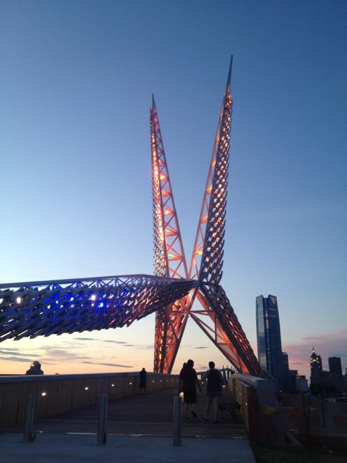
ABOVE: Instantly a part of town long written off is THE place to be, to get photographs together with the bridge in the background.
ABOVE: The powerful LED lights change colors so it’s not static
ABOVE: Looking west at the Skydance bridge from the Robinson Ave bridge nearby

I visited two nights in a row and talked with numerous strangers both times. My entire life this area was a “bad” part of town and here I was talking with strangers at night. They’ve successfully begun to change perceptions of an area ignored for decades!

Take a look to see why.
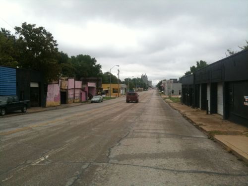
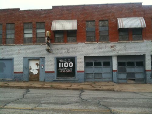
ABOVE: In August 2010 I drove south of the new I-40 construction on Robinson Ave, this was always auto junkyard row.
ABOVE: This building at 1100 South Robinson Ave caught my eye in August 2010. This was just south of the construction for the new I-40.
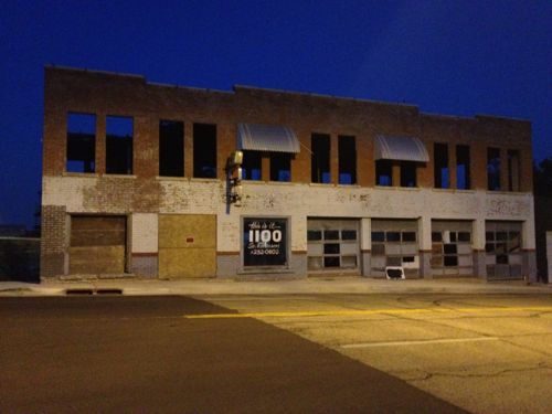
ABOVE: In July 2012 the building has been prepared for rehab. This is a block east of the south end of the pedestrian bridge, a visible location.
ABOVE: South Robinson still has junk yards but it’s a route to the river, the popular skate park and neighborhoods further south so as part of their “core-to-shore” plan it’s getting improved.

I’m still amazed I was exploring this area alone, at night, in a wheelchair!   Their Core to Shore plan was big:

In 2006, the City of Oklahoma City undertook an ambitious planning process to redevelop 750 acres of underutilized land between the core of downtown to the shore of the Oklahoma River.

Envisioned as Core to Shore, efforts are now underway to build and connect a series of neighborhoods, parks, and economic opportunities that will reinvent downtown Oklahoma City, leading to new jobs and a higher quality of life for residents.

Major aspects of the Core to Shore plan include:

  • Creation of a world-class, pedestrian-friendly boulevard
  • Development of a 40-acre central park
  • Development of business, retail and mixed use housing along the central park
  • Building of a Convention Center and Convention Center hotel
  • Relocation of some of the existing businesses and homes in the area

This is a vastly different thinking than the 1960s Pei Plan that led to the destruction of much of downtown and the creation of many superblocks. Financing for this work was part of the Metropolitan Area Projects Plan (MAPS) which began in the early 1990s. The highway move and other recent work was part of the third phase, MAPS3.

Many have been critical of the taxes paid and the cumulative costs of the numerous projects over the last 20 years. But schools have been updated, downtown energized, attracted a winning NBA franchise, saw massive private  investment from major corporations (Chesapeake, Devon, SandRidge, etc.

In the country as a whole, single-family woes are fueling the multifamily surge. Stubbornly persistent foreclosure rates, mortgage bankers’ continued reluctance to lend to any but those with the very best credit and most stable employment history, as well as still-high unemployment in most places, have apartment investors investing in new product.

But here, a healthy local economy — enviable unemployment rates, population growth on the rise — has cautious and seasoned but willing single-family builders building again. (newsok.com)

Investing in your community pays dividends! It doesn’t happen overnight but financing the big ideas gets noticed eventually. Oklahoma City’s 2010 population was 579,999 and the metropolitan area was 1,322,459, half that of Greater St. Louis.

Back to St. Louis:

This is the type of planning St. Louis should’ve been doing to reclaim areas like Pruitt-Igoe and the 22nd Street Interchange, two areas where Paul McKee stepped in to fill the city’s planning absence.

It’s I-70 that currently uses the elevated and depressed highway dividing parts of downtown St. Louis. In 2014 I-70 will cross over into Illinois on the north edge of downtown rather than on the south edge at the Poplar Street Bridge.

— Steve Patterson
 

Travel: Elevated Highway Removal In Oklahoma City Part 1

Count me among those who think St. Louis needs to remove the elevated section of I-70 north of Washington Ave that cuts off Laclede’s Landing from the rest of downtown. These types of elevated lanes were built during a period where little, if any, consideration was given to pedestrians. The negative consequences weren’t considered at the time but they became apparent later.

As a kid growing up in Oklahoma City we’d have to drive under an elevated highway to get to downtown. I rarely drove on I-40 since it was an east-west route and we lived a few miles directly south of downtown. The few times I did drive across the elevated highway I was nervous doing so, the lanes were narrow and the condition was poor. I never once walked under it.

The Oklahoma City Crosstown is an elevated four mile (6 km) stretch of Interstate 40 that dissects downtown Oklahoma City from Agnew Avenue to Byers Avenue. It is owned and maintained by the Oklahoma Department of Transportation (ODOT). It is the primary east–west artery through Oklahoma City, and serves an unofficial dividing line between north and south Oklahoma City (the official dividing line for address purposes is [Reno Avenue]). While the Crosstown designed to withstand about 76,000 vehicles a day, it is currently used by nearly 120,000 vehicles a day. The Crosstown was completed in the 1960s using an engineering process commonly termed as “fracture critical”, a process that has not been used since the 1970s because it does not provide redundancies. According to Brian Windsor, an ODOT structural engineer, without redundant support, the failure of a single beam creates the risk of total collapse of that section of bridge. The entire stretch of the Crosstown is elevated, and at some points, the elevation is as much as 50 feet (15.2 m). Other safety problems of the existing Crosstown include falling chunks of concrete and a lack of shoulders or breakdown lanes. In an August 2007 poll sponsored by The Oklahoman, nearly ? of respondents indicated that they were “afraid to drive across the Crosstown bridge in Oklahoma City”. (Wikipedia)

It wasn’t a good roadway, nor could it be retrofitted. It had to come down.

ABOVE: I-40 in Oklahoma City in August 2009

Well, the four mile elevated stretch of I-40 is now closed and is being dismantled. This was years in the planning and before you ask, yes they built a replacement highway in a wide trench a half mile to the south. Part 2 tomorrow will look at the new highway.

As I indicated earlier, I-40 is a major east-west highway:

Interstate 40 (I-40) is the third-longest major east–west Interstate Highway in the United States, after I-90 and I-80. Its western end is at Interstate 15 in Barstow, California; its eastern end is at a concurrency of U.S. Route 117 and North Carolina Highway 132 in Wilmington, North Carolina. Much of the western part of I-40, from Oklahoma City to Barstow, parallels or overlays the historic U.S. Route 66. I-40 intersects with eight of the 10 primary north–south interstates (all except I-5 and I-45) and also with I-24, I-30, I-44, I-77, and I-81. (Wikipedia)

Locals use I-40 but so do many more just passing through Oklahoma.

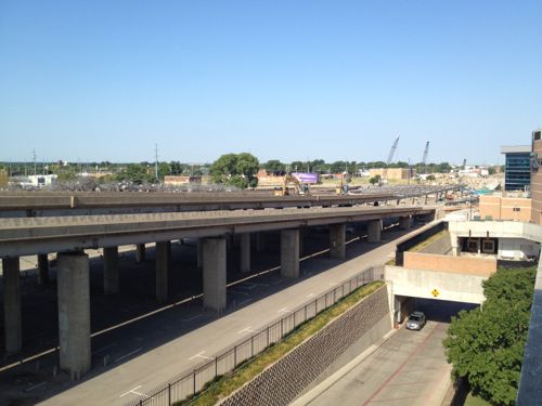
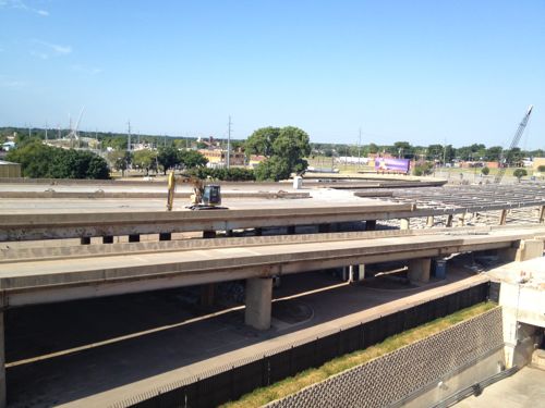
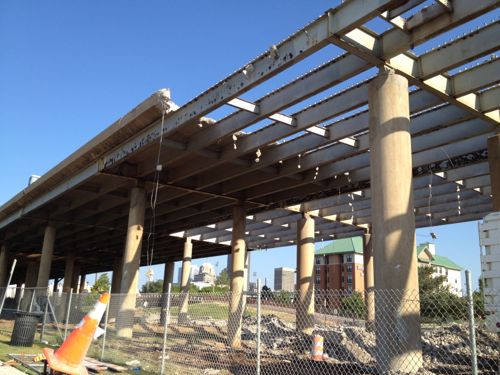
ABOVE: The old I-40 elevated lanes in Oklahoma City being demolished.
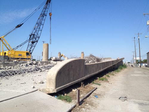
ABOVE: Close-up of old on-ramp to westbound I-40 cutting through the south edge of downtown Oklahoma City as the highway is being removed.
ABOVE: Crews slowly dismantle the old I-40 elevated lanes.
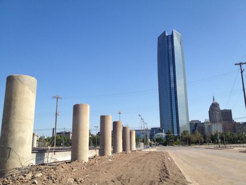
ABOVE: New development (background) can continue to the south once the elevated highway is removed.
ABOVE: Just to the north is the Myriad Botanical Gardens and the new 844ft high Devon Tower, click image for more information. The Gateway Arch is only 630ft tall.
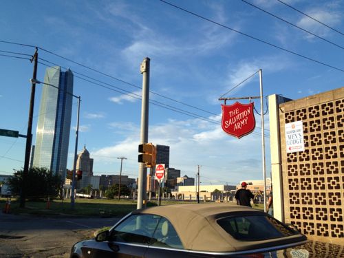
ABOVE: South of the highway was cut off from downtown and investment, places like the Salvation Army were the only ones that would locate there.
ABOVE: Vacant land where part of the elevated highway has been completely removed.
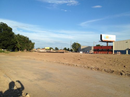
ABOVE: A new entrance to the Chesapeake Arena, home of the OKC Thunder NBA franchise, is being constructed now that the adjacent highway is being removed.
ABOVE: A sign indicates a trail, directing people southward through no-man’s land toward the new highway and the Oklahoma River beyond.

Tomorrow I’ll continue the story with a look at the new I-40 and how to cross it as a pedestrian. I’m excited about visiting Oklahoma City during the coming years as they fill in where the highway was removed.

— Steve Patterson


Every City Needs An Old Fashioned Soda Fountain

July 21, 2012 Featured, Travel 1 Comment

Crown Candy Kitchen in St. Louis has been a favorite place of mine since my first visit in the Fall of 1990. Every city should have a family-run soda fountain and perhaps every city does.

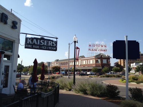
A few days ago I retuned from a trip that included a day in Dallas, a couple of hours in Ft. Worth and five nights in my hometown of Oklahoma City. I was 23 when I moved to St. Louis but at no point did I ever make it to Kaiser’s. That changed Tuesday.

ABOVE: Kaisers Ice Cream in Oklahoma City is their Crown Candy — a long running soda fountain

Like Crown Candy, Kaiser’s has a history starting with an immigrant:

In 1910, Swiss born Anthony “Tony” Kaiser opened Kaiser’s Ice Cream Parlor on NW 7th and Robinson. In 1918 he moved his operation to this very spot. Through hard work, imagination, and commitment to his guests Tony shaped Oklahoma City and manifested the American dream. While the Kaiser’s building and concepts therein have evolved over the years, the philosophy Mr. Kaiser predicated over 100 years ago remains the same: feed people and make them happy. (Kaiser’s)

Oklahoma didn’t become a state until 1907 but Kaiser’s is three years older than Crown Candy (or 5 years younger at this location). Not sure why I find that fascinating,

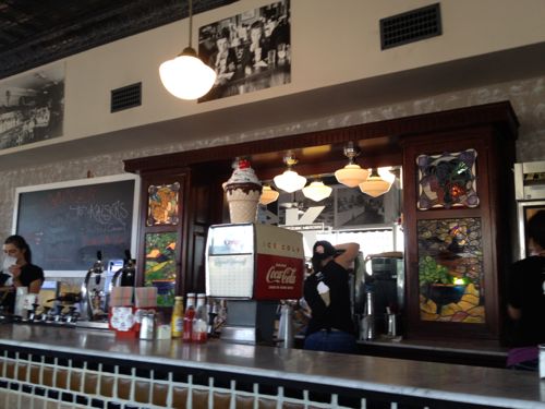
ABOVE: Interior of Kaiser’s

As a kid this area was one of those nobody would visit, it was rundown to say the least. Today a roundabout solves a decade-old traffic problem and popular restaurants abound in the area.  The Plaza Court building was built in 1926 and it includes structured parking at the back of the building, a new thing for the 1920s. It was largely vacant and derelict most of the time I lived in Oklahoma City.

The lesson here is for St. Louis natives, St. Louis has had rough times, some self-inflicted, but things are improving even if you refuse to open your eyes and see them. During my visit to Oklahoma City I found myself in areas I’d have felt uncomfortable driving through 25+ years ago and now I was in them as a pedestrian after dark.

I don’t want to move back — St. Louis is home, but I’m glad to see Oklahoma City doing things to force me to drop my notions about how I thought Oklahoma City will always be.

— Steve Patterson
 

What Is Normal? A Small College Town In Central Illinois

Normal is & isn’t many things, but it’s definitely a town in Illinois. The old downtown of Normal IL is undergoing a transformation and rebranding into Uptown Normal, which is the reason for this post. First, some background:

Normal is an incorporated town in McLean County, Illinois, United States. As of the 2010 census, the city population was 52,497. Normal is the smaller of two principal municipalities of the Bloomington-Normal metropolitan area, and the seventh-most populous community in Illinois, outside of the Chicago Metropolitan Area. The mayor of Normal is Chris Koos.

The town was laid out with the name North Bloomington on June 7, 1854 by Joseph Parkinson. From its founding it was generally recognized that Jesse W. Fell was the force behind the creation of the town. Fell had arranged for the new railroad, which would soon become the Gulf Mobile and Ohio, to pass west of Bloomington and then curve to cross the Illinois Central Railroad at a point where he owned or controlled land. Most of the Original Town lays south of the tracks, with Beaufort Street as its northern limit, and some blocks west of the Illinois Central and north of the tracks. Fell, his brothers, and associates quickly laid out many additions to the Original Town.

The town was renamed as Normal in February 1865 and officially incorporated in 1867. The name was taken from Illinois State Normal University, a normal school (teacher-training institution) located there. The school has since been renamed Illinois State University after becoming a general four year university. Normal is adjacent to Bloomington, Illinois, and when mentioned together they are known as the “Twin Cities”, “Bloomington-Normal”, “B-N”, or “Blo-No.” (Wikipedia)

Bloomington’s 2010 population was 76,610 for a combined total of 129,107 with a 40/60 split between the two municipalities. Why Normal?

Last month I attended a LEED-ND workshop sponsored by the USGBC Missouri Gateway Chapter.

 The LEED for Neighborhood Development Rating System integrates the principles of smart growth, urbanism and green building into the first national system for neighborhood design. LEED for Neighborhood Development is a collaboration among USGBC, Congress for the New Urbanism, and the Natural Resources Defense Council. (Source)

The facilitator was architect/planner Doug Farr.  Of the numerous examples presented one was in Normal IL, with a traffic circle with the center as a destination spot. The circle includes water features using filtered storm water.  I was intrigued. A few hours later I had my train ticket and hotel reservations for the Friday and Saturday night before Memorial Day.

ABOVE: Uptown emerging from the former downtown, click image to view aerial in Google Maps

Many of the old buildings were razed, new parking garages built, and street patterns were changed.  From Farr & Associate’s website:

Despite being home to Illinois State University and having a population of 22,000, downtown Normal has been in a prolonged state of decline, marked by reduced retail choices and deferred building maintenance. Farr Associates prepared a redevelopment master plan to revitalize the downtown. The preliminary $211 million redevelopment plan is anchored by a new traffic circle and stormwater-treating fountain, an Amtrak multi-modal high speed rail facility, a new children’s museum, beautiful streetscaping, and new retail and mixed-use buildings.  (Source)

The railroad line runs behind the buildings on the right in the picture above. Currently passenger service is on the far side of the tracks, away from the new development  in Uptown.

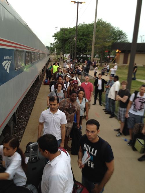
ABOVE: The Normal IL Amtrak station is the "fourth busiest Amtrak station in the Midwest behind Chicago, Milwaukee, and St. Louis, and the station served more passengers per train than St. Louis." Click the image for the source from Wikipedia

With Illinois State University within walking distance students use Amtrak often. Students returning in the fall will get off the train near the Uptown Circle.

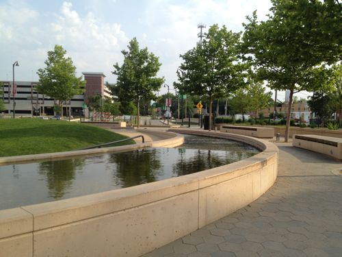
ABOVE: The center of the Uptown Circle uses storm water as a design feature. Click image for more information
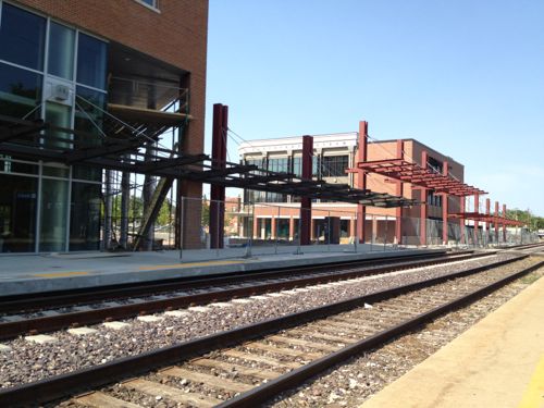
ABOVE: This summer Amtrak service will switch to the other track and a new station the faces the Uptown Circle

The new station will be in the building on the left. Also in the building and garage will be the Bloomington-Normal Public Transit System, the bus service operated independently of the two municipalities. The top two floors will become the new Normal City Hall. The existing city hall near the existing Amtrak station will be full with other departments, including more room for the police department.

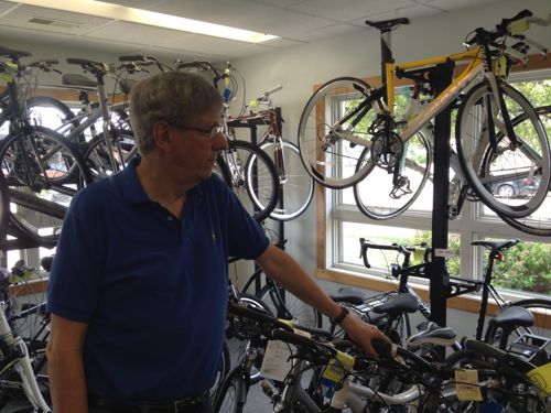
ABOVE: Normal IL Mayor Chris Koos chats with an employee in his bike shop

I met with Mayor Chris Koos at his bike shop to discuss the goals and process of this dramatic change. Koos has been mayor since 2003, their elections are non-partisan. I asked if people questioned all the bike racks in Uptown since he sells bikes for a living. “All the time” he said, adding “My response to then is ‘Would you question the street resurfacing budget  if I owned a car dealership?'” I was quite surprised by the number of pedestrians and cyclists I saw — more bikes than I’d see in all of downtown St. Louis!

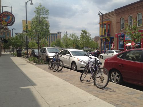
ABOVE: Seeing bikes locked to bike racks is a common sight in Uptown Normal

One area has so much demand for bike parking that an automobile space on the street has been converted to bike parking.

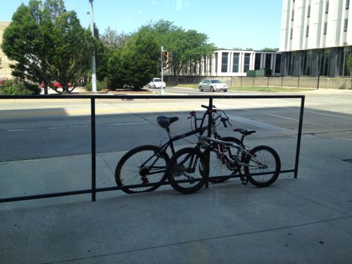
ABOVE: As I was eating breakfast at a 24 hour diner facing ISU two young guys biked up and had to lock to a railing since no racks were provided on the outer edges of the development
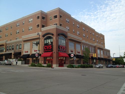
ABOVE: The same building as the 24 hour diner contains apartments and an urban CVS

Really? Normal can get an urban CVS while we get typical suburban stand alone stores in a sea of parking? Other retail spaces in the building aren’t yet leased, the apartments above are off campus housing managed by ISU. Nice to see a university involved in new high-density urban development! Someone get Biondi a train ticket to Normal IL.

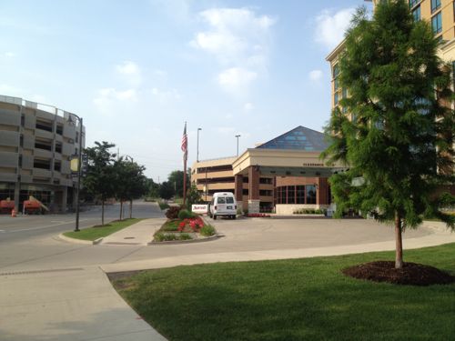
ABOVE: Normal isn't immune to bad design, the Marriott is set back behind a wide driveway
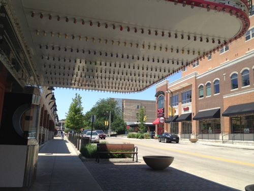
ABOVE: In 1993 Normal bought and renovated an art deco theater from 1937, click image for more info
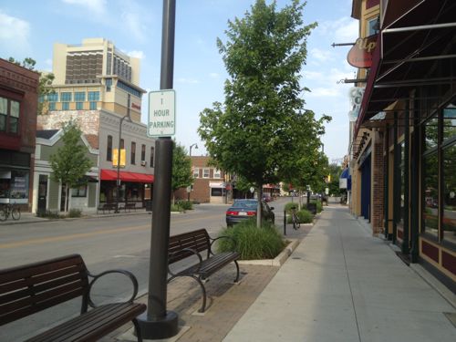
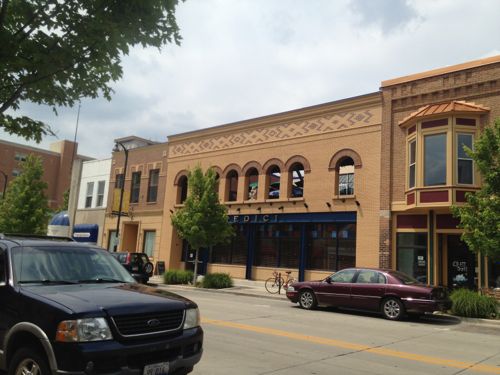
ABOVE: Looking west on North St toward Broadway, older buildings retained
ABOVE: The restaurant with the 2nd floor arched openings was created based on photographs of a building that burned down in the 1970s. Part of the upstairs is an open-air patio.
ABOVE: Uptown Normal has more maps to guide visitors than downtown St. Louis
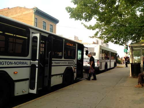
ABOVE: On Saturday I used the Bloomington-Normal Public Transit System to go from Uptown Normal to downtown Bloomington, they don't have bus service on Sunday

I’ll return for another visit once the new Amtrak station is open and more new buildings have been finished. It would be nice to visit during the school year to see how active Uptown is or isn’t. On the train trip I noticed evidence of track work to reduce delays.

– Steve Patterson
 

OKC’s Devon Tower Taller Than St. Louis’ Arch

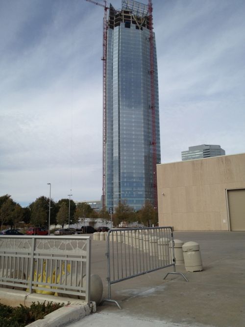
The tallest building in St. Louis is Metropolitan Square at 593 feet, just under the 630 foot Arch. The Devon Tower under construction in downtown Oklahoma City reaches a height of 850 feet! Wait, what?

Yes, Oklahoma City is getting a massive new tower added to it’s skyline. More like dwarfing the rest of the skyline. Tuesday I posted about how Chesapeake Energy is redeveloping retail shopping adjacent to it’s campus and today the story of another OKC corporate giant, Devon, changing Oklahoma City. Cost estimates are $750 million.

ABOVE: Devon Tower under construction in downtown Oklahoma City, November 2011

The 2nd tallest building in OKC is the 1971 Chase Tower at 500 feet. The 3rd is the 493 foot First National Center built in 1931. Forty year gaps between these buildings, though I doubt in 2051 a building will top the Devon Tower.  I won’t be around anyway…

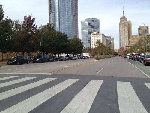
ABOVE: The Devon Tower looms over the historic 145 foot tall Colcord Hotel (white, right of tower)

Devon’s employees are already downtown, just in various buildings. Consolidating into one facility makes sense but the scale is enormous. I look forward to seeing the completed building and how well it connects to the streets.

Meanwhile in St. Louis we don’t seem to have any companies even considering a new building.  We certainly have plenty of available land.

– Steve Patterson
 

Advertisement


[custom-facebook-feed]

Archives

Categories

Advertisement


Subscribe