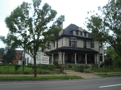
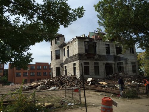
The once-stately residence at 3630 Page Boulevard was used as an assisted living facility for years. Now the 1888 structure is being razed.
2009 photo of ‘Page Manor’ from GEO St. LouisEarlier this week from the #94 MetroBus
The sad part is this property is in the 19th ward, so Cultural Resources wasn’t even given a chance to review the request for the demolition permit. Most of the city is in a “preservation review” area where trained staff look at requests for demolition, referring some to the Preservation Board for a decision on the fate.
Note: city records list the property address as 3630 Page Blvd, but Page Manor used the address 3636 Page Blvd.
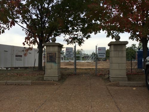
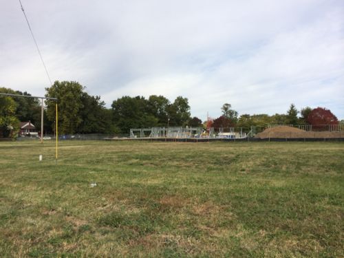
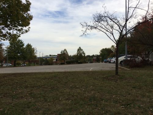
Construction workers are busy building a new child care center near the Wellston MetroLink station:
The Wellston Developmental Child Care Center is a key component of the Wellston Sustainable Neighborhood Initiative Masterplan. Located adjacent to a Metrolink Light Rail Sytstem (with which it will share parking) as well as being in close proximity to the Metropolitan Enterprise Center (a new job training center) will allow the Development Center to attain the goals of providing early childhood education in a depressed neighborhood, preparing children for the K-12 system, and providing day care assistance for parents training for new jobs.
The 14,650 SF building is oriented primarily on an E-W axis maximizing orientation for energy efficiency and daylighting. The building footprint had been placed on the site to minimize driveway length and take advantage of the adjacent public parking. Stormwater from the site will be handled by a series of micro-detention areas integrated with native landscaping. The program includes public, administrative, infant/toddler, classrooms and support spaces. (Hellmuth + Bicknese Architects)
I’ve requested the site plan & Wellston masterplan from the architects & county economic council, neither have been received.
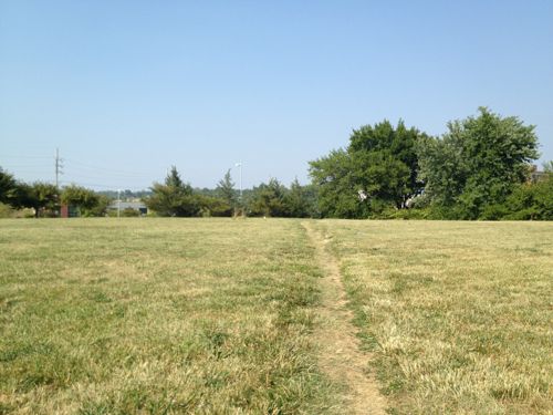
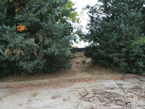
Construction of the building in Powell Park, seen from the far end of the station’s park-n-ride lotLast year Powell Park was just a field that area residents cut through to reach the bus & train. Click image for post.The long used shortcut is now blockedFrom the parking lot we see the point where the shortcut comes through the greenery
The shortcut was the most direct path for pedestrians to reach public transit. It wasn’t even paved, but since 1993 it was heavily used. However, I support building on the field — especially facilities that’ll benefit the community.
How will pedestrians now reach the station?
Rather than cut through the field to the right, pedestrians must now walk along Werley AveJust past the construction fence is the west edge of the large station parking lot.Turning east we see the parking lot, the station is at the bottom of the hill. The stop for the #94 MetroBus is on the left
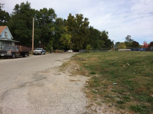
The new child care center will use the existing parking, rather than have a separate parking lot. Still, the parking lot remains a divider between train, bus, residents, and new child care center. It’s possible pedestrian routes will be constructed in the parking lot to connect these elements. Without pedestrian connections the new construction is just transit-ajacent, not transit-oriented.
Once I see an actual site plan I’ll post an update.
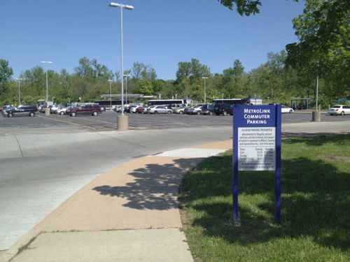
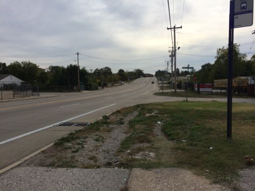
The Rock Road MetroLink station was designed in the early 1990s as a drive-to station with 183 parking spaces. For twenty years now pedestrians have endured horrible conditions to reach the train platforms and MetroBus lines.
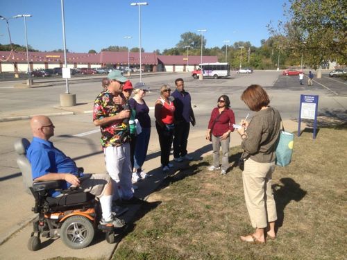
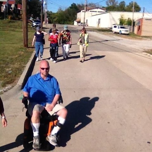
On Sunday I joined a Citizens for Modern Transit (CMT) Ten Toes walking group as it did a walk audit in the neighborhood to the south.
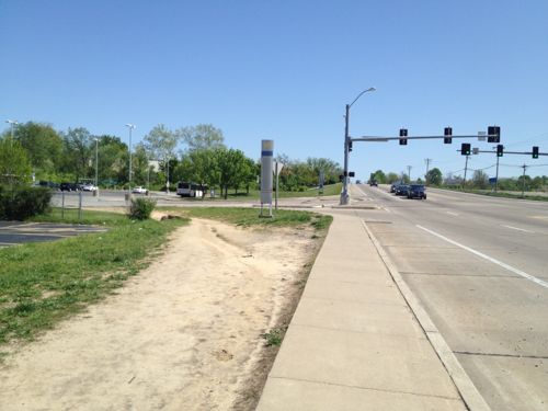
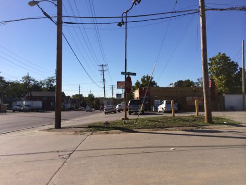
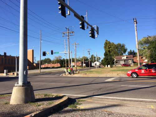
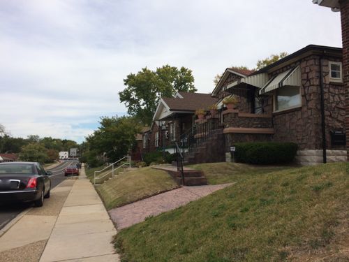
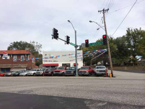
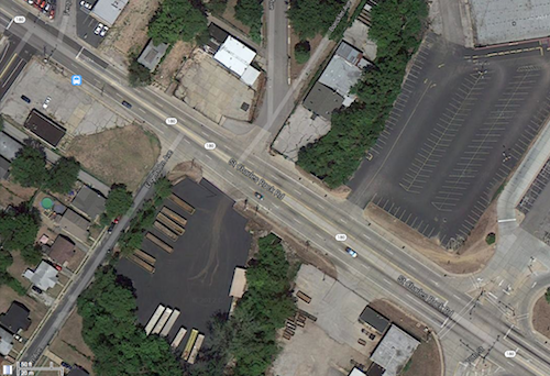
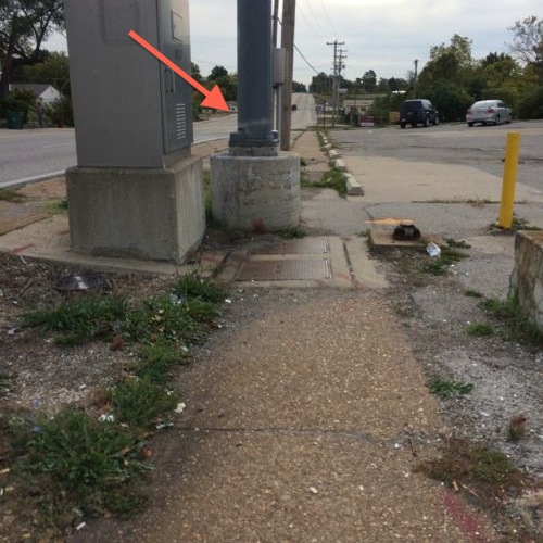
We started at the ticket machines, our first stop was the entry point. Half did a straight shot through the parking lot, the rest of us went the long way on the sidewalk. Photo: CMTIn April 2012 I noted: The parking was placed between the entry off St. Charles Rock Rd. and the station itself, pedestrians must either go out of their way to stay on the sidewalk or schlep through the parking lot. Click image to view April 2012 post on the Wellston & Rock Road stationsApproaching from the west pedestrians have worn a strong path to reach the station. April 2012We went south on Kingsland to Page, most of the way we had to use the road since no sidewalks exist. Photo CMTAt Page we headed west to Ferguson, click image for mapAt Ferguson I had to split off since I forgot to charge my chair the night before. I caught a #94 back downtown. Click image for map.Ferguson surprised me with cute houses and a decent, but narrow, sidewalk. The only issue is many people park on the curb. St. Charles Rock Road can be seen at the end of FergusonWhen you reach St. Charles Rock Road there’s no easy or safe way to cross to the north side. So I decided to stay on the south side and cross at the entry to the station. Click image for map.I was in the upper left and had to get to the lower right to cross the street and enter the station property.My destination is marked by the red arrow, but traveling the short distance looks problematic20 years of pedestrians have worn a pathI had to use the shoulder because my chair can’t jump curbs, a worn path is visible.
Again, it baffles me that we could spend hundreds of millions to build transit infrastructure and, after two decades, not do what it takes to make it accessible nearby to pedestrians. No wonder we’ve not seen any new development around this busy station.
School district boundaries are arbitrary, but many act like they’re etched in stone. Thankfully slightly more than half the readers who voted in the unscientific poll last week are ok with forcing districts to take students from unaccredited districts:
Q: Should schools be forced to take students from unaccredited districts?
Yes, education is that important 38 [54.29%]
No, it isn’t fair to taxpayers and students 32 [45.71%]
This is the opposite of the results from the original poll on the St. Louis Business Journal where only 37% voted yes.
That said, the process this year was anything but ideal. Hopefully state & local leaders can find ways to ensure every child gets a good public education.
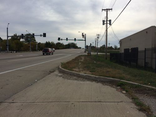
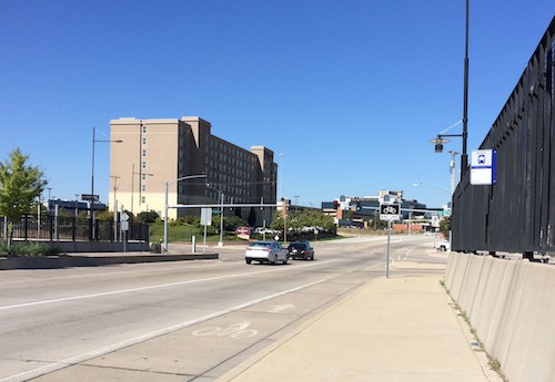
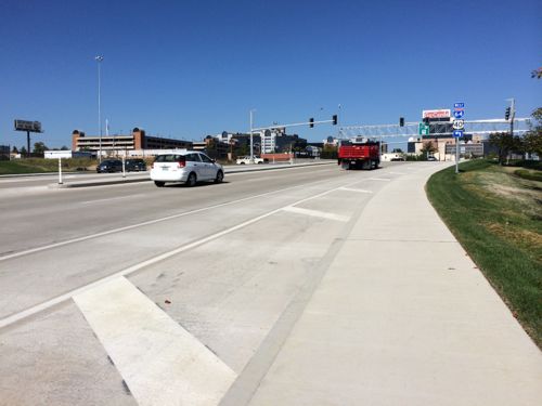
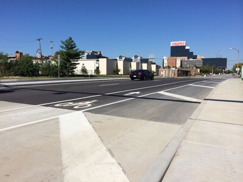
Jefferson Ave has been a major 6-lane roadway for decades, but with substantially fewer residents and interstate highways, it has been excessively wide. Recent work along Jefferson between Chouteau and Market have reduced the number of travel lanes to four, with plus bike lanes added to the mix. Unfortunately, the road is still too wide.
The new-ish viaduct over the railroad tracks has four wide high-speed lanes. Yes, the bus stop here gets used. Note the faded markings in the bike lane.Left over road width, as wide as the sidewalk, is just paintedAt the new bridge over I-64 the unused roadway width is wider than the sidewalk!
This was the perfect opportunity to place the curb in a position to give excess width to the sidewalk, giving room for street trees to separate pedestrians from passing cars.
AARP Livibility Index
The Livability Index scores neighborhoods and communities across the U.S. for the services and amenities that impact your life the most
Built St. Louis
historic architecture of St. Louis, Missouri – mourning the losses, celebrating the survivors.
Geo St. Louis
a guide to geospatial data about the City of St. Louis