Forest Park Ave from Kingshighway to Grand (map) is 1.6 miles long with the potential to be a dense urban corridor. Developers, however, would like to make it a typical low-density big box chain retail corridor. I’d like to show you why I believe two big box retail developments at Forest Park Avenue & Vandeventer are out of character, why these will undo the work others have done recently.
I had enough photos of various buildings along Forest Park Ave to write this post, but Saturday I spent about 90 minutes taking around 150 photos as I traveled the entire length in my wheelchair. Why go to such trouble? I believe cities can’t be properly understood driving through in a car, or worse, relying on Google street view. You’ve got to hit the pavement to really get what an area is about.
I got off the bus on Forest Park Ave at the first stop east of Kingshighway and returned downtown from the Grand MetroLink station, about 2 miles of travel. Don’t worry, I’m only going to show you a small percentage of the images I took.
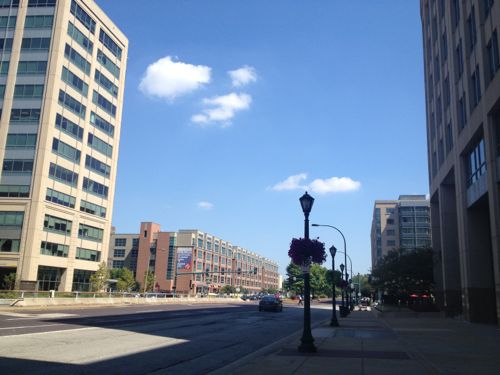
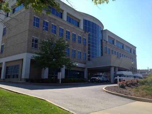
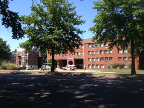
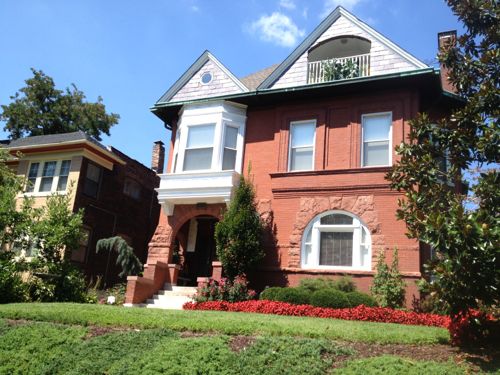
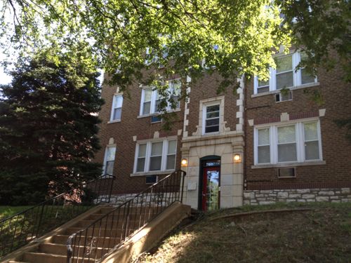
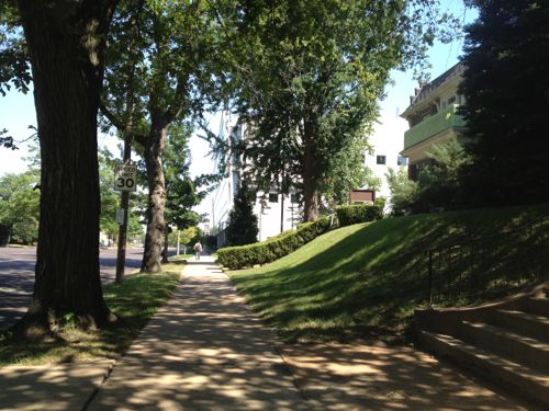
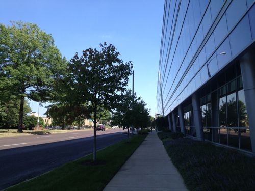
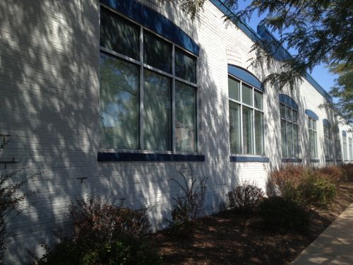
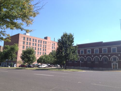
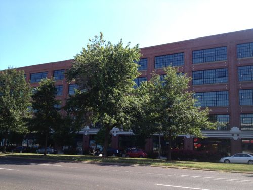
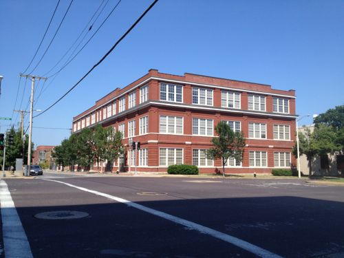
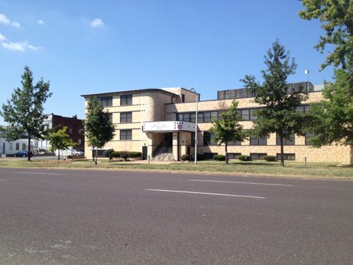
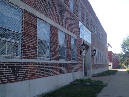
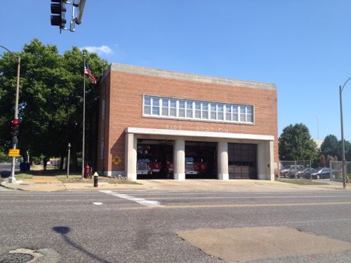
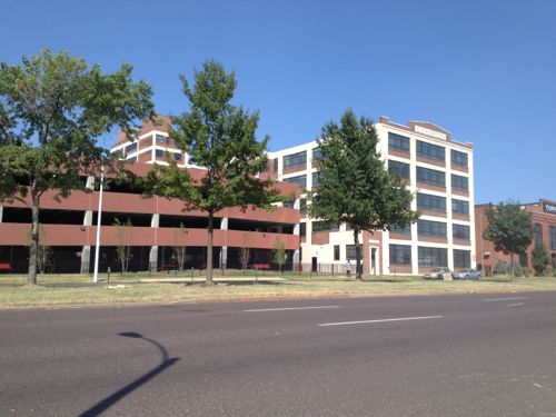
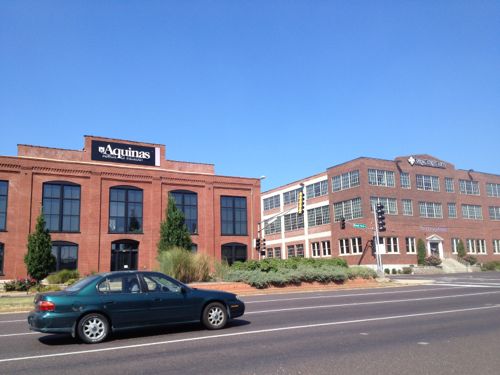
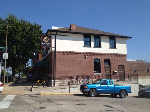
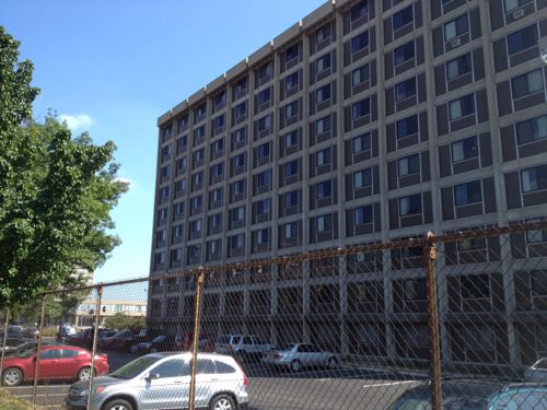
Looking east toward Euclid Ave we see numerous multi-story buildings, including medical, hotel, & apartments, all recent structuresOne low-rise strip center exists on the NE corner at Taylor Ave. If the St. Louis Streetcar gets built expect this 1985 building to be replaced with something more denseThe 1972 Parkview Apts next door contain 192 units on a lot just 65% bigger than the strip center.This 3-story apt building was built in 1930, it contains 24 units. The building next door was built in 1908Across Forest Park is the Rehab Institute, I had some outpatient physical therapy here.Back on the north side of Forest Park we have a 242 unit building built in 1977This block contains older buildings as well, all 2-3 storiesSame is true on the south side of Forest Park AveThis is a very pleasant place to be a pedestrian even with many cars passing byThe 3-story Cortex building from 2006 faces Forest Park AveUnfortunately this 2-story structure at S. Boyle, built in 1919, will be razed for a wide pedestrian mall leading to a new MetroLink station to be built 2 blocks southAcross the street a similar building was successfully renovated for an independence center and upscale resale store. This was built in 1931.One of the few 1-story buildings, this one dates to 1912 and has many windows on the street-facing facade. Currently used as a dialysis center.The general rule, however, is 2-levels up to 6 or more at times. All front Forest Park AveFormer Ford plant is now apartments with street-level retailTwo of the four storefronts are still available.The 3-story warehouse from 1901 is now part of the Center for Emerging TechnologiesA long-time Salvation Army facility, 3-stories facing Forest Park AveA 2-story Laclede Gas buildingThe 2-story firehouse at Vandeventer was built in 1965A former warehouse facing Forest Park, and another facing Laclede, are apartments geared toward SLU students. The parking garage was set back enough to permit a shallow liner building.At Spring Ave millions have been invested in existing urban buildingsMicrobrewer Six Row is in the urban building on the SE corner at Spring AveFinally at Grand we have one of SLU’s residence halls, though not oriented to Forest Park Ave
As you can see each block for the last 1.5 miles from Kingshighway has buildings fronting Forest Park Ave, nearly all 2 or more floors. Seems like every decade since the early 20th century new buildings have followed this pattern. But now Pace wants to change the pattern drastically, a new vision.
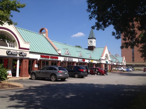
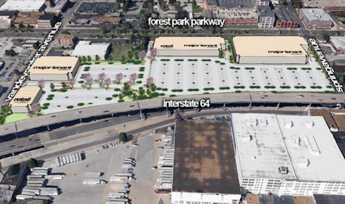
Pace Properties wants to build a retail center, called Midtown Station, on Forest Park Ave. between Vandeventer and Spring.
Pace says the site is ideal because of its proximity to St. Louis University and Washington University, as well as major employers like Ameren Missouri, BJC and Wells Fargo. (KSDK)
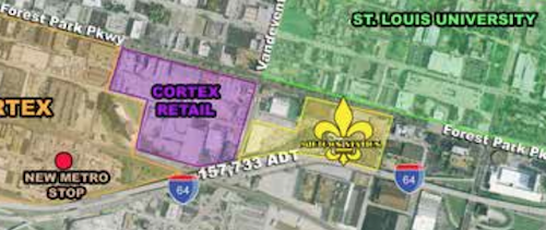
Pace wants to have the backs of big boxes facing Forest Park Ave & Vandeventer AveThis big box development (yellow) coupled with another to the west (purple) will completely undo the hard work and investment of others along the Forest Park Ave corridor
Next to Saint Louis University should be walkable retail shops, not the blank walls of the back of big boxes. I’m not opposed to retail, I’m opposed to the form these developments will likely take. I’m gathering examples of how this could be done much better, look for another post next month.
I don’t want this new suburban big box vision to reverse the urban corridor.
Two landfills in St. Louis County ceased accepting trash after 12/31/2004.
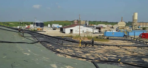
Bridgeton Sanitary Landfill, from here forward referred to as Bridgeton, is currently owned by Bridgeton Landfill LLC, and is a subsidiary of Republic Services Inc., from here forward referred to as Republic. The landfill waste mass encompasses approximately 52 acres with approximately 240 feet below the ground’s surface and a total waste thickness of 320 feet. The waste is located in two distinct areas known as the North and South Quarries. Bridgeton was initially permitted on Nov. 18, 1985 and ceased accepting waste on Dec. 31, 2004. (DNR)
Bridgeton Landfill, August 2013. Source: Missouri Department of Natural Resources, click to view
The West Lake Landfill site is on a parcel of approximately 200 acres in Bridgeton, Missouri. The site consists of the Bridgeton Sanitary Landfill, which stopped receiving waste on Dec. 31, 2004, and several old inactive areas with municipal solid waste and demolition debris. The site is divided into two Operable Units, or OUs. OU-1 consists of radiological areas and OU-2 consists of the other landfill areas, which did not receive any radiologically contaminated soil. In 1990, West Lake Landfill was listed on the National Priorities List making it a Superfund site. In May 2008 a Record of Decision was signed for OU-1, which describes the Selected Remedy to contain the radiological contamination using a modified solid waste landfill cover. EPA is the lead agency for this site. (DNR)
Both now have issues, including a smoldering underground fire at one that some fear will reach radioactive material buried in the other. How did this happen? Could government (federal, state, or local) have done more? Were the companies over regulated? Maybe you think the government response was just right? The poll in the right sidebar is where you vote, the answers are presented in random order.
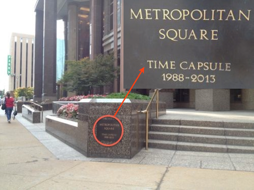
Metropolitan Square, at 593 feet, is the tallest office building in St. Louis. The Gateway Arch is slightly taller, at 630 feet. When Met Square was being built a 25-year time capsule was placed.
The time capsule marker is on the NE corner of the block
Here we are at the end of August 2013, I’ve not heard anything about opening the time capsule.
1988 (MCMLXXXVIII) was a leap year that started on a Friday, in accordance with the Gregorian calendar. It is the 1988th year of the Common Era, or A.D.; the 988th year of the 2nd millennium; the 88th year of the 20th century; and the 9th year of the 1980s decade. In the 20th century, the year 1988 has the most Roman numeral digits .
1988 was an important year in the early history of the Internet – it was the year of the first well-known computer virus, the 1988 Internet worm. The first officially sanctioned online commercial e-mail provider debuted as well. (Wikipedia)
What might be in the time capsule?
Floppy disks?
Copy of Bobby McFerrin’s Grammy-winning “Don’t Worry Be Happy” album?
Tickets from the INXS concert at Kiel Auditorium in March? Or to Tommy Shaw at the Arena, also in March?
KSDK’s interview with Michael Jackson’s unknown backup singer, Sheryl Crow? On tape, of course.
Newspaper with story on Richard Gephardt’s bid to be the Democratic nominee for president?
April issue of GQ with Ozzie Smith on the cover?
No matter what they put in the time capsule I’m sure it’ll make many of us feel old. Now to get someone to set up an opening event.
Update 8/23/13 @ 12:15pm: From a Jones Lang Lasalle representative “We are thinking about October but the date has not been set.”
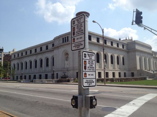
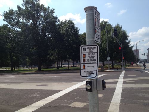
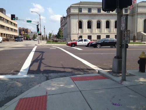
Most signalized intersections in St. Louis don’t require pedestrians to push buttons to get a “walk” sign, but this is changing as sidewalks & signals are updated. The biggest challenge is hunting for the right button to press. Take 14th & Olive, for example.
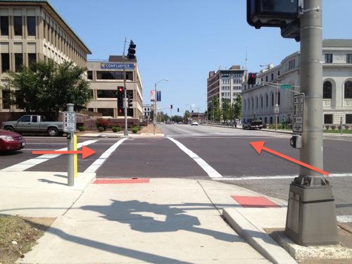
The NW corner has both buttons on the same poll, top for Olive, lower for 14thThe NE corner also has both buttons on the same poll, top for Olive, lower for 14thLike the others, the SE corner has both buttons on the same poll, top for Olive, lower for 14thThe SW corner, however, is totally different from the other 3 corners. The button on the left is next to the ramp to cross Olive, but it is for 14th. The button at right is closest to the ramp to cross 14th, but controls Olive. What were they thinking?
On the SW corner I’m not sure why both buttons aren’t on the same poll, with the top one for Olive, the one already controls the 14th signal. Typically when the buttons are separated from each other the one nearest a ramp controls that signal.
Every time I go through this intersection I forget and have to circle around to hit the right button. I’m not sure if this can easily be rectified, but I’ll find out.
AARP Livibility Index
The Livability Index scores neighborhoods and communities across the U.S. for the services and amenities that impact your life the most
Built St. Louis
historic architecture of St. Louis, Missouri – mourning the losses, celebrating the survivors.
Geo St. Louis
a guide to geospatial data about the City of St. Louis