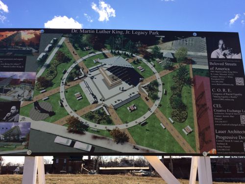
An event ia taking place tomorrow afternoon in a once-thriving commercial district: The Wellston Loop.
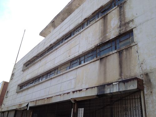
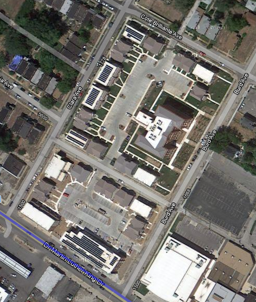
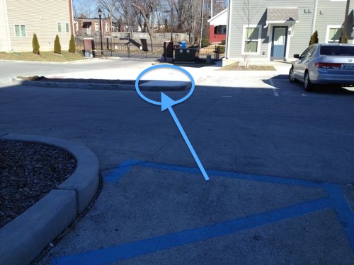
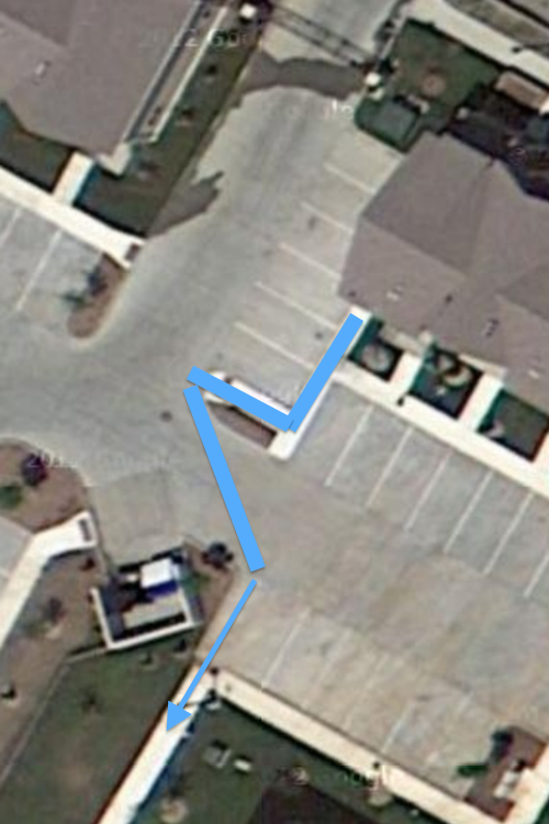
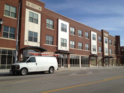
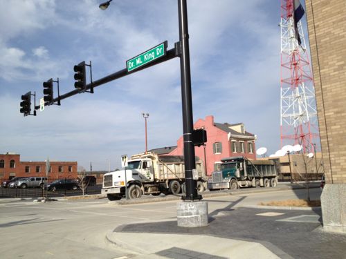
“Wellston Loop Family Reunion & Exhibit” will take place on Saturday, November 21 from 1 to 3pm. A sidewalk exhibition of recent photographs and historic documents will highlight the community. The event will offer free food, drink, music and videos. The primary venue will be the former J.C. Penney Department Store (on the National Register of Historic Places) at 5930 Dr. Martin Luther King Drive, St. Louis, Missouri 63112.
We’re inviting members of the surrounding community (past or present) who would like to share stories, photographs or videos of the neighborhood (Wellston Loop, Hamilton Heights and Wells/Goodfellow) from any era to submit them for inclusion and display.
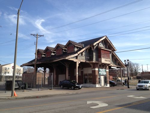
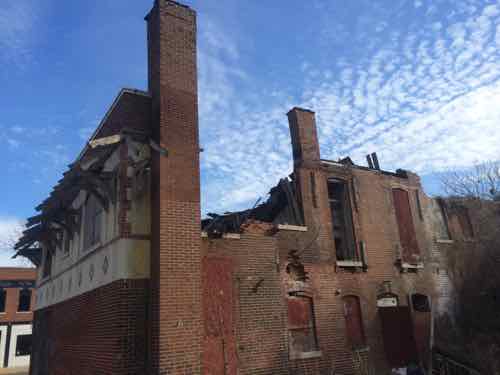
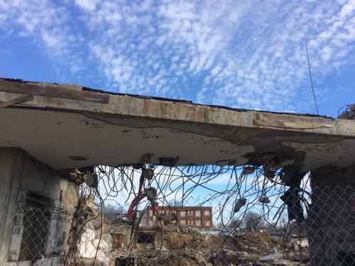
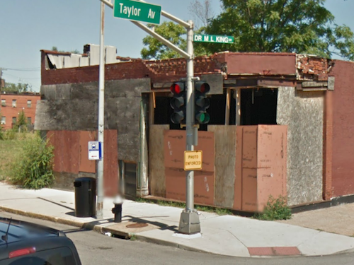
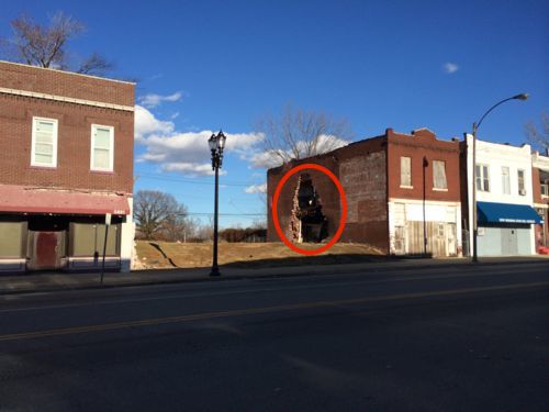
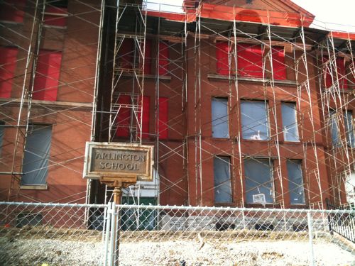
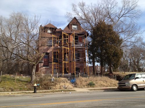
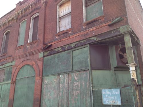
Another significant building in the former shopping district is the Wellston streetcar transfer station from 1909. It is also on the National Register of Historic Places. This building has recently been awarded funding for a complete historic restoration scheduled to begin December 2015. It is the only building of its kind (streetcar station building) left standing in St. Louis.
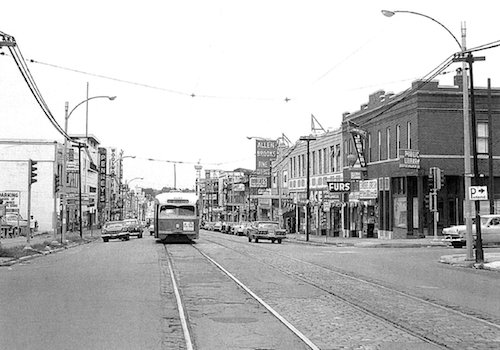
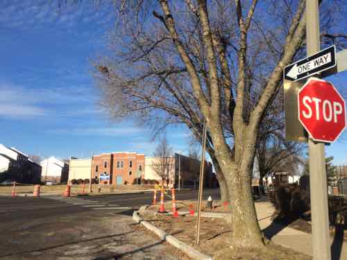
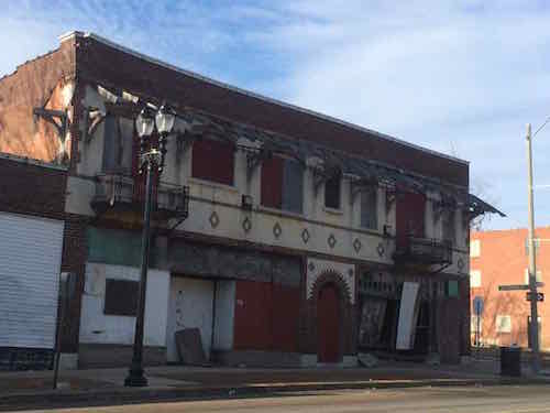
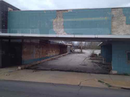
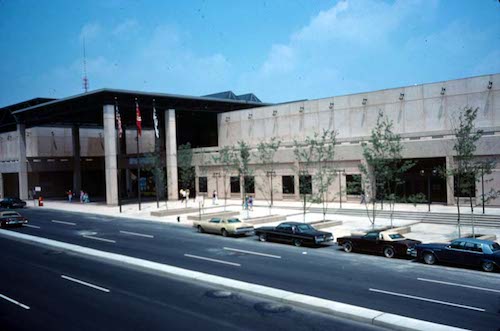
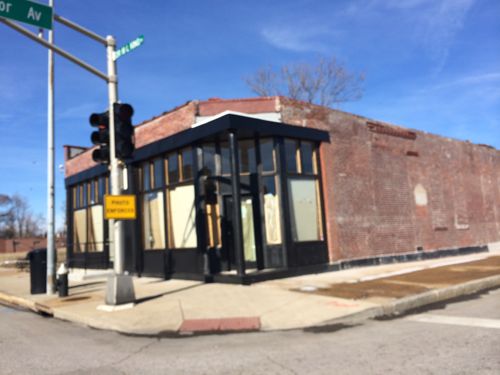
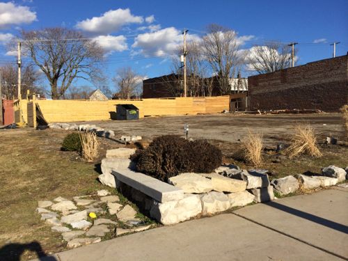
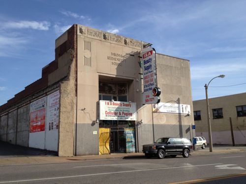
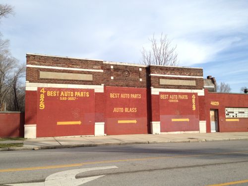
July 1963 image of The Wellston Loop from page 59 of the district nomination to the National Register, click to viewJust inside the city limits is the old Wellston Loop streetcar building, 2013 imageThe main location Saturday will be In front of the former JC Penny store at 5930 Dr. Martin Luther King Drive, click image for map. 2013 photo
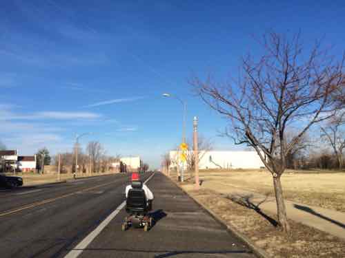
Today is Martin Luther King Jr. Day, and for the 11th year in a row, I’m posting about St. Louis’ Dr. Martin Luther King Dr. (MLK herein). Unlike the past couple of years, this year offers no new projects completed or started. To check out changes I rode the #32 MetroBus on Thursday January 15th — the #32 runs on Cass until it merges with MLK West of Grand. Then on Saturday 1/17 I drove the length of the continuous portion of MLK — from East of Tucker to past the city limits.
This post covers the main changes I saw from last year:
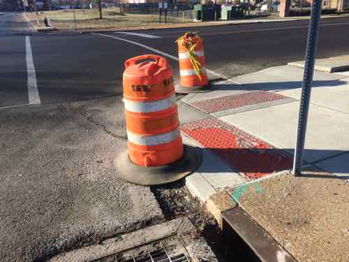
Modifications to ADA ramps, new crosswalks
Buildings being torn down or that may be gone before next year
Signalized intersections now 4-way stops
In the car I started at Tucker, the farthest East MLK is continuous, and headed West past the city limits in the suburb of Wellston.
1) DA Ramps & New Points to Cross MLK
MLK goes through multiple wards, areas built at different period and very different grids. Within the last decade a major traffic calming project on MLK between Jefferson & Grand reduced travel lanes, protected parking lanes, installed new lighting, and replaced sidewalks. As I’ve written before, this multi-million dollar from-scratch project forgot to make any provisions to cross MLK for the mile-long project. Now, years later, this is finally getting corrected as best they can after the fact.
The Jefferson-Grand had the greatest need, but this new work took place from end to end, where needed. These examples from East to West. For those unfamiliar, I often use public transit with a power wheelchair.
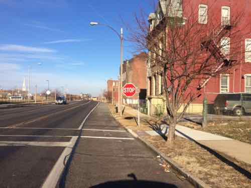
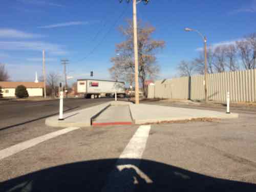
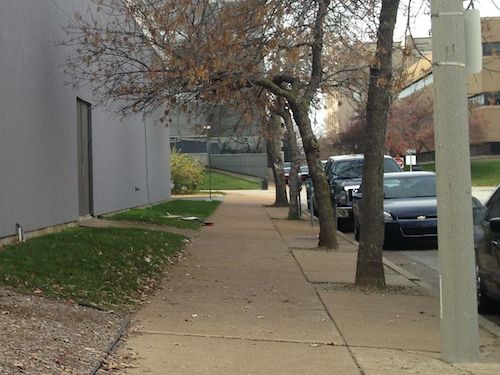
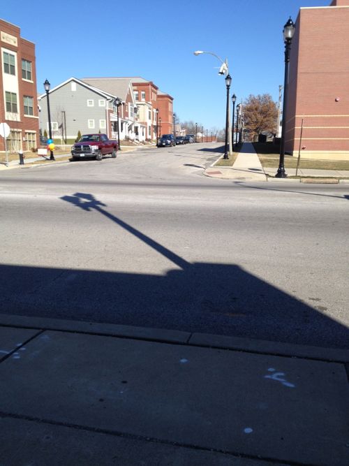
All along MLK Dr I saw evidence of new ramps and crosswalks. Hopefully the city will come back to fill in the asphalt gap — I often need to report these as I encounter them.This new crossing point is at N 22ndAnother view of the same. Lack of crosswalks is often an unintended consequence of street removal to create super blocks.I’ve personally had trouble getting to/from the bus stop on the North side of LeffingwellLooking South-ish at LeffingwellJust West of Glasgow Ave, looking NorthSame new crosswalk, looking SouthNew crosswalk at N Cardinal Ave, has been a 3-way stop for years, just no way to crossI was driving this day but I’m usually in a wheelchair, I first saw this man East of Jefferson and now he’s almost to Cardinal. He’s in the street because the new ramps have those huge gaps that can’t be crossed until filled with asphalt.Where MLK meets Cozens a new channel was created for wheelchair navigation, lacks a point to pass when two meet each other. Sorry for the blurry image.The crosswalk leads to where a new ramp was, based on Google’s aerial, but a newer ramp was build midway between Cozens & MLKSame type of channel to the West where Cass & MLK meet, again no place to meet anyoneMuch further West, at Burd Ave, a needed crosswalk is now completed.
If only the civil engineers had considered the basic idea that pedestrians need to places to cross the street.
2) Demolished or will be
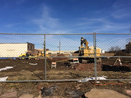
I saw no evidence of buildings removed in the last year, but one was actively being razed and others will likely be razed rather than rehabbed/rebuilt.
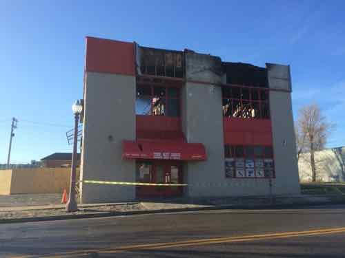
In November 2014 fire destroyed The Hit Zone at 2618 MLK, just West of Jefferson. According to city records he 2-story building was built in 1996. Click image for KSDK story on the fireEast side view of the destroyed bar at 2618 MLK
b
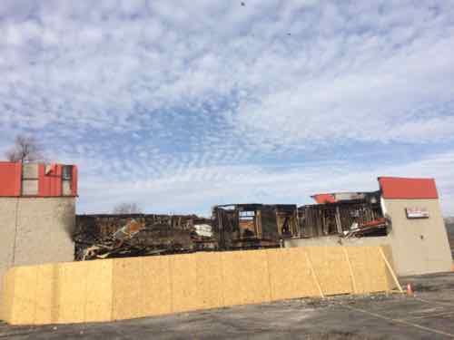
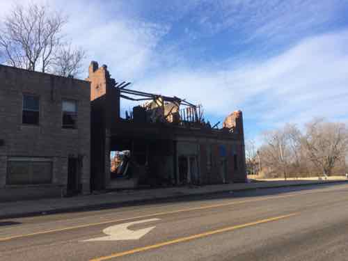
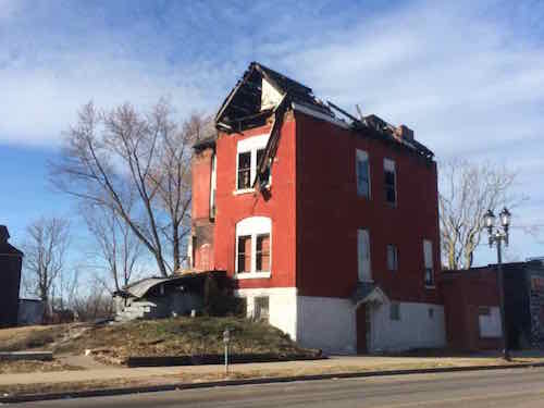
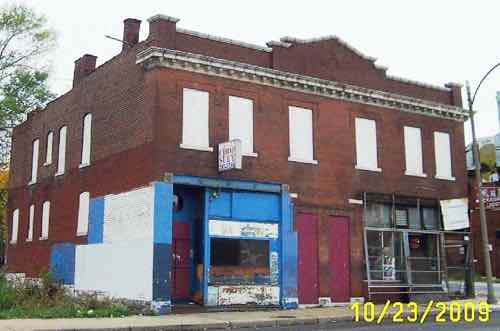
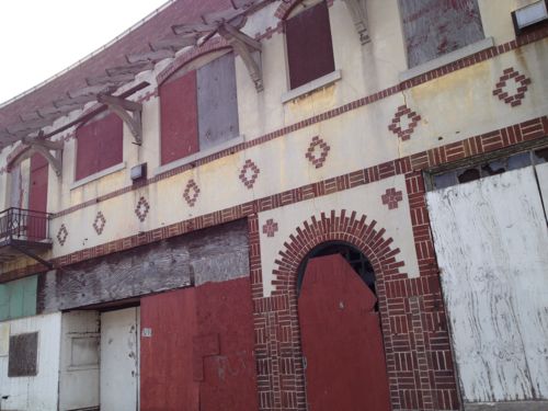
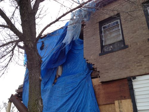
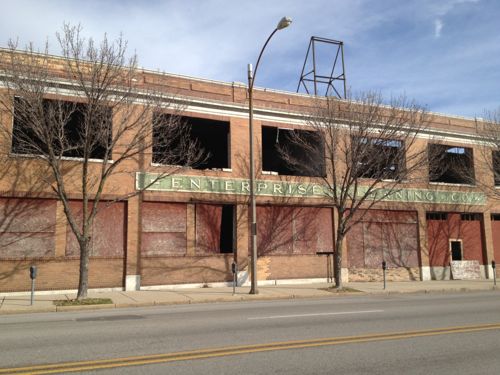
5088 MLK, just West of kingshighway, had a big fire in the fall It was inspected/condemned on 10/30/2-141495 Stewart Pl, built in 1890, was condemned on 12/24/2013 — over a year ago.I’ve been watching 5716 MLK for years, I love the design. After seeing daylight through a side window I drove down the side street (Shawmut) to see the back.Unfortunately the roof has collapsed over the Western half of the building.5746 MLK being razed brick by brick, built in 1907. A city (LRA) propertyOctober 2009, Source: GEO St. LouisLast remains of the State Bank of Wellston, in Wellston. Click image for more informationPassing by on MetroBus, April 2013
Many of these neighborhoods are depressing; lots of poverty, few jobs in the area. I’d imagine many residents would like a way out. Yet, efforts to bring investment and jobs would be labeled as gentrification. Not sure how to change the situation in these neighborhoods, but I don’t like watching them crumble.
3) From Signalized to 4-Way Stop
Two intersections that have traffic signals, now shut off, are 4-way stops.
MLK & Euclid is now a 4-way stop, the signals are turned off.
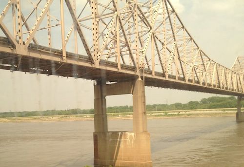
This is my 10th year blogging on Dr. Martin Luther King Jr. Day, on each of the previous nine years I’ve taken a look at Dr. Martin Luther King Drive in the City of St. Louis. Let’s start at the Mississippi River withn the King Bridge, originally known as the Veterans Memorial Bridge.
The MLK Bridge viewed from an Amtrak train in 2012
The Veterans Memorial Bridge was built by the City of East Saint Louis as a toll bridge, opening in 1951. At the time, it was the 6th longest cantilevered truss bridge in the US, and the largest cantilevered truss bridge over the Mississippi River. It carried US-40 and US-66 from 1955 until 1967. When the Poplar Street interstate highway bridge opened as a free bridge in 1967, the toll revenue from the Veterans Memorial Bridge dropped off dramatically. Eventually, both the bridge and the City of East Saint Louis would end up going bankrupt. The bridge was renamed in honor of Dr. Martin Luther King, Jr. in 1968. The structure continued to go downhill until it had to be taken over by the Saint Louis Port Authority and rebuilt in the late 1980’s, opening again in early 1989. (Source)
At that time drivers coming into St. Louis on the newly renamed bridge crossed under the elevated highway but the road split — Delmar Ave. to the left (south) or Franklin Ave. to the right (north). This 1958 aerial is clearer than the 1971 aerial. My guess is there was debate in St. Louis about which street to rename for Dr. King. This is just a hunch given the fact it wasn’t until 1972 that part of Franklin Avenue and Easton Avenue were renamed to honor Dr. King. I hope to do some research on the naming process before MLK Day 2015.
MARTIN LUTHER KING DRIVE (E-W). (Official designation is DR. MARTIN LUTHER KING DRIVE.) Following the route of the early trail from St. Louis to St. Charles, this street was officially named St. Charles Rock Road in 1865 and renamed Easton Avenue in 1881 to honor Rufus Easton, an early St. Louis postmaster. It received its present name following the assassination of the Reverend Martin Luther King, Jr., in 1968. King won a Nobel Prize in 1964 for his work to gain full civil rights for black Americans.
EASTON AVENUE (E-W). Honored Rufus Easton, who was named St. Louis’ first postmaster in 1805. He also served as Missouri’s first attorney general and gained recognition as one of the leading lawyers of his day. The name Easton still occasionally appears on city street maps although Easton Avenue is now known as Dr. Martin Luther King Drive. (St. Louis Library Street Index):
Just a few years later we began removing blocks of Dr. Martin Luther King Drive, first the two blocks were between 7th-9th for the Cervantes Convention Center, which opened in 1977. This cut off the ability to drive directly from the King Bridge onto MLK Drive.
There are now several groups working in the Wellston Loop area, each with the stated goal to revitalize the area. Their strategies are diverse and not entirely compatible with each other. Over the next year I plan to talk with the various players, asking each why they think their strategy will be successful.
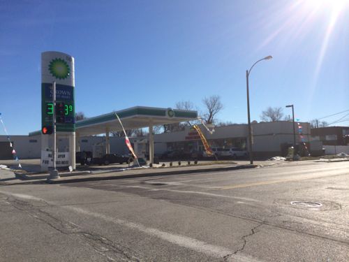
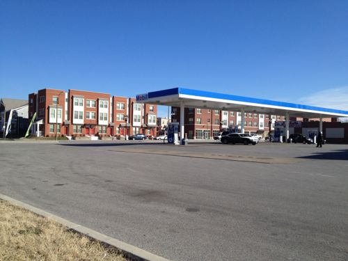
The biggest problems with Arlington Grove is the context: crossing Martin Luther King Drive on foot and recent non-urban developments.
ABOVE: The urban Arlington Grove Apts as seen from the auto-centric gas station across the street
The gas station across the street is a 4,300 square foot building on a 52,087 square foot lot, built in 2007. It is massive and destroys urban potential of the three-story buildings facing MLK Dr.
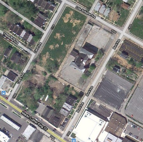
ABOVE: Aerial view of the site before construction began. Image: Google MapsABOVE: Aerial after construction completed, note the solar panels. Image: Google Maps
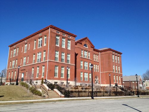
Arlington Grove contains 112 1, 2 & 3-bedroom apartments in 22 new buildings and a renovated 3-story school on two parcels totaling 213,800 square feet. At the scale of the gas station, this large site would contain just 17,650 square feet of interior space. Each floor of the renovated school contains nearly 15,000 square feet! The school, without the 22 new buildings, was already far denser than the gas station.
In other words, these two are radically different visions for the community. The 112 new apartments doesn’t detract from the gas station, but the gas station is a major detractor from the new residential neighborhood. An urban gas station like this one in Milwaukee would’ve been ideal to create a 3-story front to MLK while also providing a place for people to fuel their cars. Update 1/122 @ 9:25am: See this example of an urban gas station on Google maps here.
ABOVE: Artist rendering of people easily crossing MLKABOVE: The actual street is missing places to safely cross.ABOVE: The nearest place to cross MLK is the west side of Clara Ave that runs next to the gas station. Arlington Grove can be seen in the far right.
The next place to cross is Arlington Ave four blocks to the east! Someone needs to look at this area and make it easier/safer to cross the street.
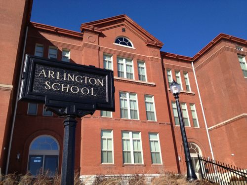
Ok, back to the development itself. Like I said, the Arlington School, built in 1900, is the centerpiece.
ABOVE: In 2011 work had begun on adapting the Arlington School to apartmentsABOVE: The renovated school building now full of apartmentsABOVE: The old Arlington School is the centerpiece of the development
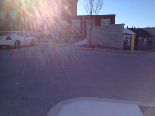
The one flaw I found with Arlington Grove is wheelchair access to the school building. A wheelchair ramp is provided in back — very convenient for anyone driving a $45,000 van.
ABOVE: Pedestrians entering from the pedestrian entry off Cote Brilliante Ave don’t have a direct path, a curb is a barrier (foreground).ABOVE: From the opposite view, what could’ve been an excellent pedestrian route is easily fixed. I had a leasing person come out to see the problem.ABOVE: The blue line shows how the current ramps force wheelchair users to go out of their way and into the auto drive rather than just crossing it at a less busy point.ABOVE: I like that one of the two 3-story buildings facing MLK has storefront spacesThe 22 new buildings have similar materials but unique designs.
I realize the entire 5+ mile stretch of Dr. Martin Luther King Drive can’t be lined with 3-story buildings, some with storefronts. But with some advanced planning the Arlington Grove development could’ve been anticipated prior to the construction of the gas station in 2007. That would’ve allowed for the plans to create similar building scales on both sides of MLK with either an urban gas station or with the gas station located a little further away.
This is my ninth look at St. Louis’ Martin Luther King Jr. Drive on Martin Luther King Day. As before, the street doesn’t do the man justice. For the previous eight years I started downtown, west to the city limits and returned. That was done by car or motor scooter, but I longer have a car. Recently returning to St. Louis in a rented car I had the foresight to exit I-44 at Jamison, making my way over to McCausland and Skinker to the west end of MLK Dr.
The following are sixteen images from my drive east to downtown.
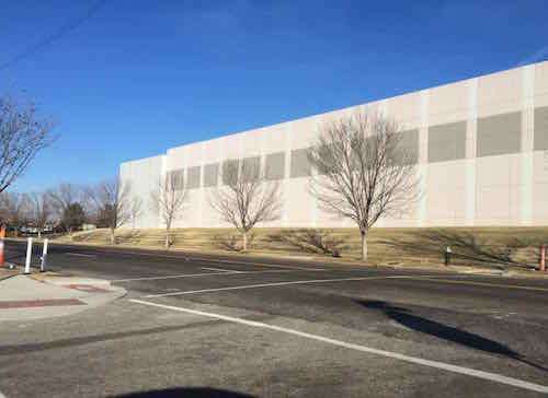
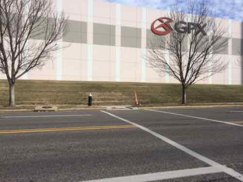
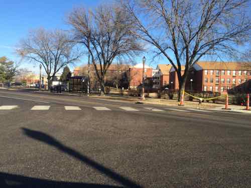
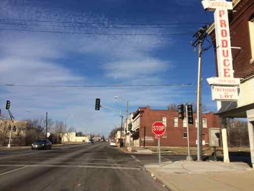
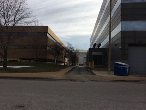
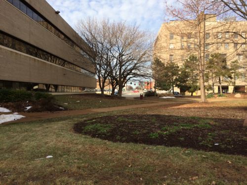
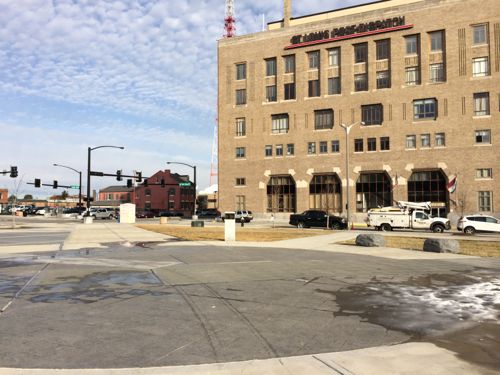
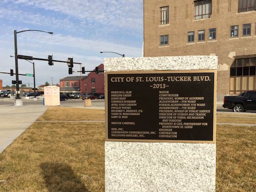
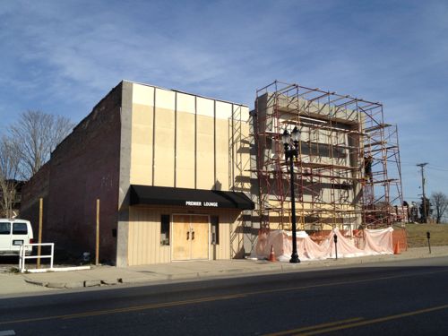
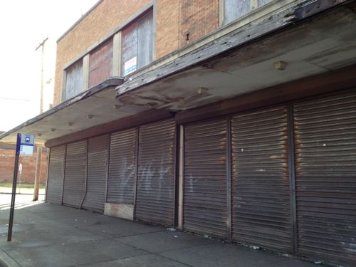
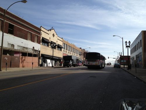
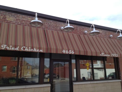
ABOVE: Commercial district continues west off the city limits lineABOVE: Just inside the city limits is the old Wellston Loop streetcar buildingABOVE: Across the street the once bustling district is largely vacsantABOVE: The former JC Penny store continues to deteriorateABOVE: But businesses do exist today, still serving the needs of area residentsABOVE: Just east of Goodfellow is one of my personal favoritesABOVE: Housing development Arlington Grove is now open — the residential units are fully occupied. More on this tomorrow.ABOVE: Surprised to see this building still standing, even more surprised to see the front being tuck pointed.ABOVE: Two of the four corners of Union & MLK have former gas stations, a third is currently a gas station.ABOVE: A new tenant is in the retail space at MLK & Kingshighway, but it wasn’t even built with a connection to the public sidewalk just a couple of feet awayABOVE: Boards over former windows is a too common sight, auto-related businesses dominate the area east of KingshighwayABOVE: Across from the renovated buildings of Dick Gregory Place is a nice looking restaurant, Arkansas Fried Chicken. Click image for Yelp listingABOVE: The corner of one building is collapsingABOVE: Another favorite building waiting for a new use.ABOVE: Nearby is yet another favorite, in very original condition.ABOVE: Skipping ahead from Vandeventer to Tucker we have the ongoing project to fill in the former railroad tunnel.
A few bright spots exist along this 5.7 mile stretch (map), but a more comprehensive approach is needed to address the myriad of problems that exist. The piecemeal approach isn’t going to do much beyond the immediate areas that have seen reinvestment.
We must find ways to get sources of good employment in the area again. It’s easy for you tell tell me the reasons why reality is that won’t happen, why jobs left and won’t return. I know why. I want to know ideas for bringing new jobs in the future.
Tomorrow I’ll take a closer look at the Arlington Heights Apartments.
AARP Livibility Index
The Livability Index scores neighborhoods and communities across the U.S. for the services and amenities that impact your life the most
Built St. Louis
historic architecture of St. Louis, Missouri – mourning the losses, celebrating the survivors.
Geo St. Louis
a guide to geospatial data about the City of St. Louis