Tenth Year Looking at St. Louis’ Doctor Martin Luther King Drive
This is my 10th year blogging on Dr. Martin Luther King Jr. Day, on each of the previous nine years I’ve taken a look at Dr. Martin Luther King Drive in the City of St. Louis. Let’s start at the Mississippi River withn the King Bridge, originally known as the Veterans Memorial Bridge.
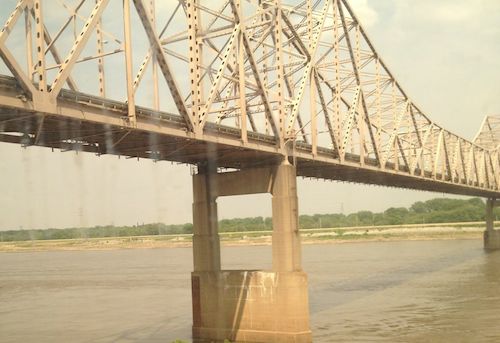
The Veterans Memorial Bridge was built by the City of East Saint Louis as a toll bridge, opening in 1951. At the time, it was the 6th longest cantilevered truss bridge in the US, and the largest cantilevered truss bridge over the Mississippi River. It carried US-40 and US-66 from 1955 until 1967. When the Poplar Street interstate highway bridge opened as a free bridge in 1967, the toll revenue from the Veterans Memorial Bridge dropped off dramatically. Eventually, both the bridge and the City of East Saint Louis would end up going bankrupt. The bridge was renamed in honor of Dr. Martin Luther King, Jr. in 1968. The structure continued to go downhill until it had to be taken over by the Saint Louis Port Authority and rebuilt in the late 1980’s, opening again in early 1989. (Source)
At that time drivers coming into St. Louis on the newly renamed bridge crossed under the elevated highway but the road split — Delmar Ave. to the left (south) or Franklin Ave. to the right (north). This 1958 aerial is clearer than the 1971 aerial. My guess is there was debate in St. Louis about which street to rename for Dr. King. This is just a hunch given the fact it wasn’t until 1972 that part of Franklin Avenue and Easton Avenue were renamed to honor Dr. King. I hope to do some research on the naming process before MLK Day 2015.
MARTIN LUTHER KING DRIVE (E-W). (Official designation is DR. MARTIN LUTHER KING DRIVE.) Following the route of the early trail from St. Louis to St. Charles, this street was officially named St. Charles Rock Road in 1865 and renamed Easton Avenue in 1881 to honor Rufus Easton, an early St. Louis postmaster. It received its present name following the assassination of the Reverend Martin Luther King, Jr., in 1968. King won a Nobel Prize in 1964 for his work to gain full civil rights for black Americans.
EASTON AVENUE (E-W). Honored Rufus Easton, who was named St. Louis’ first postmaster in 1805. He also served as Missouri’s first attorney general and gained recognition as one of the leading lawyers of his day. The name Easton still occasionally appears on city street maps although Easton Avenue is now known as Dr. Martin Luther King Drive. (St. Louis Library Street Index):
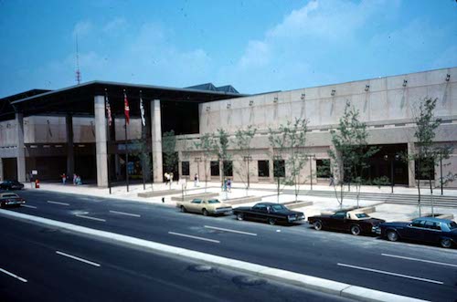
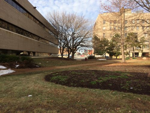
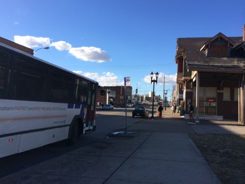
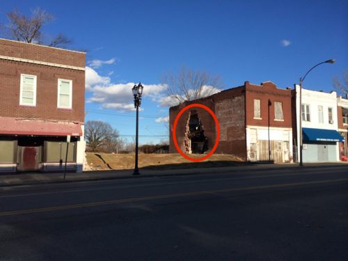
Just a few years later we began removing blocks of Dr. Martin Luther King Drive, first the two blocks were between 7th-9th for the Cervantes Convention Center, which opened in 1977. This cut off the ability to drive directly from the King Bridge onto MLK Drive.
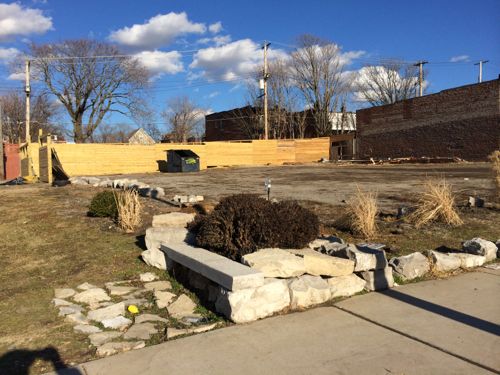
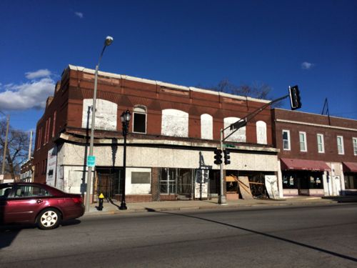
There are now several groups working in the Wellston Loop area, each with the stated goal to revitalize the area. Their strategies are diverse and not entirely compatible with each other. Over the next year I plan to talk with the various players, asking each why they think their strategy will be successful.
— Steve Patterson
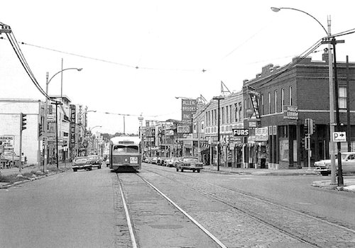
Back in the day, way, back, from the 1940s through early 1960s, before the age of Interstate Highways, shopping malls, and massive sprawl, the Wellston Loop was thee place for shopping in the St. Louis area. I’m trying to understand why?
One reason might be that it was located on one of the city’s most direct east-west routes. Today, MLK, formerly Easton Avenue, is one of the most convenient streets to take from Mid-County to downtown St. Louis, so perhaps it was Easton Avenue’s convenient central location that helped position the Wellston Loop as a commercial anchor?
Shopping areas need purchasing power and population density. Was the area a center of population density and resources? Was it access to a streetcar line? All the major roads at the time had streetcar lines and population density.
So maybe it wasn’t so much as how memory serves. Maybe in reality St. Louis was served by a variety of neighborhood commercial areas. Places like S. Broadway in Carondelet, Cherokee on the south side, Baden and Easton on the North side, downtown for the region,
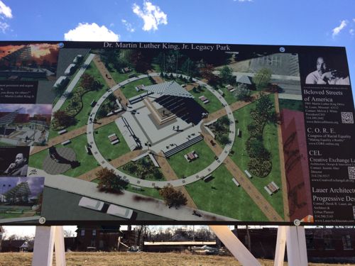
What can we learn? And maybe with that information, winning strategies for the revitalization of the MLK Corridor can be found.
During this era, African Americans stayed in mainly the urban core areas. Wellston loop bordered the urban core yet, it was a gateway to, suburbia. Segregation we must remember was still oh so real. People shopped where they were comfortable. Easton, Franklin Ave. boasted a lot of stores that supported African Americans. Many shoppers were neighborhood people who the store owner knew (many Jewish store owners) let families buy on time, “credit” and lay-away. Transportation was not as easy as it is for African Americans as it is today and many people simply walked from home. Downtown was still densly populated. At this time, St. Louis’ population was approximately 800,000 which began to decrease in the 70’s.
MLK was replete with businesses from car supplies to clothing. Anything, most anything you wanted, you could find on Easton Ave.
Some of your reasons were on point! As a child I remember going to WELLSTON! Penny’s was the anchor, Kresgee’s, and a plethoria of other specialty stores. There was even a Central Hardware and Landmark Bank where I opened my first savings account. MLK was and still remains a major thoroughfare. I remember riding the St. Charles Rock Rd. bus all the way from St. Charles home from Lindenwood College one weekend when my father could not pick me up. You could basically take one street from downtown St. Louis to St. Charles, MO.
Quality of life is the key that is going to unlock the door to our city’s success. St. Louis needs people! When you have a current population of 330,000 where you once had a population of 800,000. You stopped doing the good things you used to do to keep people living here!
Yes Steve, why have new strip malls and plazas when you don’t have consumers to support them.