Northside-Southside Light Rail Wouldn’t Be Good For St. Louis Neighborhoods

Lately I’ve been hearing people wanting the build the long-planned Northside-Southside MetroLink lines. While I’m a huge advocate of public transit, rail transit in particular, this would ultimately be a costly disaster for St. Louis’ neighborhoods.

For the Northside corridor, the preferred transit alternative was a MetroLink line running from downtown St. Louis north by using rights-of-way along several streets including 14th Street, Natural Bridge Avenue, and West Florissant Avenue into North St. Louis County. Two potential preferred alternatives were selected for the Southside corridor. One was a MetroLink extension from downtown St. Louis running south using rights-of-way within 14th Street, Chouteau Avenue, the Union Pacific Railroad track and along I-55. The other possible design was a Bus Rapid Transit system from downtown south via Market Street, Grand Boulevard, to rights-of-way alongside the Union Pacific Railroad track and Loughborough Avenue, then via I-55 to South St. Louis County. (Northside-Southside Overview)

Here’s what I think these people don’t understand:

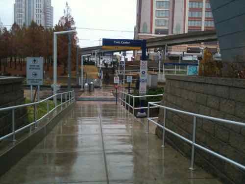
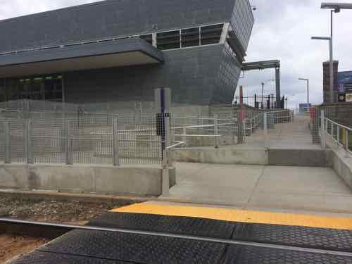
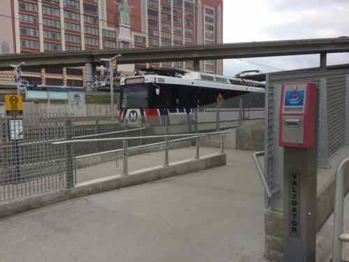
  • This would be a completely separate system from our existing light rail — Northside-Southside would use different vehicles & track. An existing line coming from the airport, for example, wouldn’t be able to run into south city. Passengers would need to exit the older high-floor light rail vehicles at the Civic Center MetroLink station and walk to 14th Street to board the new line. Fares could be integrated, but physically separate otherwise.
  • The vehicle type used would be the same as the proposed St. Louis Streetcar.  These are modern vehicles and are an excellent choice. When used as “light rail” they operate in dedicated right-of-way (ROW) with far fewer stops so as to achieve desired speeds end to end. As streetcars they stop much more frequently, putting more people closer to a stop. The tracks can be crossed easily by pedestrians & motorists. Connectivity, not speed, is the priority.
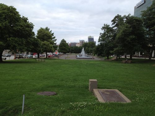
  • The goal for Northside-Southside was to end at large park-n-ride lots and get suburbanites through “scary” city neighborhoods and into downtown as quickly as possible. Stops would be over a mile apart.
  • To achieve necessary speeds the number of conflict points between rail & autos/pedestrians would need to be greatly reduced. This is accomplished by building a median down the center of the road (Natural Bridge, Jefferson) with very few points to cross. That left turn you used to make would become impossible, as would walking across the street at all but a few points.
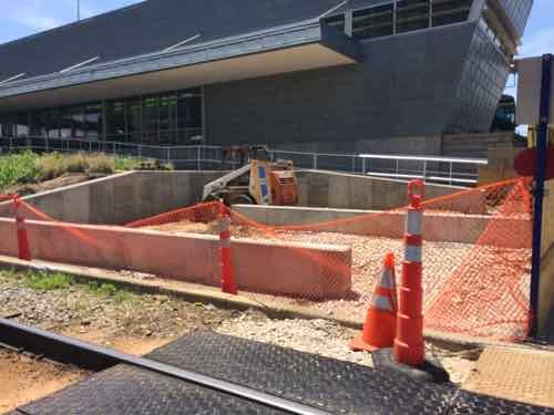
  • Property along the routes would need to be taken, some buildings razed. This is because creating a dedicated ROW takes lots of room — more than even our generous ROWs have to offer.This light rail ROW would act similar to a highway — dividing the neighborhoods on either side in an effort to rush people through as quickly as possible.

These are not positives for the neighborhoods, unless you live near one of the few stops it won’t be useful to residents.

We don’t have any examples of light rail in the center of a road, so we need to look elsewhere. In 2012 I visited Dallas and rode their Blue Line south in the center of Lancaster Rd.

ABOVE: One of several auto-centric strip shopping centers along the Blue line
One of several auto-centric strip shopping centers along their South Blue line, the physical design of the light rail line discourages new development, walking, etc

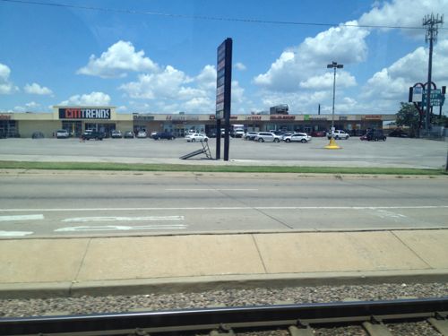
All of my photos are from inside the light rail car or at the stations. To understand you you need to view from outside. Short of a personal visit, you can look at Google’s Street View.

This view from Google Street View shows how traffic & pedestrians from a side street are forded to turn right. Click image to view the location on a map
A 2012 photo I took of the shopping center on this corner

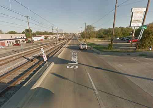
Light rail doesn’t appear to have spurred any development in the 18 years it has been open. The rail vehicles, however, do move at a high speed between stations. Success depends on your goals.

What the St. Louis neighborhoods North & South need is an investment in excellent localized rail transit — streetcars. Again, the vehicles are virtually identical — it is the design of the track and number of stops that make the difference. To me, the South/Jefferson County person driving downtown is likely to just stay on I-55 to reach their destination — we shouldn’t design this to persuade them to exit the highway and park in a big parking lot.

We should design & invest in infrastructure that brings the neighborhoods together, that helps local merchants.  Light rail is the wrong choice, streetcars is the best rail choice. If you’re opposed to MoDOT’s plans for Gravois you should be opposed to creating a light rail ROW in the middle of our major aerials.

— Steve Patterson


Thirty Hours on Megabus: St. Louis to Memphis to Little Rock to Dallas & Back

May 12, 2015 Featured, Transportation, Travel Comments Off on Thirty Hours on Megabus: St. Louis to Memphis to Little Rock to Dallas & Back

Two week ago I arrived in Dallas for a workshop & conference. I left St. Louis at 3:40pm Monday, arriving at 7:35am Tuesday morning. Amtrak? Drive? Greyhound? No, Megabus.  I last wrote about Megabus in August, see My First Trip Via Megabus. At that time the official stop was just a spot on 14th between Spruce & Clark. Now Megabus uses one of Greyhound’s bays at the Gateway Transportation Center — a huge improvement.

Sign inside the Gateway Transportation Center

Departing & arriving inside a building with food & restrooms is so much nicer than just a spot next to the road. At just before 4pm in the afternoon it isn’t a big deal — assuming it isn’t raining. But in a couple of weeks we’ll be leaving just after midnight for a trip to Chicago. It’s the middle of the night when a building makes a difference — especially in a strange city.

Two hours each way were spent in Memphis.
Two hours each way were spent in Memphis at the META North End Transfer Center. The restroom was awful, but they had plenty of outlets for charging electronics.
Very happy when we arrived in Dallas!

But when your conference stipend covers your hotel for four nights sometimes sacrifices must be made. My roundtrip was $32.50 — purchased about a month in advance. Airfare & Amtrak were both in the hundreds, renting a car would’ve been just as costly. Flying or driving wouldn’t have allowed me to have my power wheelchair, not a good option in this case.

— Steve Patterson


75th Anniversary of Aloe Plaza, Carl Milles’ ‘Meeting of the Waters’

May 11, 2015 Parks 17 Comments

I’d hoped there would be a big celebration over the weekend, continuing into today, to celebrate the 75th Anniversary of Aloe Plaza and ‘Meeting of the Waters’ by Swedish sculpture Carl Milles. A year ago I contacted 6th-ward Ald Christine Ingrassia, IKEA, and others about collaborating on an event. Nothing.

Carl Milles' 'Meeting of the Waters' is the focal point of Aloe Plaza
Carl Milles’ ‘Meeting of the Waters’ is the focal point of Aloe Plaza, dedicated 75 years ago today
Aloe Plaza across from Union Station cleared away "undesirable"  buildings, followed by decades more demolition creating the largely failed Gateway Mall
Aloe Plaza across from Union Station cleared away “undesirable” buildings, followed by decades more demolition creating the largely failed Gateway Mall

The Carl Milles wanted the title to be “Wedding of the Waters” but prudish attitudes didn’t think nude figures should be associated with weddings, so he agreed to change the name to “Meeting of the Waters.” Through Aloe Plaza has suffered from decades of neglect, the sculpture is still magnificent. Others agree, it was the top vote getter in yesterday’s poll:

Q: What are your two favorite public fountain/water features in the City of St. Louis? Pick two — one can be added

  1. Meeting of the Waters — Aloe Plaza 13 [25.01%]
  2. Grand Basin — Forest Park 11 [21.16%]
  3. Splash fountain — Citygarden 8 [15.38%]
  4. Lily pond — Tower Grove Park 7 [13.46%]
  5. World’s Fair Pavilion Fountain — Government Hill in Forest Park 4 [7.69%]
  6. TIE 3 [5.77%]
    1. Kiener Memorial/Runner Statue — Kiener Plaza
    2. Waterfall — Citygarden
  7. TIE  1 [1.92%]
    1. May Amphitheater Waterfall — Kiener Plaza
    2. Fountain Park fountain — Fountain Park
    3. Unsure/no answer
  8. TIE 0 [0%]
    1. Clock Tower fountain — Saint Louis University
    2. Grand & Lindell — Saint Louis University
    3. Waterfall — Old Post Office Plaza
    4. Wading pool — Tower Grove Park
    5. Circular Fountain — Benton Park
    6. Wading pool & spray — St. Louis Place Park

Two answers were added for fountains listed in the poll (Aloe Plaza & Grand Basin), they were added to the totals above. The Grand Basin nearly beat out “Meeting of the Waters”, which is understandable.

The Grand Basin, Forest Park

The size & proportions of the basin are very pleasing. From various angles, close up or far away it is captivating.

— Steve Patterson


Sunday Poll: Favorite Public Fountain in St. Louis?

May 10, 2015 Featured, Sunday Poll Comments Off on Sunday Poll: Favorite Public Fountain in St. Louis?
Please vote in the poll, located in the right sidebar

Unlike Kansas City, St. Louis isn’t known for fountains. Still we have a nice collection of them and other water features (waterfalls, wading pools, etc). Today’s poll is about celebrating these!

The exact poll question today is: “What are your two (2) favorite public fountain/water features in the City of St. Louis? Pick two — one can be added

Let me clarify a few things:

  • Public fountain means you don’t need to pass through an entrance gate or pay an admission. For example, this excludes fountains in the Missouri Botanical Garden, Saint Louis Zoo, etc.
  • By fountain/water feature I mean something manmade — the Mississippi River doesn’t count.
  • 15 answers are provided, but you can add one additional that’s not listed when you vote.
  • Please vote for TWO in the right sidebar.

Tomorrow I’ll present the results, focusing on the top 1-3 fountains. The poll closes at 8pm tonight.

— Steve Patterson


New Switchback Ramp Between Civic Center MetroLink & Gateway Transportation Center Should Reduce Accidents

To reduce pedestrians being hit by light rail trains they’ve been making changes to conflict points, this is about the access to the Civic Center MetroLink Station from the Gateway Transportation Center, which opened in late 2008.

When the Gateway Transportation Center (Amtrak & Greyhound) opened in the Fall of 2008 the access to the adjacent Civic Center MetroLink Station was a straight shot. November 2010 photo
In May 2014 work was underway
View looking the opposite direction
By March 2015 the change was complete
Now it isn't a straight shot across the tracks.
Now it isn’t a straight shot across the tracks.
Everyone must go through a wide switchback

This change may also be related to the coming smart card technology, a reader is shown above. The question I have is will I have a problem passing through the Civic Center MetroLink to reach the Gateway Transportation Center?

— Steve Patterson


Advertisement


[custom-facebook-feed]

Archives

Categories

Advertisement


Subscribe