November 11, 2022Books, Featured, ZoningComments Off on Recent Book — “Arbitrary Lines: How Zoning Broke the American City and How to Fix It” by M. Nolan Gray
Over a century ago a new idea called “zoning” began, intended to guide cities to grow in a less chaotic manner than they had until then. Reality, however, was very different. It’s time to let go, change.
A recently published book explains the why & how.
What if scrapping one flawed policy could bring US cities closer to addressing debilitating housing shortages, stunted growth and innovation, persistent racial and economic segregation, and car-dependent development?
It’s time for America to move beyond zoning, argues city planner M. Nolan Gray in Arbitrary Lines: How Zoning Broke the American City and How to Fix It. With lively explanations and stories, Gray shows why zoning abolition is a necessary—if not sufficient—condition for building more affordable, vibrant, equitable, and sustainable cities.
The arbitrary lines of zoning maps across the country have come to dictate where Americans may live and work, forcing cities into a pattern of growth that is segregated and sprawling.
The good news is that it doesn’t have to be this way. Reform is in the air, with cities and states across the country critically reevaluating zoning. In cities as diverse as Minneapolis, Fayetteville, and Hartford, the key pillars of zoning are under fire, with apartment bans being scrapped, minimum lot sizes dropping, and off-street parking requirements disappearing altogether. Some American cities—including Houston, America’s fourth-largest city—already make land-use planning work without zoning.
In Arbitrary Lines, Gray lays the groundwork for this ambitious cause by clearing up common confusions and myths about how American cities regulate growth and examining the major contemporary critiques of zoning. Gray sets out some of the efforts currently underway to reform zoning and charts how land-use regulation might work in the post-zoning American city.
Despite mounting interest, no single book has pulled these threads together for a popular audience. In Arbitrary Lines, Gray fills this gap by showing how zoning has failed to address even our most basic concerns about urban growth over the past century, and how we can think about a new way of planning a more affordable, prosperous, equitable, and sustainable American city. (Island Press)
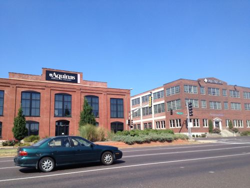
St. Louis’ first city planner, Harland Bartholomew, a civil engineer, was big on zoning. His planning firm unfortunately helped hundreds of municipalities adopt zoning laws — including in St. Louis. This form of zoning is known now as used-based zoning based on how it separates everything into separate pods. No longer can a business owner build a new building with their apartment over their store — these uses must be separate. No longer can a 2-family residential building be near single-family detached houses — these must be separate.
The latter ended up being a way of keeping immigrant/people of color communities separated from white folks — because whites shouldn’t be subjected to living near anyone different than themselves. Idyllic new suburbs, in their mind, meant all white — except for servants, of course. This attitude wasn’t limited to just the Jim Crow south, northern cities joined in this more subtle form of housing discrimination.
The St. Louis region is a prime example — it’s one reason why we have so many tiny municipalities. Going forward we must change the status quo, otherwise the entire region will continue to suffer.
Gray’s book will help you understand the problems & solutions.
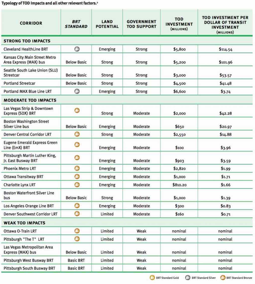
“Per dollar of transit investment, and under similar conditions, BRT can leverage more (development) investment than LRT or streetcars.”
For example, Cleveland’s Healthline, a BRT project completed on Cleveland’s Euclid Avenue in 2008, has generated $5.8 billion in development —$114 for each transit dollar invested. Portland’s Blue Line, a light rail project completed in 1986, generated $3.74 per dollar invested.
and…
The U.S. has seven authentic BRT lines in Cleveland, Las Vegas, Los Angeles, Eugene Ore., and several in Pittsburgh. None achieve the internationally recognized “gold standard” of BRT like Bogota’s TransMilenio line. But one planned for Chicago’s Ashland Avenue might.
“There’s no gold standard BRT in the U.S. yet,” Weinstock said, “but if we continue with the Ashland project on the current trajectory, Ashland could be the first gold in the U.S.”
I’ll address Chicago’s Ashland Ave in a future post. BRT — more development return than LRT or streetcars?
Long-time readers know I love rail — especially streetcars. Public transit was often about real estate development, to get people to a new project, developers would build a streetcar line to get them there. Cities would lease part of the public right-of-way (PROW) so they could operate. Cities, including St. Louis, would have multiple private companies providing public transit. Eventually cities would increase the fees for the track & overhead wires in the PROW or even require the operators to repave roads where they operated. This quickly made streetcar operations unprofitable. One solution, of course, was to abandon the track and use rubber tire vehicles — the bus.
Eventually governments bought up all the private systems — remaining streetcar lines and those that had been converted to bus. Remember, their origin was rooted in the development of real estate. With land developed these lines became strictly about moving people to/from. We need to retuning to the days of the connection between transit and development!
As you can see from the BRT, LRT, and streetcar limes above the return on investment is all over the board. In the top section (Strong TOD Impacts) we see the LRT cost more than the BRT or streetcar lines, but had significantly less development. A return of $3,74 on every dollar looks good until compared to $41.68 or more. Kansas City’s MAX bus line doesn’t even meet the basics to be BRT — yet it has had a return of $101.96 per dollar!
The report begins talking about the Metro subway system in Washington D.C. — a long & costly undertaking:
A growing number of US cities are finding, however, that metro or subway systems are simply too expensive and take too long to implement to effect significant changes in ongoing trends toward suburban sprawl. As such, cities are turning to lower-cost mass transit options such as LRT, BRT, and streetcars. These systems, which frequently use surface streets, are much less expensive and can be built more quickly than heavy-rail subways or metro systems. Over the past decade, some evidence has emerged that some LRT systems in the US have had positive development impacts. Outside of the US, in cities like Curitiba, Brazil, and Guangzhou, China, there is copious evidence that BRT systems have successfully stimulated development. Curitiba’s early silver-standard BRT corridors, completed in the 1970s, were developed together with a master plan that concentrated development along them. The population growth along the corridor rate was 98% between 1980 and 1985, compared to an average citywide population growth rate of only 9.5%. However, because bronze-, silver-, or gold-standard BRT is still relatively new to the US, evidence of the impact of good-quality BRT on domestic development is only now beginning to emerge and has been largely undocumented. (p14)
A detailed look at the Corridors with Strong TOD Impacts begins on page 110:
The analysis shows that all of the corridors in the Strong TOD Impacts category had Strong government TOD support and either Emerging or Strong land potential.
The only two transit corridors in our study that rate above bronze — the Cleveland HealthLine BRT and the Blue Line LRT — both fell into the Strong TOD Impacts category and were in Emerging land markets. The Blue Line LRT leveraged $6.6 billion in new TOD investments, and the Cleveland HealthLine BRT leveraged $5.8 billion, making them the two most successful transit investments in the country from a TOD perspective. Portland achieved this over a much longer time period and in a stronger economy than Cleveland did.
In the Strong TOD Impacts category, three corridors with below-basic-quality transit had Strong land development potential and Strong government TOD support: the Portland Streetcar, the Seattle SLU Streetcar, and the Kansas City Main Street MAX.
In each of these cases, local developers and development authorities did not feel that the transit investment was all that critical to the TOD impacts. Thus, we can conclude that if the land market is strong enough, and the government TOD efforts strong enough, a below-basic transit investment might suffice; but a higher-quality transit investment could have even greater impacts.
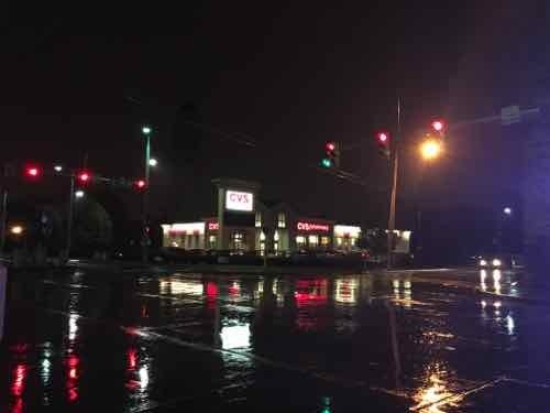
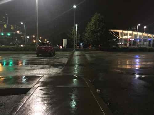
Not all of the investment along Cleveland’s Healthline is urban. We visited this CVS — built right after the line opened. The building is set back behind a fenced parking lot.
A typical suburban CVS is among the new development along Cleveland’s Healthline. Click image to view in Google Maps.
Like most newer CVS stores, it has an ADA accessible route out to the public sidewalk. In this view from the entry pedestrians must go left to the intersection to reach the EB & WB stations. If the entry were at the corner less walking would be required.
As I noted previously. a lot of the new development was on college & hospital campuses — it would’ve happened anyway — but it faces the street rather than looking internal (like SLU, BJC, etc).
I’ve got to read the full report a few more times so absorb it all — while recognizing it was written with a pro-BRT viewpoint.
Any TOD effort is most successful when land-use planning and urban development efforts are concentrated around a high-quality mass transit corridor that serves land with inherent development potential. Assistance from regional and city-level agencies, community development corporations, and local stakeholders can help create more targeted policies to direct development to such transit corridors. Local foundations can be critical to the process of funding redevelopment and providing capital and equity for projects. Local NGOs, which can communicate the projects to the public to help broaden support, are also important.
Although cities in the US are still far from fully transforming their declined urban neighborhoods into high-quality, mixed-use urban developments, they are well on their way. Gold-, silver-, or bronze-standard BRT, when combined with institutional, financial, and planning support for TOD, is proving to be a cost-effective way of rebuilding our cities into more livable, transit-oriented communities.
Regardless of their bias, the above is true — we’ve invested hundreds of millions in light rail and have little TOD to show for it because of poor land-use planning.
Like streetcars & LRT, I think BRT is a great option to consider in the St. Louis region, We can argue about the mode, but we need to take action to have land-use planning that will strongly support transit-oriented development!
Big box stores with surface parking lots don’t fit in urban contexts — they’re sub-urban. For example, the Menard’s in O’Fallon IL I drove past on Saturday, a MetroBus stop is right out front but there’s no accessible pedestrian route to get to the entrance. See it on Google Street View here.
Decades ago the big boxes were the downtown department stores, but those days are long gone. However, a few big box retailers have taken over some of the vacant space left behind by shuttered department stores.
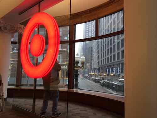
Taget in Chicago’s former Carson Pirie Scott department store designed by Louis Sullivan. February 2014. Click image to view the Wikipedia entry on the building
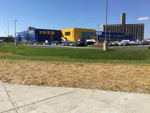
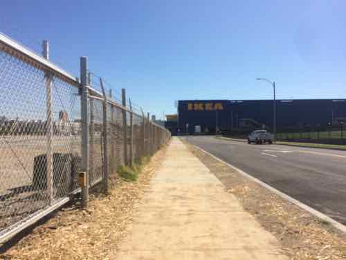
More often, big boxes have been trying to fit into walkable urban neighborhoods; they’ve been concealed by smaller liner storefronts, stacked, etc. The Target at Hampton & Chippewa is built over parking, but it still has surface parking facing Hampton & Bancroft, with docks & garage facing Chippewa. Inevitably someone says “it’s better than what was there” or “It’s better than the location in [insert any suburban municipality.” Sorry, but new development will be around for 20+ years, so standards should be higher than simply doing marginally better than awful suburban development or old derelict properties. Which brings me to IKEA St. Louis, located on the SW corner of Forest Park Ave & Vandeventer Ave.
IKEA’s blue & yellow big box set behind a surface parking lot at Forest Park & Vandeventer. View from the point where the two public sidewalks meet.
Opening day I ran into an acquaintance at IKEA — she also arrived via MetroBus — she hadn’t yet seen my post on the pedestrian access points. Upon arriving at the corner pictured above how would a pedestrian know where to find accessible routes to the entry? By big box standards, IKEA St. Louis did an excellent job providing pedestrian access routes from each go the three adjacent streets, but the massive setback from the sidewalks
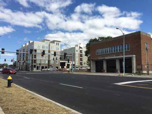
The big question now is what will happen at development sites around IKEA St. Louis? Other buildings, old & new, within a block of the intersection are all urban — built up to the public sidewalk.
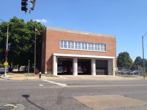
Two other corners contain urban buildings a historic firehouse and a new apartment complex built around a parking garage
The 3-story building on the NW corner was razed 4+ years ago. At right you can see the South end of the historic Gerhart Block that I posted about on Friday.
In July 2011 I posted about the building on this very same corner being razed. The Southeast corner, except for the firehouse, is to be retail.
The firehouse is supposed to remain, will help “hold” the corner. But how will everything else relate to the street & sidewalk?
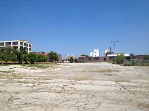
Behind the firehouse is largely an old industrial site
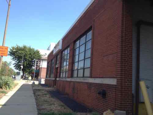
But even the old industrial office is urban in form
The urban form continues across Spring Ave
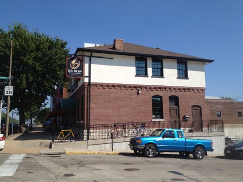
And across Forest Park Ave more urban form. Will the new retail to the South respect the urban pattern?
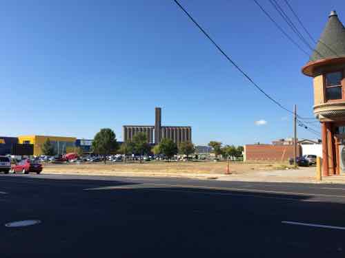
One of the most critical development parcels is immediately to the West of IKEA, at 4052 Forest Park Ave.
Looking West from the IKEA property line. The other three sides are bounded by Forest Park Ave, Sarah Ave, and Duncan Ave. The former Ford plant in the background is now lofts
Looking South across Forest Park. IKEA is to the left, just out of view. The development parcel straight ahead will ideally be of similar massing as the lofts on the right, with storefronts at sidewalk level.
Looking East on Duncan Ave, from Sarah Ave. The CORTEX master plan wants Duncan to be a pedestrian-friendly spine through the district. The form of new building(s) on the parcel on the left will matter greatly.
This site could be developed similar to new apartments at Forest Park & Vandeventer — a parking garage concealed on all sides by habitable buildings. The difference here is it should have storefront spaces on the ground floor. A boutique hotel, like one of these chains, should occupy part of the upper floors.
Hopefully IKEA St. Louis will be the exception, not the rule.
Though not always easy, I like to end the week on a positive note. Today’s post is positive in that something bad hasn’t happened, hopefully won’t.
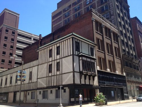
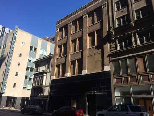
June 2013: The first two buildings remain threatened with demolition. I’m not attached to them, I just want buildings not a circle driveway.
Still standing…but still threatened, Massing here is better than yet another void.
The corner building, 923 Locust, didn’t always have that fake half-timber look. The second, however, is mostly original. As I’m not a preservationist, I have no problem razing one or both of these. As an urbanist, the only acceptable solution would be new buildings of equal or greater massing.
This is one reason why the Downtown Neighborhood Association is looking to add a form-based zoning overlay. I think Thursday October 8th is the date for the first public meeting on the subject. I’ll have details before then.
AARP Livibility Index
The Livability Index scores neighborhoods and communities across the U.S. for the services and amenities that impact your life the most
Built St. Louis
historic architecture of St. Louis, Missouri – mourning the losses, celebrating the survivors.
Geo St. Louis
a guide to geospatial data about the City of St. Louis