Home » Public Housing » Recent Articles:

Corrections to the Mill Creek Valley Narrative

November 29, 2021 Featured, History/Preservation, North City Comments Off on Corrections to the Mill Creek Valley Narrative

I feel the need to correct the record regarding Mill Creek Valley, to counter the false information being repeated.

“Horizontal, black and white photograph showing a row of dilapidated residential buildings in the 3200 block of Lawton in Mill Creek Valley. The buildings appear to be empty and awaiting demolition. Low wooden fences enclose the small front yards. There are several inches of snow on the ground.” February 16, 1960. Missouri Historical Society

Though St. Louis was founded in 1764 it wasn’t incorporated until 1823. At that time “the city limits were expanded west to Seventh Street and north and south by approximately 5 blocks each.” (Wikipedia) In 1861 the limits were expanded west to Grand, but streets and development had already gone further west. The land for Forest Park was purchased in 1875 — it was located in St. Louis County, not within the city limits of St. Louis. The current municipal boundaries were set in the 1876 divorce from St. Louis County, they were rural at the time.

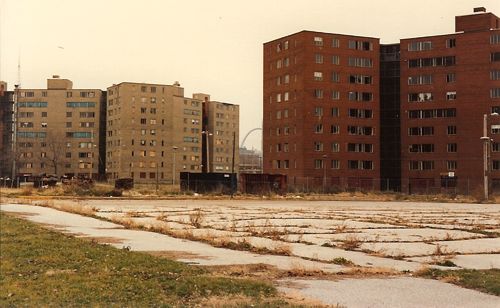
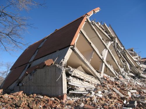
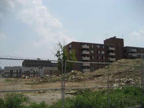
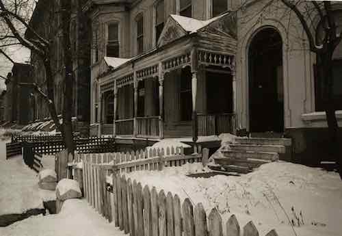
There was no singular cohesive Mill Creek Valley neighborhood. The large rectangular area (454 acres) the city demolished for “urban renewal”, bounded by 20th St, creek/railroad, Grand Ave, Olive St., included many communities, businesses, homes, etc. was built over many decades — neighborhoods plural. Our modern perception of neighborhoods having distinct edges didn’t exist then, your neighborhood was where you lived. People who lived between 20th & Jefferson didn’t see their area belonging to the newer area west of Compton. The fact this large area ended up being grouped together and labeled by the city as a redevelopment area doesn’t make it a single neighborhood.

Commonly the word “downtown” refers to a city’s central business district (CBD). The size/location of “downtown St. Louis ” varies depending upon who you ask. To some anything east of I-270 is downtown. When St. Louis Union Station reopened at its new facility on September 1, 1894 it was considered far west of the CBD/downtown. The original station, on the east side of 12th (now Tucker), opened on June 1, 1875.

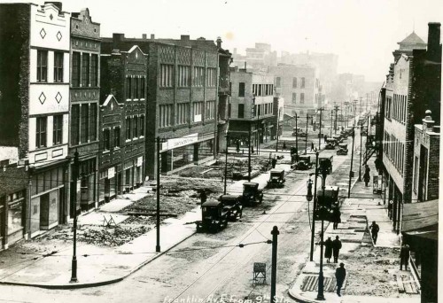
Thus, the Mill Creek redevelopment area wasn’t the heart of downtown. Not even close. Starting at 20th and going west, it wasn’t the oldest part of the city either. The stately row houses in this area were significantly newer and nicer than the tenements east of 10th Street. It was certain old by the 1940s, just not the oldest. It was also dense and lively, with everything within a short walk. Market Street ran down the center of the rectangular redevelopment area and contained the majority of the commercial activity, but corner shops also existed.

Since the city’s founding African-Americans lived in tight pockets throughout the city and St. Louis County. The black population before the Civil War was a very small percentage.

Not all persons of color in St. Louis were slaves, and in fact, as the 19th century progressed, the number of free blacks continued to rise. This can be explained by looking at several factors. Conditions in St. Louis enabled self-purchase. St. Louis’ proximity to Illinois, a state where slavery was supposed to be illegal, allowed a small number of slaves to sue for their freedom in St. Louis courts based on the premise that they had been held as slaves for a period of time in a free state. A very small number were also set free by masters who had come to see slavery as a moral wrong. Former slaves who wished to remain in the State of Missouri as free blacks were supposed to obtain a license from the state.

In addition to the over 1,000 free blacks in St. Louis who owned small businesses, were laborers or worked odd jobs, a certain elite group of African-American St. Louisans styled “the Colored Aristocracy” were large landowners and businesspersons, many descended from some of St. Louis’ earliest residents. Several owned the large barber emporiums, while others owned drayage businesses which moved goods from steamboat to steamboat on the levee. Still others, like Madame Pelagie Rutgers, owned huge tracts of land which they sold at great profit as the city expanded. The “Colored Aristocracy” of St. Louis had its own social season and debutante balls. A member of this social class, Cyprian Clamorgan, wrote a book in 1858 called the Colored Aristocracy of St. Louis, in which he profiled the group. (National Park Service — highly recommended)

Yes, wealthy blacks in the 19th century. They didn’t live in the area we know today as Mill Creek. They lived in The Ville.

During the 1920s, The Ville was home to an elite community that included black professionals, businessmen, entertainers and Annie Malone, one of the country’s first African-American millionaires. One of St. Louis’ most historically significant neighborhoods, The Ville was home to Sumner High School, the first school west of the Mississippi River to provide secondary education for blacks. Some of the school’s best known alumni are Rock ‘n’ Roll Hall of Famer Chuck Berry, opera diva Grace Bumbry, and tennis great Arthur Ashe. During the 1920s and ‘30s, the neighborhood thrived, as more and more African-American institutions were established, including Harriet Beecher Stowe College and Homer G. Phillips Hospital.

The Ville served as the cradle of African-American culture and nurtured its rich heritage for the black population of St. Louis. Today, the soaring Ville Monument pays tribute to the neighborhood’s achievements and its famous sons and daughters. (Explore St. Louis)


Sumner High School, mentioned above, opened downtown on 11th between Poplar & Spruce in 1875 — the same year as the adjacent first new Union Station mentioned earlier:

Charlton Tandy led protests of the planned siting of Sumner High School in a heavily polluted area in close proximity to a lead works, lumber and tobacco warehouses, and the train station as well as brothels. He said that black students deserved clean and quiet schools the same way white students do. The location went unchanged, and Sumner High opened in 1875, the first high school opened for African Americans west of the Mississippi. The school is named after the well-known abolitionist senator Charles H. Sumner. The high school was established on Eleventh Street in St. Louis between Poplar and Spruce Street, in response to demands to provide educational opportunities, following a requirement that school boards support black education after Republicans passed the “radical” Constitution of 1865 in Missouri that also abolished slavery.

The school was moved in the 1880s because parents complained that their children were walking past the city gallows and morgue on their way to school. The current structure, built in 1908, was designed by architect William B. Ittner. Sumner was the only black public high school in St. Louis City until the opening of Vashon High School in 1927. Famous instructors include Edward Bouchet and Charles H. Turner. Other later black high schools in St. Louis County were Douglass High School (opened in 1925) and Kinloch High School (1936). (Wikipedia)

Sumner High was an 1867 school renamed. Originally it was District School Number Three. Source: 1960 handbook.

Locations:

  • 1867, 5th & Lombard
  • 10th & Chambers
  • 1875, 11th & Spruce — now known as Sumner instead of #3.
  • 1896, 15th & Walnut
  • 1908 construction on the current location in The Ville neighborhood began
  • 1910 classes began, moving from 15th & Walnut.

Wealthy blacks in St. Louis were successful in relocating Sumner t0 their neighborhood, where their homes and businesses were located.

Another well-known institution in The Ville was Homer G. Phillips Hospital.

Between 1910 and 1920, the black population of St. Louis increased by sixty percent, as rural migrants came North in the Great Migration to take industrial jobs, yet the public City Hospital served only whites, and had no facilities for black patients or staff. A group of black community leaders persuaded the city in 1919 to purchase a 177-bed hospital (formerly owned by Barnes Medical College) at Garrison and Lawton avenues to serve African Americans. This hospital, denoted City Hospital #2, was inadequate to the needs of the more than 70,000 black St. Louisans. Local black attorney Homer G. Phillips led a campaign for a civic improvements bond issue that would provide for the construction of a larger hospital for blacks.

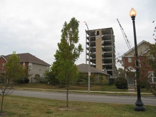
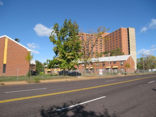
When the bond issue was passed in 1923, the city refused to allocate funding for the hospital, instead advocating a segregated addition to the original City Hospital, located in the Peabody-Darst-Webbe neighborhood and distant from the center of black population. Phillips again led the efforts to implement the original plan for a new hospital, successfully debating the St. Louis Board of Aldermen for allocation of funds to this purpose. Site acquisition resulted in the purchase of 6.3 acres in the Ville, the center of the black community of St. Louis. But, before construction could begin, Homer G. Phillips was shot and killed. Although two men were arrested and charged with the crime, they were acquitted; and Phillips’ murder remains unsolved.

Construction on the site began in October 1932, with the city initially using funds from the 1923 bond issue and later from the newly formed Public Works Administration. City architect Albert Osburg was the primary designer of the building, which was completed in phases. The central building was finished between 1933 and 1935, while the two wings were finished between 1936 and 1937. The hospital was dedicated on February 22, 1937, with a parade and speeches by Missouri Governor Lloyd C. Stark, St. Louis Mayor Bernard Francis Dickmann, and Secretary of the Interior Harold L. Ickes. Speaking to the black community of St. Louis, Ickes noted that the hospital would help the community “achieve your rightful place in our economic system.” It was renamed in 1942 from City Hospital #2 to Homer G. Phillips, in his honor. (Wikipedia)

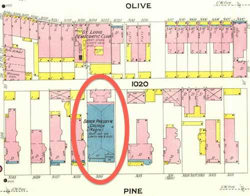
Prior to Homer G. Philips Hospital in the Ville, an existing building was used as City Hospital #2 between 1919-1936. That 19th century building was at Garrison & Lawton. That intersection no longer exists. Lawton was an east-west street between Pine and Laclede, known as Chestnut east of Jefferson. So yes, the first hospital for blacks in St. Louis was within the boundaries of the Mill Creek redevelopment area, for 17 years. Then the significantly larger City Hospital #2 opened in the Ville — where the wealthier black families lived.

February 1909 Sanborn Map showed a stone (blue) church at 3015 Pine, labeled “Berea Presby’n Church (Negro)”. This is one the few buildings to survive the clearance of the Mill Creek redevelopment area.

As stated at the beginning, black residents lived in small pockets throughout the city. Wealth, social class, and geography separated the residents of the Ville from those in the older Mill Creek redevelopment area.

This is not to say every black person living in The Ville was wealthy, that was not the case. As poor blacks moved north to escape the Jim Crow south they likely lived where they could, including in The Ville. I know of one family that lived in The Ville during the 1940 census that had migrated from Alabama. I’d love to see maps showing where black persons lived in the region following the Civil War, showing shifts each decade.  The change from 1950 to 1960 would give us better information on where families displaced by the demolition of Mill Creek relocated.

We know white home owners in the areas immediately outside The Ville had racially restrictive covenants on their properties since the early years of the 20th century. One block, now part of the Greater Ville neighborhood, was still white when the Shelley family had a white person act as the buyer so they could purchase 4600 Labdie in 1945. In 1948 the U.S. Supreme Court ruled the court system couldn’t be used to enforce restrictive covenants (Shelley v Kraemer).

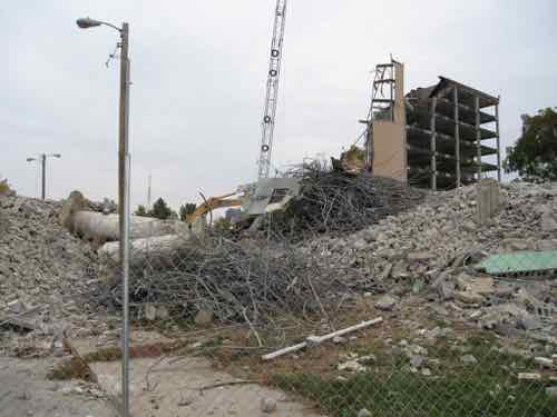
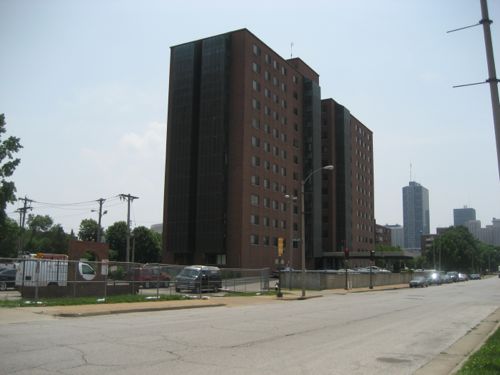
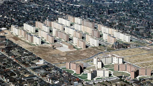
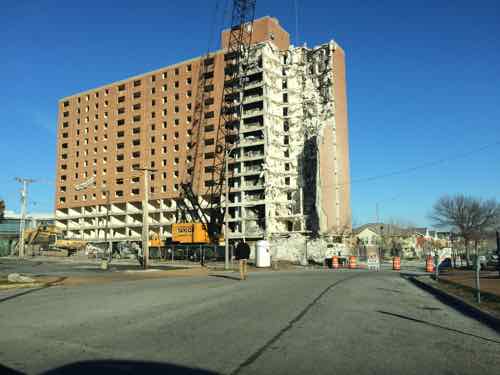
This prompted many white homeowners surrounding The Ville to sell and move further away. At the same time people were being forced to leave the  Mill Creek Valley redevelopment area many more options were available on the city’s north side.  Yes, some may have moved into numerous high-rise public housing projects that were open prior to the February 16, 1959 start of demolition in Mill Creek.

  •  Cochran Garden Apts, April 1953
  • Pruitt-Igoe, 1955
  • (In December 1955) a judge ruled St. Louis and the housing authority had to stop segregation in public housing.
  • Vaughn Apts, October 1957

The low-rise Neighborhood Gardens and Carr Square Village opened in May 1935 and August 1942, respectively. Again, segregated until 1956. One of the problems with large-scale demolition is people get scattered in the process.

The demolition was certainly a land grab, no question. Wealthy whites living west in the Central West End, Clayton, Ladue, etc had to drive on Market Street to reach Union Station and the CBD. They didn’t like driving through old dense areas, especially predominantly occupied by African-Americans.

Back east demolition was increasingly happening. Soldiers Memorial opened in 1938, Aloe Plaza opened two years later — both on the north side of Market Street. St. Louis leaders got hooked on demolition so clearing out the west entry to downtown followed. Also in the late 1930s the Oakland Express opened, a highway from Skinker to Vandeventer & Chouteau.

Hopefully the incorrect information will cease.

— Steve Patterson


Four St. Louis High-Rise Public Housing Projects Replaced With Low-Rise Developments

September 30, 2020 Featured, History/Preservation, Neighborhoods, Planning & Design Comments Off on Four St. Louis High-Rise Public Housing Projects Replaced With Low-Rise Developments

Today’s post is about HOPE VI projects. You may have heard that term before, but if you’re unfamiliar here’s an introduction:

HOPE VI is a program of the United States Department of Housing and Urban Development. It is intended to revitalize the worst public housing projects in the United States into mixed-income developments. Its philosophy is largely based on New Urbanism and the concept of defensible space.

The program began in 1992, with formal recognition by law in 1998. As of 2005, the program had distributed $5.8 billion through 446 federal block grants to cities for the developments, with the highest individual grant being $67.7 million, awarded to Arverne/Edgemere Houses in New York City.

HOPE VI has included a variety of grant programs including: Revitalization, Demolition, Main Street, and Planning grant programs. As of June 1, 2010 there have been 254 HOPE VI Revitalization grants awarded to 132 housing authorities since 1993 – totaling more than $6.1 billion. (Wikipedia)

The short answer is HOPE VI was the program used to raze & replace distressed high-rise public housing with low-rise mixed-income private housing. With the notable exception of Pruitt-Igoe, all of St. Louis’ high-rise public housing was replaced with low-rise housing — three using the HOPE VI program. Pruitt-Igoe was famously imploded two decades before the start of the HOPE VI program.

From a May 2004 research report after a decade of HOPE VI:

Launched in 1992, the $5 billion HOPE VI program represents a dramatic turnaround in public housing policy and one of the most ambitious urban redevelopment efforts in the nation’s history. It replaces severely distressed public housing projects, occupied exclusively by poor families, with redesigned mixed-income housing and provides housing vouchers to enable some of the original residents to rent apartments in the private market. And it has helped transform the Department of Housing and Urban Development’s (HUD) approach to housing assistance for the poor. This report provides a comprehensive summary of existing research on the HOPE VI program. Its central purpose is to help inform the ongoing debate about the program’s achievements and impacts, and to highlight the lessons it offers for continuing reforms in public housing policy.

HOPE VI grew out of the work of the National Commission on Severely Distressed Public Housing, which was established by Congress in 1989. Congress charged the Commission with identifying “severely distressed” public housing developments, assessing strategies to improve conditions at these developments, and preparing a national action plan for dealing with the problem. Based on its investigation, the Commission concluded that roughly 86,000 of the 1.3 million public housing units nationwide qualified as severely distressed and that a new and comprehensive approach would be required to address the range of problems existing at these developments.

In response to these findings, Congress enacted the HOPE VI program, which combined grants for physical revitalization with funding for management improvements and supportive services to promote resident self-sufficiency. Initially, housing authorities were allowed to propose plans covering up to 500 units with grant awards of up to $50 million. (Introduction to an Urban Institute report)

I should clarify the HOPE VI program isn’t limited to only remaking high-rise public housing, but that is the type of distressed public housing we had in St. Louis. Other cities, like Chicago, also used it to replace high-rise projects. Cabrini-Green, for example.

Let’s take a look at the four St. Louis high-rise public housing projects that were replaced with low-rise housing built on a more traditional street grid.

Darst-Webbe

The Darst-Webbe towers on the near south side circa 1990-91, razed

This was officially known as the J.M. Darst Apartments and the A.M. Webbe Apartments. The Darst apts., opened in October 1956, occupied 14.75 acres bounded by Lafayette, Hickory, Tucker (12th) & 14th.  The four 9-story buildings contained 645 units.  The Webbe apts. opened in May 1961 between the Darst apts. and Chouteau.  It had a mix of buildings on 12.27 acres: two 9-story, one 12-story, and one 8-story. These four buildings had 580 units.  The combined Darst-Webbe then had 1225 apartment units on 27.02 acres.

This was the first high-rise public housing project in St. Louis to be razed and rebuilt under the HOPE VI program. In its place is a mix of apartments and privately-owned single-family homes. On the south is King Louie Square apartments, with 152 1-4 bedroom units. In the middle of the redevelopment site is the single-family homes, called La Saison. Habitat for Humanity is building new homes here on the few vacant lots remaining. The north part of the original site contains more apartments, called Les Chateaux — with 40 1-2 bedroom units.

House at La Saison on Tucker near Park Ave, the north edge of King Louie Square can be seen on the left. Photo December 27, 2013.
Looking north on 14th street toward LaSalle. The buildings on the left are rental townhouses in the redevelopment area, just not sure if they have a name. Photo: November 7, 2018.

In 1995 HUD gave the St. Louis Housing Authority a grant of $46.7 million to redevelop Darst-Webbe. Defunct developer Pyramid Construction is responsible for the pretentious names.

Vaughn

This was two projects, both called G.L. Vaughn Apartments. The first, opened in June 1957, was bounded by Cass, O’Fallon, 18th, and 20th. It had four 9-story towers on 16.67 acres — with 647 units. The second opened at the NE corner of 20th & O’Fallon in September 1963. Basically this was just an expansion of the project that opened six years earlier, it had one 8-story building on 2.05 acres, 112 units.

The last Vaughn tower being razed in October 2006.
New housing, called Murphy Park, had already been built where the other four towers had been razed.
The Murphy Park senior building and management offices.
Looking south on Vinson Street from a new park on Biddle Street.

Vaughn was completed, to the best of my knowledge without the use of a HUD HOPE VI grant, but like others it got state low income tax credits.

 The partnership event highlighted Phase III of Murphy Park. Its 126 units will bring to 413 the total number of rental dwellings built in the neighborhood that once was the site of the notorious George L. Vaughn public housing high-rises. One third of the completed project will be market rate apartments, with the balance constructed as tax credit units – with just more than half available for public housing-eligible families as part of the replacement of the former public housing complex. Units range from two to six bedrooms and include disability-accessible garden apartments. Each apartment features full size appliances including washer and dryer, refrigerator, stove and dishwasher. McCormack Baron Management Services, the management agent, reports that Phases I and II (completed in 1997 and 2000) have high-90 percent occupancy. Phase III units will be available in March 2003. (HUD)

As the above indicates, this was a McCormack Baron development.

Blumeyer

This was officially the A.A. Blumeyer Apartments. It opened in October 1968, bounded by Compton, Delmar, Grand & Page. It had two 14-story buildings for “elderly”, three 15-story buildings, and forty-two 2-story buildings. There was a total of 1,152 units on 33.90 acres.

Low-rise & high-rise buildings at Blumeyer before being razed. Photo October 2006
Blumeyer Elderly Apartments on Page, January 2007

This was replaced by the Renaissance Place at Grand apartments and the offices of the St. Louis Housing Authority.  To the north, across Dr. Martin Luther King Blvd, Senior Living at Renaissance Place was built on land not part of Blumeyer.  Additionally, the North Sarah Apartments were built on…North Sarah… to provide additional units.

New apartment within a grid of new streets in February 2013, the last Blumeyer tower in the background — demolition on it began in the fall of 2014

The $35 million dollar HUD grant was issued in 2001. Like Vaughn, this was a McCormack Baron project.

Cochran

Officially the J.J. Cochran Garden Apartments.   Completed in April 1953, it was St. Louis’ first high-rise public housing project — more than two years before Pruitt Homes and three years before Igoe Apartments. The 18.03 acre site contained four 12-story, two 7-story, and six 6-story towers — containing 703 units. It was built to clear out old tenemts businesses on the north edge of the business district didn’t like. Then Cochran became a problem, but tenants pushed for the ability to self manage — and won!

Cochran Gardens was a public housing complex on the near north side of downtown St. Louis, Missouri. Construction was completed in 1953. The complex was occupied until 2006, it was famous for its residents’ innovative form of tenant-led management. In 1976, Cochran Gardens became one of the first U.S. housing projects to have tenant management. Built by the same firm, Leinweber, Yamasaki & Hellmuth, as the infamous Pruitt–Igoe complex, Cochran Gardens was more successful than its ill-fated sister project. In the mid 1970s, Bertha Gilkey and a group of friends successfully led a community driven rehabilitation effort; in 1976 she won a property management contract from the city. Independent management improved Cochran Gardens and created small business jobs in the neighborhood. President George H. W. Bush visited the site in 1991, commending tenant management and Bertha Gilkey. However, in 1998 city authorities took over Cochran Gardens, citing tax mismanagement by the tenant association. The buildings rapidly deteriorated, by 1999 vacancy rate increased from under 10% to one-third. (Wikipedia)

I photographed the area in May 2007 as towers still existed and as new construction was going up, streets going in.

The last high-rise tower from the Cochran Gardens project was razed in 2011. This is 9th & O’Fallon on May 29, 2007.
At 7th & O’Fallon you can just see the historic Neighborhood Gardens project on the left, new Cambridge Heights apartments on the right. In the background is an old Cochran tower about to be demolished. Note traffic signals were still in place along 7th street.
From 9th street we can see the other side of the Cochran tower before demolition, and new townhouses facing 8th street. The building on the horizon is on 7th, was part of McGuire Moving & Storage.
Project sign
Looking to the left we see more new townhouses between 8th & 9th
Looking south on 8th Street from Dickson Street. Dickson Street didn’t exist between 7th and 9th prior to Cochran, but the street name was used east of 7th. Eighth street was removed for Cochran, it was mostly rebuilt.

This project was completed by an LLC that includes architect Michael Kennedy of KAI (previously known as Kennedy Associates, Inc). McCormack Baron was management from the very beginning, until February of this year. In a future post I’ll go into more detail on Cochran Gardens & Cambridge Heights.

Summary

These four areas are all significantly better because of each redevelopment. The New Urbanist influence has been a key factor in their success. The buildings in all four orient toward the public street. HOPE VI projects have valid criticism, largely the reduction in the number of public housing units for the very low income. The other is the charge of gentrification, a valid claim in other cities but not in St. Louis. More on that in the future.

— Steve Patterson


Fifty Years Since the St. Louis Rent Strike of 1969 Ended

October 30, 2019 Featured, Politics/Policy Comments Off on Fifty Years Since the St. Louis Rent Strike of 1969 Ended

Yesterday was the 50th Anniversary of the end of the 1969 St. Louis Rent Strike. Upset by poorly built & maintained public housing, tenants refused to pay their rent.

The 1969 rent strike focused on the failed Pruitt-Igoe project.

Much was written about the rent strike, here’s the abstract from a 2013 academic paper titled The St. Louis Rent Strike of 1969: Transforming Black Activism and American Low-Income Housing:

In 1969, public housing tenants launched a rent strike that shaped federal legislation and helped make housing a central concern of the Black Freedom Struggle. In addition to providing a detailed narrative of the rent strike, this article follows the lives of the rent strike’s three primary leaders—Ivory Perry, the Rev. Buck Jones, and Jean King. Following the rent strike, Ivory Perry worked to curb lead poisoning while Buck Jones sought to reform welfare in Missouri. Later, Jones labored to improve living conditions in East St. Louis, Illinois. Jean King worked with private developers following the rent strike, helping remake the architecture and management of low-income housing. By focusing on how these individuals aided the rent strike, and by following their subsequent life careers, this article demonstrates that the St. Louis rent strike influenced developments central to American low-income housing and black activism in the St. Louis metropolitan area.

Strikes are an effective way to force change. Still, some would like to end unions and strikes. In the recent non-scientific Sunday Poll there was more responses than usual, but the pattern didn’t change.

Q: Agree or disagree: To reduce economic disruption strikes should be limited by law

  • Strongly agree: 2 [2.7%]
  • Agree: 0 [0%]
  • Somewhat agree: 0 [0%]
  • Neither agree or disagree: 1 [1.35%]
  • Somewhat disagree: 0 [0%]
  • Disagree: 5 [6.76%]
  • Strongly disagree: 65 [87.84%]
  • Unsure/No Answer: 1  [1.35%]

We must be diligent to protect the right to strike.

— Steve Patterson


St. Louis’ Original “Little Italy” Neighborhood: North Downtown/Columbus Square

June 3, 2019 Downtown, Featured, Neighborhoods, North City, Urban Renewal Comments Off on St. Louis’ Original “Little Italy” Neighborhood: North Downtown/Columbus Square
Bocce is one of many long-standing traditions on The Hill

When you think of an Italian neighborhood in St. Louis, The Hill naturally comes to mind.

The Hill’s roots are interspersed with the history of St. Louis, generating two of the region’s proudest exports – world-class athletes and Italian cuisine. Baseball’s Yogi Berra and Joe Garagiola grew up here, and today it maintains a traditional collection of authentic Italian bakeries, grocery stores, restaurants and mom-and-pop trattorias.

Everything is colorful here – even the fire hydrants are painted red, white and green. Twenty-first century additions include coffee houses, studios, retail and small businesses that create additional energy in the cozy enclave. Its epicenter is one intersection that sums it up perfectly, with St. Ambrose Catholic Church on one corner, an Italian bakery/restaurant on another, an import shop across the street, and a neighborhood tavern/bocce garden on the fourth corner. (Explore St. Louis)

In the late 19th & early 20th century immigrants from Sicily first settled in the ethnically diverse neighborhood on the North edge of the Central Business District and further North — the southern part of today’s Columbus Square neighborhood.

The Italians came to St. Louis in the late 1880s. They lived in what is now downtown St. Louis among the Germans, Greeks, and Irish and attended St. Patrick’s Catholic Church or Our Lady Help of Christians in an area referred to as Little Italy, along Cole Street.

In the early 1900s, the Italians started another community southwest of Little Italy called The Hill. By the mid-1900s, most Italians had left Little Italy and moved to The Hill. (St. Louis Genealogical Society)

By the time they arrived the shopfronts, flats, and tenements were already old. In addition to the races mentioned above, Jewish families also called the neighborhood home.

Before going further it’s important to note that today’s boundary lines didn’t exist. Highways didn’t cut through neighborhoods, wide streets like Cole were the same width as Carr.  Cole wasn’t even called Cole.

Here’s a look at East-West street names and what they were called in 1909, starting at Washington Ave and going North to Cass:

  • Washington Ave was Washington Ave
  • Lucas Ave was Lucas Ave
  • Convention Plaza was Delmar, called Morgan in 1909. (Could’ve been the Morgan divide?)
  • Dr. Martin Luther King was Franklin
  • Cole was Wash
  • Carr was Carr
  • Biddle was Biddle
  • O’Fallon was O’Fallon.
  • Cass was Cass

Again, Cole today is a very wide street that separates Downtown from Columbus Square. Like Franklin to the South, and Carr to the North, it was a normal neighborhood street — not a dividing line.

Franklin Ave looking East from 9th, 1928. Collection of the Landmarks Association of St Louis

Major change came as the city decided to widen comfortable neighborhood streets like Franklin. Everything in the photo above has been part of the convention center since the mid-1970s. One neighborhood spaghetti joint became St. Louis’ top restaurant — Tony’s:

Before Tony’s, the Bommarito family had St. Louis’ first Italian bakery. It was at 7th and Carr Streets, plus they operated a spaghetti factory at 10th and Carr.  Tony’s was created by Anthony Bommarito in 1946, and, in its earliest life was a small café, soon to be called Tony’s Spaghetti House and by the early 1950s Tony’s Steak House. It was located just north of the heart of downtown at 826 N. Broadway between Delmar Boulevard (formerly Morgan St.) and Franklin Avenue in the old Produce Row district at the edge of the soon to disappear Little Italy neighborhood. Family names of those who lived nearby included: Polizzi, Impostato, Olivastro, Lapinta, Viviano, Difirore, Impielizzeri, Tocco, Arrigo, Marino and Capone. (Tony’s)

In the early 1990s Tony’s was forced to relocate because of the construction of the football stadium being built to get an NFL expansion team. Ton’y was on the East side of Broadway, part of today’s Baer Plaza. As indicated above, Broadway was also part of Produce Row, before moving to 2nd & North Market in the 1950s. [Produce Row history]

At least one Italian immigrant from the neighborhood likely worked at Produce Row: Frank Cammarata.

Small plaza on the SW corner of 11th & Carr was built in 1981 as part of the Columbus Square apartments, now known as CitySide.
A small plaque on the South wall reads: “THIS PLAQUE COMMEMORATES THE MEMORY OF FRANK A. CAMMARATA, SR., AND HIS WIFE, ANTONIA “LENA” CAMMARATA, ITALIAN IMMIGRANTS WHO CONTRIBUTED TO THE ORIGINAL DEVELOPMENT OF THE NEIGHBORHOOD.

This little plaque is why I began looking into Italian immigrants into the neighborhood. Here’s what I’ve learned through a lot of digging:

Frank Cammarata’s middle name was William. He was born in Italy and came to the states on August 28 1913, via Canada.  A Joseph Cammarata was already in St. Louis, presumably his brother, with various addresses over the years: 614 Biddle, 616 Biddle, 618 Biddle,  1003 N 6th, and 1121 N 11th. In 1915 Frank Cammarata was living at 805A Carr.

Directories  & census listed Frank as a fruit pedlar, though he was no longer working by the 1940 census.  Lena Cammarata died in late August 1939, they were living at in  the Shaw Neighborhood at 4152 Castleman. Frank Cammarata died in 1950 at age 72, still living in Shaw on DeTonty.

The Cammarata’s were already living on Castleman in 1929. I contacted the apartment complex owner, the Mills Group, online to see if they knew anything. They never responded. I stopped by the apartment leasing office to ask. Due to many steps I couldn’t enter, so I called and two women came out to chat. They didn’t even know a plaque existed. They suggested I ask the city, though the plaque is on their private property.

One of the Cammarata’s sons was Frank A. Cammarata, Jr. (1912-1986). My assumption is the 1981 plaque got put up because of him, but the maker goofed and put the son’s middle initial “A” instead of the father’s “W”. I’ve been unable to find anything to substantiate how they contributed to the “original development of the neighborhood” — especially since the neighborhood was already old when they were born in Italy.

As one of the oldest neighborhoods, the building stock was old. Many of the 1909 Sanborn Fire Insurance map pages indicate the neighborhood buildings are old, many are tenements.  In 1937 a private housing project, Neighborhood Gardens, was built on a single block. It had goal of providing affordable housing to low-income neighborhood residents. It failed, as the rents needed to be higher than anticipated to cover obligations.

When the federal government got into the low-income housing business the neighborhood was the site of one of the city’s first high-rise public housing projects: Cochran Gardens. It opened in 1953, a year before Pruitt-Igoe located, due west. This brings me to the story of two of the last old Italian-American businesses in the neighborhood.

From the Post-Dispatch November 9, 1936 page 33 of 36 [a daily special section)

For the last 31 years the  Rosciglione family has been, by popular appointment, official confectioners to the Italian-American population of St. Louis. For 31 years the Roscigliones, brothers and father, have been shaping almond paste fruits and flowers, molding hard sugar scenic pieces and baking rich cakes for a critical clientele. No wedding, birthday, feast day, church or State holiday has been properly observed in Italian-American homes without some sweet, traditionally symbolic of the day, from the Rosciglione kitchens at 1011 1/2 North Seventh Street. 

This would’ve been on the west side of 7th Street between Wash (now Cole) and Carr. Later in the same article:

When Frank Rosciglione came to this country in 1906 from Palermo, one brother, Tony, already in St. Louis and had a small confectionary shop on Eighth street. Business was good, so he sent for his brother, this time Frank. Shortly afterwards, the two moved their pastry tubes, baking pans and molds over to the Seventh street location. The next year business had increased again so they sent for another brother, Dominick. When they thought they were pretty well on their feet, in 1911, they sent for their mother and father who still kept the confectioners shop in the Old Country. Now all are gone except Dominick who carries on the family profession with one helper and his oldest son. 

More than 15 years after Cochran Gardens opened, the neighborhood had changed. The shiny new housing project was losing its luster. Rent strikes were happening at Cochran, Pruitt-Igoe, and other housing projects.

The Post-Dispatch on July 20, 1969 page 119 of 338 had a story about the last two Italian-American businesses leaving the neighborhood, not for The Hill, but St. Louis County.

“We cannot endanger our customers,” said tall, sandy-haired Peter Rosciglione, 47 years old. He was explaining why he was closing his 70-year-old bakery at 1011 North Seventh Street. He and his wife, Josephine, and their son, Peter, have packed up the bride-and-groom figures for the tops of wedding cakes, the ornate, old-fashioned candy jars, the molds for three-foot sugar dolls. All these things will be carefully placed in their new store in St. Louis County, at 9839 West Florissant Avenue, Dellwood.

Rosciglione related that in the last month, six customers were approached by innocent-looking small boys who asked for the time, snatched the exposed watches and ran. His shop and the Seventh Street Market, a meat market at 933 North Seventh Street, have been robbed “over and over again” after hours, though the shopkeepers have not been held up.

“I work with this on the counter,” he said, holding up a pistol. “We have to walk with our women customers to their cars to keep them from having their purses snatched. Recently  I heard that because we were spoiling the purse-snatching business for the juvenile gang, that they were out to get me.”

“This is just one mass jungle,” Rosciglione said. “The good families who live nearby in the Cochran housing project and in the neighborhood are as terrified of the gangs as our customers are. I can’t allow them to jeopardize themselves for our merchandise any more.

Rosciglione Bakery still exists today…in St. Charles, MO.

Vincenzo Rosciglione came to the United States in 1898 from Palermo, Sicily.  He opened the first Italian Bakery in downtown St. Louis at 1011 North 7th Street.  The bakery was well received by the large Italian community in the downtown area known as “Little Italy“.
Vincenzo’s son, Francesco, still in Sicily studying under a famous pastry and sugar artist, was sent for at the age of 16.  He and his wife, Cosimina, ran the well established bakery until his death in 1949.  After working under the tutelage of his father for many years, Peter and  his wife, Rose, took over the bakery.
The bakery left downtown St. Louis in 1969 and opened in Dellwood, Mo. where it remained until 1997.  Rosciglione Bakery then moved to it’s present location in St. Charles, Mo. where it continues to be family owned and operated by 4th generation, Francesco Peter Rosciglione.  (Rosciglione Bakery)
The Bommaritos and Roscigliones both lay claim to being the first Italian bakery, not sure which, if either, is correct. The Dellwood address where Rosciglione Bakery moved to in 1969 is the original Sweetie Pie’s location.
I still feel like I have so much to learn about the former residents of what’s now known as Columbus Square neighborhood. Hopefully some of you will know bits & pieces that’ll help with the puzzle.
 — Steve Patterson
 

Last Blumeyer High Rise Tower Coming Down

Now that residents of the last tower at the former Blumeyer public housing project have been relocated, see New Phases of North Sarah Apartments, Buildings on Vandeventer, the balding is being razed.

The last Blumeyer tower being razed
The last Blumeyer tower being razed, demolition started on October 23rd
bbb
3501 Franklin in March 2012
Blumeyer Elderly Apartments, January 2007
Most of the Blumeyer towers were razed years ago, photo from January 2007

A 2011 article says the site will become “green space.”  I doubt it’ll be quality park space, just a green-ish rectangle.

— Steve Patterson


Advertisement


[custom-facebook-feed]

Archives

Categories

Advertisement


Subscribe